|
The Queen's River trailhead is located at the far southern end of the Sawtooth Mountains, not far from Atlanta (Idaho that is). From here, there’s a nice opportunity for a 4-plus day backpacking trip that climbs up the Little Queen's River, then back down the main Queen's River. Guidebooks refer to this as the Queen's River Loop, and it’s a great trip that provides quite a bit more solitude than the other better-known destinations in the Sawtooths.
Day 1
The Drive - We wanted to get an early start, so JJ and Jordan pick up Ken and I at the Albertson's and we were on the road by about 6:30am. JJ felt that the fastest access to the trailhead was going through Idaho City, over Mores Creek Summit, then heading east off Highway 21 at Edna Creek. Sure enough, it only took us about 2.5 hours to get to the trailhead (instead of closer to 3 hours if we'd gone via Arrowrock and the middle fork). As a bonus, we saw tons of deer along the way, and even an elk or two.
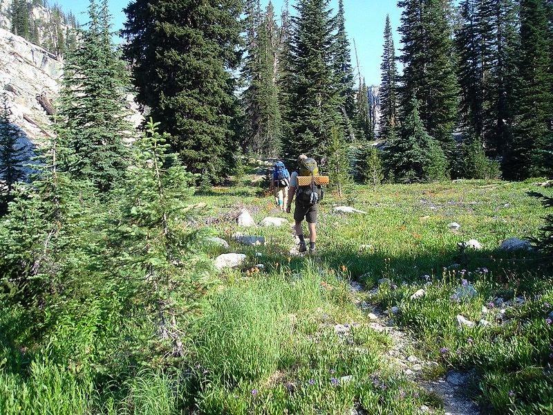
Hike to Scenic Lake - Our destination for the first night was Scenic Lake. The start of the day took us up a fairly gentle climb along the Little Queen's River. The scenery was definitely pleasant, but not typical Sawtooths. Soon enough though, we began to see more of the more familiar jagged mountains. But those views came with a price, as the trail got way steeper once we left the main loop trail and headed up the side trail towards Scenic Lake. In the heat of the afternoon, I was definitely hoping for a few more switchbacks, but they were few and far between until we reached about 8000' feet. From there, it was much more pleasant, with great views as we wandered through wildflower filled meadows on our way to the lake. Total for the day was about 10 miles and 3200' of elevation gain, in under 8 hours. Not bad for 35+ pound packs. After resting our weary bones for a while, we did a little fishing (with decent results), eating, more fishing, then hit the hay.
Day 2
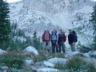
Cross Country to Johnson Divide - The first day was one of the longer backpacking mileage days we'd done in quite a few years, and day two would be just as long but with more elevation gain and a fair amount of cross-country travel thrown in. The plan was to get an early start, but none of us had set an alarm, and nobody woke up early thanks to our workout the day before. At any rate, I think we were back on the trail by about 9am. We backtracked for about a mile down the trail, then headed northeast up a draw where the map shows a trail that has long since vanished. The bottom section was a little steep, but it was nothing compared to chute we would have to climb from the pond at 8600' to the pass on the ridge located northwest of Flat Top Mountain. It was kind of a butt-kicker to climb up to the saddle in multi-day packs, but it took us less than 45 minutes to reach the top. In the saddle we were greeted with great views of Browns Peak and Mount Everly, and we rested there for a bit while discussing route choices. I had wanted to climb Browns Peak, and then descend to Johnson Lake. But I knew we still had a lot of ground to cover, and didn't put up much of fight when the others leaned towards dropping down to Browns Lake instead of climbing Browns Peak. Once at the lake, we stopped for lunch and did some fishing. It would make a great place to camp, but that didn't fit the schedule and we continued on our way. From Brown's Lake, we continued hiking cross-country mostly to the north, until the saddle just east of point 8828'. From here we got a good view of Johnson Lake far below us, and could even see the Rakers in the distance. Very cool. We thought about descending to the lake, but it was a bit steep so we just followed the ridge west until we found the trail.
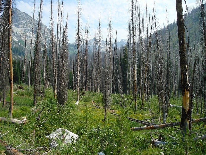
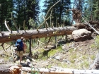
 Hike to Arrowhead Lake - From Johnson Divide (some guidebooks call this "High Pass") our cross-country travel ended and we began the 1500' descent into the Johnson Creek drainage. The upper section is a well-constructed trail with great views, so the going was easy. But after a mile or so, we entered the burn area from a forest fire in mid 1990's. The area is recovering nicely, but there are some downed trees to contend with, and the underbrush was fairly thick. On our way down, we encountered our first people of the day, who were heading to Pat's lake with their two barking dogs (more on that later). On the way down, it seemed like the descent would never end, as we gave up precious elevation with every step. By late afternoon, we finally reached the trail that would take us up toward Pat's Lake. The trail in this area was overgrown with thick Buck Brush in many areas, and we were in no mood for climbing at that point. But we forged on, and made decent time for the next couple miles before losing the trail for a while. Soon after, we caught up with a couple who where in the midst of a 10-day trip, and were headed to Pat's Lake for the night. The lake wasn't much farther, and we stopped there to discuss our options when we got there. We were plumb tuckered out, but the thought of sharing Pat's Lake with two other groups (and a couple of barking dogs) was enough to convince us to continue to Arrowhead Lake. This ended up paying off for us. Pat's lake was pretty, but Arrowhead Lake was much more our style. It didn't have many tent spots, but it did have a great "alpine feel" and plenty of fish to catch. Hike to Arrowhead Lake - From Johnson Divide (some guidebooks call this "High Pass") our cross-country travel ended and we began the 1500' descent into the Johnson Creek drainage. The upper section is a well-constructed trail with great views, so the going was easy. But after a mile or so, we entered the burn area from a forest fire in mid 1990's. The area is recovering nicely, but there are some downed trees to contend with, and the underbrush was fairly thick. On our way down, we encountered our first people of the day, who were heading to Pat's lake with their two barking dogs (more on that later). On the way down, it seemed like the descent would never end, as we gave up precious elevation with every step. By late afternoon, we finally reached the trail that would take us up toward Pat's Lake. The trail in this area was overgrown with thick Buck Brush in many areas, and we were in no mood for climbing at that point. But we forged on, and made decent time for the next couple miles before losing the trail for a while. Soon after, we caught up with a couple who where in the midst of a 10-day trip, and were headed to Pat's Lake for the night. The lake wasn't much farther, and we stopped there to discuss our options when we got there. We were plumb tuckered out, but the thought of sharing Pat's Lake with two other groups (and a couple of barking dogs) was enough to convince us to continue to Arrowhead Lake. This ended up paying off for us. Pat's lake was pretty, but Arrowhead Lake was much more our style. It didn't have many tent spots, but it did have a great "alpine feel" and plenty of fish to catch.
Day 3
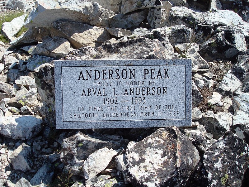
Arvals Peak and Blacknose Mountain - We’d seen lots of great scenery so far, but I knew today would be the highlight of the trip. Partially because we had less ground to cover, but mostly because I was looking forward to some great views of the Rakers. After spending some time fishing, I pulled my gear together and got a head start on the others so I could climb Peak 9704’. I hike the half-mile up to “Queen’s Divide”, then dropped my pack and headed southwest up the ridge, which was a fun scramble. The easiest going was on the east side of the ridge, but I veered over to the west side a couple times for some great views of the lakes below. On the summit, I was surprised to find a good sized rock (larger than a Boise phonebook) which was etched with the following: “Anderson Peak; Named in honor of Arval L. Anderson; 1902-1993; He made the first map of the Sawtooth Wilderness Area in 1927.” I was pretty impressed that someone had carried that big thing (15lbs +) way up in there. After taking in the views for a while, I scampered back down the ridge to meet the others at the saddle.
 Next on the agenda was a climb of Blacknose Mountain. We headed up the ridge, with me lagging in the rear a bit. At some point, the others decided to stop at the first knob, and I somehow got around them. I hustled my way along the ridge, expecting to catch them, but arrived at the summit to find it vacant. It was a little weird since I didn’t know where the others were, but I still managed to enjoy the views for a while, and to flip through the summit register (which only had about 6 entries since being placed in 1989). Eventually I became resigned to the fact that my partners wouldn’t be joining me, and I headed back down the Class 3 ridge to the saddle where they were waiting. Next on the agenda was a climb of Blacknose Mountain. We headed up the ridge, with me lagging in the rear a bit. At some point, the others decided to stop at the first knob, and I somehow got around them. I hustled my way along the ridge, expecting to catch them, but arrived at the summit to find it vacant. It was a little weird since I didn’t know where the others were, but I still managed to enjoy the views for a while, and to flip through the summit register (which only had about 6 entries since being placed in 1989). Eventually I became resigned to the fact that my partners wouldn’t be joining me, and I headed back down the Class 3 ridge to the saddle where they were waiting.
Hike to Plummer Lake - After a bite to eat, we headed down the trail from Queen’s Divide, winding our way through the lakes along the trail. We were treated to excellent views of Mount Everly’s northwest face, and there was no doubt in my mind that I’d be climbing that mountain later in the day. Eventually our trail bottomed out at about 8300’, where we met with the Benedict Creek trail. After following it up and over a low pass then down a ways, we reached the Everly Lake trail. This one soon put us on some steep switchbacks, but they weren’t too tough compared to the climb to Scenic Lake. At Everly Lake, we dropped our packs and went looking for campsites. There were a couple options at Everly Lake, but we opted for a site on the south end of Plummer Lake to help shorten up the mileage for the following day. We fished for a while as we battled the bugs, then I went to set up my tent and prepare for a climb of Mount Everly.
 Mount Everly - This trip put several peaks within range for me, but my number one goal was Everly. The in your face views we had throughout the day just solidified that. It was 6pm when I started making my way towards the peak. After heading over to take a peek at the south slopes, I eventually headed up the steep east face. There as a gully that was a little loose at the bottom, but the rock seemed to get more stable as I went higher. About halfway up, I could tell there would be no obstacles and the scrambling was very enjoyable Class 3 on fun rock ledges. Once at the top of the east face, it was a quick walk along the summit ridge to reach the highpoint. It was a summit that I had a hard time leaving. There were great views of the peaks I’d climbed earlier in the day, along with the Rakers and Warbonnet. The angle of the sun even made for a pretty good view of Castle Peak, far off in the distance. Eventually I pried myself off the summit, and headed down the talus fields on the south slopes. This required me to do a couple hundred feet of elevation gain to get back up to Plummer Lake, but I figured that would be better for me than down-climbing the class 3 east face, at the end of a long day. I was pretty tired when I got back to camp, but was definitely riding a major summit high. I made my dinner in the dark (in between swatting at bugs), then turned in for the night. Mount Everly - This trip put several peaks within range for me, but my number one goal was Everly. The in your face views we had throughout the day just solidified that. It was 6pm when I started making my way towards the peak. After heading over to take a peek at the south slopes, I eventually headed up the steep east face. There as a gully that was a little loose at the bottom, but the rock seemed to get more stable as I went higher. About halfway up, I could tell there would be no obstacles and the scrambling was very enjoyable Class 3 on fun rock ledges. Once at the top of the east face, it was a quick walk along the summit ridge to reach the highpoint. It was a summit that I had a hard time leaving. There were great views of the peaks I’d climbed earlier in the day, along with the Rakers and Warbonnet. The angle of the sun even made for a pretty good view of Castle Peak, far off in the distance. Eventually I pried myself off the summit, and headed down the talus fields on the south slopes. This required me to do a couple hundred feet of elevation gain to get back up to Plummer Lake, but I figured that would be better for me than down-climbing the class 3 east face, at the end of a long day. I was pretty tired when I got back to camp, but was definitely riding a major summit high. I made my dinner in the dark (in between swatting at bugs), then turned in for the night.
Day 4
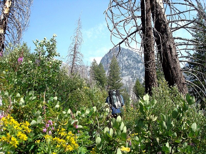
 Big miles back to the trailhead - Knowing that we had close to 14 miles to cover, we were all mostly motivated to get an early start, although its always hard knowing the trip is nearing its end, and not wanting it to be over. The first mile or so (from Plummer Lake down to the Queens River trail) was cross-country. It was pleasant though, since the views were good, and the brush wasn’t very thick. JJ even managed to navigate us to a creek crossing that was only a few feet from the trail. The long haul began at this point. The scenery was nice, with an abundance of wildflower filled meadows to wander through for the first several miles. Farther down, it was still nice to be in the mountains, but the “alpine feel” was replaced by seemingly endless fields of chokecherry bushes. Later, it felt kind of like a steeplechase with quite a bit of downed timber to climb over, and numerous river crossings. Big miles back to the trailhead - Knowing that we had close to 14 miles to cover, we were all mostly motivated to get an early start, although its always hard knowing the trip is nearing its end, and not wanting it to be over. The first mile or so (from Plummer Lake down to the Queens River trail) was cross-country. It was pleasant though, since the views were good, and the brush wasn’t very thick. JJ even managed to navigate us to a creek crossing that was only a few feet from the trail. The long haul began at this point. The scenery was nice, with an abundance of wildflower filled meadows to wander through for the first several miles. Farther down, it was still nice to be in the mountains, but the “alpine feel” was replaced by seemingly endless fields of chokecherry bushes. Later, it felt kind of like a steeplechase with quite a bit of downed timber to climb over, and numerous river crossings.
Finishing with a bang - We knew we were getting pretty close to the trailhead when we spotted a pick-up and tents on the other side of the river. The campers apparently hadn’t seen us, because after a couple hundred yards, all four of us simultaneously hit the deck after hearing the sound of a ricochet bullet buzz by our ears. Our first instinct was to get the heck out of there, but Jordan remembered that we’d just passed a day hiking family on the trail who wasn’t too far behind us. Needless to say, the shooters were pretty shocked to see a torque’d off backpacker come charging out of the bushes. It was 3 rednecks sitting in their lawn chairs, while apparently plunking trees with a .22 pistol. We didn’t hear any more shots after that. Our adrenaline was running pretty high at that point, so we made a quick pace back to the trailhead, which was less then a mile down the trail. Then we took a quick dip in the river, and headed home.
Other than the final half-hour, it had been an awesome trip. The scenery was excellent, and we saw only a handful of other hikers. The 43 miles was the most I’d every covered (it would have been only 39 without side-trips to bag peaks), but I still felt surprisingly fresh at the end of the trip.
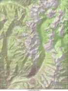
Overview map of our 4-day route, we went clockwise.
|
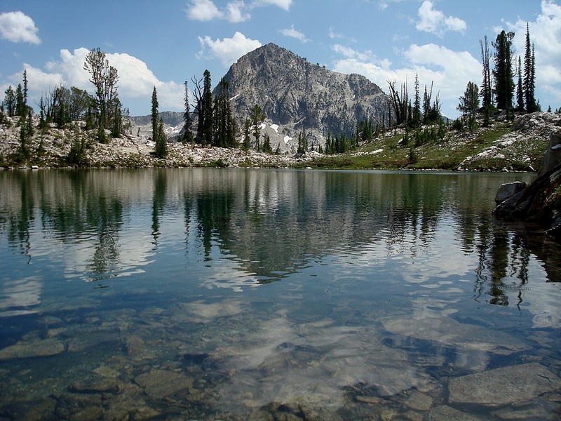
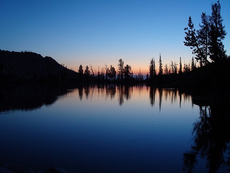
Sunset view from our campsite at Scenic Lake, Nahneke Mountain in the background.
|
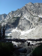
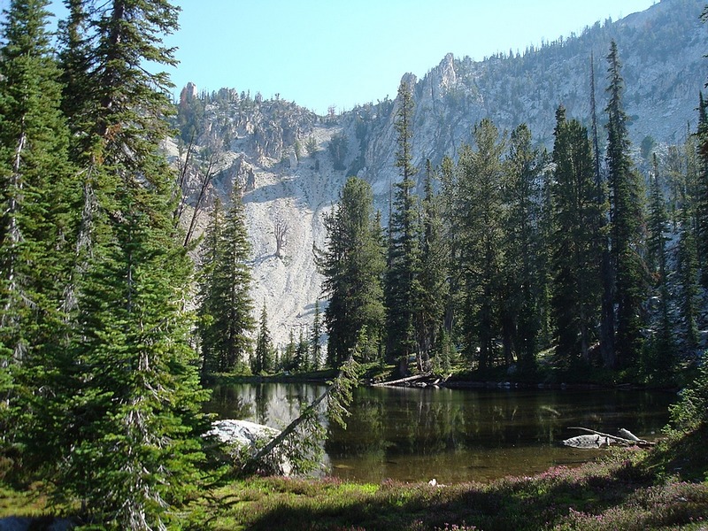
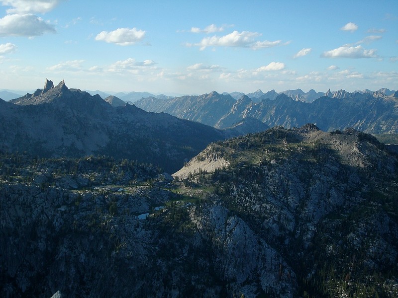
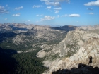
Cliffs above lower Scenic Lake.
|

Hiking through a wildflower filled meadow along upper Scenic Creek.
|

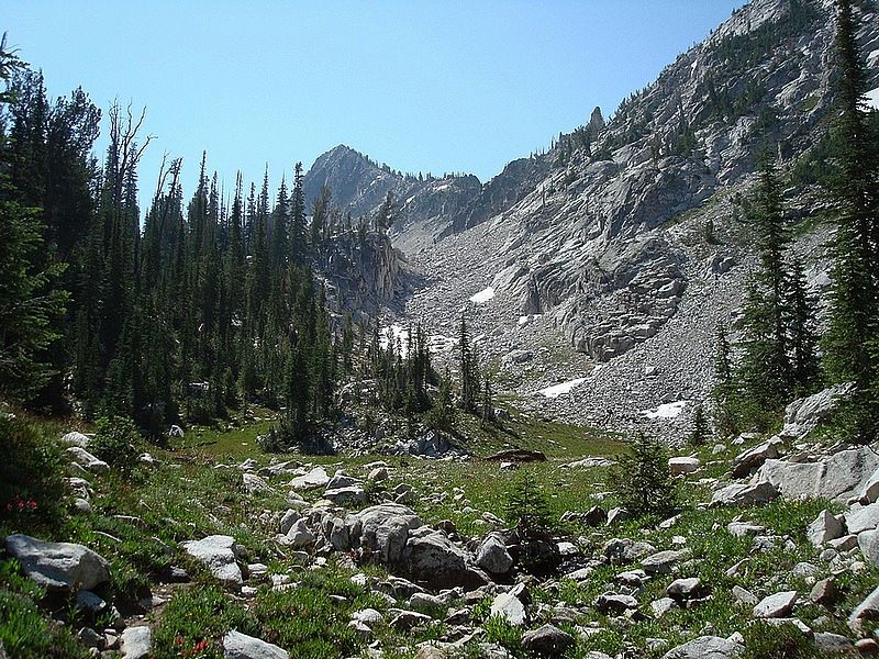
We climbed this chute to a pass northwest of Flat Top Mountain.
|
Browns Peak, Mount Everly, and Lake 8901' from the pass.
|

Looking back at Flat Top Mountain during our descent to Browns Lake.
|
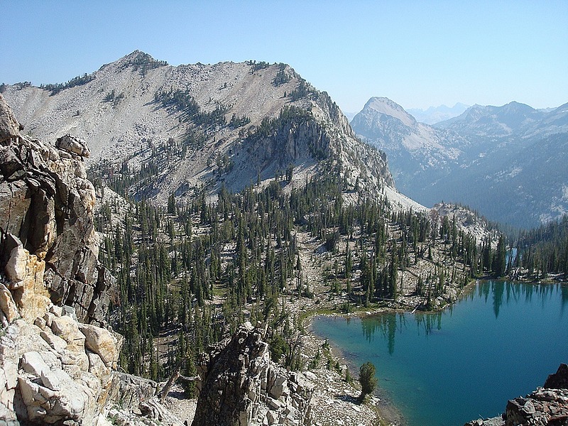
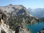
Johnson Lake from the south, with the Rakers in the background. Anderson Peak (9704') in the center.
|
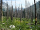
The view back into the upper Johnson Creek drainage from the burn area.
|

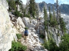
Making our way up the overgrown "trail", a couple miles below Pats Lake.
|
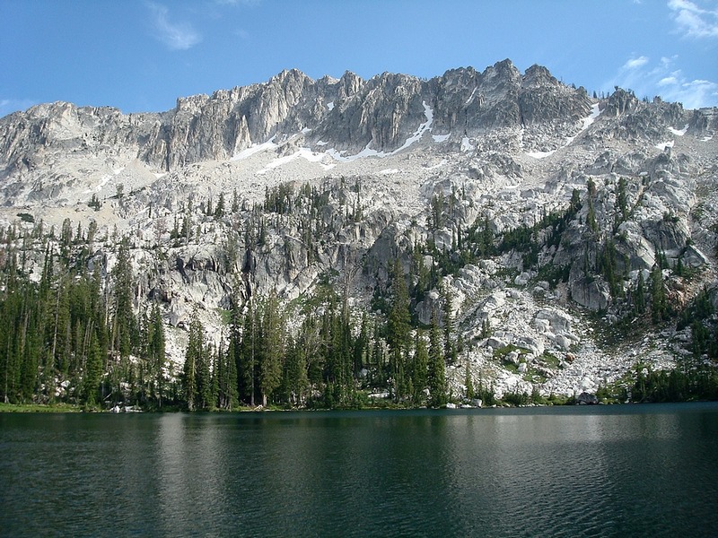
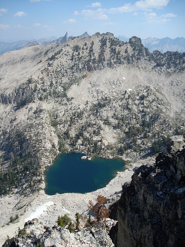
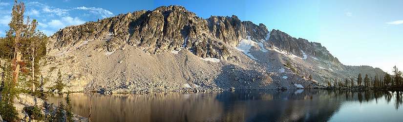
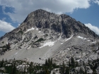
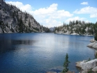
Pats Lake and the north face of Anderson Peak (9704').
|
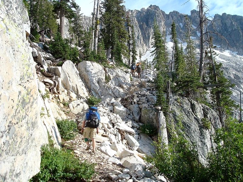
Climbing the switchback to Arrowhead Lake, near the end of a long day.
|

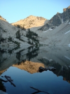
Sunset at Arrowhead Lake, about 9:30pm.
|

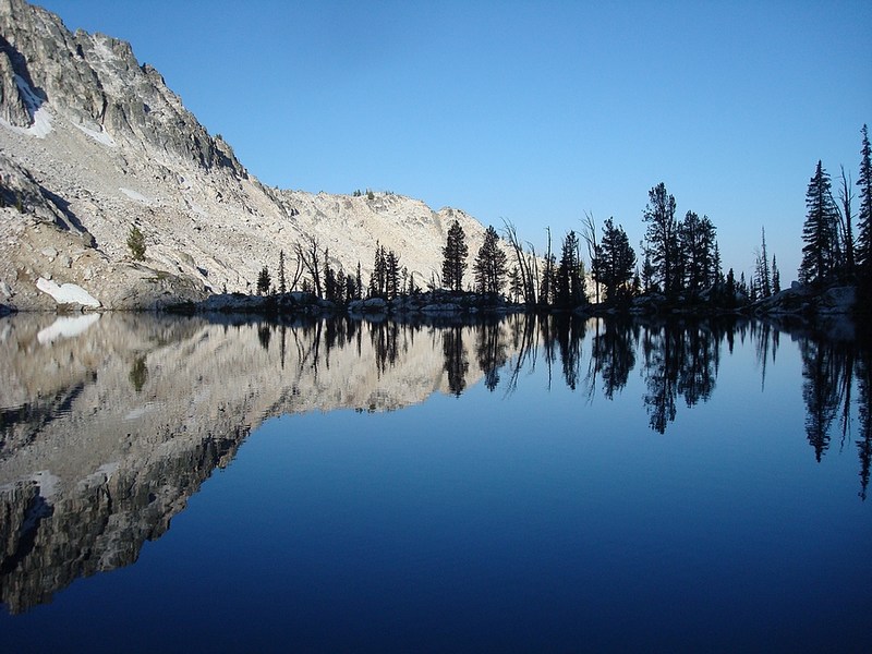
Morning view of Arrowhead Lake, about 8:30am.
|
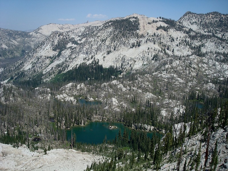
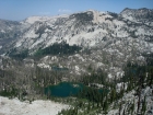
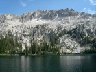
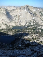
Arrowhead Lake and Pats Lake from the east.
|
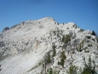
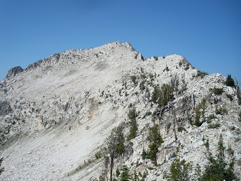
The northeast ridge of Anderson Peak from where the trail crosses the saddle.
|

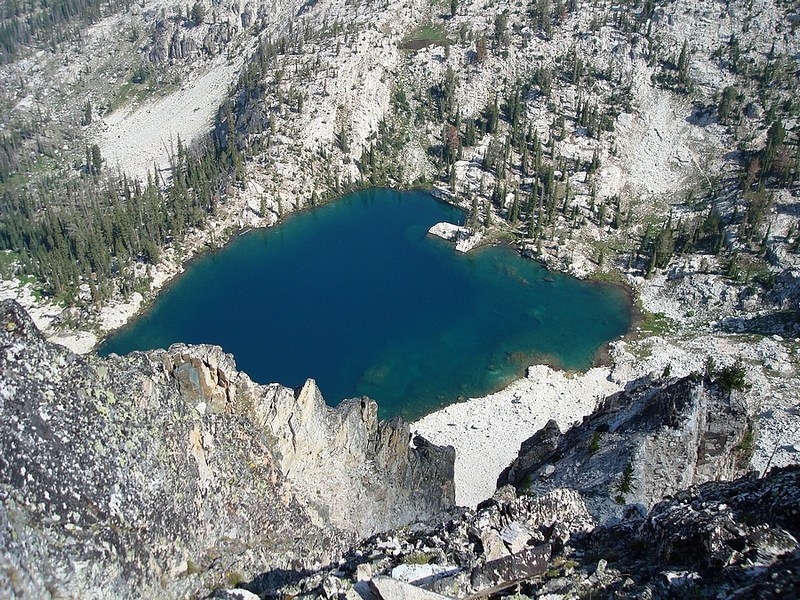
Arrowhead Lake from above.
|
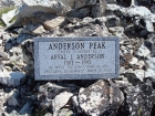
Large etched stone on the summit of Anderson Peak (9704').
|
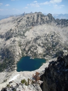
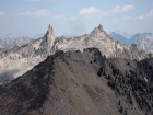
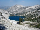
Arrowhead Lake, Blacknose Mountain, and the Rakers from the summit of Anderson Peak.
|
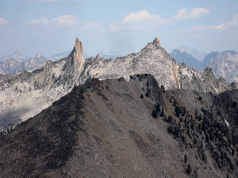
Close-up shot of the Rakers from Blacknose Mountain.
|
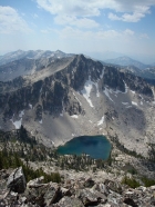
Anderson Peak and Arrowhead Lake from Blacknose Mountain.
|

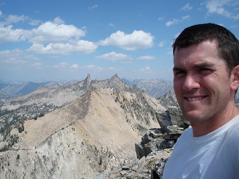
Me on the summit of Blacknose Mountain, with the Rakers in the background.
|
The mammoth northwest face of Mount Everly.
|
Looking across Everly Lake from the southeast.
|
Everly Lake, Plummer Lake, and Plummer Peak from high on the east face of Mount Everly.
|
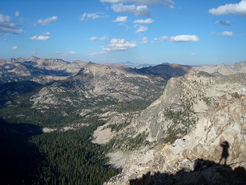
A view of Castle Peak (way in the distance) from Mount Everly. Mount Cramer is to the left.
|

The Rakers on the left, and Warbonnet on the right, from the summit of Mount Everly at 7:30pm.
|
Getting ready to leave our campsite at Plummer lake on the last day.
|
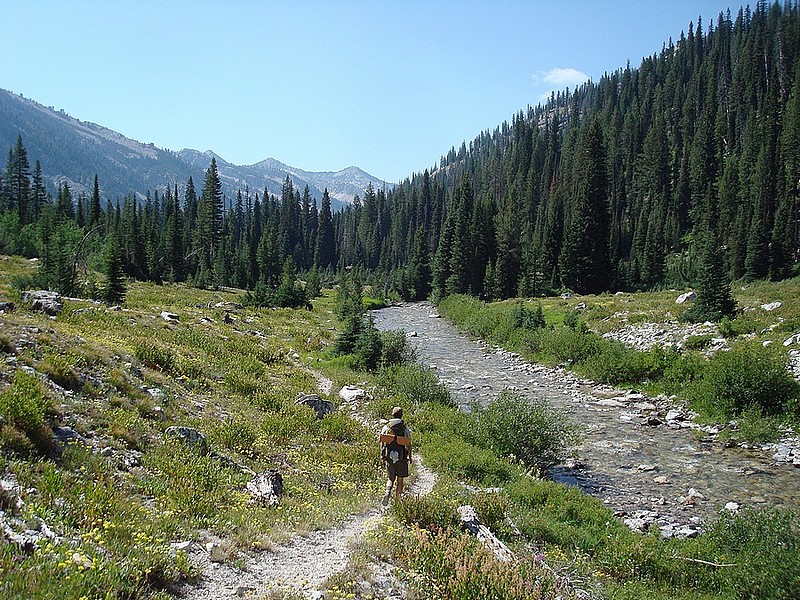
Typical meadow scenery on the trail along the upper Queens River.
|
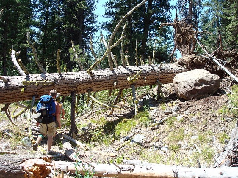
Giant Ponderosa that had fallen across the trail, a mile or so from the trailhead.
|
|