|
The Boulder Chain of Lakes is one of the most popular destinations in the White Clouds. This highly scenic string of 12 lakes is usually accessed from the east, but we opted for a route that made a loop starting from Fourth of July trailhead. This shortens the driving time from Boise, and allowed us to make a return trip to Quiet Lake in the process. It’s a great route option if you don’t mind a bit of scrambling in a few places.
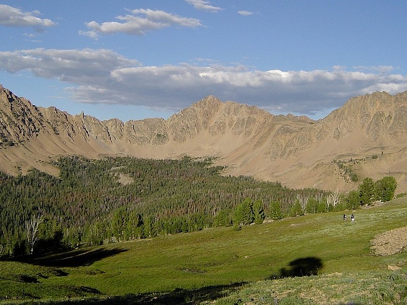
Day 1 - Born Lakes: After a noon departure from town, and some road construction near Garden Valley, we didn’t make it to the trailhead until late afternoon. We were planning to do much mileage, and I managed to convince the others (JJ, Jordan, & Ken) that we should climb Blackmon Peak (formerly called Blackman Peak) along the way. It’s a shorter distance, and not much more elevation gain, plus the views would be worth it. So we took the trail towards Strawberry Basin, then climbed up Blackmon’s southwest ridge. It was a little steep in our big packs, but not too bad and the views are some of the best in the White Clouds. Next we descended the east ridge and descended into Antz Basin, and worked our way over to Born Lakes. Only one other group was there, so it was pretty quiet and we enjoyed some bratwurst over that campfire that I’d pulled out of the freezer just before leaving town.
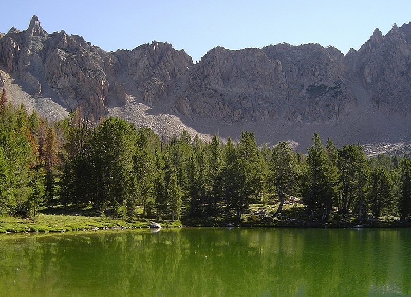
Day 2 - Devil’s Staircase to Hummock Lake: After some morning fishing in Born Lakes, we took our time breaking camp. The first order of the day was to climb Devil’s Staircase, the crux of the entire trip. This steep chute leading to the low point on the ridge east of Born Lakes is full of loose rock, and isn’t a good place for novices or large groups. We split into pairs for the climb. Ken and I gave JJ and Jordan a 30-minute head start, then began making our way up the staircase. It wasn’t too bad down low, but the rock got increasing unstable as we climbed. I stayed right behind Ken so that no rolling rock could gain momentum and take me out. No worries though, after about 35 minutes we were at the top of the ridge taking in great views in both directions. After a snack, we began our northerly descent, eventually picking up a goat trail that took us to a tarn below Windy Devil Pass. This spot was way too scenic to leave, so we stopped for an early lunch and relaxing. This is a great spot to check out the north side of Castle Peak and Serrate Ridge. Next we wandered up the trail to Windy Devil, for some great views of the upper Boulder Chain Lakes. As we followed the switchbacks down to the trail, we knew the climb back out would be a chore. It was early afternoon when we arrived at our campsite next to Hummock Lake, and we spent to rest of the day fishing Hidden, Hummock, and Hourglass Lakes.
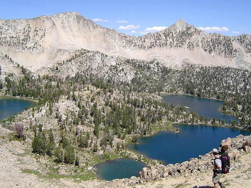
Day 3 - Boulder Chain Lakes: We had a leisurely day ahead of us, and we again took our time getting ready to hit the trail. The plan was to leave our camp at Hummock Lake, day hike to the bottom of the Boulder Chain of Lakes, then fish our way back up. The hike down was very nice, especially without the weight of our packs. We went as far down the chain as Willow Lake, then got out the poles. The fishing at each of the lakes was decent, but we didn’t catch any big ones at any of the lower lakes. The largest ones we caught were back up at Hummock Lake that evening, and the other guys cooked up a few of them on flat rock in the campfire for dinner. It had been a great day in the mountains, hard to beat fishing at lake after lake all day long.
Day 4 - Hummock Lake to Quiet Lake: Staying true to the pace of this trip, we weren’t in any hurry to break camp, and eventually started the climb back up to Windy Devil, with stops to fish at both Scoop Lake and Headwall Lake (no fish caught), before climbing the switchbacks. Once at the pass, JJ and Jordan headed down to Shallow and Scree Lakes, while Ken and I climbed up to Pt 10296’ to check out the views, which were excellent. On the way down, we stopped at my favorite tarn again, then wandered down to Shallow Lake and further down to Scree Lake. Both were very scenic, and I wouldn’t mind making a return trip to Scree since its well of the beaten path and full of fish. We would have stayed longer, but a thunderstorm set-in, and we had to carefully descend the steep wet rocks down to Quiet Lake. After huddling in the trees to wait out the storm, we circled around the lake and set up camp near the inlet, just over the rise from a troop of boy scouts. They were mostly quiet, so it wasn’t too bad.
Day 5 - Quiet Lake to Fourth of July, via Patterson Peak: Skies were dark the next morning, so we packed up quickly hoping to stay ahead of the storm. But we were out of luck, the clouds opened up on us as we climbed to Four Lakes Basin. Fortunately the rain stopped as we began our ascent of the east face of Patterson Peak. It was kind of tedious, trying to avoid loose rock while balancing our big packs. I for one was huffing and puffing until we reached the northeast ridge a couple hundred feet below the summit. It was windy up on top, but the views were great so we hung out for a while before heading down the south ridge. Ken and I followed some goat trails over to the next saddle and some great views of Chamberlain Basin, then headed back to meet JJ and Jordan who were taking in the views of Four Lakes Basin, and the Fourth of July drainage (this was a couple months prior to the Valley Road Fire). We managed to do a little scree skiing down Patterson’s south face, than wandered over to Fourth of July Lake where we picked up the trail back to the car for PB&J’s, my favorite!
Overall, it had been a great trip with excellent scenery and good fishing. We covered only 25 miles in five days. Much of the route was off-trail, but still pretty easy days in general.

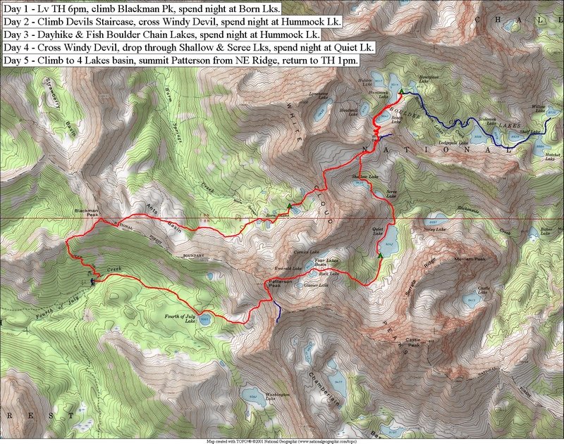
Overview map of our route.
|
JJ and Jordan making their way up the southwest ridge of Blackmon Peak.
|
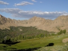
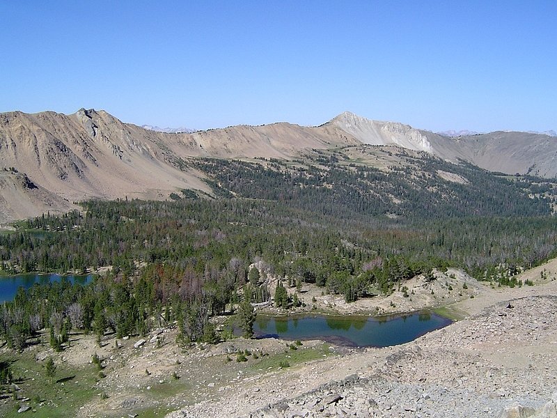
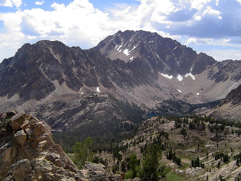
Looking west across Ants Basin from the base of Blackmon Peak. Peak 10857 and the Devils Staircase are visible in the background.
|
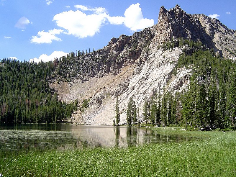
The south face of David O. Lee Peak, as seen from Ants Basin.
|
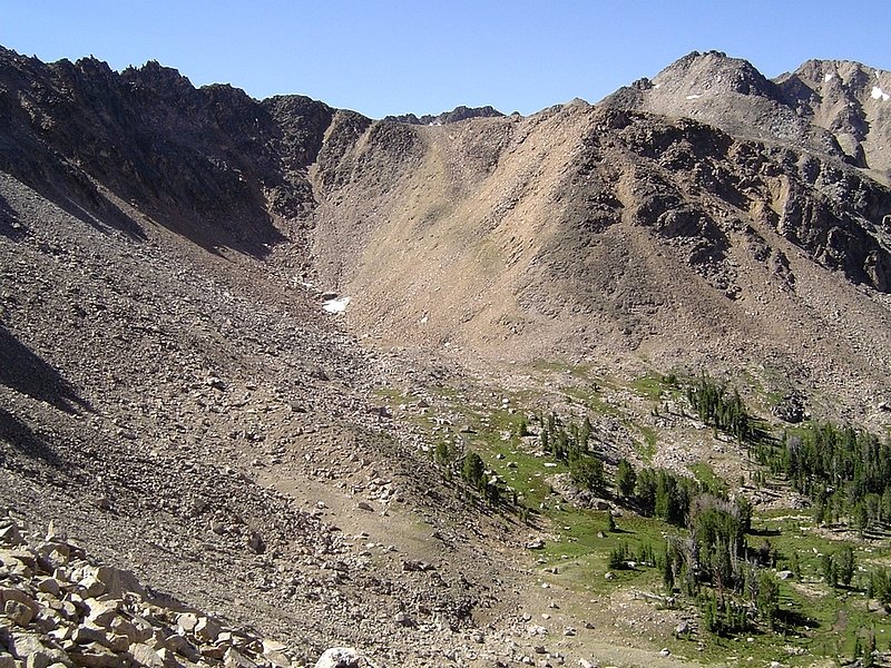
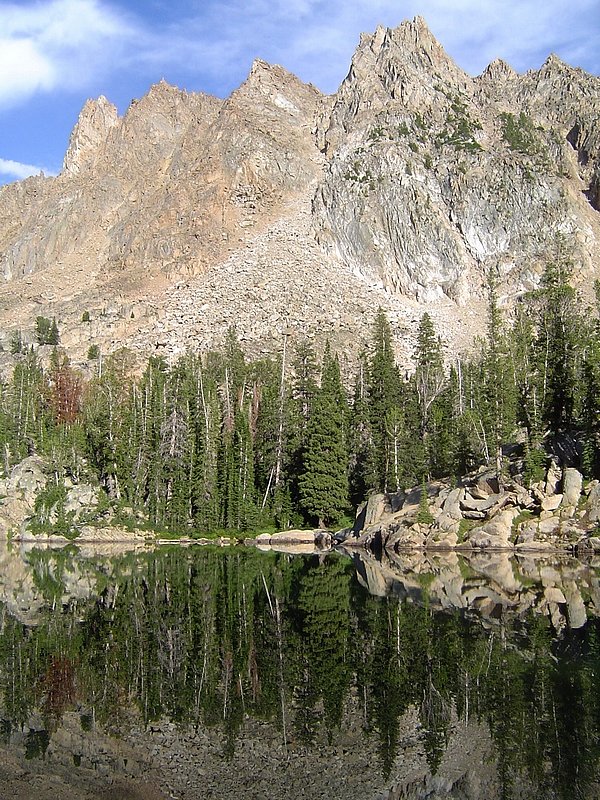
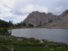
The low point in the ridge and the scree chute that lead to it are known as the Devil's Staircase. One of the Born Lakes is in the foreground.
|

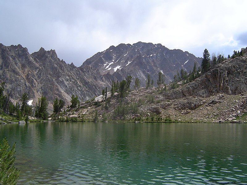
A view of Blackmon Peak from the bottom of the Devils Staircase with a few Born Lakes below.
|

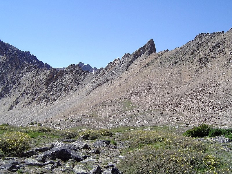
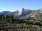
The pass leading to Four Lakes Basin with Patterson Peak off to the right. Photo taken from the Devils Staircase.
|
Ken taking a rest on his way up the staircase.
|
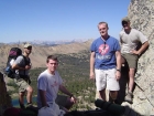
Four posers at the top of Devil's Staircase.
|

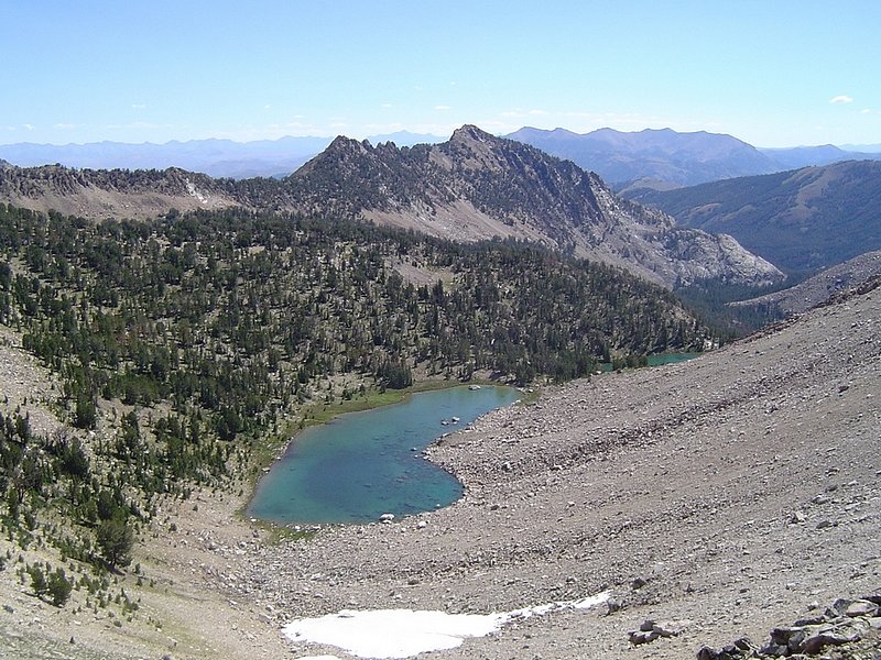
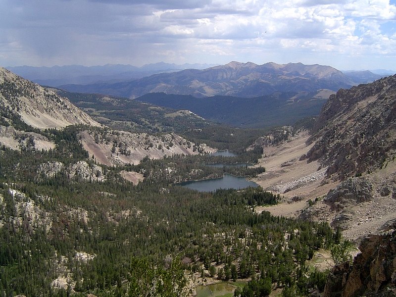
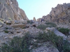
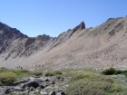
Shallow Lake and Scree Lake to the east of the staircase.
|
Looking back on the Devil's Staircase from the east. Here's an overlay marking the route.
|
Castle Peak and Serrate Ridge from the small tarn near Windy Devil pass.
|

JJ beginning the descent from Windy Devil pass down to the upper Boulder Chain lakes. Its hard not to stare at the awesome blue water.
|
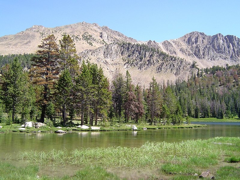
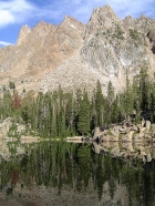
This is White Cloud Peak 11202' reflecting in Hourglass Lake.
|
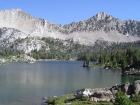
The fellas getting ready for a day of fishing, and a view of Lonesome Peak (11302') from our campsite at Hummock Lake.
|
From Shelf Lake, you can get a good look at Peak 11202'.
|

This very distinctive formation is the backdrop for Hatchet Lake.
|
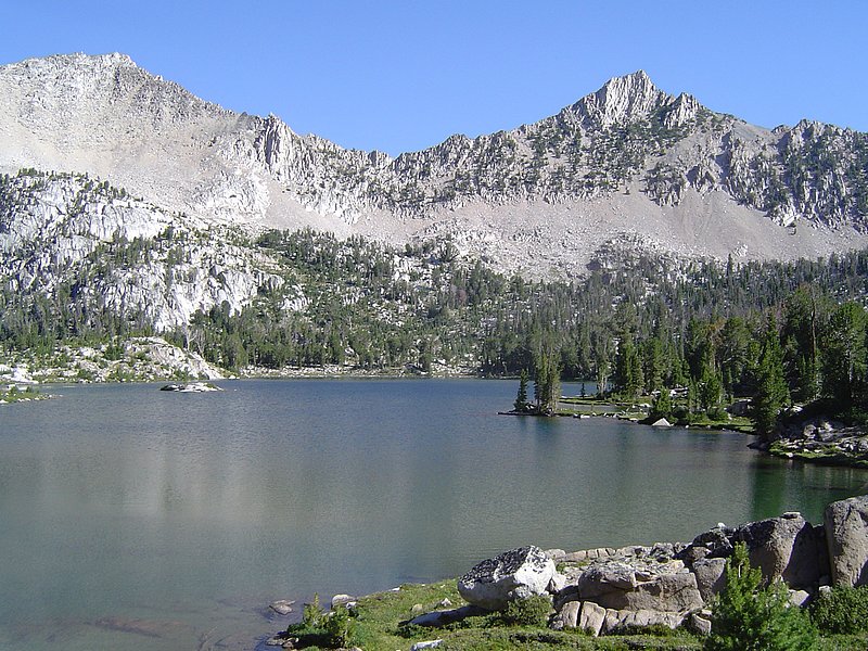
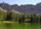
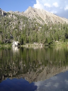
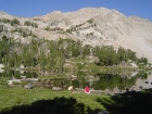
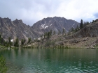
The view across Hummock Lake, taken from the south.
|

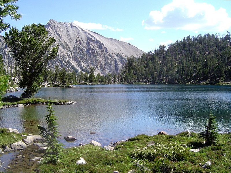
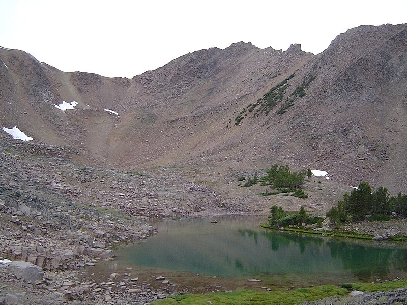
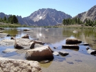
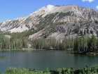
Scoop Lake with Peak 11202' in the background.
|
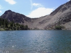
Looking up at Windy Devil Pass from the north shore of Headwall Lake.
|
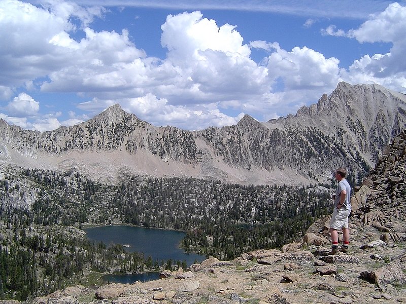
Ken surveying the upper Boulder Chain Lakes from Windy Devil Pass.
|
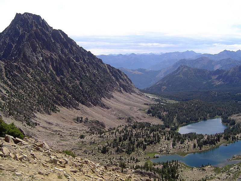
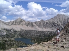
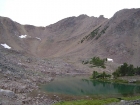
Castle Peak and the Serrate Ridge connecting to Merriam Peak from point 10296', Quiet Lake is below.
|

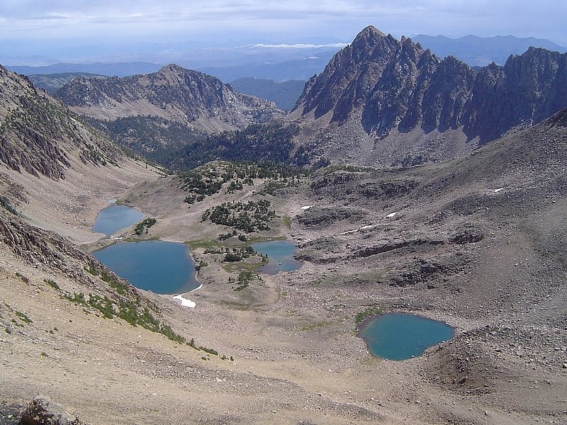
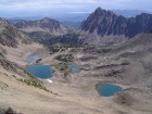
The Lower Boulder Chain of Lakes (Lodgepole, Sliderock, & Shelf) from point 10296'.
|
Merriam Peak as seen from Shallow Lake.
|
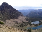
Castle Peak from Scree Lake.
|

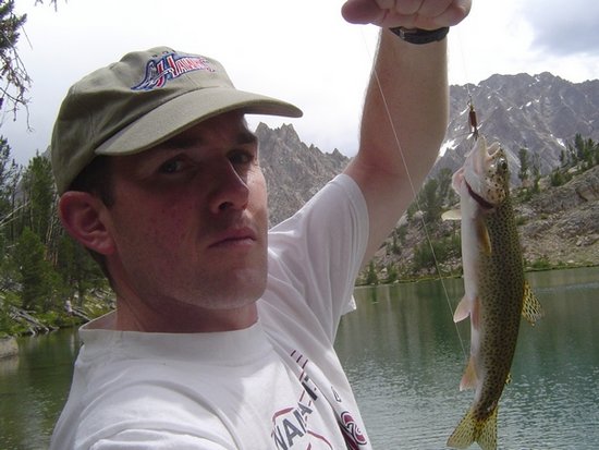
Me and the big rainbow I caught in Scree Lake, just before the rainstorm.
|
Part of Serrate Ridge, above Quiet Lake.
|
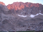
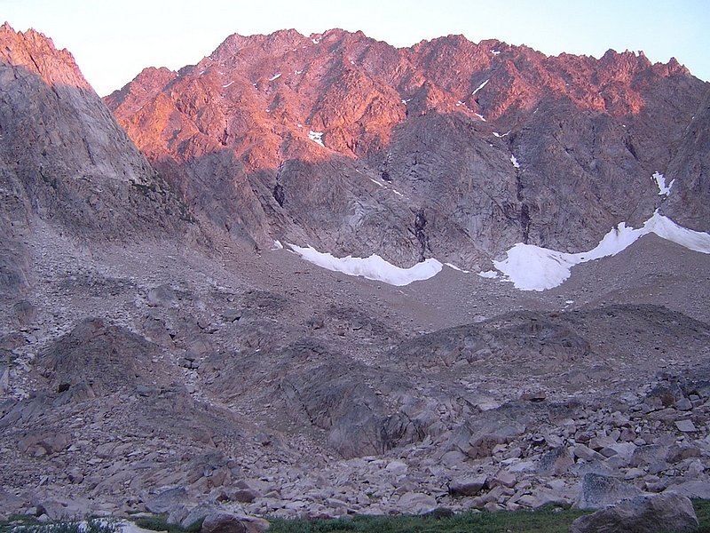
Alpenglow from the sun setting on the northwest side of Castle Peak.
|
The east face of Patterson Peak from Four Lakes Basin. Here's an overlay marking the route we used to climb out.
|

Looking north from the summit of Patterson Peak you can see David O. Lee Peak, Caulkens Peak, and Lonesome Lake Peak.
|
Blackmon Peak to the west of Patterson Peak with the Sawtooths in the background.
|
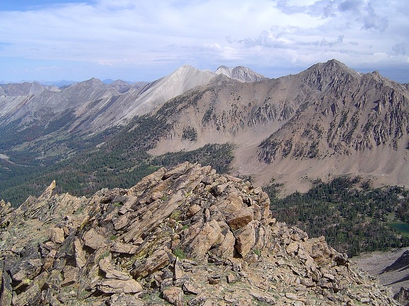
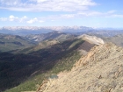
The view down on Four Lakes Basin from the summit of Patterson Peak with Merriam Peak in the background.
|
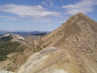
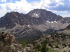
Patterson Peak from the saddle to the south, with Blackmon Peak off to the left.
|
Castle Peak as seen form the ridge northwest of Chamberlain Basin.
|

Patterson Peak standing behind Fourth of July Lake on our way back to the trailhead.
|
|