|
The Owyhee Canyon lands area of southwest Idaho is considered to be some of the most remote terrain in the state. The newly minted “Owyhee River Wilderness” could be the most remote of all. The area is truly unique, with vast tracts of high desert sagebrush country carved up by deep river canyons. Late spring and early summer are the best times for a visit, while the wildflowers are blooming and the summer heat hasn’t set in yet. Early May is probably optimal.
I had some major cabin fever and had been reading a lot about the Owyhees lately, and just happened upon some info about the East Fork Owyhee River, and an area called “The Tules” that caught my attention. I hit the road Friday night, and even made a stop at the Bruneau Canyon Overlook, before arriving at the trailhead just in time for sunset. There really aren’t any trails in the area, so I just parked near the end of the road up on a bluff southwest of Garat Crossing. Probably one of the highlights of the trip was the immense star-filled sky over my head that night.
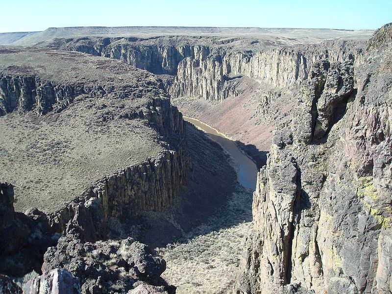
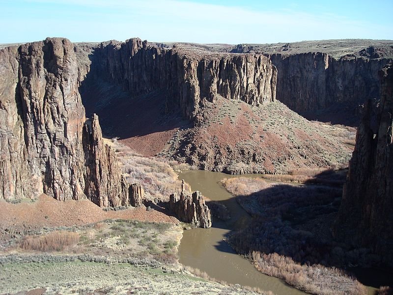
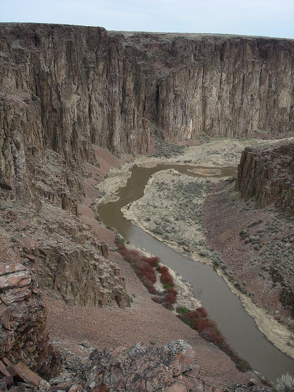
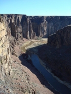
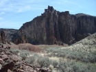
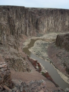
The next morning, I wandered down the hill through the sagebrush for my first look at the canyon; a view I shared with a couple vulchers perched on a nearby rock. I then followed an old jeep trail for a short while before making my way north along the canyon rim. To my left was a seemingly endless expanse of sagebrush, but to my right was an amazing view down into the canyon, and the river several hundred feet below. The river meandered its way through the landscape, cutting deep into the earth resulting in 400 feet sheer vertical rhyolite cliffs. I’d never seen anything like it. I basically just wandered along the rim taking in the views for a few miles until I reached an area on the map called “The Tules”, a spot where the river had once flowed and then left behind a marshy grassland area in the middle of a desert. I found a way down into the tules, and then decided to climb up on top of the huge island of rock in its center. While sitting on the highpoint, I heard some rock fall echoing in the canyon, and turned just in time to see a Bighorn ewe and her lamb crossing the talus behind me.
After a bite to eat, I did some exploring down below to check out the rock towers at the south end of the tules. It was a truly unique experience, and a major departure from the alpine terrain I usually like to explore. I made it back to the truck at about 2pm, after about 5 hours covering around 10 miles and 1400’ of elevation gain.
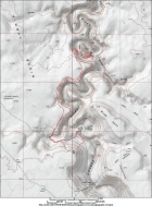
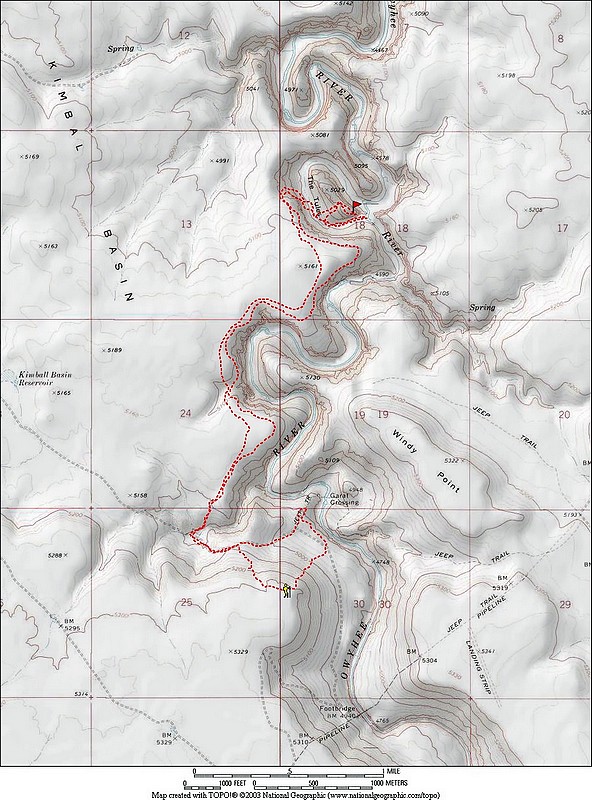
Map of my route, about 10 miles round trip and 1400' gain. |
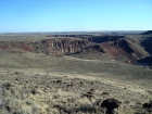
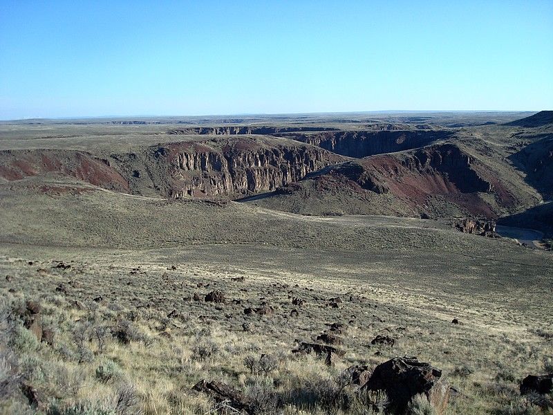
A view of the canyon from above Garat Crossing. |
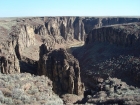
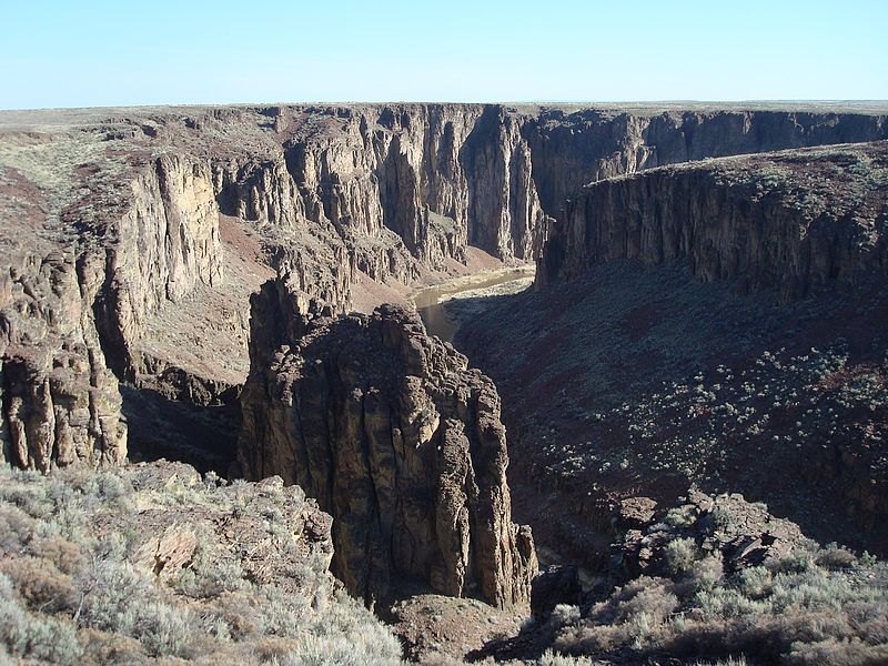
One of the first big bends in the river. |
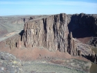
The canyon walls are just a little steep. |

Looking back on the canyon, the truck is somewhere up on the bluff in the background. |

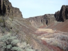
The first view of The Tules. |
"Tule Rock", and island in the middle of the tules. |

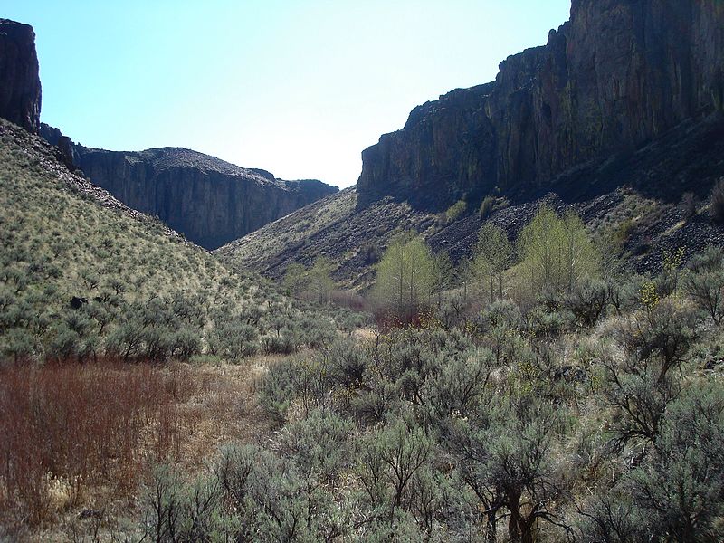
Aspen and sagebrush, down in the tules. |

The view south east from the top of Tule Rock. |
Southern end of the tules. |
The highpoint of Tule Rock, over 300 feet above. |
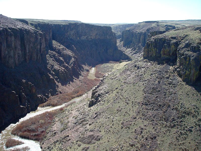
The east side of The Tules. |
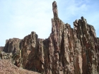
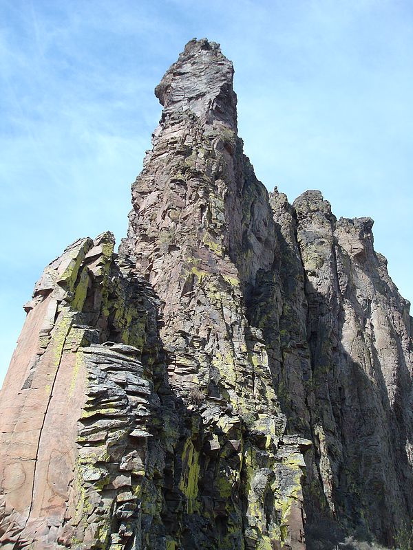
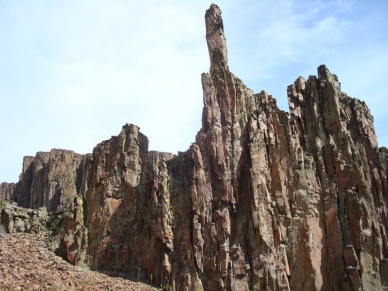
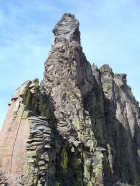
Rock pinnacles next to the river. |
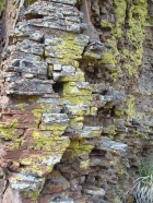
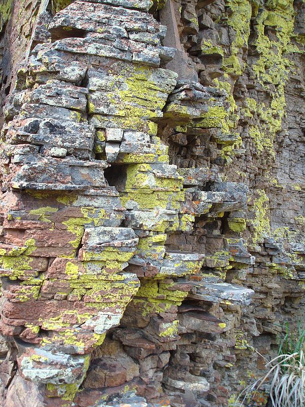
Stacked rocks seem to make up the base of this cliff. |
A final look back on the canyon taken on the way back. |
|