|
Big Boulder Lakes
July 9-11, 2004
Located in the White Cloud Mountains of central Idaho, the Big Boulder Lakes are a fantastic grouping of alpine lakes surrounded by jagged limestone peaks. It is an awesome backpacking destination.
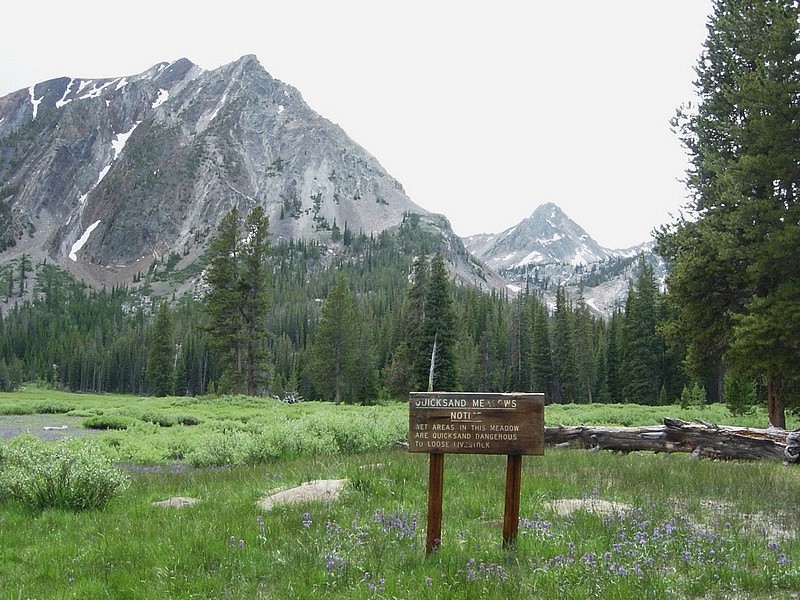
JJ and I got out of Boise at around 8am Friday morning and made the long (4hrs or so) drive to the Livingston Mill trailhead near the East Fork of the Salmon River. After a quick lunch, we hit the trail which wound through sagebrush for a while and parallels the mill complex for the first half-mile or so. From there the trail climbs as evergreen trees gradually replace the sagebrush creating a more alpine feel. The trail, which is open to motorcycles in this section, is well maintained and climbs gradually and steadily to a junction at about 2 miles. From here, the trail up Big Boulder Creek becomes fainter as the bikes are forced to take the other fork. The trail is pretty mellow for the next mile or so, which was a good thing based on our early season physiques (or lack thereof). At about 4 miles from the trailhead, we made it to Quicksand Meadows where we stopped for a break in this peaceful wildflower filled meadow. I dropped the pack and went looking for quicksand, but no luck. After another mile, the steep trail to Walker Lake (not Walter Lake as shown on some maps) splits off to the right. Once at the lake, about six miles from Livingston Mill, we chose an excellent campsite just south of the outlet stream to pitch the tents.
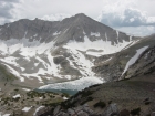
The next morning, we switched to daypacks for a day of exploring in the upper Big Boulder Lakes. We followed Margaret’s directions up the creek, then up the steep slopes south of Hook Lake. At the lake, we were greeted with views that were totally spectacular. Even with slightly overcast skies, the White Cloud Peaks were stunning, and the alpine terrain was beautiful. We took in the views at Hook Lake for a while before wandering over to Cove Lake for more of the same. After a while, JJ made his way around the north side of the Lake and I went south, heading up to the three small upper lakes (Gentian, Snow, and Boulder). These three are will above tree line and we had great views of the larger lakes below. Here we ate lunch, and did some fishing before heading north for a great view of Sapphire Lake, and then west up the rocks to go check out “The Kettles” area. It was some fun scrambling, including a snowfield that JJ had to kick steps across since I only had soft soled running shoes. We eventually reached the top of the edge of the cirque with the 1000 foot east face of David O Lee Peak towering above us. We wandered around in the talus and boulder fields for a while, checking out the geology, and then headed down to the still partially frozen Cirque Lake for some fishing.
From Cirque Lake, we headed north towards the saddle east of WCP9 on our way to the very secluded Slide Lake. At the saddle, JJ headed down to the lake, but I went east to the highpoint on the ridge to check out the views. It was a commanding position, with lakes and peaks in all directions. I caught up with JJ at Slide Lake and then we made our way down past the very small Neck Lake to Sheep Lake, and then back to our camp at Walker Lake. It was a fantastic day, and probably the single most enjoyable of many days spent in the mountains during my life.
After breaking camp on the third day, we still felt pretty energetic and decided to explore a couple more lakes before heading back to the trailhead. We made our way back down the trail to the fork and then over to Island Lake, which is a gem. After circling the lake to take in the views, we backtracked a little, and climbed to the saddle west of Goat Lake. It was very nice also, highlighted by several colorful rock bands in the cliffs above it. Soon enough, it was time to begin the trek back to the trailhead. JJ took a gradual pace, while I hurried along making frequent stops to pick wildflowers to make a bouquet for my wife along the way. Soon we were back down in the hot sunny sagebrush and back to the car for an enjoyable lukewarm Mountain Dew. It was an awesome weekend.
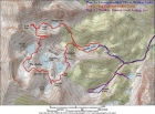
Overview map showing most of our route.
|

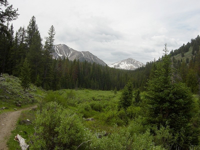
Marshy area near the beginning of the hike, taken just after the first crossing of Big Boulder Creek.
|

Quicksand Meadows.
|

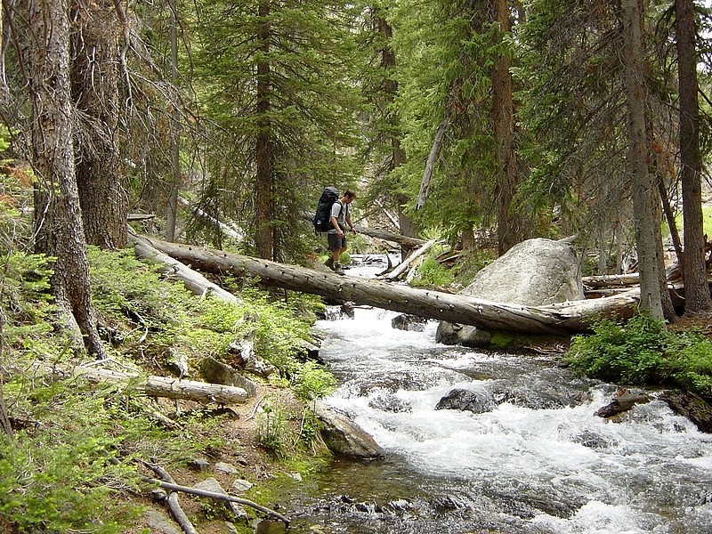
JJ crossing a log over Big Boulder Creek.
|
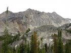
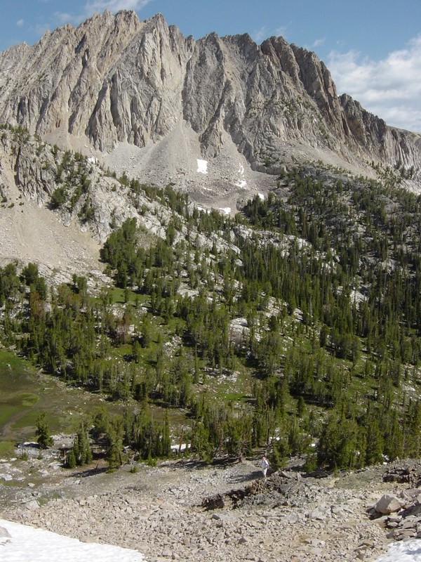
Cliffs below Peak 11202'.
|
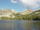
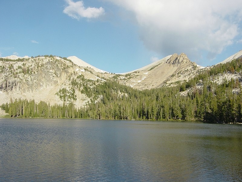
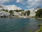
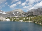
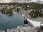
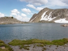
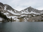
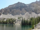
Looking across Walker Lake from our campsite.
|
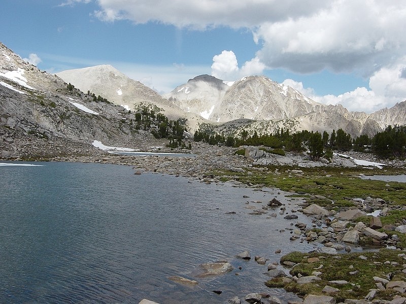
Me making the climb up towards Hook Lake with WCP10 in the background.
|
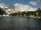
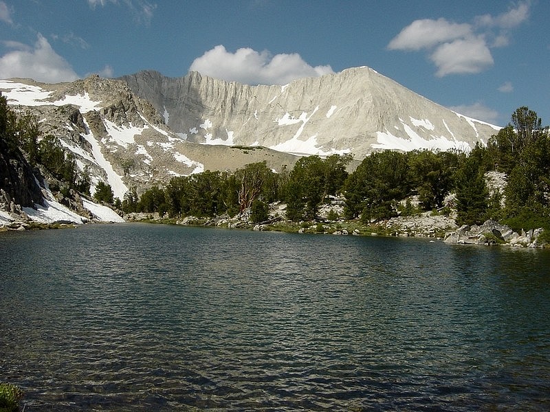
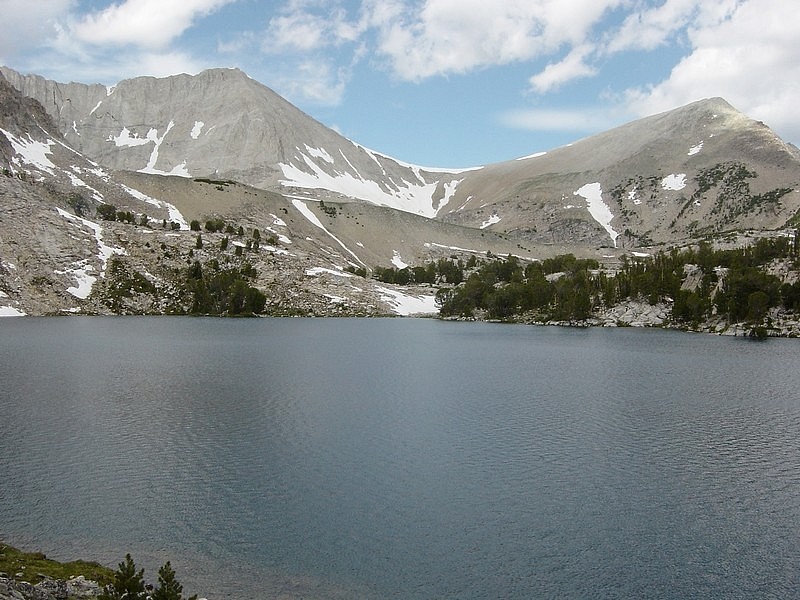
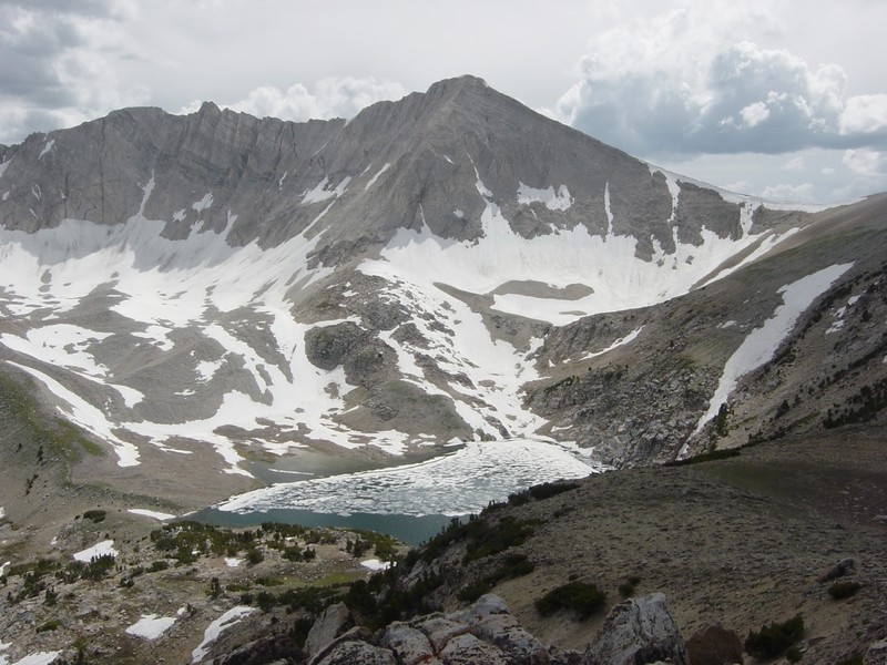
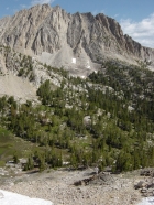
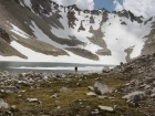
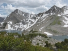
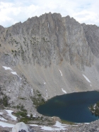
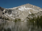
Hook Lake and David O. Lee Peak. The scenery in the area is hard to beat.
|
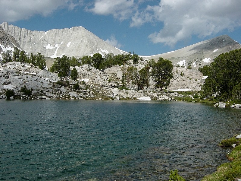
DO Lee Peak and WCP9 from Cove Lake.
|
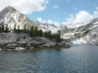
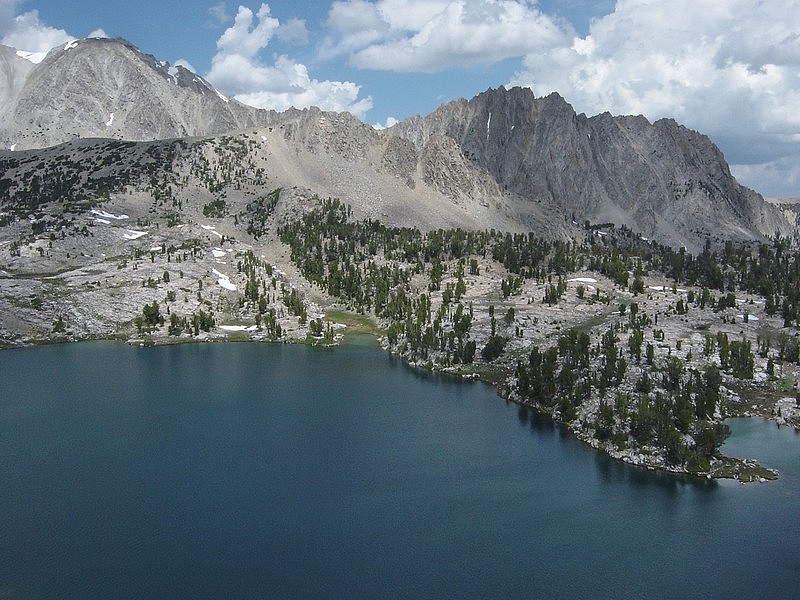
Cove Lake and Peak 11272'.
|
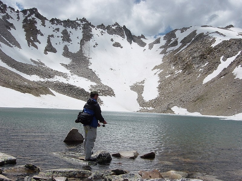
JJ fishing from a point on the northeast corner of Cove Lake, DO Lee Peak in the background.
|

DO Lee Peak and WCP9 from Cove Lake.
|
WCP9 and Caulkens Peak from above Cove Lake.
|
Another view of WCP9 and Caulkens Peak from above Cove Lake.
|

JJ fishing in Snow Lake.
|
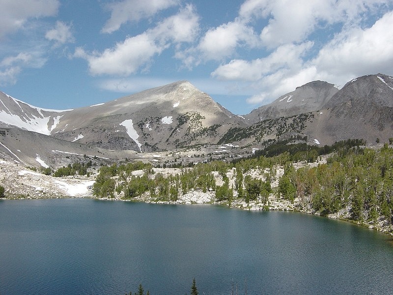
Snow Lake and Gentian Lake with WCP10 in the distance to the left.
|
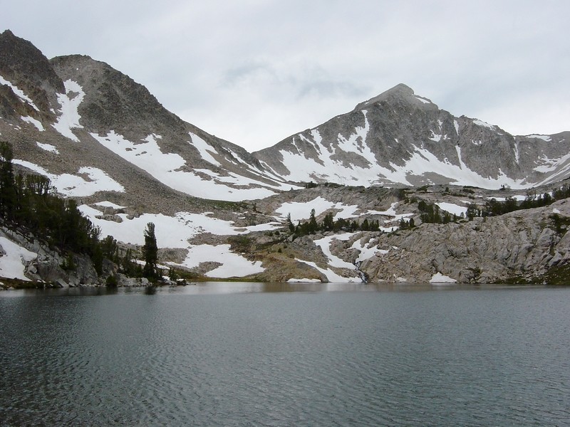
WCP9 and Caulkens Peak from Snow Lake.
|
Dave and Snow Lake.
|

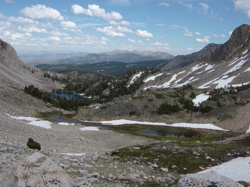
Caulkens Peak and WCP10 from far above Sapphire Lake.
|
Dave above Sapphire Lake.
|

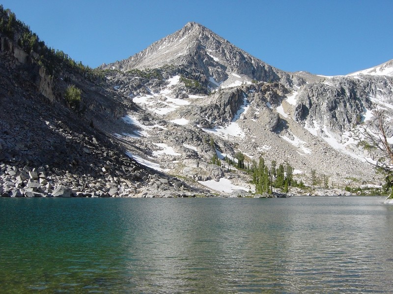
Caulkens Peak from above Sapphire Lake.
|
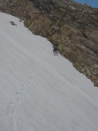
JJ kicking steps across a steep snow field on our way up to The Kettles.
|

Sapphire and the Big Boulder Lakes from the West.
|
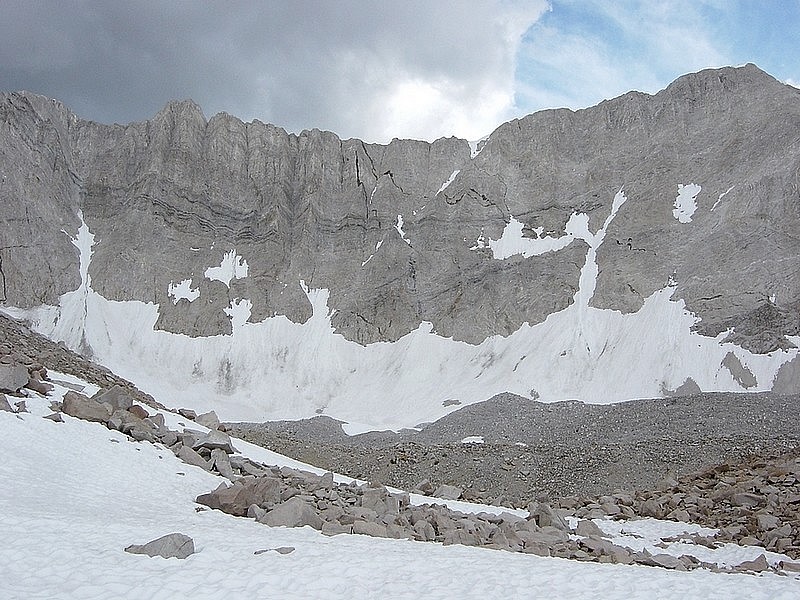
The 1000' vertical east face of David O. Lee Peak from near The Kettles.
|
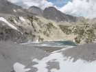
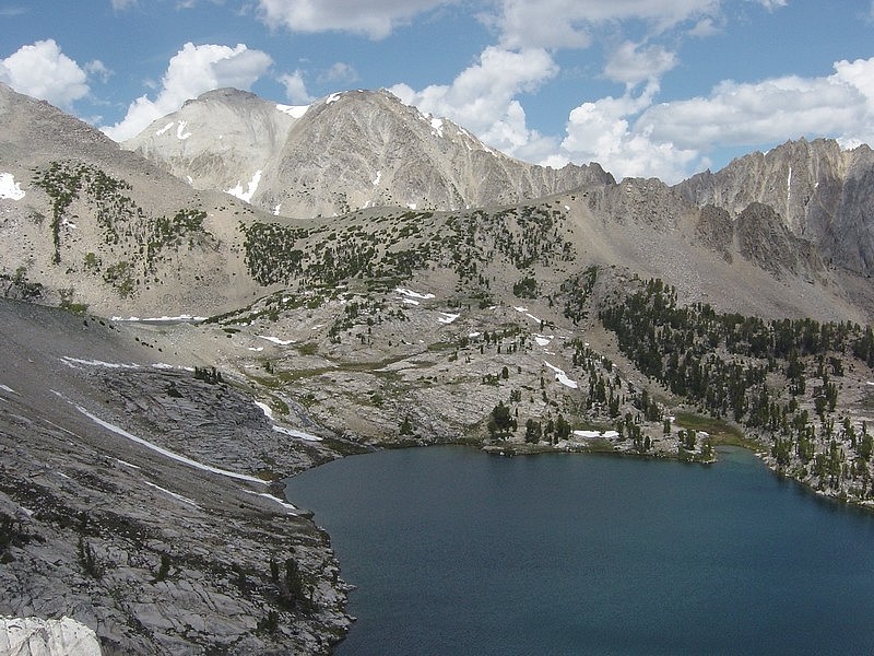
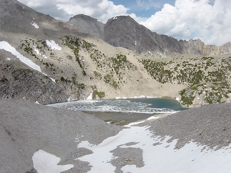
Looking down on Cirque Lake with Caulkens Peak in the background.
|
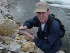
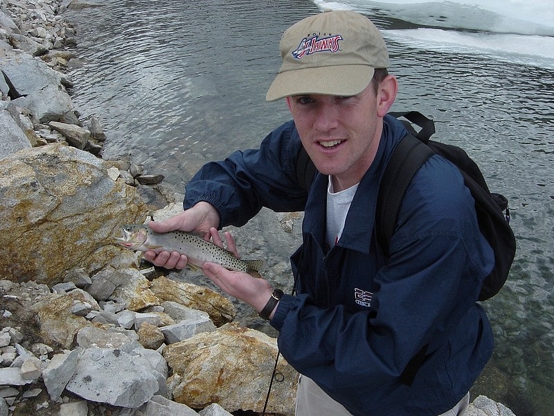
Me and the trout I caught in Cirque Lake.
|
Peak 11272' from the slopes north of Cirque Lake. You can see the long chute we crossed earlier in the day..
|

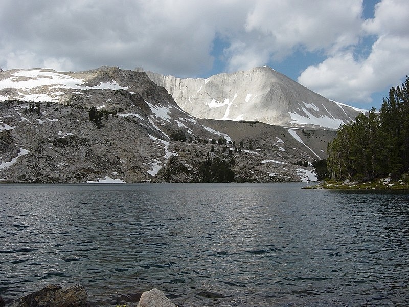
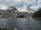
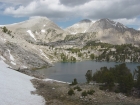
Slide Lake with WCP9 and Caulkens Peak above.
|
Walker Lake from the ridge north of Cirque Lake.
|

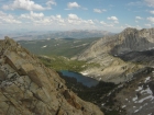
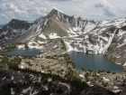
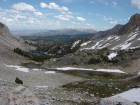
Peak 11202' and the Big Boulder Lakes from the ridge.
|
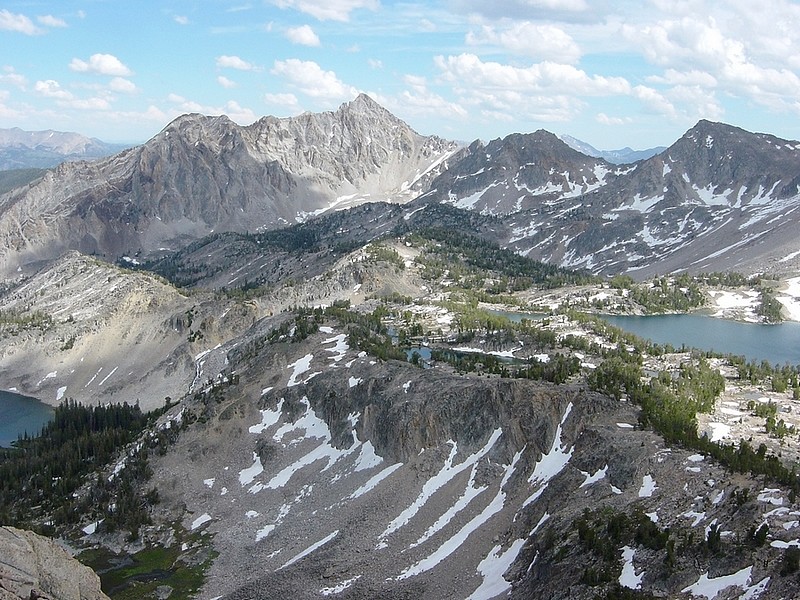
Awesome view of Peak 11272' and the Big Boulder Lakes from the ridge.
|
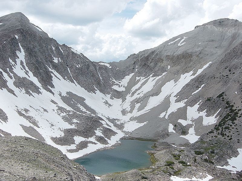
DO Lee Peak and Cirque Lake.
|
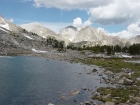
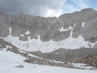
WCP10 and Sheep Lake.
|
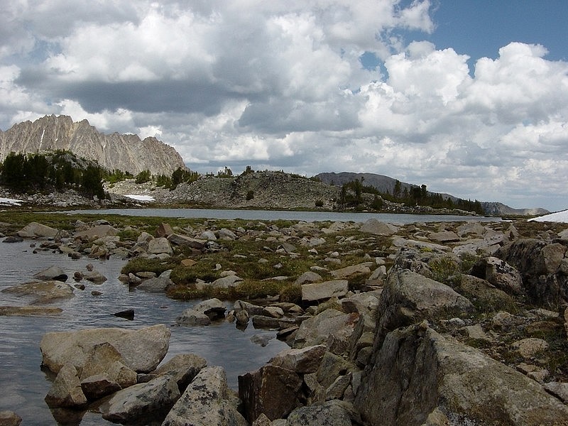
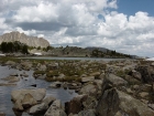
View from the west shore of Slide Lake.
|
Neck Lake and Sheep Lake.
|
WCP9 from Sheep Lake.
|
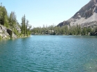
Peak 11272' from Island Lake.
|

Point 10881' from Island Lake.
|
View from the southwest shore of Goat Lake.
|
Dave sitting next to Goat Lakes with some colorful cliffs above.
|
|