|
After a successful climb of Diamond Peak we hopped back into the Durango and made the drive north to Leadore then headed west to the trailhead for our next hike. The road into Stone Reservoir (a.k.a. Timber Creek Reservoir) was a bit rough, but not too bad. There was a big group camped at the reservoir, so we drove the last mile to the end of the road and the trailhead. We made camp here, enjoyed some burgers and bratwurst on the open fire, then called it a night.
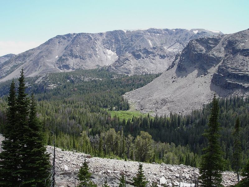
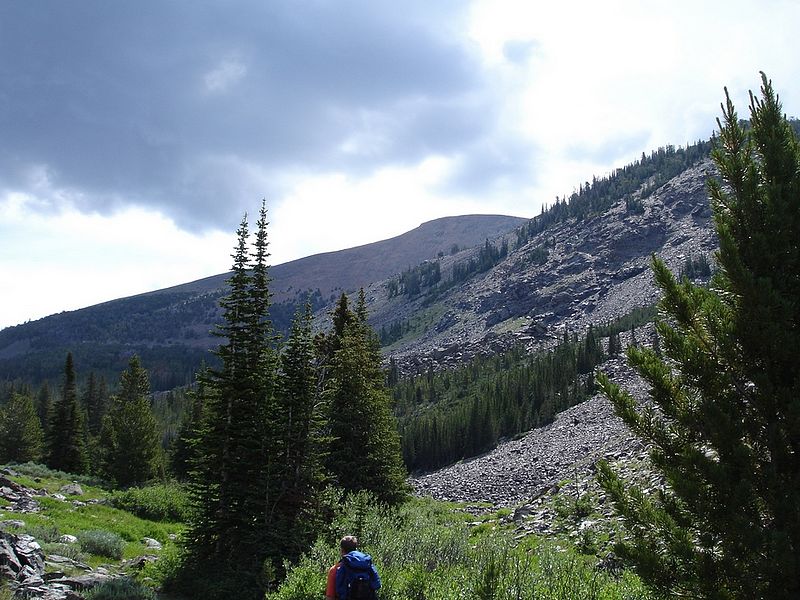
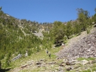
Morning came quickly and we began our hike up the Middle Fork of Little Timber Creek. We were a little bummed that the trail was open to motorbikes, but it really wasn't very torn up. Traffic is pretty minimal in most of the Lemhi's due to the remoteness of the range. The trail followed the north side of the creek for just over 2.5 miles where we took a fainter offshoot path towards unofficially named Middle Fork Lake (9157'). This lake was very nice and was where we came across the only other hikers during our entire three day trip. From the lake, the path got sketchy, making its way over a pass at around 9800'.
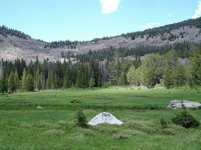
After reaching the top of the pass, JJ made an announcement. Due to the strenuous climb the day before, and the aggressive goal of reaching Devil's Basin today, he decided that Yellow Lake would be his destination for the night. So we decided to split up. JJ and Jordan would stay at the scenic Yellow Lake, while Ken and I would make the trek to Devil's Basin. Then we'd meet up at Park Fork Lake the next afternoon. This ended up being a pretty good compromise all in all. JJ and Jordan got rested up (with around 20 hours of sleep in a 24 hour period at Yellow Lake), while Ken and I continued on a longer loop hike.
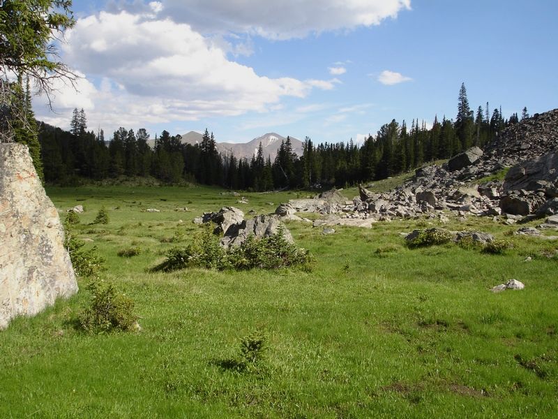
From Yellow Lake, we wandered across the meadow until we picked up the remains of an old trail west heading to a pass at 9892'. The trail is shown on the map, but is very faint since it'd probably been at least a decade since any maintenance was done on it. The climb to the pass wasn't too bad, and we had a good view of an unmapped lake below to the south. Once on the ridge, we had a decision. Either drop down into the drainage that held Big Eighmile Creek, or traverse the ridgeline across Big Eightmile Peak (10601') before dropping down to the saddle above Devil's Basin. We decided the effort would be about the same either way, but ended up taking the ridge route to get some views and to let me bag peak. I think this was a good decision, and the views of the surrounding area didn't disappoint. The highlight was the unobstructed view of the entire Lost River Range, home to many of Idaho's highest mountains. It was very impressive. To finish off the hiking portion of the day, we walked down the gentle ridge to the saddle, then down into the gorgeous Devil's Basin area.
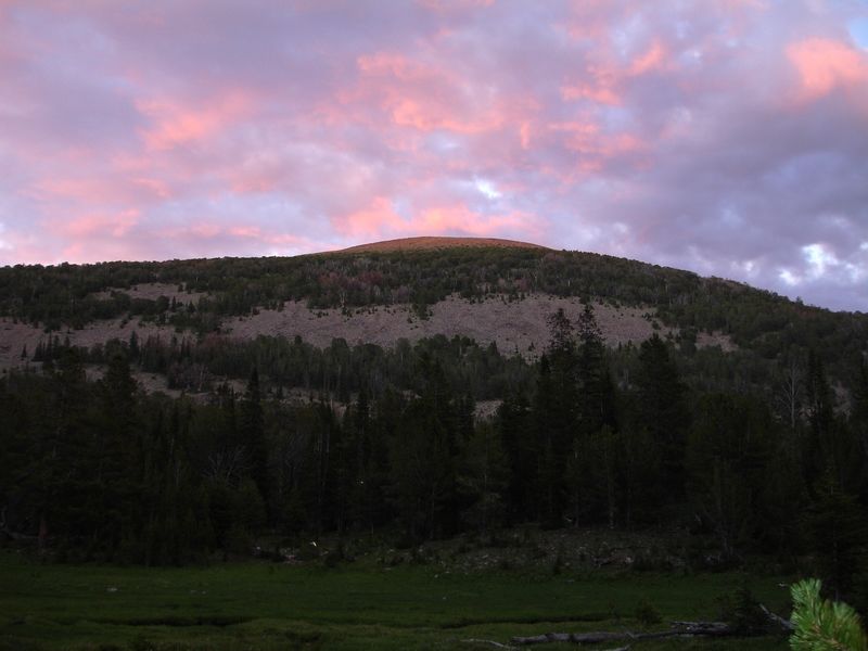
We made camp in the southwest corner of the basin, then lathered up with bug spray before relaxing for a while. Not long before nightfall, we were visited by a doe Mule Deer and two nursing fawns, which was pretty cool. Then we got to see some great sunset colors on the clouds above Big Eightmile Peak.
We agreed to let ourselves sleep in the next morning, but still awoke at just after six. We broke camp and made our way down the trail following the North Fork of Big Creek. The trail was pretty easy to follow about 80% of the time, but faded in and out. We passed several nice waterfalls on our way through fairly thick forest. The best part was meeting up with a moose on the trail. We saw him not long before reaching the fork in the trail leading up the Park Fork of Big Creek. After leaving the fork, the trail made several steep switchbacks on its way up the Park Fork before leveling off somewhat.
Our next goal was the outlet stream from the unofficially named Park Fork Lake coming in from the north. When we got the stream, we were in no mood for the steep bushwhacking terrain that lay in front of us, so we decided to stick with the main trail for a while before contouring back to the lake. This worked out okay for the most part, except that we ended up at least 500 feet above the lake. We were a bit annoyed at our wasted elevation gain, but were happy to have reached our destination for the night. The rest of our party arrived about an hour later via the cut-off trail from Yellow Lake, surprised that we'd gotten there first.
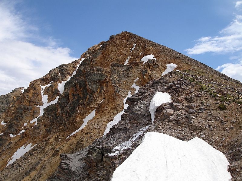
It was still before three o'clock so I decided to go climb Yellow Peak while the others dozed for a few hours. I was tired too, but had been hoping to climb this peak ever since the initial planning stage of the trip months earlier. It would be around 5 miles round trip, and I figured there was probably just enough gas left in my tank to make the trip. From the lake, I contoured along the hillside for a while, then angled down to the trail we'd come up. I then followed the trail up to the a four way fork called Lemhi Divide. From here I headed south to the base of the aptly named Yellow Peak. The north ridge of the peak looked doable, so I left the trail and started climbing. At this point the weather was looking ominous but raindrops were only occasional, so I continued up the ridge. By the time I reached the summit, I was pretty winded but happy that the weather hadn't gotten any worse. The views were great, but I didn't hang around long before dropping down the west ridge to where the trail crosses the saddle at Yellow Pass. A couple nice lakes were just south of the pass, but I decided to head back instead of exploring.
When I got back to the campsite, the rest of the guys were just waking up. After yet another layer of bug spray, we talked around the campfire for a few hours before turning in for the night. The weather was great the next morning as we broke camp, then made our way back to the trail. The day was mostly downhill back to the trailhead and we made good time, especially the psychotic JJ who actually broke into a jog for a while. I guess all that sleep did him good. Once back at the Durango, we enjoyed some PB&J's before making the drive home. It was a very nice trip, but it'll probably be awhile before any of us make the long journey back to the remote Lemhi's.

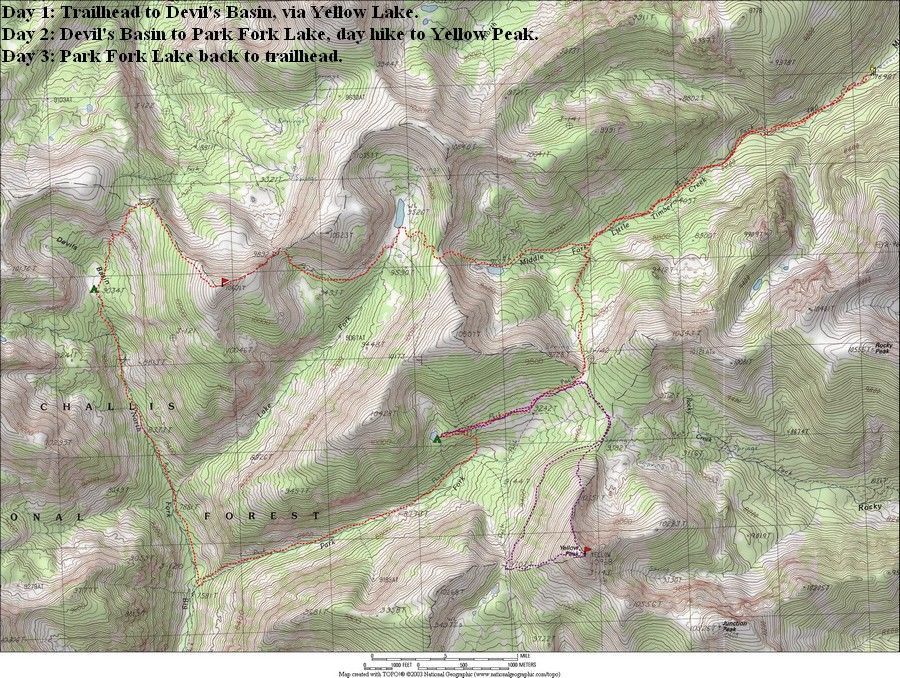
Overview map of our route, about 24 miles round trip.
|

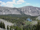
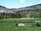
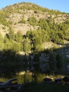
Unofficially named "Middle Fork Lake" at 9157' is the first lake you reach on your way up the Middle Fork of Little Timber Creek.
|
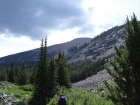
Here are Ken and JJ making their way towards the 9800' saddle above Middle Fork Lake en route to Yellow Lake.
|
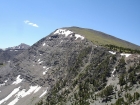
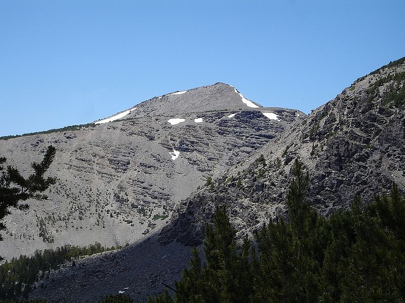
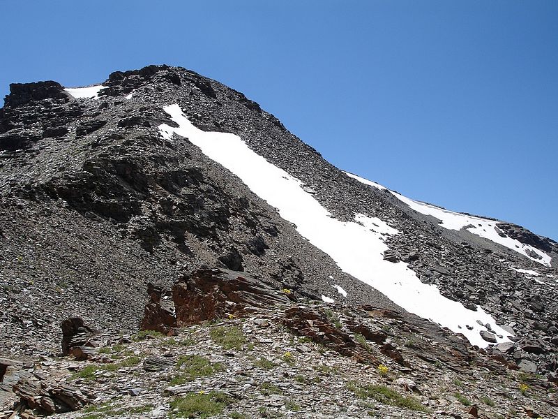
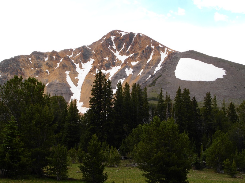
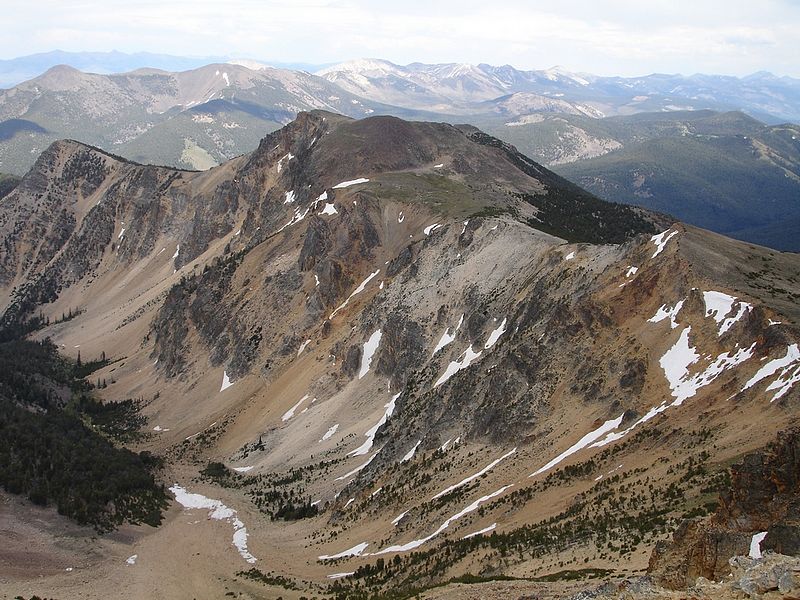
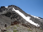
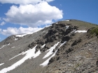
The north ridge of "Slate Roof Peak" (10507') with Yellow Peak in the distance to the left.
|
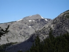
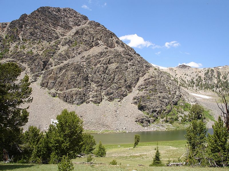
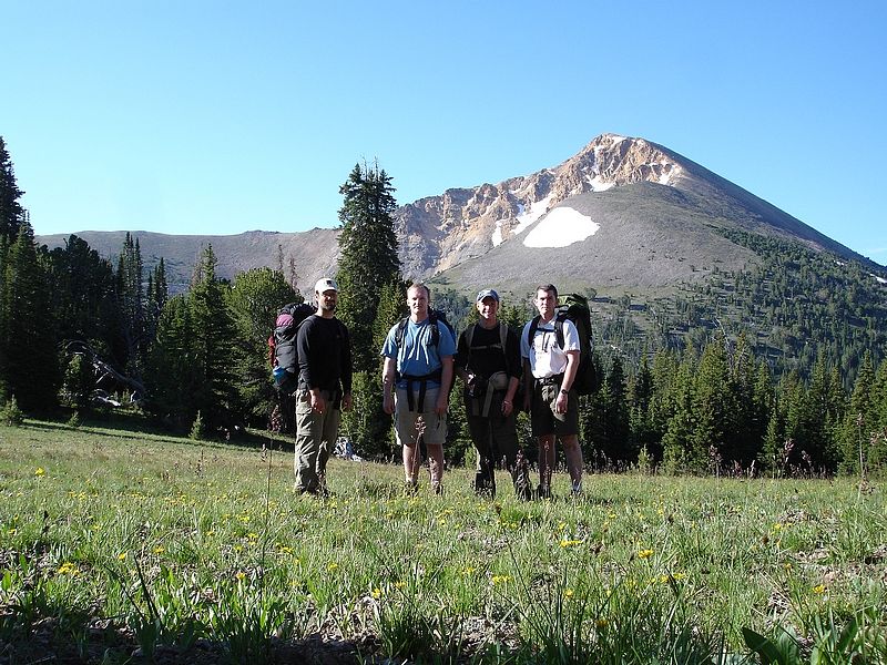
A view of "Big Eightmile Peak" (10601') from the slopes east of Yellow Lake.
|
Yellow Lake, a great place to catch some zzzzz's.
|

Ken climbing to the 9892' saddle northeast of Big Eightmile Peak.
|
This beautiful little lake east just east of Big Eightmile Peak isn't even on the map. That's the tip of Yellow Peak in the background.
|
Here's a view up the northeast ridge of Big Eightmile Peak from the 9892' saddle.
|
The Big Eightmile Creek drainage lies to the north of Big Eightmile Peak.
|
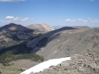
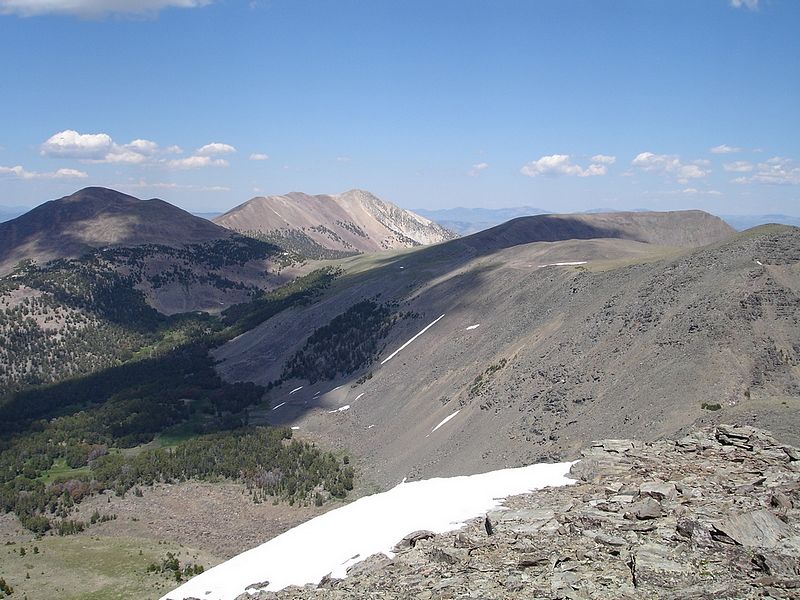
To the northeast of Big Eightmile Peak you can see "Ray Lode Peak" (10723') and Gunsight Peak (10835'). The Beaverhead Mountains are in the distance.
|
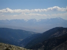
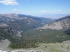
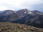
Probably the best view form Big Eightmile Peak is of the Lost River Range to the southwest.
|
Here's Ken starting his way down the northwest ridge of Big Eightmile Peak.
|
Looking back up the northwest ridge of Big Eightmile Peak during our descent.
|
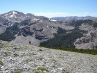
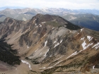
A view of "Devil's Basin" from the ridge to the east.
|
The beautiful Devil's Basin with the 9623' saddle to the north which holds the trail.
|

This shot was taken from the north end of Devil's Basin, looking south.
|
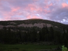
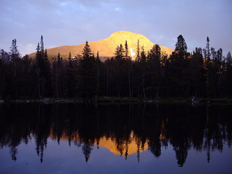
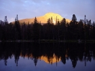
The sun setting on Big Eightmile Peak from our campsite in Devil's Basin.
|
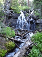
One of several waterfalls we passed while descending the North Fork of Big Creek.
|
Here's a young moose we saw on the path, not far from the junction with the trail to the Park Fork of Big Creek.
|
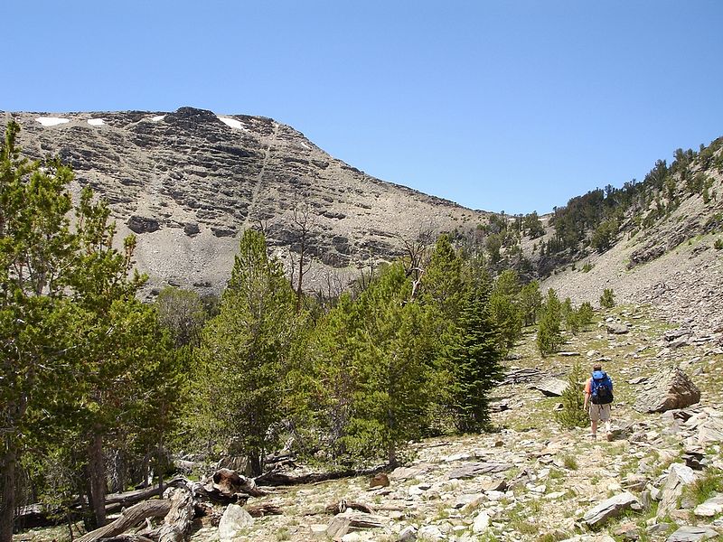
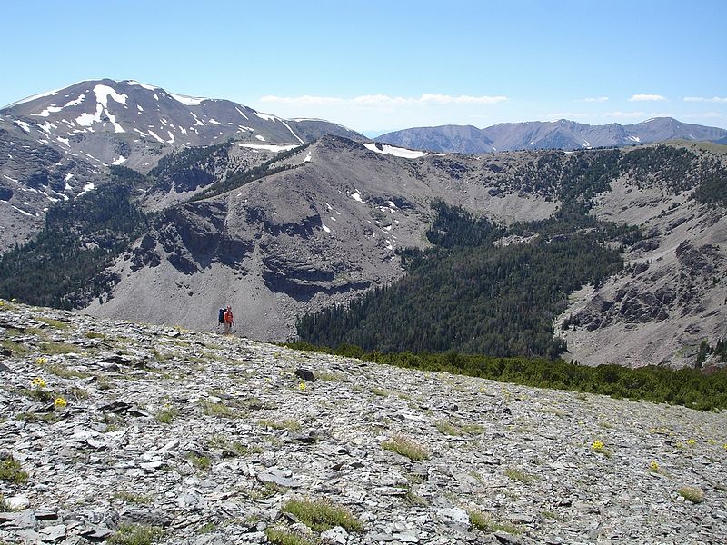
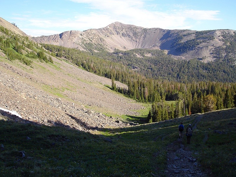
The trail up the Park Fork starts out pretty steep, but eventually levels out and gives you some nice views of Yellow Peak.
|

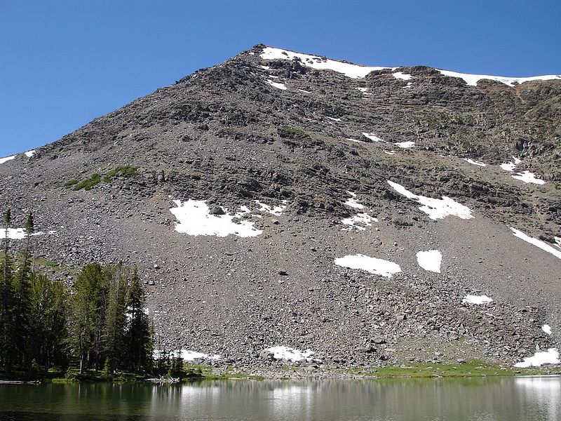
A view of the northeast face of Yellow Peak, as seen from the north from about the 9500' contour.
|
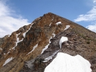
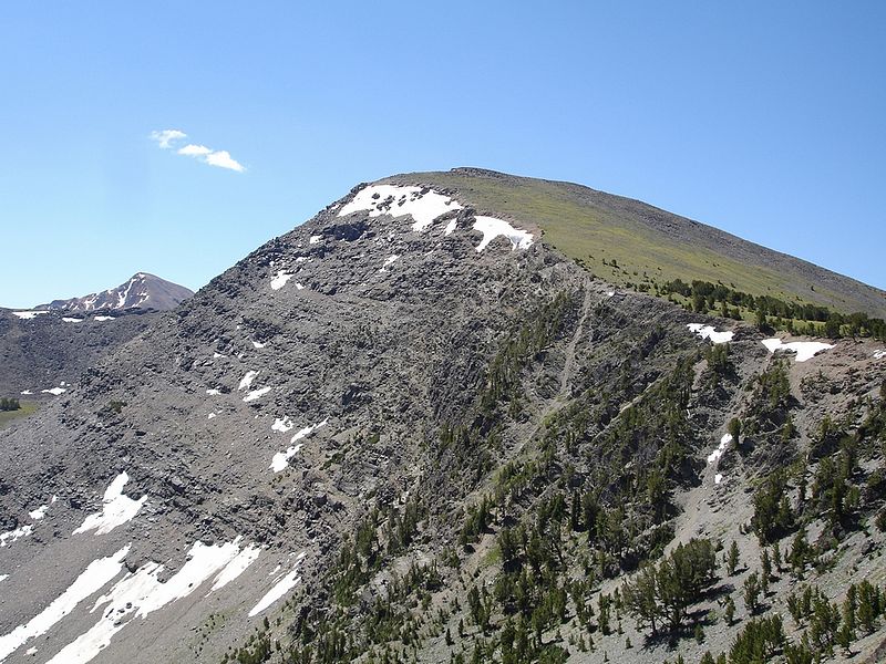
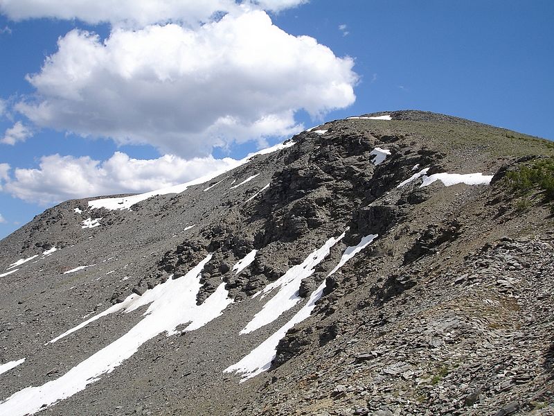
Aptly named Yellow Peak as seen from high up on the north ridge.
|
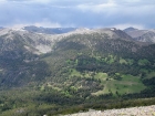
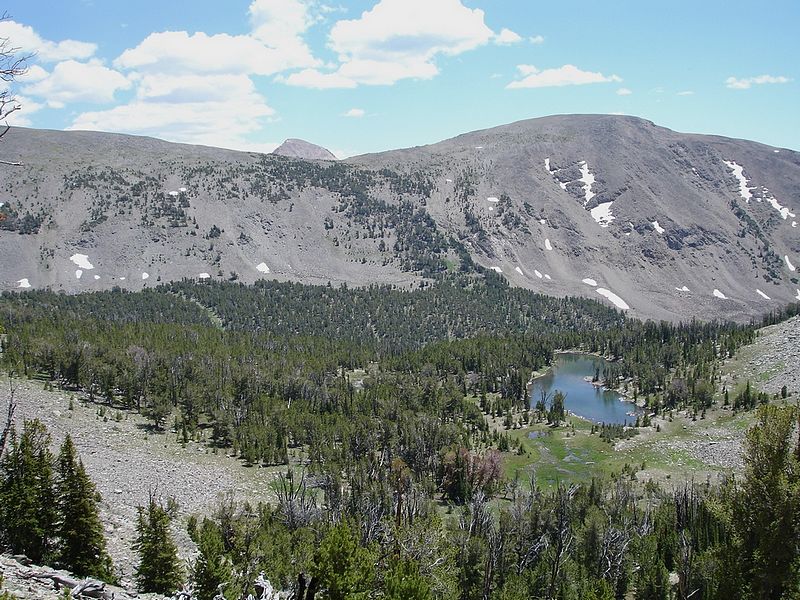
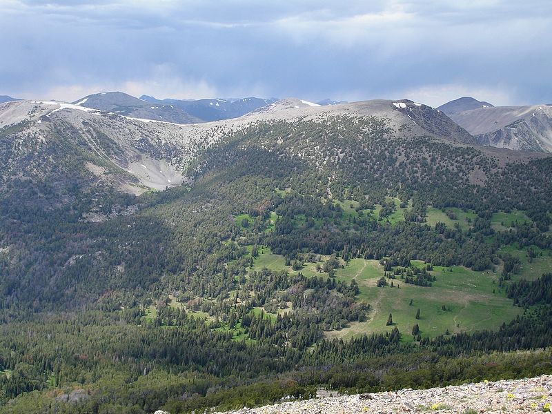
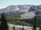
Looking down on the meadows in the Park Fork Big Creek valley. Park Fork Lake isn't quite visible in the trees to the left.
|
From the summit of Yellow Peak, you get a nice view of the connecting ridgeline to Junction Peak to the east.
|
To the south of Yellow Peak, you can see Flatiron Mountain (11019') and Big Creek Peak (11350').
|
The sun setting on Yellow Peak from our campsite on Park Fork Lake.
|
A morning view of Park Fork Lake.
|
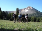
This is JJ, Ken, Jordan, and me at Yellow Junction, the saddle prior to dropping back into the Middle Fork of Little Timber Creek. Yellow Peak is behind us.
|

Here's Ken, JJ, and Jordan dropping back down off the saddle on our way back to the trailhead.
|
|