|
Bighorn Crags
Backpacking in the Frank Church Wilderness
July 29 - August 1, 2004
The Bighorn Crags are a beautiful backpacking destination located in Idaho's Frank Church River of No Return Wilderness, the second largest wilderness area in the lower 48 states. The trailhead at Crags Campground is very remote, but the area is still the most popular backpacking destination in The Frank Church wilderness area.
Ken and I made the 6+ hour drive from Boise on Wednesday afternoon and decided to make camp at Yellow Jacket Lake campground. Getting there required just a little extra driving, but I'd heard it was less crowded and more scenic that the trailhead campground. We had the place to ourselves at first, but were joined by some folks who arrived later that evening. At first we were a little bummed that we had to share the lake, but we were sure grateful for the company the next morning when we needed a jumpstart because of a dead battery in the pick-up. One of those blessing in disguise cases for sure…
The next morning we drove over to the trailhead at Crags Campground and parked on an incline so we could get a rolling jumpstart on the way out. The campground was pretty full, and the backpacker parking lot had license plates from all over the place. Even with the amount of activity, we were optimistic that our planned destination for the day (Terrace Lakes) would be enough out of the way to keep it from being too busy. We hit the trail by around 9am and made our way through the up and down early portion of the hike for the first 3.5 miles to Cathedral Rock. Soon after that, we split of the main trail (which heads to Wilson & Harbor Lakes) and went west on "The Waterfall Trail" leading to Welcome Lake. Don't let the name fool you, there aren’t many waterfalls in this section of the trail. However, it was nice and cool as it wound through the trees while we gradually dropped off the ridge down to Wilson Creek. Here we stopped for lunch, checking out the Columbines on the creek-side, and talking with a group from Florida who had read about the area in Backpacker Magazine.
From here we continued on to Welcome Lake, took a short break, and then made the climb to Heart Lake. This would have made a good campsite, but we still had plenty of daylight left and we were looking forward to getting to the more secluded Terrace Lakes. So we headed up the switchbacks to the west which leadto the pass west of Heart Lake. From here we had a great view of Fish Fin Ridge to the east and Terrace Lakes to the west. The terrain was very craggy in all directions, with granite outcroppings of various sizes sticking up all over the place. After taking in the views for a while, we headed down to the lowest Terrace Lakes and set up camp for the night. After a quick swim and some fishing, I decided to take a stroll over to Barking Fox Lake while Ken took a nap. I ended up going beyond the lake and climbed up to a saddle that overlooked Skyhigh Lake from the north. The sun was setting at this point, so I headed back to camp for some dinner.
Our plan for day 2 was to go cross-country to the north from Terrace Lakes, up and over the ridge, then drop down to the lakes south of Ship Island Lake and hopefully run into a fisherman's trail to descend. But it didn't quite work out that way… We had no problems with the climb up the ridge, just wound through the trees with frequent stops to catch our breath. Once on the ridge, the views were awesome! But with all the cliffs nearby, the way down wasn't obvious. We followed the ridge to the east for a while then found a scree chute that we could use for a descent route. The terrain was pretty open as we dropped down to lake 8395', but there was no sign of a fisherman's trail to the next lake, that was for sure. We continued going down through increasingly dense brush and downed trees. Finally we make it to the second lake, but it took way longer than expected, and we were beat. An extended rest stop did us good, and then we got out the fishing poles and began catching cutthroat trout that were swimming amongst the logjam at the lake's outlet. At one point, Ken lost his lure on one of the logs and decided to go in after it since we hadn't brought along too many lures. Somehow during this endeavor, the log that supported his shoes and the camera got bumped, so that was the end of the road for the camera and any future photos of the area. We were both bummed, but decided not to let that get us down.
From the second lake, we got lucky and found a descent trail that made its way down to the south shore of Ship Island Lake. The lake was beautiful. We circled around to the east, then made the climb up to Airplane Lake where we made our camp for the second night. Surprisingly we had the lake and some good fishing to ourselves. On the third day, we wouldn’t have to carry the packs very far, and made quick work of the 1.5 miles up to Birdbill Lake where we staked claim to a good campsite before putting together our daypacks for a hike over to Big Clear Lake. I’d read that there were California Golden Trout in that lake, and even though we were there at a bad time of day for fishing (shortly after noon), I did manage to catch a nice 14-incher off the point on the west shoreline. After that, we did a fishing tour of the other nearby lakes. It made for a nice relaxing afternoon before making the hike back to camp.
The fourth and final day was uneventful. We’d heard there’d be a good chance of seeing some bighorn sheep on the trail between Birdbill Lake and Wilson Lake Pass, but we came up empty this time through. The views from the pass were very good and it was a great vantage point to survey the terrain we’d toured during the last few days. From there we just followed the up-and-down trail back to the truck. Good thing we’d parked pointed downhill, because the battery was dead, again. We just kept it running all the way home, except when we stopped at the top of a hill to pick Sego Lilies for my wife (her favorite), All in all, a great four day trip.
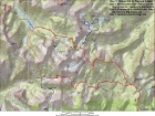
Map showing our route.
|
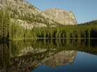
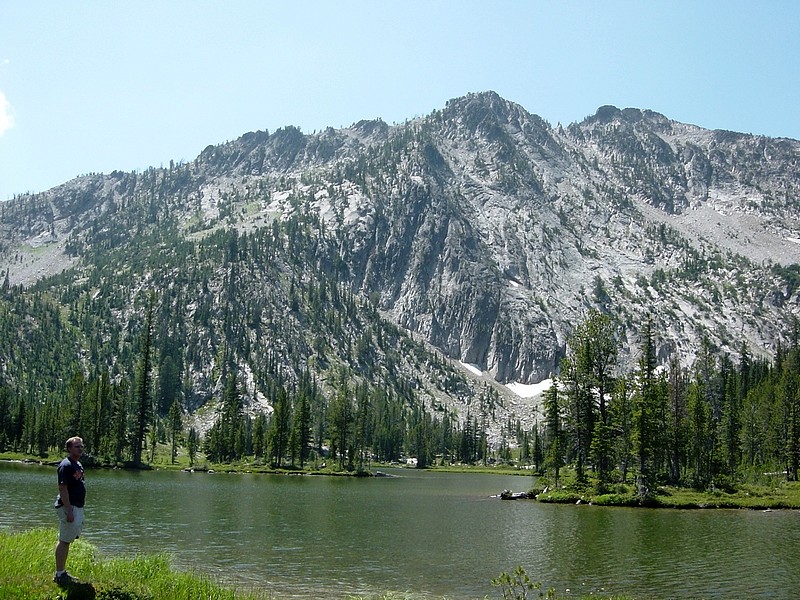
Evening sun on Sugarloaf (9045') from our campsite at Yellowjacket Lake. An awesome backdrop.
|

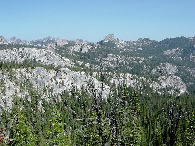
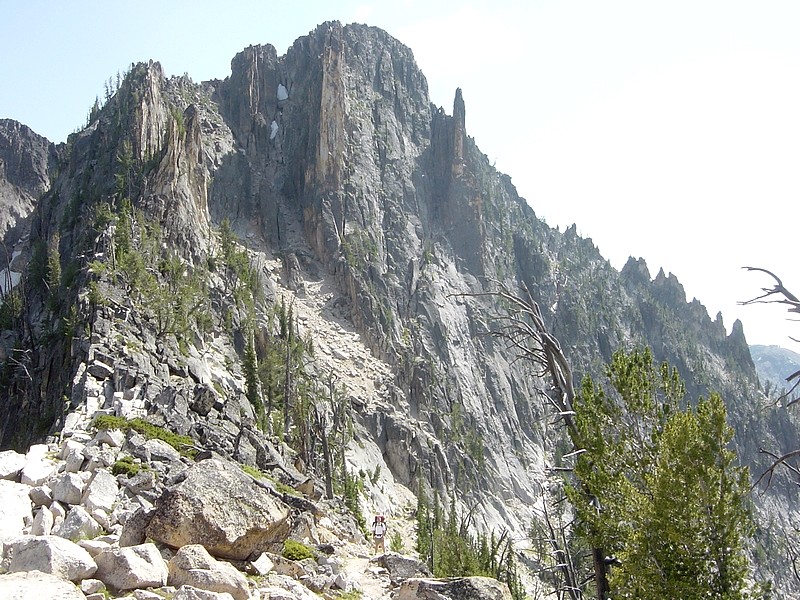
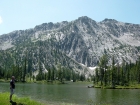
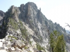
Craggy terrain as seen from early in the approach. Visible in the distance are Fishfin Ridge, Mount McGuire, and Cathedral Rock.
|
Here’s Ken during a rest-stop at Welcome Lake.
|

Me on the trail leading up the Heart Lake, with Fishfin Ridge in the background to the right.
|
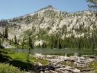
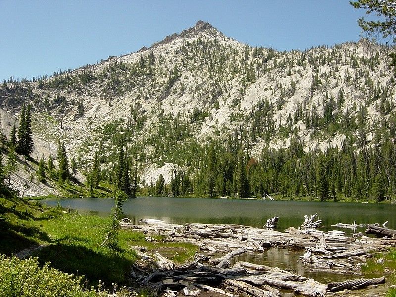
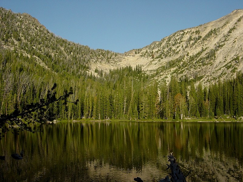
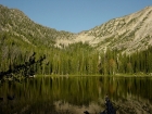
This is Heart Lake from the west. In the background, you can see the trail that climbs over the pass to Terrace Lakes.
|
Based on this view from the pass leading to Terrace Lakes, its easy to see where Heart Lake got its name.
|
Here I am standing on the pass between Heart Lake and Terrace Lakes.
|

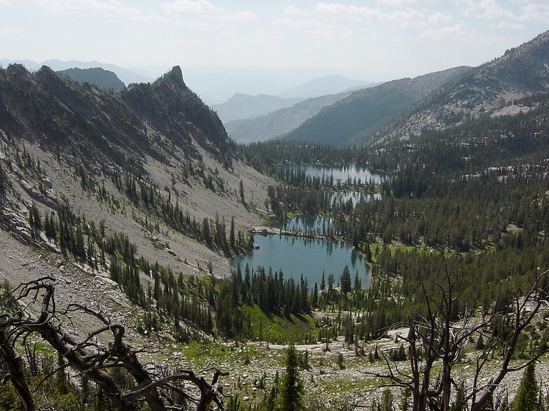
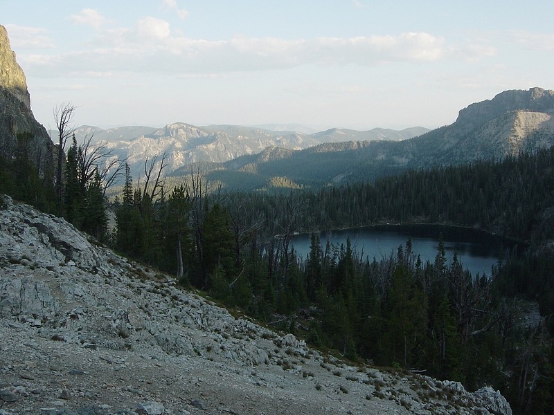
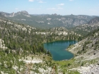
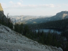
Looking down on Terrace Lakes from the east.
|

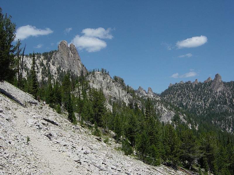
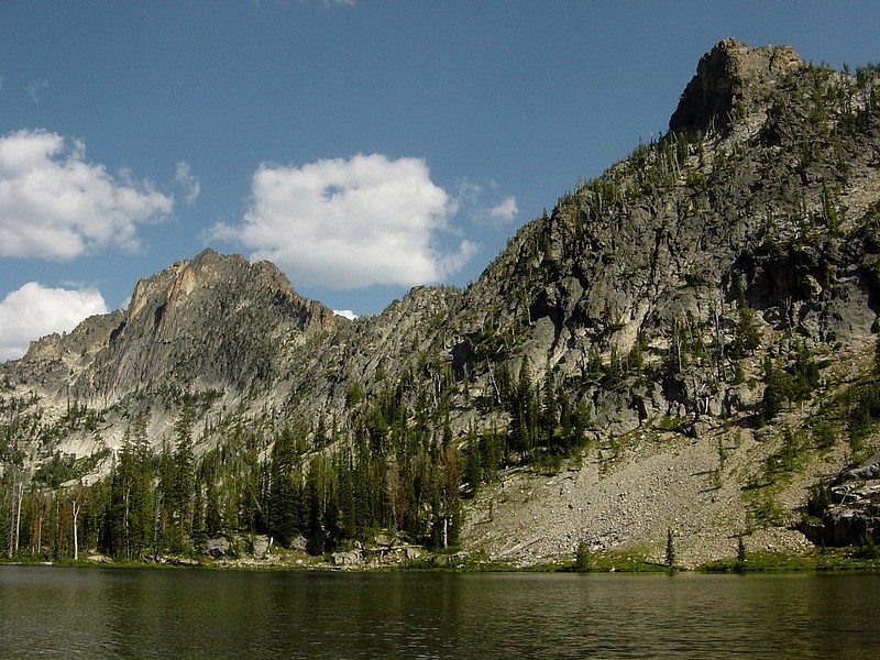
A view of the ridge south of Terrace Lakes.
|
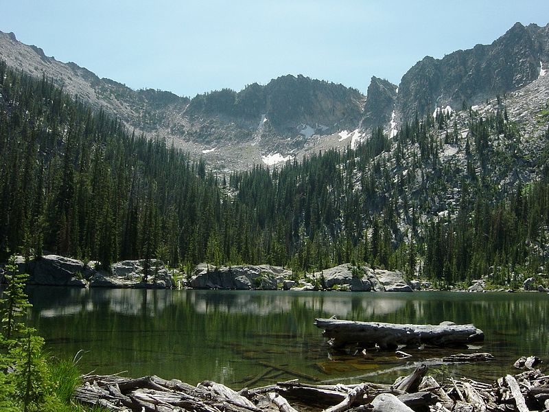
Here is a view of Barking Fox Lake from the west shore.
|
This is the view looking down on Skyhigh Lake from the saddle to the north.
|

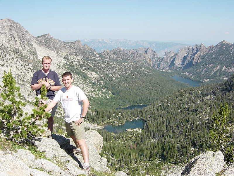
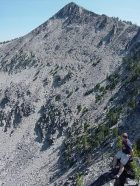
Ken and I standing high on the ridge between Terrace Lakes and Ship Island Lake, which is the lake furthest behind us.
|
Here's Ken perched on the ridge, with Sheepeater Mountain (9920') behind him to the northeast.
|

Looking back up at the ridge we crossed after leaving Terrace Lakes. Photo taken from lake 8395'.
|
|