|
Mount McCaleb
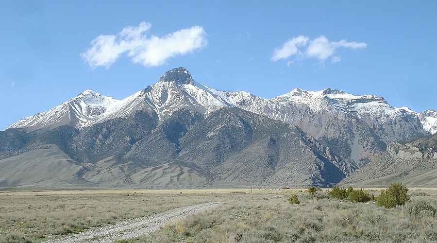
As you head north on highway 93 from Arco, Mount McCaleb is one of the most distinctive summits in the Lost River Range. It’s the crown like mountain that towers over the town of Mackay. George, John, and I had been talking all winter about a climb that would link up Little Mac, Mount McCaleb, and USGS Peak. Late spring seemed like the best time to do this. The thought was that there would be enough snow hiding the loose scree down low, but not enough to create problems along the ridgelines. The only unknown would be "the crux" on the ridge northeast of Mount McCaleb.
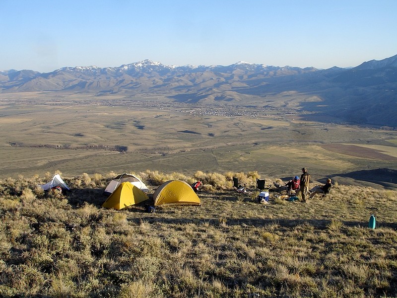
We got out of Boise by around 1pm on Friday so there was still plenty of daylight left by the time George, John, Pat and I got to Mackay. We'd originally planned to camp at the Reservoir, but decided to head towards the trailhead and camp there if there was space enough to pitch our tents. The drive in from the highway was an adventure in itself. We had to backtrack a few times on the unmarked roads, and took the "scenic route" in a few places before arriving at the start of the jeep trail that headed up to the base of Mount McCaleb. It was a bit on the steep side (understatement), so we put the fully loaded Durango in 4WD Low, and first gear for the climb up the mountain. I've been on roads that steep in the past, but not for anywhere near that long. When we reached the end of the road at about 8200', we were pleasantly surprised to see a nice flat spot with enough room to camp and commanding views of the valley below.
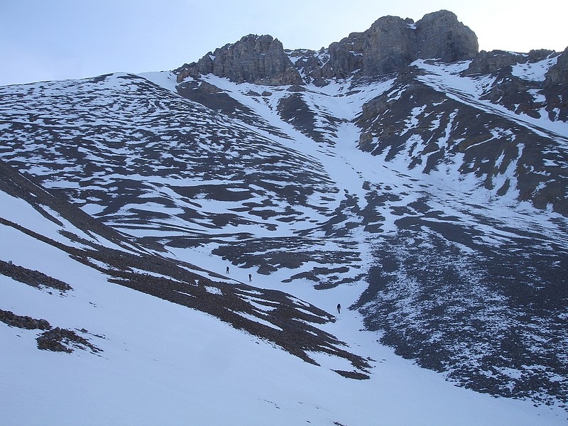
After a decent night of sleep we were on the trail the next morning by 6:45 making our way up Little Mac's south ridge. Not long after passing the tree line, the scree on the ridge became a little loose for our tastes, so we dropped back into the gully between Little Mac and Mount McCaleb. At this point we put on crampons for the climb up to the saddle between the two peaks. As we neared the saddle, the sun was staring to hit the east side of Little Mac, and we began to hear occasional ahhwuuump sounds. The snow was very consolidated and the slope wasn’t too steep, but the sound was still unnerving.
At the saddle, we were rewarded with an awesome view of the west face of USGS peak. From here we made the 500’ climb up to the top of Little Mac. The summit was surprisingly small. (For some reason I just expected it to be a more rounded.) The peak is actually pretty impressive, especially the steep north face with about a 1000’ of vertical drop off the backside. After a short rest, we headed back down to the saddle and began the climb up Mount McCaleb’s west ridge. The sun was starting to hit that part of our route also, which caused some occasional post-holing, but nothing too bad. It was definitely a test of our early season conditioning though.
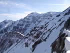
The summit views from McCaleb were great, and we got our first unobstructed view of the ridge leading to USGS Peak. I would rate it at least Class 3-4, maybe harder with the cornices along the ridgeline. It had taken us around 4 hours to get to the summit of McCaleb (a little longer than expected), and the prospect of crossing that ridge didn’t excite us. This coupled with the likelihood post-holing in the soft snow on USGS’s south ridge and having to re-cross the corniced section back to McCaleb was enough to make us throw in the towel on the traverse. I know we were all a little bummed, but it was no doubt the right decision.
We hung around on the summit for a while, and then hiked back towards the McCaleb’s west ridge where we started a nice glissade down the face. About halfway down the gully between the peaks, we met a couple guys who were heading up to the saddle to make camp for the night. They were talking about some training so all we could figure was that they must have been shaking things out for some future “big mountain” trip.
Once back at the campsite, it was unseasonable warm for April, probably at least 75 degrees. After packing up camp, all that was left was the drive back down the steep jeep road. I kept the Durango in 4WD low and first gear for the crawl to the bottom. It was so steep that we actually lost oil pressure a couple times with all the oil draining forward away from the oil-pump. Luckily no damage was done.
It was a definite let-down that we hadn’t made it all the way to USGS Peak, but it would be hard to complain too much considering how awesome the weather was. USGS will have to wait for another day..
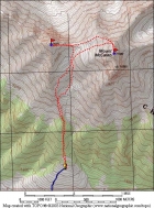
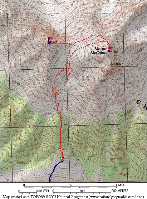
Map showing our route. |

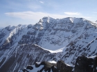
View from the road of Little Mac, Mount McCaleb, and USGS Peak. |
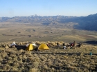
Our campsite at 8200 feet. Great views and just enough flat area to pitch a few tents. |
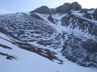
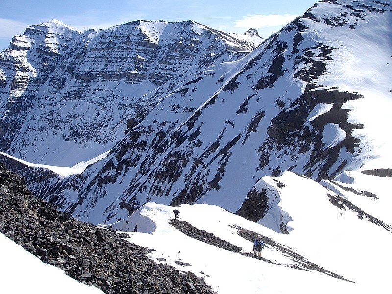
Pat, John, and George climbing the gully, Mount McCaleb above them. |
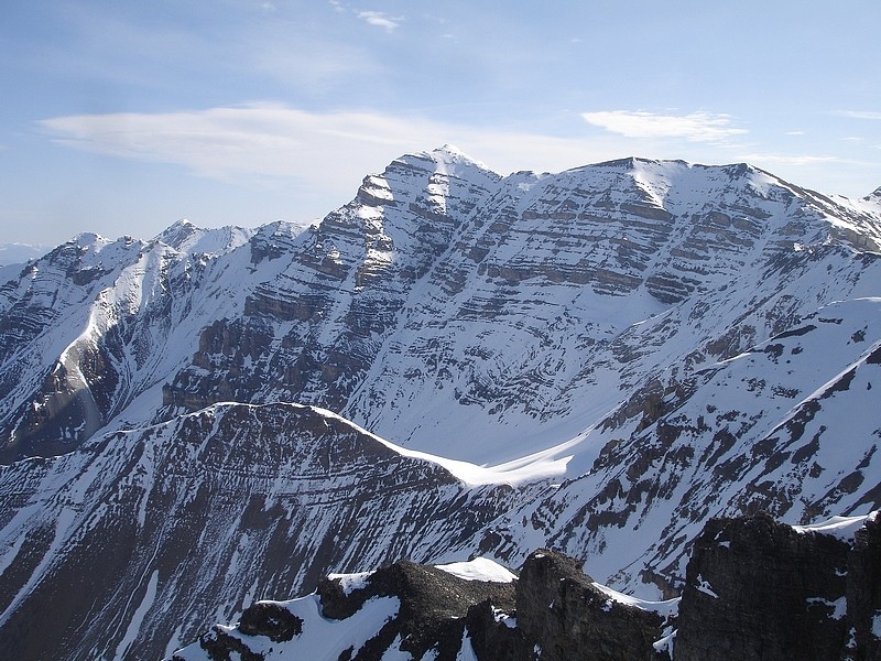
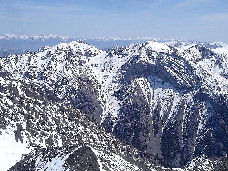
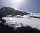
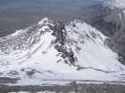
A view of USGS Peak from the saddle between Little Mac and Mount McCaleb. |
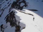
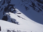
John climbing towards Little Mac, giving plenty of room to those cornices. |
George heading up Little Mac from the saddle. (John R. photo.) |
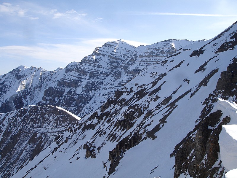
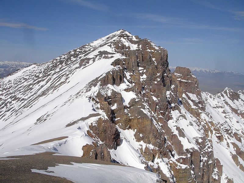
USGS peak from Little Mac. |

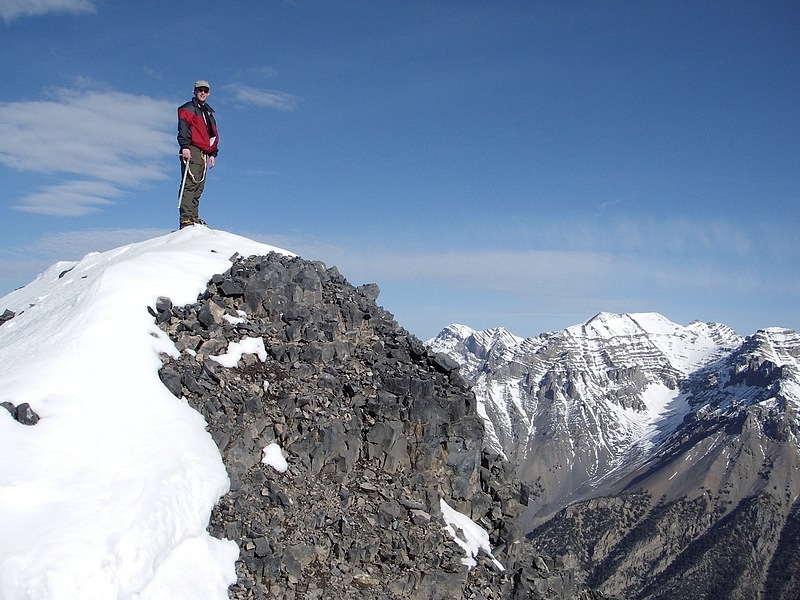
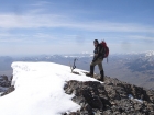
Dave on the summit of Little Mac. (John R. photo.) |
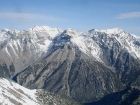
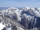
View to the northwest of Little Mac, highlighted by Lost River Peak and Far Away Mountain. |

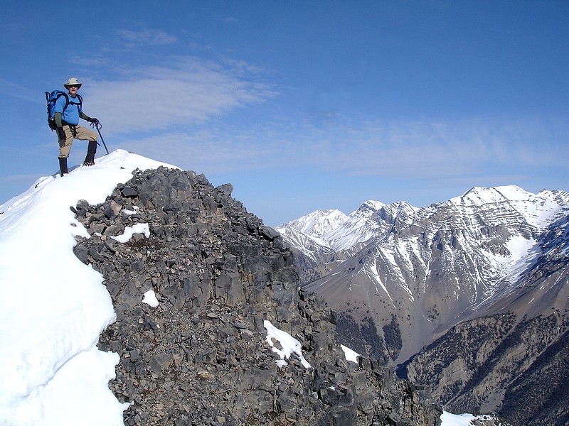
George on the pointy summit of Little Mac, Lost River Peak is to the right. |

Making our way down from the summit of Little Mac. |
The west face of Mount McCaleb. |

Little Mac from low on the west face of Mount McCaleb. |
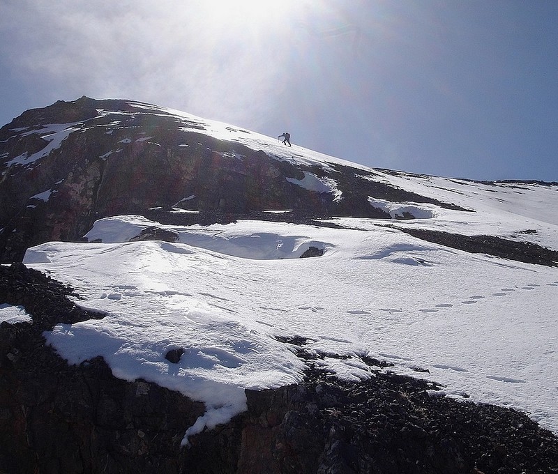
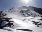
Pat climbing into the sun on the Mount McCaleb's west ridge. |

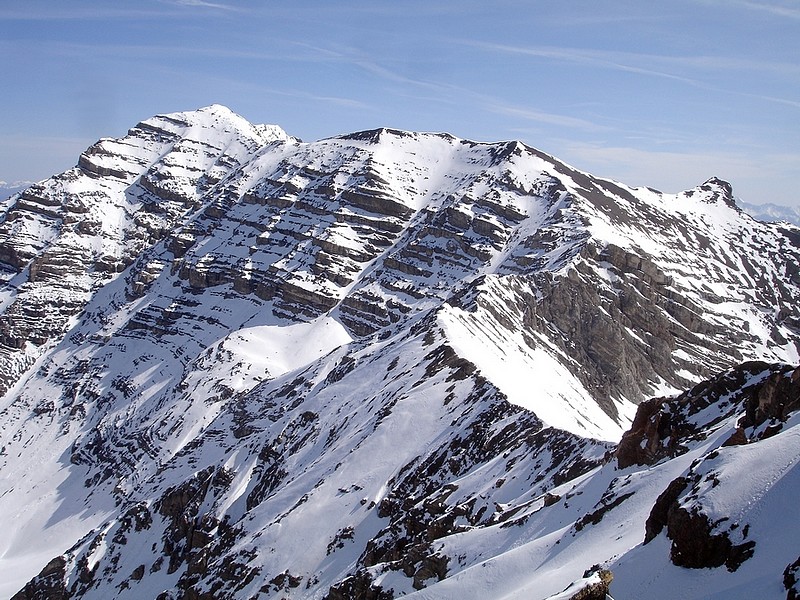
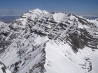
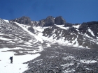
The ridge leading from Mount McCaleb to USGS Peak. |

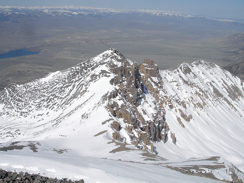
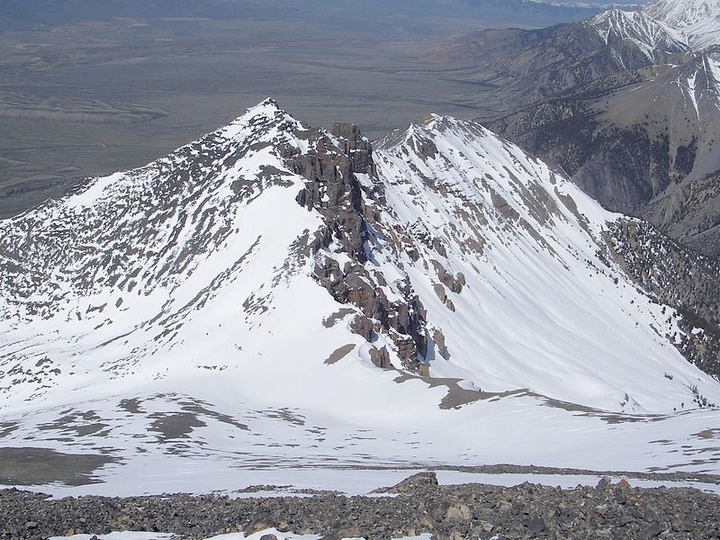
Looking down on Little Mac from Mount McCaleb, with Mackay Reservoir in the background. |
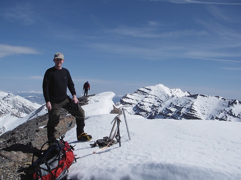
John on the summit of Mount McCaleb. |

Pat nearing the summit of Mount McCaleb. |

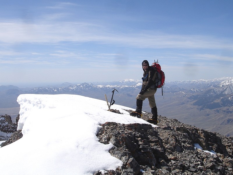
Me on Mount McCaleb's summit. (John R. photo.) |
Hidden Peak and Wet Peak from Mount McCaleb. |
USGS Peak from Mount McCaleb. |
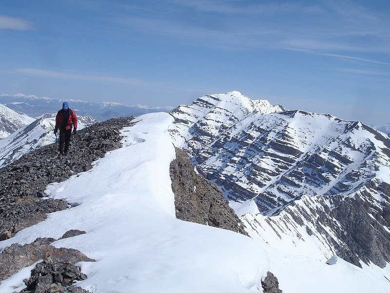
Little Mac from Mount McCaleb's summit ridge. (John R. photo.) |
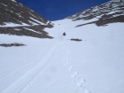
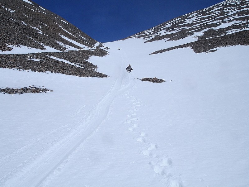
Glissading down the gully between Little Mac and Mount McCaleb. |
George looking back up at Mount McCaleb during our descent. |
|