|
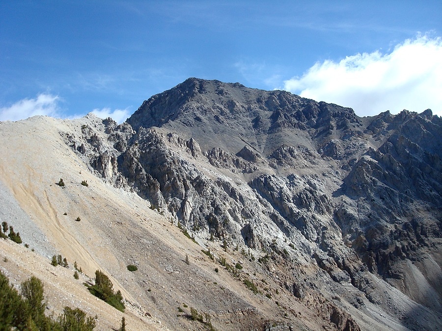
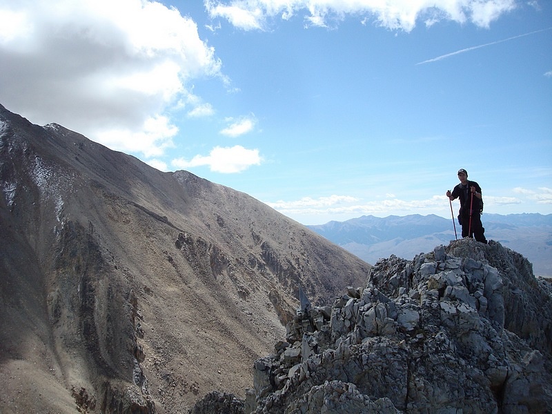
With an elevation of 12065’, Mount Idaho is the seventh tallest peak in the state. It’s located in the Lost River Range, not far from Mount Borah. Many climbers consider this to be the most enjoyable of the 9 twelve thousand foot peaks in Idaho, because of the views and relatively solid rock along the way. It would be my 9th and final 12er to climb, so I was really looking forward to the climb and completing that goal.
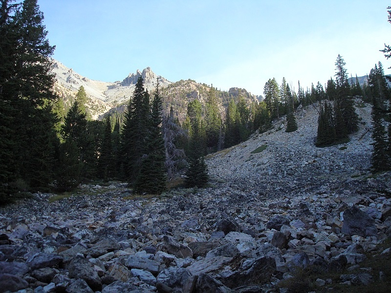
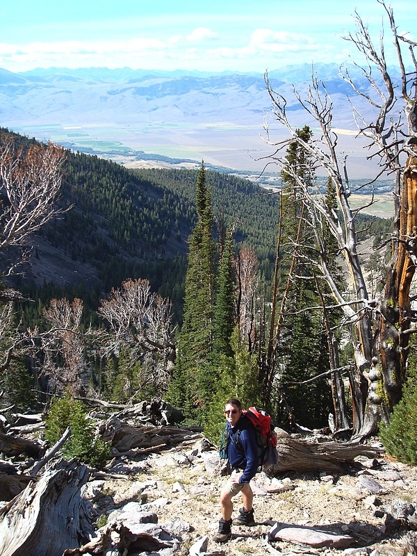
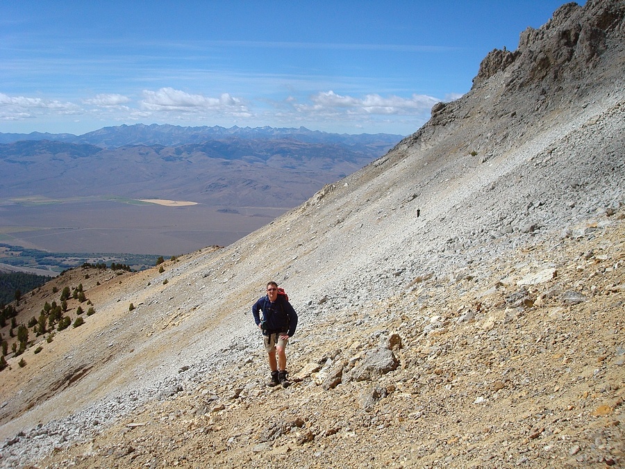
After leaving Boise at 4:30am, we arrived at the Elkhorn Creek trailhead at 8am, with a quick stop at the golden arches in Hailey included. The end of the road is at about 7000’, a mile from the highway. It takes high clearance to get that far, but a sedan could make about half that far. Brendon, Erik, and I hit the trail under perfect weather conditions. It was a little chilly at first, but we were peeling off layers in no time. The lower portion has a trail that we were able to follow for a while. It crosses over to the north side of the creek just above the trailhead, and then crosses back not too much later. From there, we tried to stay with the trail as best we could, but it kind of peters out after a while. We just kept wandering our way up through the trees until we got to the base of the cliffs at around 9200’. It had been a leisurely morning so far, with good banter along the way. The discussion was dominated mostly by ‘internet mountaineering’ topics, and Brendon telling me how ancient I was. But now it was time for the real work to begin.
From the meadow at 9200’, we headed north and climbed the forested slopes south of point 11060’. At about 10400’ we gained the top of the rib, and stopped for a while to enjoy the views and have a snack. The next step was to traverse a talus field on our way to the saddle east of point 11060’. The old dude found a nice climbers trail that took us right to the saddle with ease, but one young guy in the back wasn’t as lucky, so it took him a while longer. But that wasn’t a problem, since it gave Erik and I the chance to take in the awesome view of Mount Borah to the north, and the climbers on its summit.
From the saddle, we began the scramble portion of the route. There were some fun towers to find our way through. There are a number of options through this section, and we each took slightly different variations. Once past the towers, the going got steep and we made our way out onto the southwest face of the peak. I took off ahead of the others to take advantage of my “summit adrenaline” before it wore off. This ended working out since the rock was pretty loose and it reduced the chances of me kicking rock-fall on the others on the way up.
The views from the summit were awesome, some of the best I’ve seen, with the highlight being an in-your-face view of Mount Borah. I spent time reading the summit register until Erik and Brendon arrived not too much later. We hung out for quite a while since the weather was great. Very few clouds in the sky, and hardly any wind. We ate lunch, and Erik and I wandered over to the east end of the summit ridge for some excellent views of the Pahsimeroi, Leatherman, and Pass Lake. Then we headed down
The way back was mostly uneventful. We were very careful during the upper portion on the loose rock, then traversed back to the saddle, followed by some scree skiing down a gully that helped us make some good time. The only minor challenge was finding the trail, which we didn’t locate until we were about a mile from the car. That slowed us down a bit, but it wasn’t a big deal since the forest and brush isn’t very thick. It was just after 6pm when we finally arrived back at the car, after one of the most casual days I’ve ever had while climbing a big mountain. It was very nice. The weather and views were great, some fun scrambling mixed in, and lots of time to share hiking stories during the climb (and during the long drive both ways too).
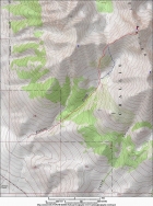
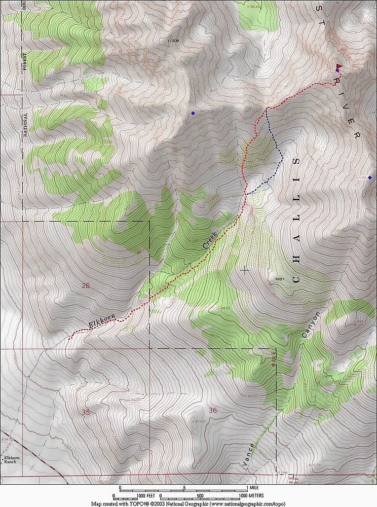
Overview map of the route, 8 miles and 5k gain. Blue line is the descent route.
|
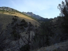
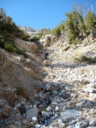
Early view looking up from the trail.
|

This is where the climbing starts at 9200'. From here we climbed the forested slope on the left to reach the knob at 10400'.
|

Erik climbing towards 10400'.
|

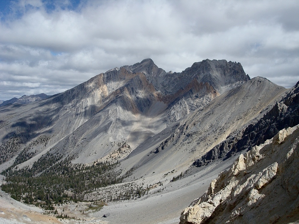
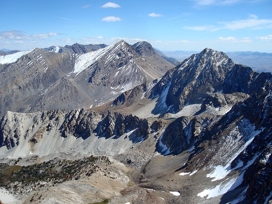
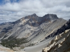
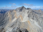
Mount Idaho's southwest face, from 10400'.
|

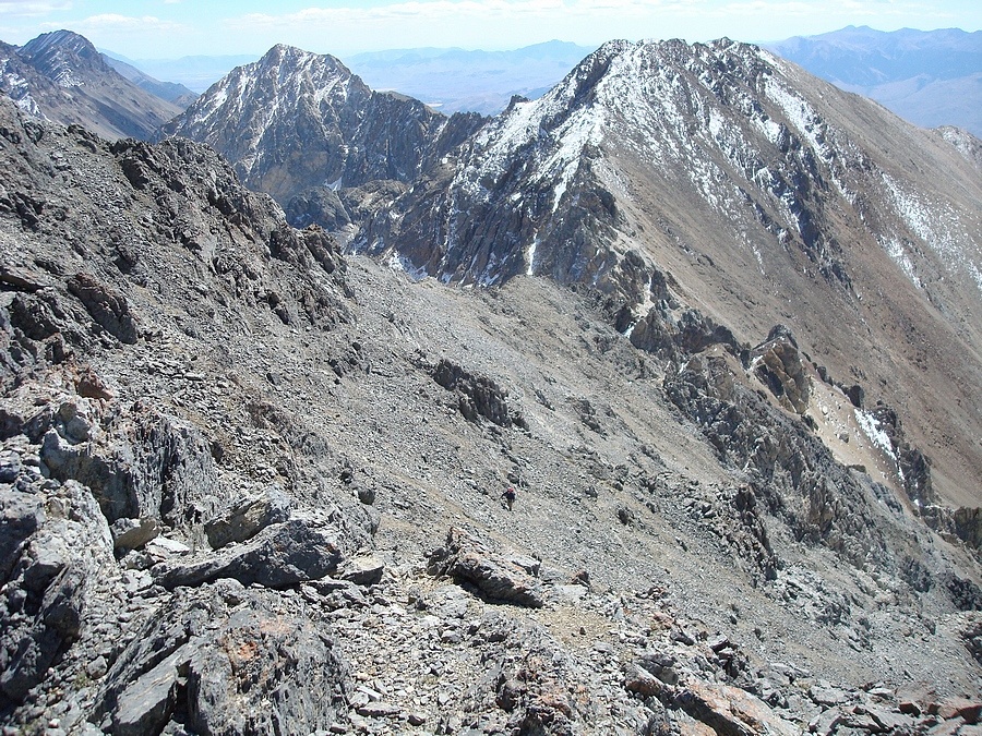
Erik and Brendon crossing the scree on our way to the saddle east of point 11060'.
|
Our first view of Borah, from the saddle.
|

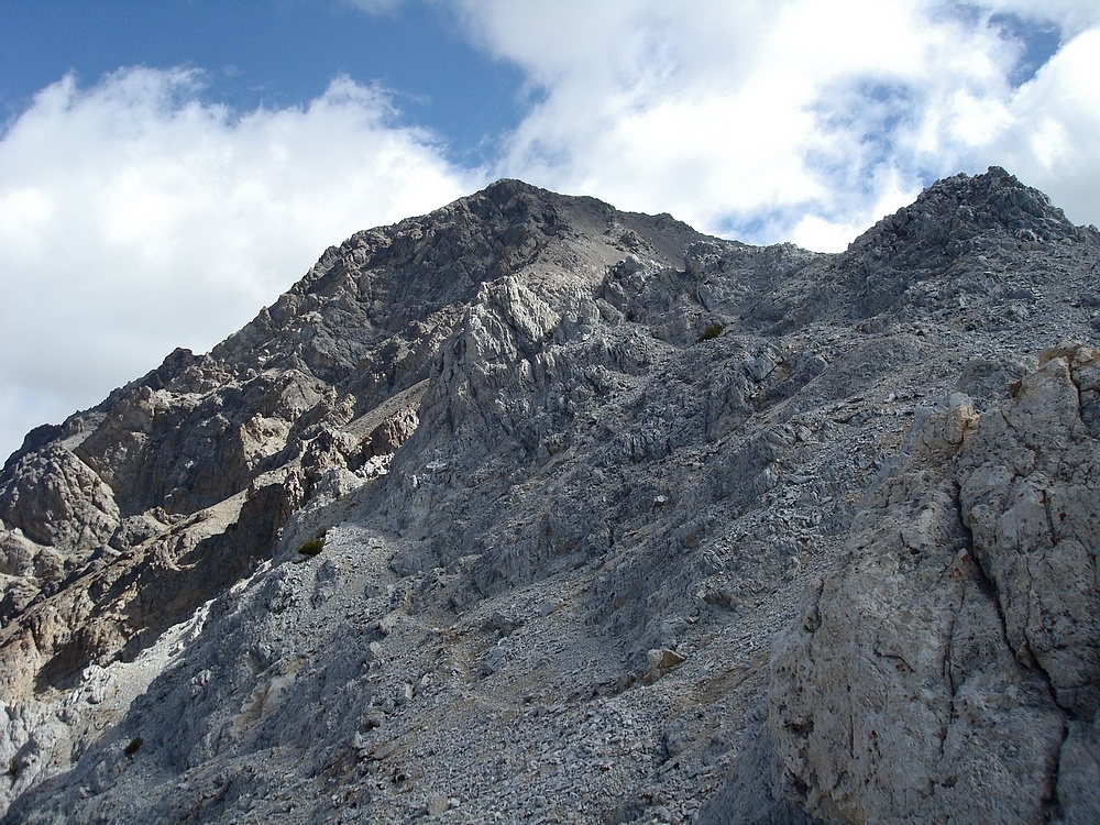
Looking up the west ridge towards the summit of Mount Idaho.
|
Brendon crossing one of the towers on the west ridge.
|
Erik and Brendon making their way out onto the face for the final section of the climb.
|

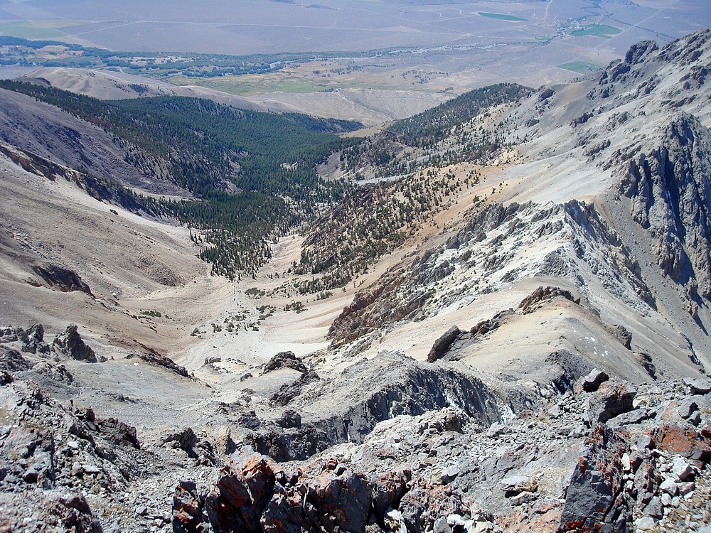
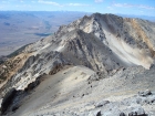
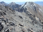
Summit view looking down into Elkhorn Creek.
|
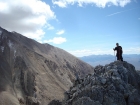
Erik about to reach the summit.
|
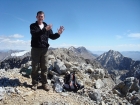
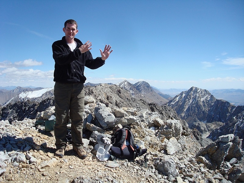
Me on the summit, my 9th and final Idaho 12er.
|

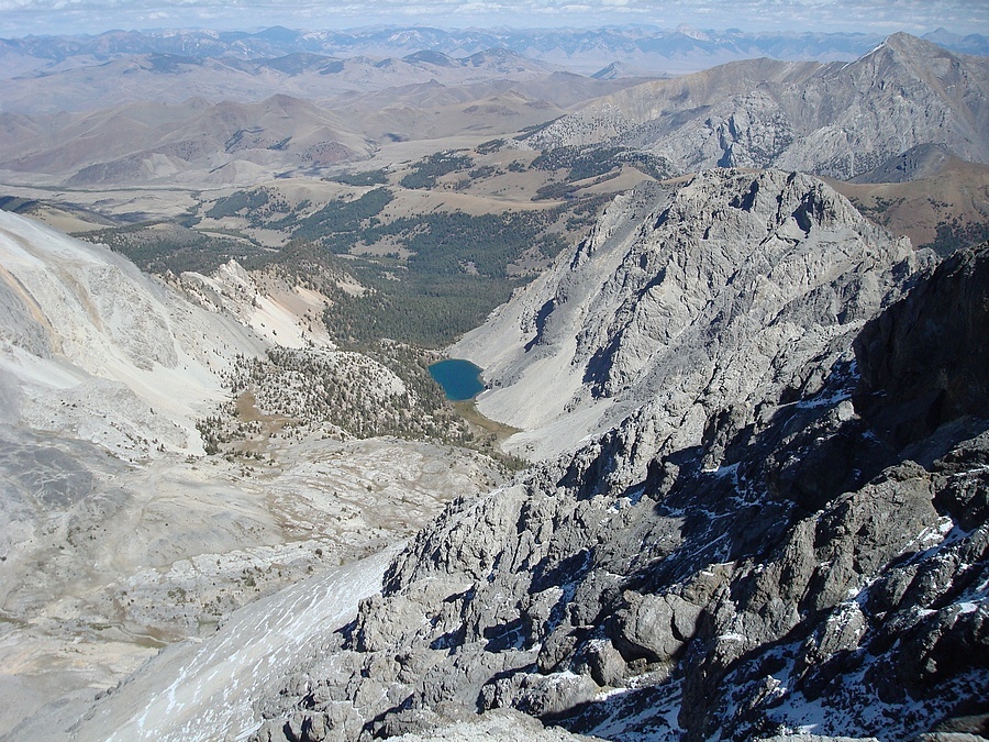
Merriam Lake from the summit.
|
Awesome view of Mount Borah from the summit of Mount Idaho.
|
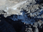
Looking down the north face of Mount Idaho.
|

The view southeast towards Leatherman, Church, etc. Pass Lake is just visible on the right.
|
Brendon coming down the descent gully.
|

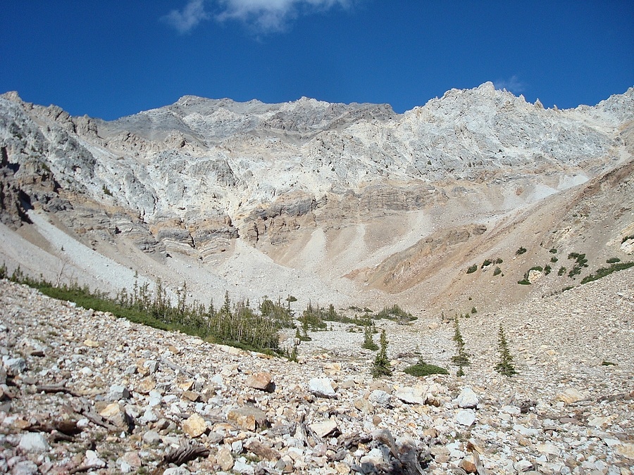
A view of the southwest face from about 9700'.
|
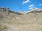
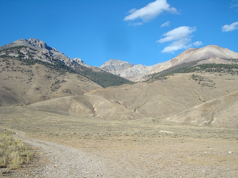
Final shot of Mount Idaho from the highway.
|
|