|
Glacier Lake Loop
Wallowa Mountains - Eagle Cap Wilderness
July 10-12, 2009
Eagle Cap - 9595'
One of the most popular backpacking areas in eastern Oregon is the Eagle Cap Wilderness Area, located in the Wallowa Mountains near the Idaho border. The area is filled with jagged peaks, alpine meadows, and high mountain lakes. JJ knows the Eagle Cap very well, but there were still a couple spots he hadn’t seen yet. He put together a great route that started at Wallowa Lake trailhead. We’d hike up the West Fork Wallowa River to Frazier Lake on day one, over Glacier Pass and down to the Lakes Basin on day two, then loop around back to the trailhead on day three.
Day 1 – West Fork Wallowa River to Frazier Lake
 A 6am departure from Boise put us (JJ, Jordan, Kris, Ken, Dave) at the trailhead around 10:30. We’d heard that the first few miles of trail was very dusty due to heavy use. Fortunately, we were early in the season and there’d been some recent rain, so the trail was pleasant. We made good time hiking next to the river, dodging occasional stinging nettles along the way. Once past Six Mile Meadow, the terrain took on a more alpine feel with open meadows and numerous waterfalls on both sides of the valley. A 6am departure from Boise put us (JJ, Jordan, Kris, Ken, Dave) at the trailhead around 10:30. We’d heard that the first few miles of trail was very dusty due to heavy use. Fortunately, we were early in the season and there’d been some recent rain, so the trail was pleasant. We made good time hiking next to the river, dodging occasional stinging nettles along the way. Once past Six Mile Meadow, the terrain took on a more alpine feel with open meadows and numerous waterfalls on both sides of the valley.
The last couple miles to Frazier Lake was very scenic, and we even had an adventurous snow bridge crossing of the creek just below the lake, which Ken led us over. Since we’d make such good time covering the 10 miles up to the lake, we debated a bit about continuing on to Glacier Lake, but opted not to due to fear of snow. Frazier Lake was quite nice, with Cusick Mountain looming overhead. We got to watch a group of goats for a while up on the ridge, and also a Bald Eagle that was hanging around the lake. Later on, I took a solo stroll up to Little Frazier Lake while Ken fished for monster sized Brook Trout, and the others enjoyed the mountain air (while taking in the views of the insides of their eyelids).
Day 2 – Frazier Lake to Glacier Lake, a climb of Eagle Cap, end at Moccasin Lake
 The next morning we slept in a little and didn’t leave camp until after 9:30. The trail from Frazier Lake to Glacier Lake was steeper than the prior day, but still very manageable. As we got higher, it became obvious that we’d be in for some snow at Glacier Lake, with numerous snowfield crossings along the trail. The lake itself was a very cool scene, and was still mostly frozen over. We hung out there for a while, before making our way up to Glacier Pass. The next morning we slept in a little and didn’t leave camp until after 9:30. The trail from Frazier Lake to Glacier Lake was steeper than the prior day, but still very manageable. As we got higher, it became obvious that we’d be in for some snow at Glacier Lake, with numerous snowfield crossings along the trail. The lake itself was a very cool scene, and was still mostly frozen over. We hung out there for a while, before making our way up to Glacier Pass.
From Glacier Pass, my plan was to climb the Eagle Cap. Most of the others weren’t compelled to make the 1200’ climb, but Jordan was up for it so off we went. We made the easy hike up the east ridge, and then contoured around the east face for a while before choosing a line up through the snow to gain the south ridge of the peak. From there it was an easy hike to the summit. We were surprised to find someone already on top, who’d climbed from the Horton Pass side. Eagle Cap is very centrally located, and has excellent views. We had no problems on the way down, and had fun glissading a few snowfields along the way.
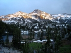
Once back down at the pass, we started the hike down to Moccasin Lake where the others were waiting. There were still tons of snow on the north facing slopes, and finding the trail was a pain, but eventually we made it down to the lake. I kind of wanted to stay there for the night, but was outvoted since the other guys wanted to go a little further to make tomorrow’s hike shorter. That thought process changed once we got around to the north side of the lake. The views from here were just too good to pass up, so we set up camp on a rocky knoll above the lake. Once camp was made, we took a short hike up to Mirror Lake, and then wandered back for dinner. The mosquitoes were heavy, but the views make it worth it. The skies had been overcast most of the day, but the sun came out just in time for an awesome sunset, with an excellent light display on the Eagle Cap. It may have been the best sunset I’ve ever experienced, and was probably the highlight of the trip.
Day 3 – Through the Lakes Basin back to Wallowa Lake
Due to stopping short and camping at Moccasin Lake, we had a 12-mile hike ahead of us on the last day. Fortunately it was mostly down hill. Unfortunately it was cloudy with occasional sprinkles for the first couple hours of hiking, so views of the lakes in the Lakes Basin were somewhat diminished. It was still quite scenic, and we took a mostly leisurely pace hiking through the forest. The sun came out for the last six miles through, and we made it back to the trailhead by early afternoon. For lunch, we cruised down the road to Wallowa for burgers from the Little Bear Drive In. I highly recommend their black raspberry milkshakes!
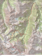
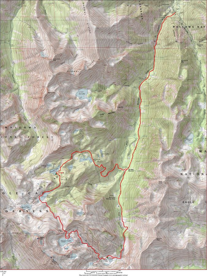
Map of our route, 28 miles for the main route, 32 miles total including side trips.
|
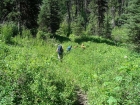
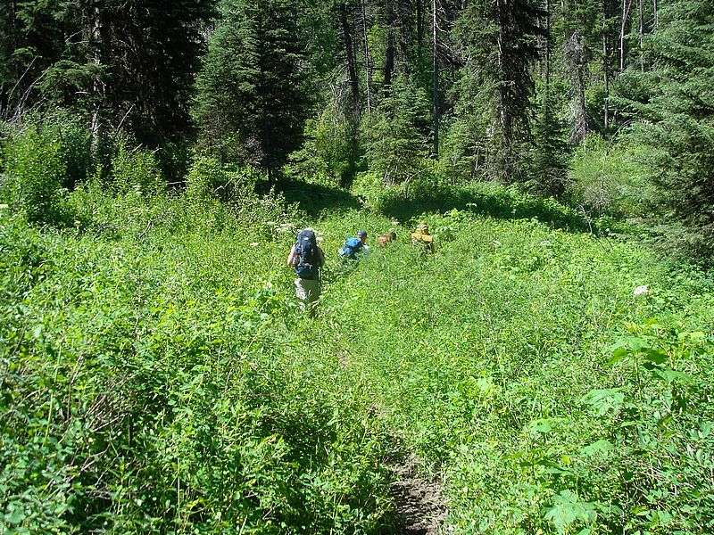
Hiking on the lower portion of the trail.
|
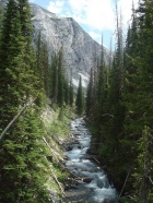
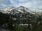
We followed the West Fork Wallowa River most of the first day. Here's a shot taken at about 6700' elevation.
|

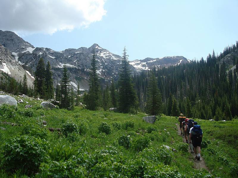
Hiking through an alpine meadow with Cusick Mountain in the background.
|
Ken about to cross a snow bridge as we near Frazier Lake.
|
Waterfalls were abundant throughout the area, this one is just below Frazier Lake.
|
JJ and Jordan at our campsite at Frazier Lake, North Imnaha Peak in the background..
|
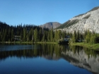
Sentinel Peak from Frazier Lake.
|
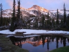
Evening view of Little Frazier Lake, still lots of snow in July.
|
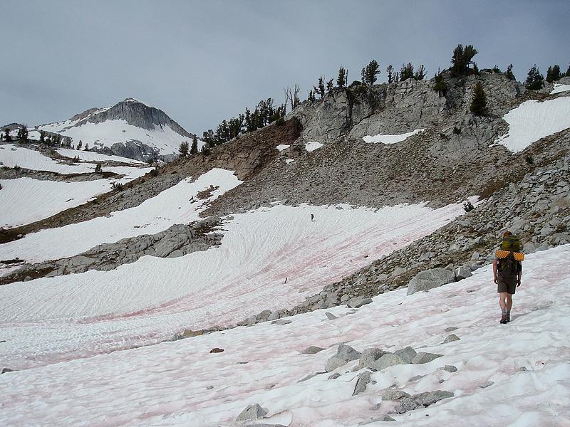
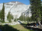
Making our way up the trail towards Glacier Lake.
|
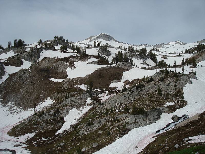
One of the first unobstructed views of Glacier Peak to the southwest.
|
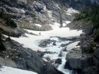
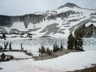
Crossing snowfields as we near Glacier Lake, Glacier Peak in the background.
|
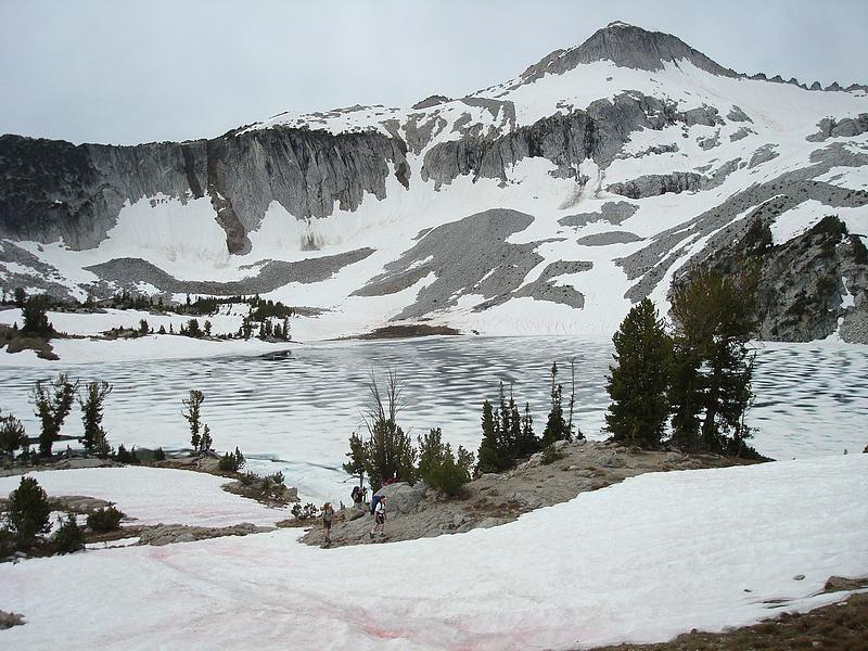
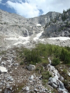
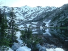
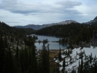
Glacier Lake was still mostly frozen over, and made for a very cool scene.
|

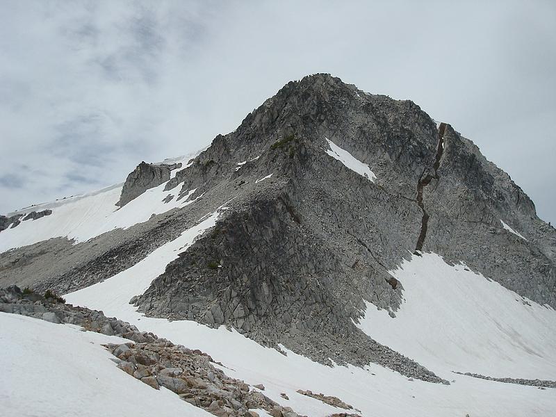
The northeast face of the Eagle Cap from about 9000' on the ridge.
|
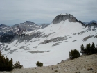
A good view of Glacier Peak and Cusick Mountain from the southern slopes of the Eagle Cap.
|
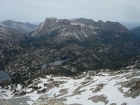
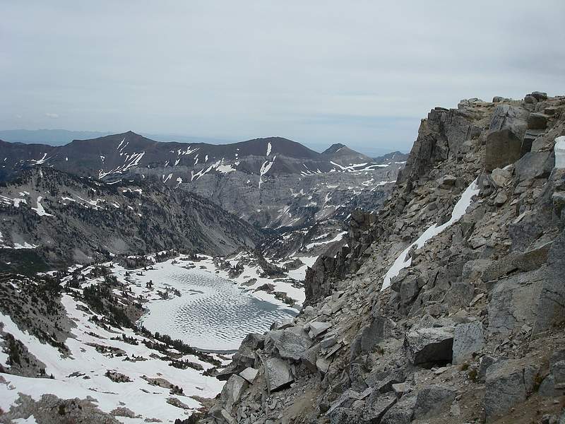
View of the south end of the Hurwal Divide (Matterhorn & Sacajawea Peak) from the Eagle Cap. Moccasin Lake below.
|
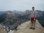
Dave on the summit of Eagle Cap, Mirror Lake on the left.
|
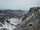
The partially frozen Glacier Lake sits below and to the east of the Eagle Cap.
|
Jordan glissading off the south ridge of the Eagle Cap.
|
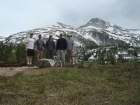
Group shot from our campsite above Moccasin Lake.
|
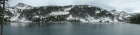
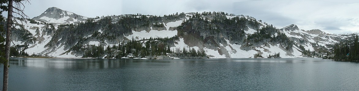
Stitched pano shot from Mirror Lake.
|
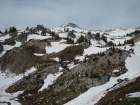
Looking down on Moccasin Lake form the trail to the southwest.
|

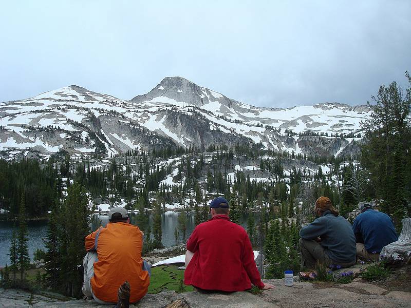
Pretty good views while we ate our dinner.
|

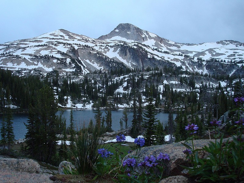
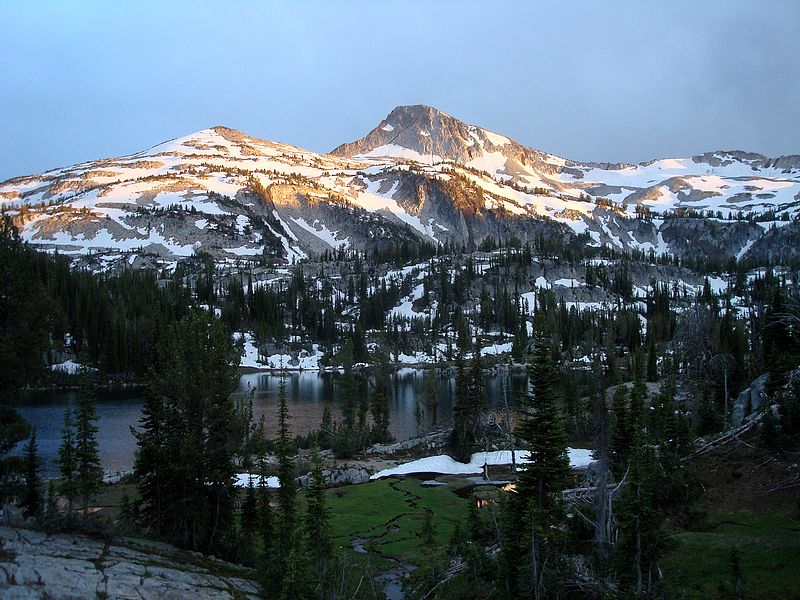
Flowery shot of the Eagle Cap from Moccasin Lake.
|
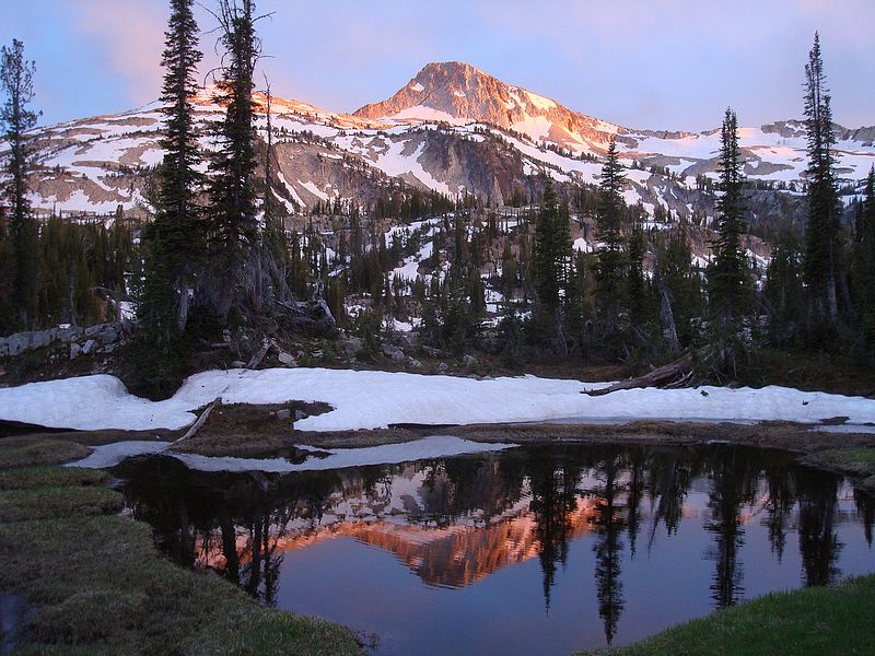
The beginning of an awesome sunset.
|
Light changing from orange to violet during the sunset.
|
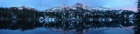
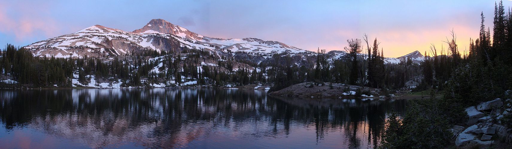
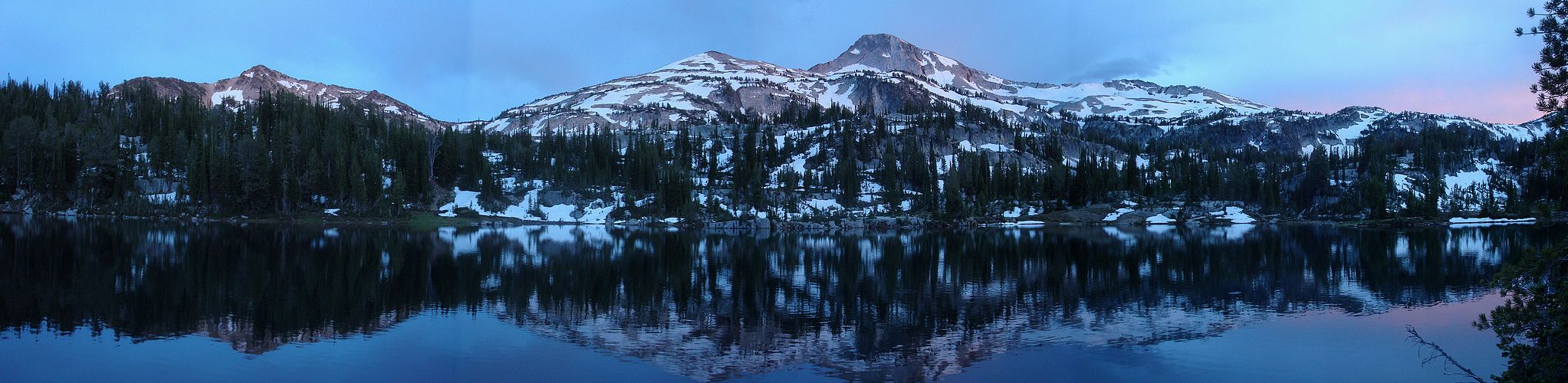
Pano view of the sunset on Eagle Cap from our campsite at Moccasin Lake.
|
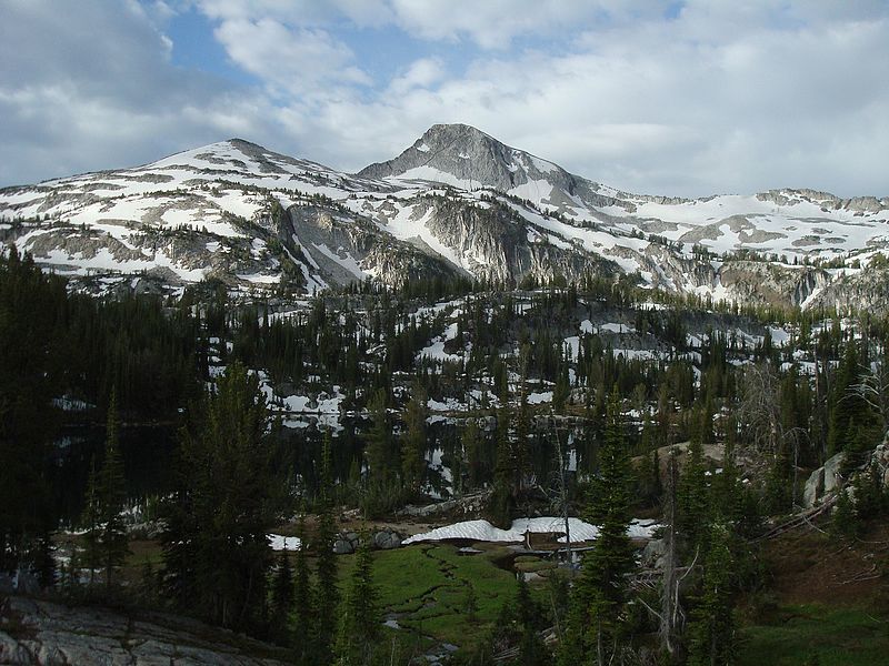
Morning view of the Eagle Cap.
|
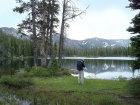
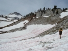
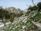
Kris taking a photo at Horseshoe Lake during the hike out.
|

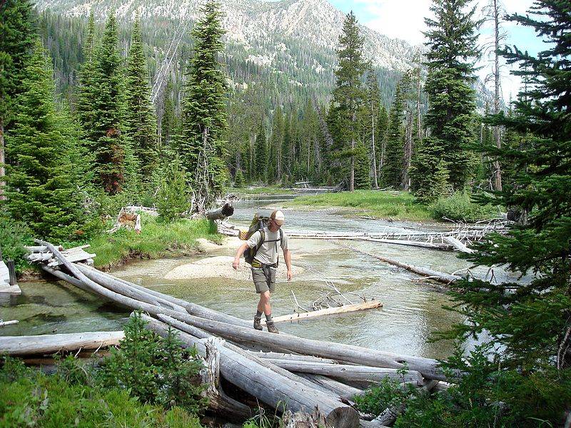
Jordan crossing logs near Six Mile Meadow.
|
|