|
Wolf Mountain (8876')
Shephard Peak (8833') & Silver Mountain (8573')
September 7, 2009
Although not very high in elevation, the northeastern corner of the Boise Mountains is quite rugged, with lots of granite and great views of the nearby Sawtooths. After plans for another hike didn’t work out, I set out on a solo outing on Labor Day to climb a few peaks accessible from the road that leads to Graham. Wolf Mountain had been on my wish list for quite a while, and I also planned to climb Shephard Peak and Silver Mountain since they were also close. Tyee Mountain was another I hoped to climb if time allowed. After a 2.5-hour drive through Idaho City, to Edna Creek, to the Jackson Peak cut-off, and over some of the roughest road you can find, I got to the Wolf Mountain trailhead at 8am.
Wolf Mountain
Many would recognize the rugged Wolf Mountain from the Tom Lopez book, but few take the time to climb it. My route would follow the east ridge of the peak and started where FS312 crosses a saddle just northeast of Pt 8498’. The temps were still in the 30’s when I left the Durango, but I warmed up quickly climbing up to reach the ridge top, where the peak came into view. The route looked like a great ridgewalk, and I was excited to get going. After passing a hunter a short ways down the ridge, I had the route to myself. It was a beautiful day, and I made good time following the undulating ridge through occasional burn areas. The climb got steeper as I neared Pt 8502'. I tried cheating over to the south side of the ridge in a few places to avoid climbing over various knobs, but was pushed back to the ridge top each time due to cliffs. The only exception was the impressive summit block which was too steep to climb without circling around to the south and then up the southwest side of the peak.
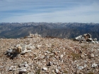
The summit views were great, but it was pretty windy so I had to put on a jacket to stay warm while reading the summit log. The peak doesn't see too get many visitors, but at least a couple folks had been back for return trips. Soon enough, I started making my way back down the ridge. I tried to move quickly, but kept getting distracted by the views of the Sawtooths. I eventually made it back to the car at 12noon.
Shephard Peak & Silver Mountain
After a short drive and a bite to eat, I started off towards Shephard and Silver. From the road, I contoured around the hillside, trying to stay at about the same elevation until reaching the saddle to the north of Shephard. It was pretty easy terrain to follow other than a dense stand of alpine fir trees not long before the saddle. From the saddle, I crossed through a burn area and then began the climb up Shephard's north slopes. It wasn't overly steep, but my pace seemed to be slowing a bit in the afternoon sun. Once on top, the views were great and the route from Shephard to Silver was obvious. I just traversed the open ridge down to the shorter but more impressive looking Silver Mountain. I hung out of the summit of Silver for a while, taking in the Sawtooth views and eyeing the impressive Goat Mountain complex to the west. It was rugged terrain, and very scenic. The hike back was uneventful, and I arrived at the Durango at 3:30, with just enough time left to tackle Tyee.
Tyee Mountain Attempt
Tyee isn't very tall (only 8752' elevation), but it is positioned to have great views. After a short drive, I thought I'd be smart and save some elevation gain by jumping on the south side ridge that connects to Tyee. So I pulled over to park, and headed of across the hillside to reach the ridge. Unfortunately, once on the ridge, I could tell I was on the wrong one, with the correct ridge now visible to the north. Optimistic that I could still make it to the summit in time, I dropped down into the ravine then climbed up onto the right ridge. It had a pretty well worn trail, but I was whipped after all the mileage I'd put on so far. Due to time constraints, I had to turn around just 650' below the summit. Which was a bummer, but at least I had a good reason to come back to the area again at some point.
I was very impressed with the area, and I hope to make return trip within the next couple years to climb Goat Mountain as well as to finish off Tyee. Total stats for the day were 16.4 miles, 5600' elevation gain, 9.5 hours. Not bad for a desk jockey.

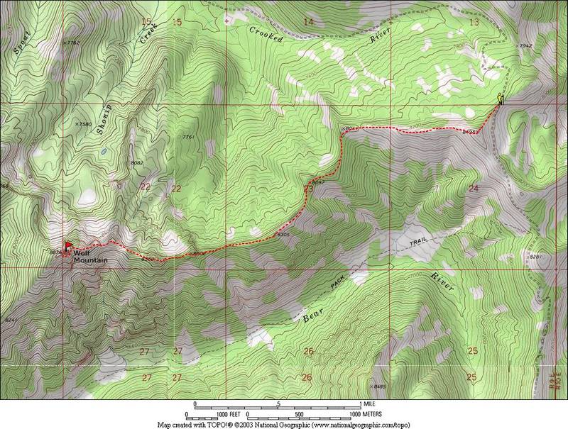
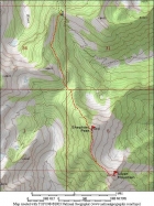
Map of the Wolf Mountain route, about 7.3 miles and 2500' gain round trip.
|

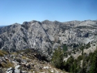
Looking west towards Wolf Mountain from Pt 8498'.
|
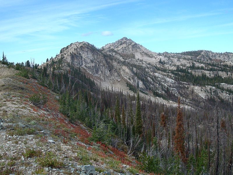
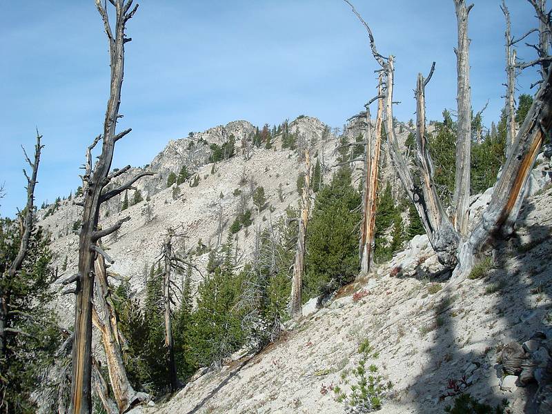
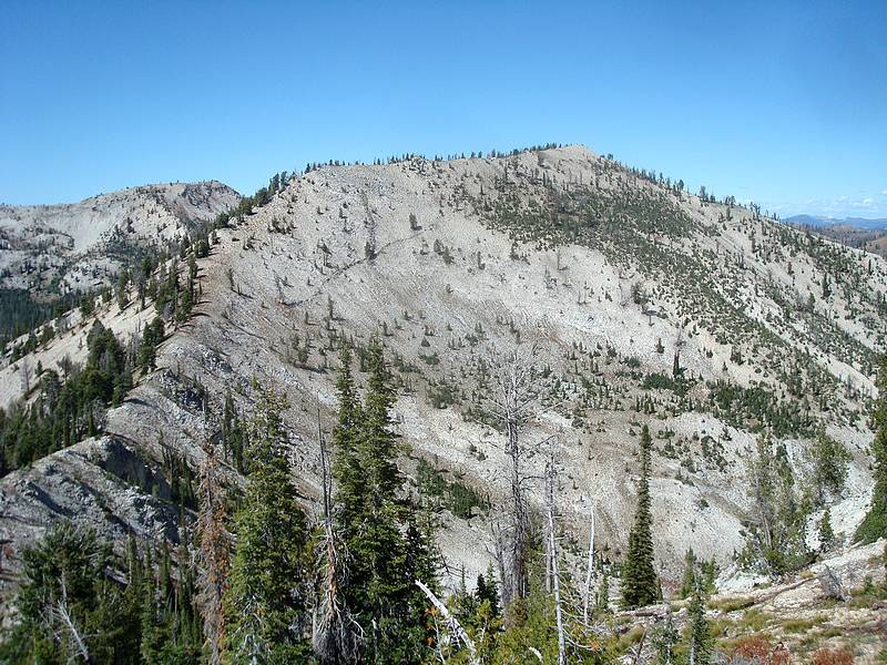
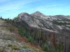
View of Wolf Mountain above the burn area.
|
The south side of the Wolf Mountain's east ridge.
|
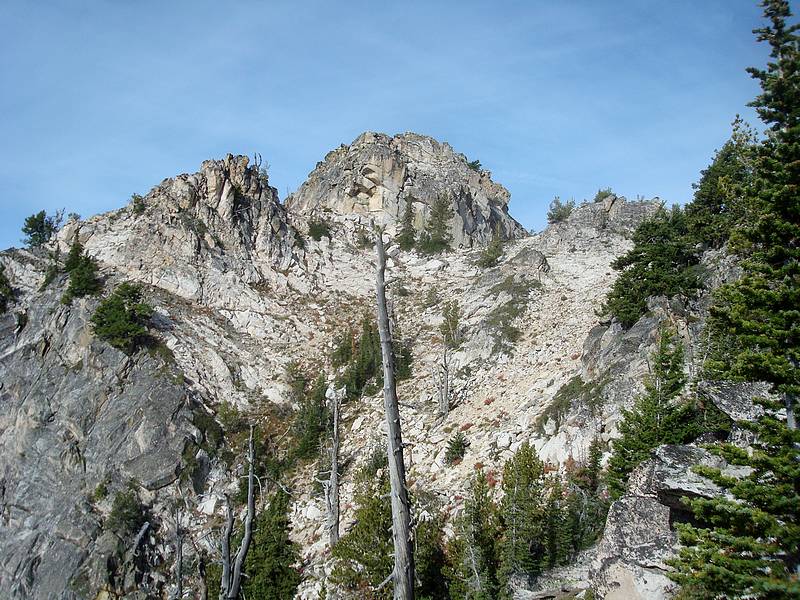
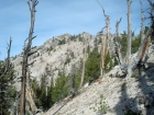
Summit block from the east.
|
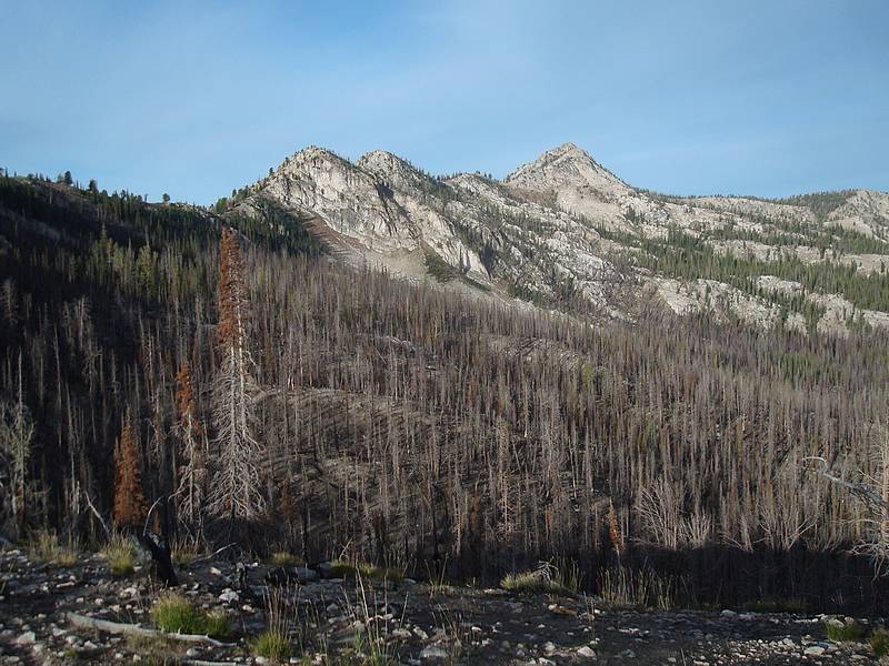
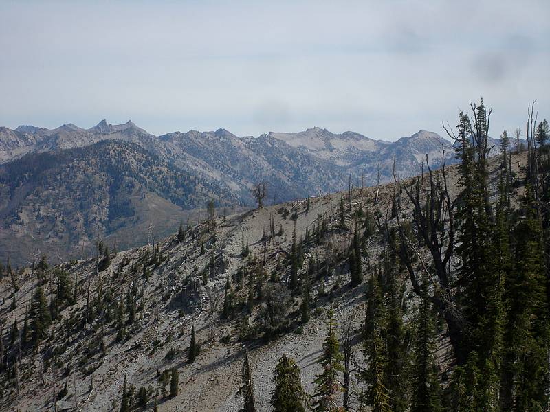
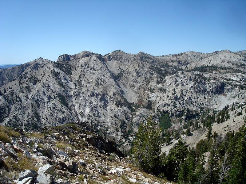
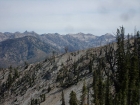
Looking back at the east ridge route, with the Sawtooths in the background.
|

My splattski shot on the summit of Wolf Mountain.
|
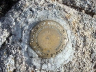
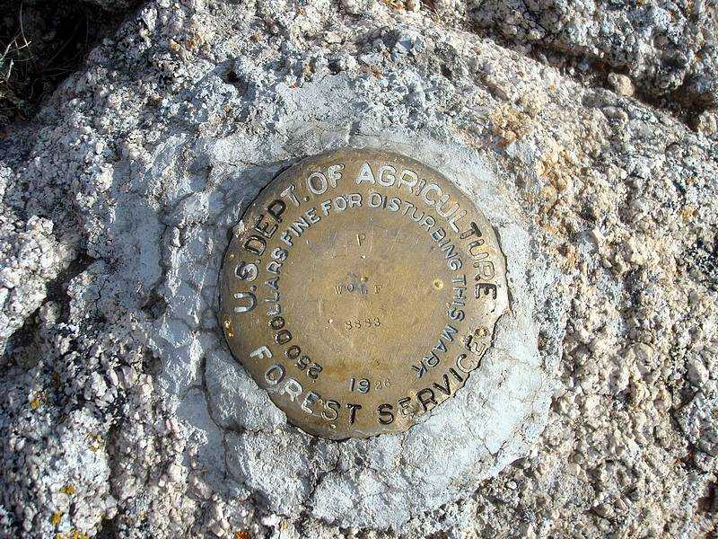
Wolf Mountain's 1926 summit benchmark.
|

View of the summit block during the descent.
|
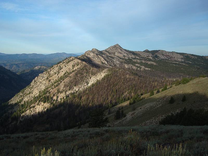
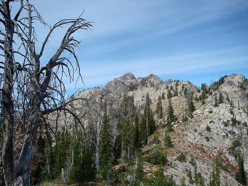
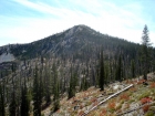
Another view of Wolf Mountain.
|
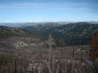
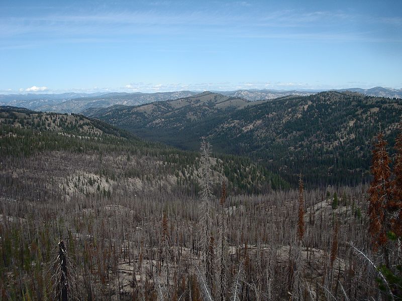
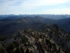
Looking down on Trapper Flats with Jackson Peak in the background.
|
Tyee Mountain from the road. A fairly easy hike if you follow the right ridge…
|
Map of the Shephard and Silver route, about 5.2 miles and 1900' gain round trip.
|
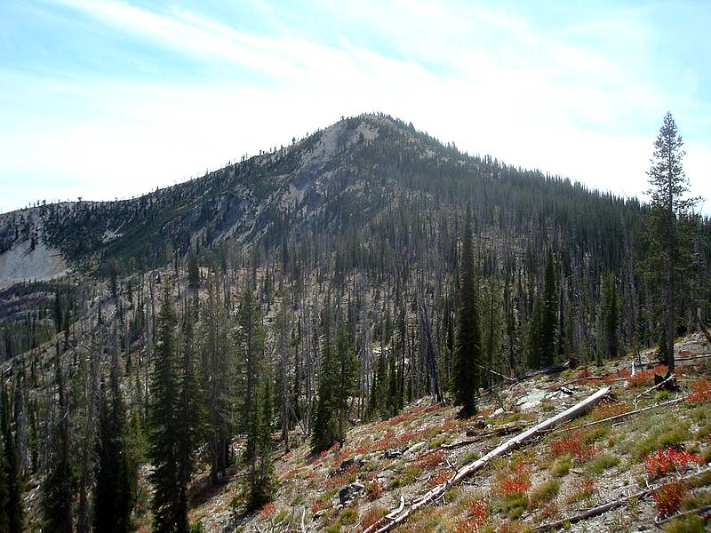
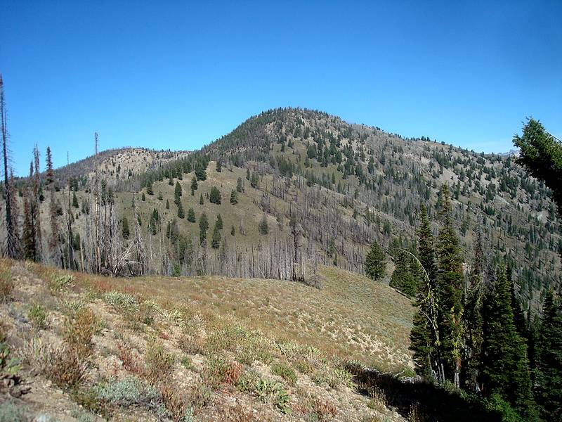
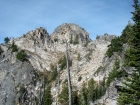
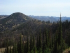
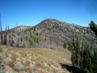
Shephard Peak from the north.
|
Close-up of the Sawtooths (Rakers, Blacknose, Arval's Peak) from the northern slopes of Shephard Peak.
|
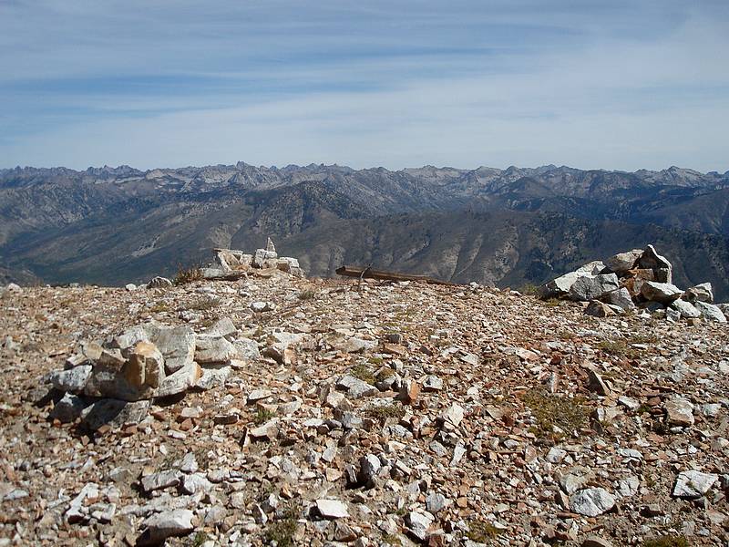
The Sawtooths as seen from the summit of Shephard Peak.
|
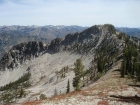
Silver Mountain from the southern slopes of Shephard Peak.
|

Shephard from Silver.
|
The Goat Mountain complex from Silver Mountain.
|
Looking over at Tyee Mountain from the wrong ridge (I was just a little too far south).
|
|