|
Hyndman Peak is the tallest peak in the Pioneer Mountains, and the ninth highest peak in all of Idaho. It can be a busy summit, and is probably second only to Mount Borah amongst high peaks when it comes to number of visitors. The class 2 southeast ridge route makes it the least technically challenging summit of the nine 12ers in Idaho, but its still plenty challenging due to the 13 mile round trip and 5000’ of elevation gain required to reach the summit.
I’d been saving Hyndman for a time when I couldn’t round up a climbing partner, since the route is less technical than the other Twelvers. After a 6am departure from Boise, I made it to the trailhead and was off and hiking by just before 9am. It was fairly chilly (under 40°F), so I tried to set a brisk pace to keep warm. The first section of the hike is pretty flat and only gains about 850’ in the first 2.5 miles. It’s a pleasant area, with occasional evergreens and an abundance of Aspen groves. After a while, the west face of Cobb Peak comes into view. It only took me about 45 minutes to cover the flat stretch, but my pace slowed considerably as the trail got steeper on its way up to a dried pond near point 8724’. There’s a yurt built near the pond that can be rented out in the winter by backcountry skiers.
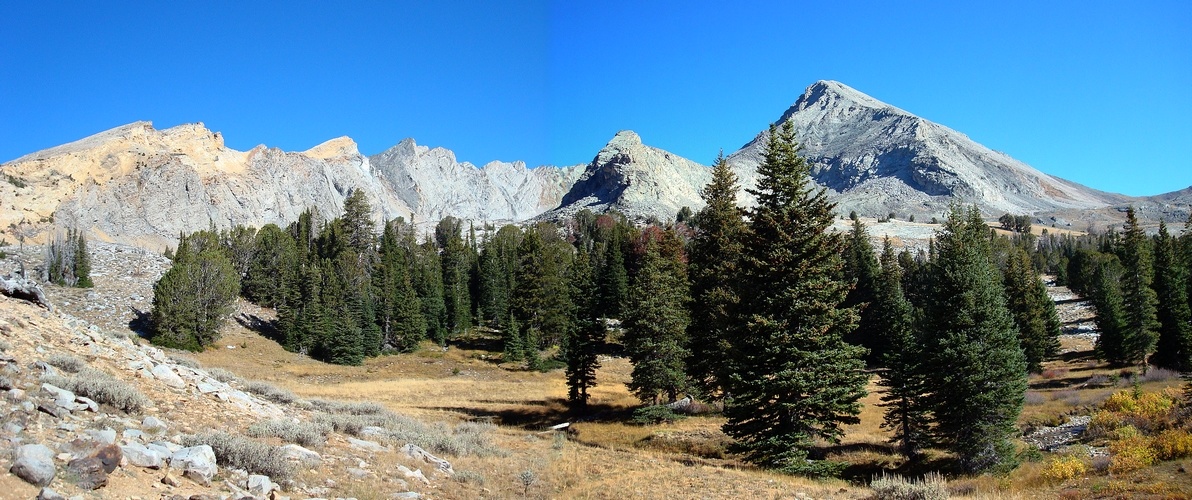
After the leaving the yurt, I crossed a creek, and climbed fairly steeply for another 700’ until the trail crested at a beautiful valley with awesome views of Duncan Ridge, Hyndman Peak, and Old Hyndman Peak. I decided to stop here for a snack, and rested for a while taking in the views. The chill had gone out of the air by this point, and it was an awesome Fall day without a cloud in the sky. From this point on, the summit remained in view for the rest of the hike. The break was nice, but I was anxious to get going too.
The trail through the valley was pretty easy to follow, and the route is peppered with cairns most of the way, which makes it easy to get back on course if you temporarily lose the trail. The scenery through the valley was fantastic as I made my way towards the saddle between Hyndman and Old Hyndman. The route itself began to feel a little more rugged at around 10200’ where the trail became harder to make out in the rocky terrain. No worries though, the saddle was straight ahead with no obstacles.
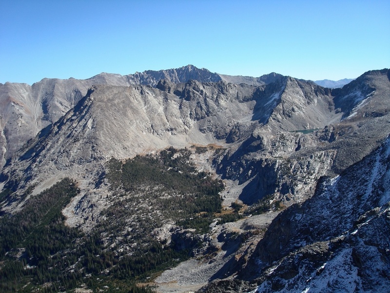
Once at the saddle, I took another break to eat and take in the views looking down into Wildhorse Canyon to the east. It was a bit breezy, so I put on a jacket and long pants before starting up the southeast ridge towards the summit. The rock on the ridge was pretty stable, but it was far from the easy class 2 stroll I’d been expecting. There were no major difficulties, but it was steep and I had to stop frequently in order to catch my breath. I was bummed with how out of shape I felt, but kept plodded along up the ridge. The summit didn’t look that far away, but it seemed to be taking me forever to get there. After 45 minutes, I’d finally completed the last 1200’ of vertical, and arrived at the summit. The views were spectacular (of course), with the jagged peaks of the Pioneers visible in all directions. I hung out for a while reading the register entries and taking photos. I didn’t want to leave, but it was nearing 2pm and it seemed like a good plan to start heading back.
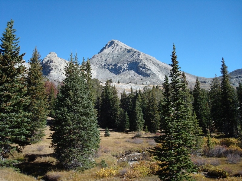
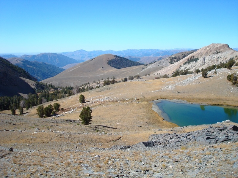
On the way down the ridge, I took it slowly since turning an ankle while on a solo hike that far away from the trailhead wouldn’t have been a good thing. The weather continued to be great, and I took my time wandering through the upper portion of the valley, taking in the views of the sun soaked mountains and stopping to check out the small lakes along the way. Soon enough though, I was back down to the flatter portion of the trail. That section seemed to take much longer to cover than it had on the way in, but it still wasn’t too bad. I arrived back at the trailhead at just before 5pm, pretty tired but very satisfied with the great day I’d spent in the mountains. I couldn’t have asked for better conditions.
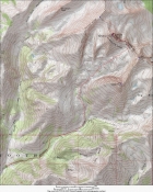
Map of the route, 13 miles round trip with about 5000 feet elevation gain.
|
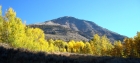
The west face of Cobb Peak from the trail early in the hike, with glowing Aspen all around.
|
A nice shot of Hyndman Peak from the southwest.
|
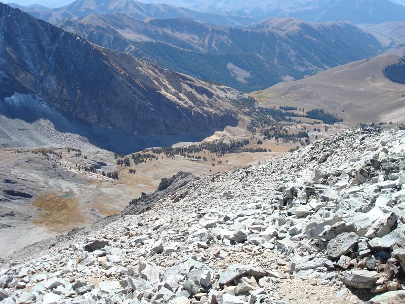
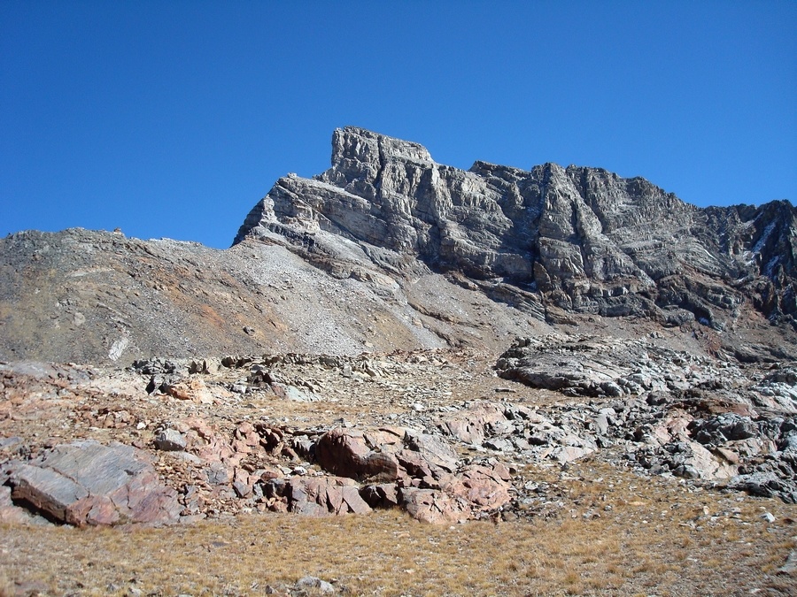
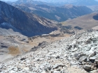
View from about 9800' looking back at the route.
|
Looking east from the saddle at Howard Peak, with Brocky Peak in the background.
|

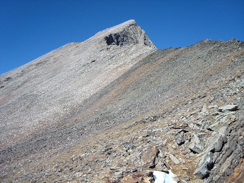
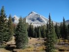
Hyndman's southeast ridge from the saddle.
|
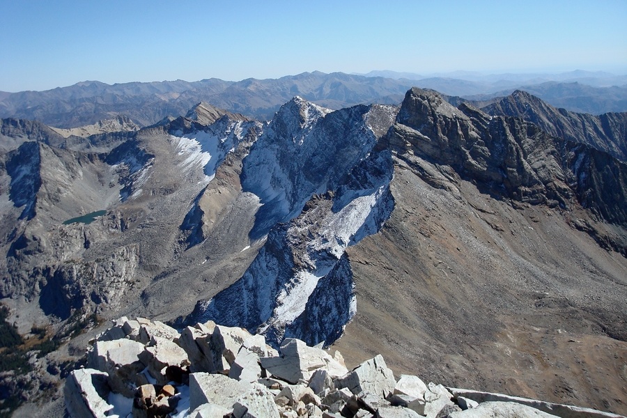
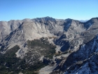
The view southeast from the summit of Hyndman Peak, highlighted by Old Hyndman and Cobb Peak. Big Basin Peak is to the left of Old Hyndman, with The Box further down the crest. To the right of Old Hyndman is McIntyre Peak, then Jacqueline Peak, then Grays Peak further off in the distance.
|
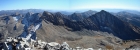
Summit view looking back down on the route.
|

This is "The Box", Big Basin Peak, and Old Hyndman, from Hyndman's summit.
|

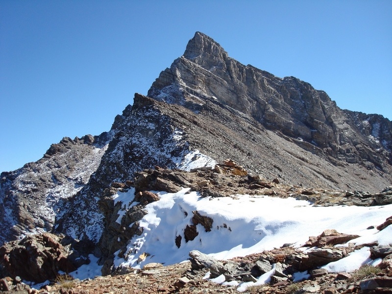
The northwest ridge of Old Hyndman Peak from the saddle.
|

A good view of the funky looking west face of Old Hyndman Peak.
|
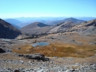
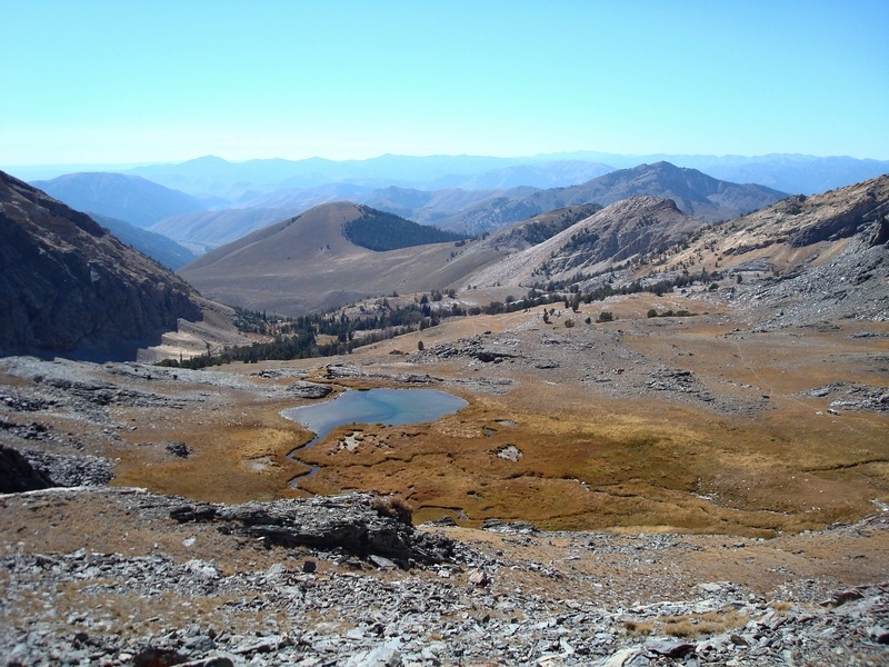
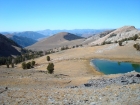
The view down on the upper lake during the descent. You can see the climbers trail off to the right.
|
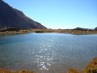
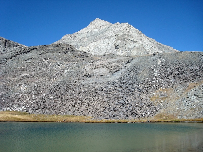
Water level view of the upper lake.
|
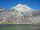
Hyndman reflecting in the afternoon sun, from the lower lake.
|

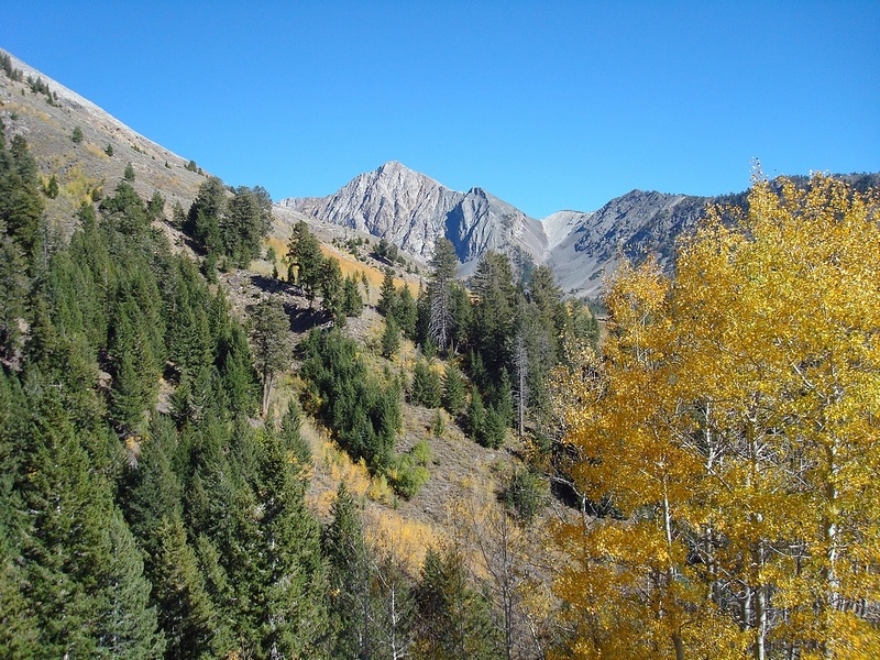
Looking west at Jacqueline Peak from the trail on the way out. Gotta love the Fall colors.
|
|