|
Castle Peak is a giant mountain located in the White Cloud Mountains of central Idaho. Its the tallest peak in the range, and towers over its surroundings. Because of this, the views are spectacular, with numerous lakes and jagged peaks visible from the summit. The approach hike is also a highlight, and any route used to access the peak allows you to pass through some of Idaho's most beautiful alpine scenery. A climb of Castle Peak should be high on any Idaho peak baggers list.
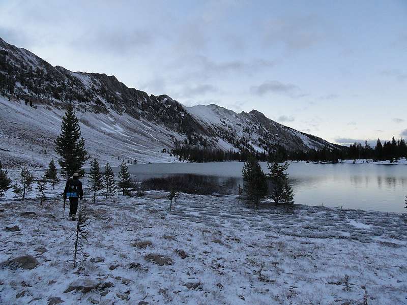
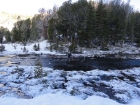
After a three-hour drive from Boise to reach the Fourth of July trailhead, Pat and I started our hike at about 7pm. Pat had suggested we put in a few miles and set-up camp at Washington Lake. This turned out to be a very good call since there was still quite a few snowy sections of the trail that made for slow going in a few places. Those delays would have cost us if we would have tried to do a single day assault on the peak.
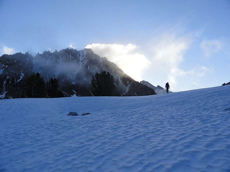
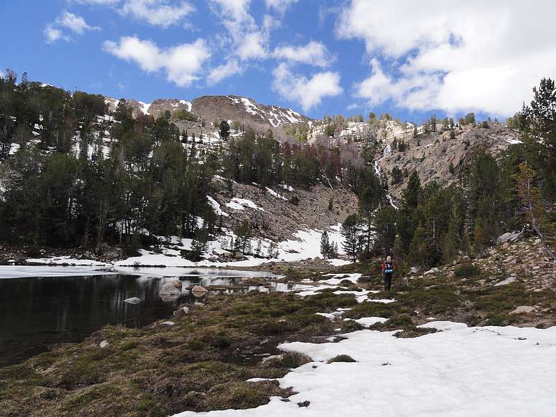
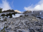
We set up camp on the northern end of Washington Lake and spend some time eyeing the "Splattski Cutoff" that would take us up and over the ridge to Chamberlain Basin. After some discussion on the best way to reach the ridge, we decided to turn in and get some sleep before the big day that was ahead of us tomorrow. A storm came through during the night and dropped a half-inch of fresh snow on us. We started hiking at about 6am, and had to take it pretty slow since the snow had formed a layer of ice on the rocks. So we rounded the lake and made our way up the chute that would take us to the ridge. Fortunately the rock wasn't too bad and we made a nice steady pace, climbing 900' up to the ridgeline. Castle Peak came into view at this point. It looked pretty ominous, shrouded in clouds with the sun starting to emerge from behind it.
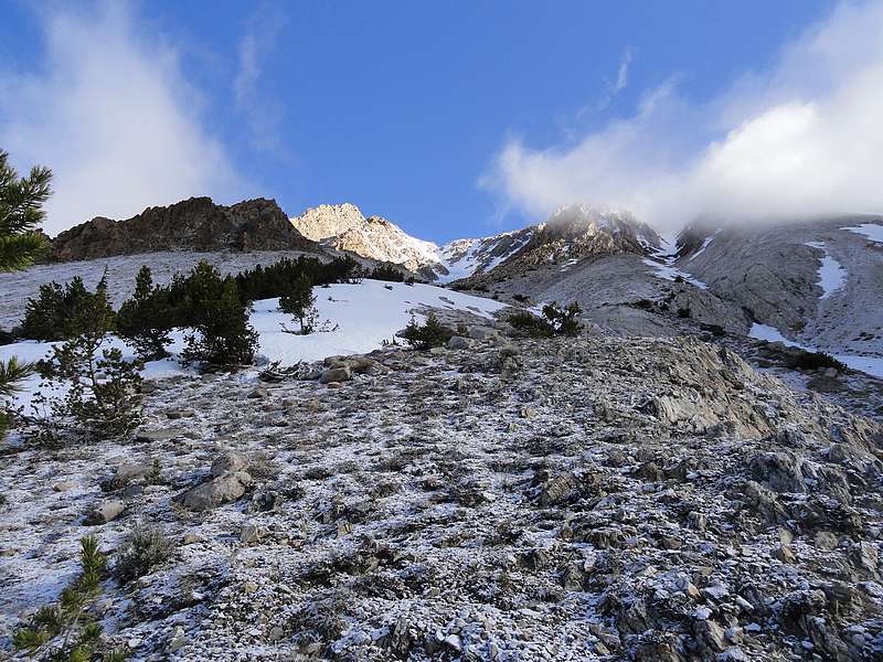
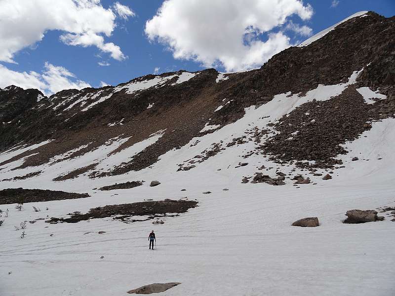
From the ridge, Pat and I studied the snow coverage down in Chamberlain Basin. After choosing our heading, we descended down off the ridge to the edge of the snowfields. It hadn't gotten as cold the prior night as we would have liked, but the snow was still firm enough to hold our weight in most areas. On we went down to the southwest corner or Lake 9477', where we made a chilly creek crossing. We located the trail at this point, but it appeared mostly snow covered, so we headed cross-country towards the base of the peak.
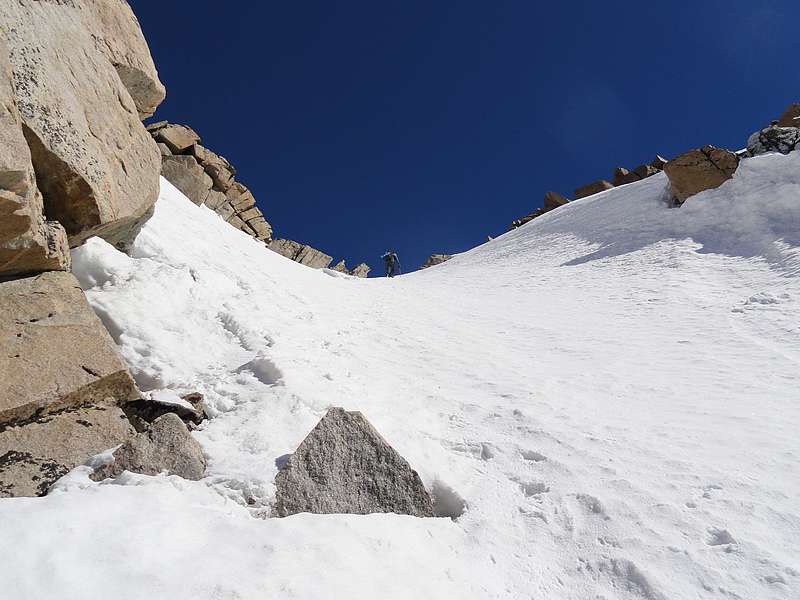
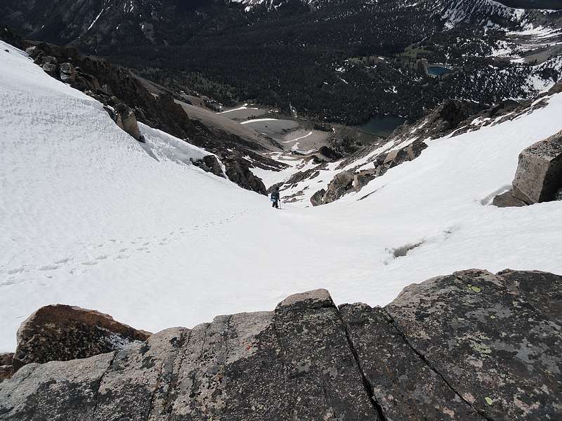
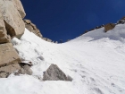
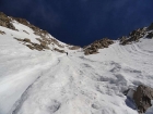 The sun had come out now, and we were hoping our route would stay in the shade to keep the snow in the gully from getting too soft. From our vantage point at the base of the south face gully, we couldn't tell for sure how much snow we would have. The more the better, since it would cover up some of the loose rock the gully is known for. There was snow down low, and Pat switched to crampons while I continued up the rock just off to the side. Up we went, with mixed patches of snow and rock. After a while, the snow became continuous and I put on my crampons too. The snow conditions were perfect. Not too soft and not too hard. Onward and upward for nearly 2000' vertical feet of snow climbing. The angle wasn't too steep, generally a 30-40 degree slope, but it was still a calf workout. It got a little steeper as we neared the ridgeline, and the snow was starting to soften enough that it was balling up a little in our crampons. Luckily we didn't have to deal with that for long, and we reached the ridge without incident. The exposure off the north face of the ridge was huge! The sun had come out now, and we were hoping our route would stay in the shade to keep the snow in the gully from getting too soft. From our vantage point at the base of the south face gully, we couldn't tell for sure how much snow we would have. The more the better, since it would cover up some of the loose rock the gully is known for. There was snow down low, and Pat switched to crampons while I continued up the rock just off to the side. Up we went, with mixed patches of snow and rock. After a while, the snow became continuous and I put on my crampons too. The snow conditions were perfect. Not too soft and not too hard. Onward and upward for nearly 2000' vertical feet of snow climbing. The angle wasn't too steep, generally a 30-40 degree slope, but it was still a calf workout. It got a little steeper as we neared the ridgeline, and the snow was starting to soften enough that it was balling up a little in our crampons. Luckily we didn't have to deal with that for long, and we reached the ridge without incident. The exposure off the north face of the ridge was huge!
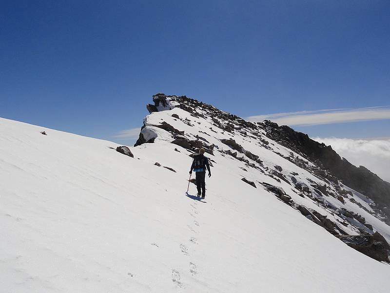
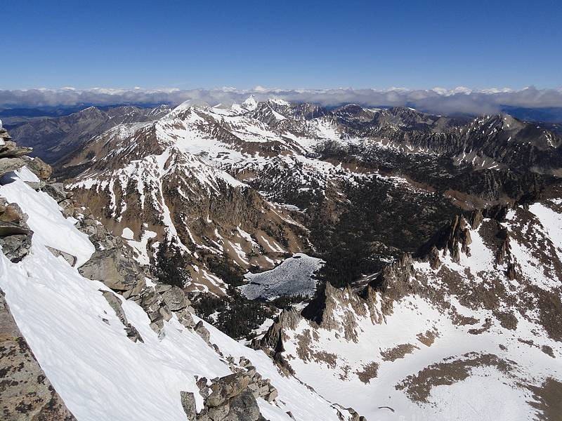
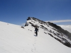
 Once on the summit ridge, we turned east and made an easy traverse over to the westernmost summit. The views were amazing, fantastic, exceptional, etc. I was surprised at just how steep the north side "big gully route" looked. After some debate about whether or not the towers to the east were higher, we eventually decided we were at the highpoint and settled in to enjoy the views. We weren't in any hurry since the was almost no wind, and waiting for the snow in the gully to soften up might make for a safer glissade on the way down. Once on the summit ridge, we turned east and made an easy traverse over to the westernmost summit. The views were amazing, fantastic, exceptional, etc. I was surprised at just how steep the north side "big gully route" looked. After some debate about whether or not the towers to the east were higher, we eventually decided we were at the highpoint and settled in to enjoy the views. We weren't in any hurry since the was almost no wind, and waiting for the snow in the gully to soften up might make for a safer glissade on the way down.
 After soaking in the views and taking a few photos, it was time to head down. Sure enough, the snow had softened enough for some easy plunge stepping down the steep section, then a nice long 1500' glissade down to the bottom of the snow. It was a blast, and one of the best perks on a climb like this. Too fun. But we didn't have time to revel in the experience for long, since we still had several miles ahead of us and some climbing to do to get back to camp. So we got back on our feet and wandered down to the trail that lead back up to Lake 9477'. The trail took us to the lake with minimal snow to cross. We decided to take the scenic route around the lake towards a cool waterfall near the northwest corner of the lake. From here we took a course up the hillside, dodging snowfields as best we could. Once in the upper basin, Pat began following some goat tracks across the sun soaked snow in hopes of avoiding sinking in too much. This ended up being very effective, and to our relief, the postholing was minimal. Now all that was left was to climb the rock back up to the ridgeline and most of our work would be done for the day. We made surprisingly good time, and got back up to the ridge with no issues. After soaking in the views and taking a few photos, it was time to head down. Sure enough, the snow had softened enough for some easy plunge stepping down the steep section, then a nice long 1500' glissade down to the bottom of the snow. It was a blast, and one of the best perks on a climb like this. Too fun. But we didn't have time to revel in the experience for long, since we still had several miles ahead of us and some climbing to do to get back to camp. So we got back on our feet and wandered down to the trail that lead back up to Lake 9477'. The trail took us to the lake with minimal snow to cross. We decided to take the scenic route around the lake towards a cool waterfall near the northwest corner of the lake. From here we took a course up the hillside, dodging snowfields as best we could. Once in the upper basin, Pat began following some goat tracks across the sun soaked snow in hopes of avoiding sinking in too much. This ended up being very effective, and to our relief, the postholing was minimal. Now all that was left was to climb the rock back up to the ridgeline and most of our work would be done for the day. We made surprisingly good time, and got back up to the ridge with no issues.
 Seeing Washington Lake again was a welcome site since that meant it was mostly "down hill from here". The chute was now dry, and we made the descent down to the lake and back to camp. After some brief relaxing, we packing up and wandered back to the trail and started the hike out. We chose a slightly different route back to Fourth of July Lake and avoided much of the snow from the prior night. From here down, the trail became less and less snowy, and we hiked back to the car, very satisfied with how well the day had gone. Castle Peak had been at the top of my list for a long time, and it didn't disappoint. What an awesome peak and an awesome climb. Seeing Washington Lake again was a welcome site since that meant it was mostly "down hill from here". The chute was now dry, and we made the descent down to the lake and back to camp. After some brief relaxing, we packing up and wandered back to the trail and started the hike out. We chose a slightly different route back to Fourth of July Lake and avoided much of the snow from the prior night. From here down, the trail became less and less snowy, and we hiked back to the car, very satisfied with how well the day had gone. Castle Peak had been at the top of my list for a long time, and it didn't disappoint. What an awesome peak and an awesome climb.
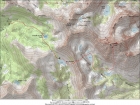
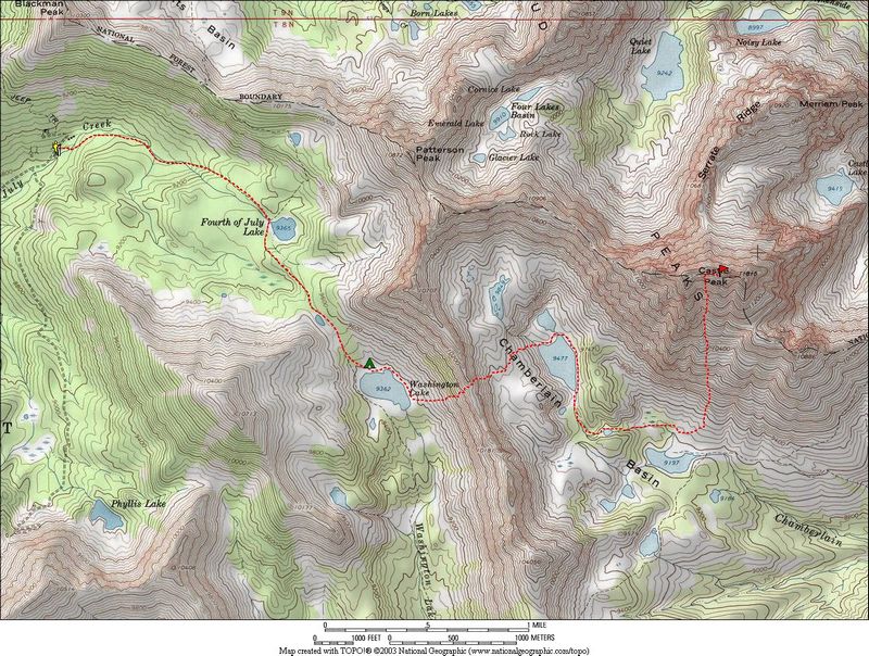
Map of the route. About 12 miles and 5500 feet gain, round trip.
|

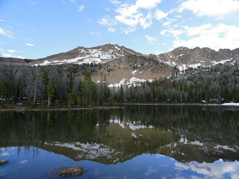
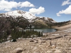
Patterson Peak and Fourth of July Lake.
|
Setting forth from Washington Lake.
|
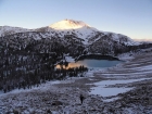
First rays of sun on Fourth of July Peak.
|
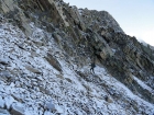
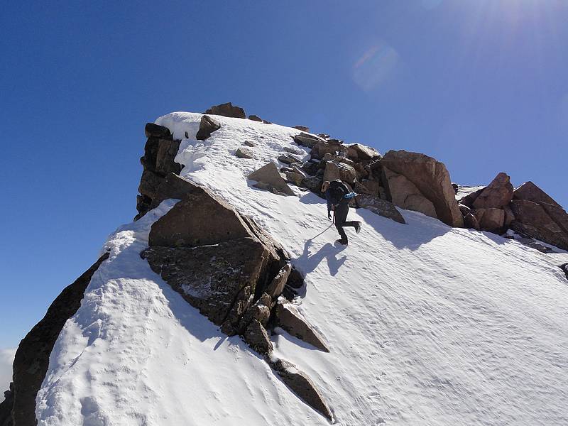
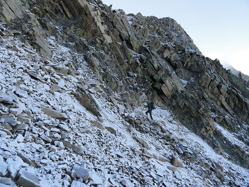
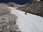
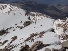
Pat climbing cautiously up the icy chute.
|
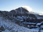
First view of Castle Peak from the ridge above Washington Lake.
|

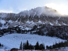
We were greeted with mostly firm snow in upper Chamberlain Basin.
|
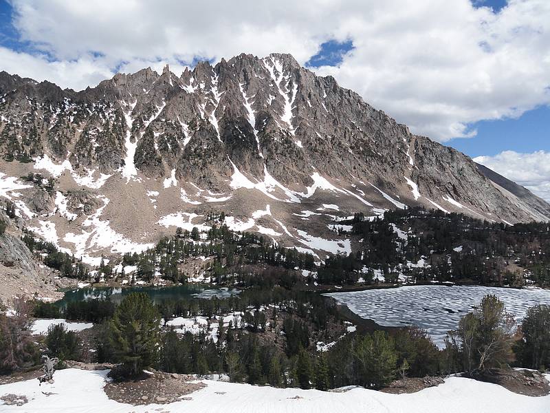
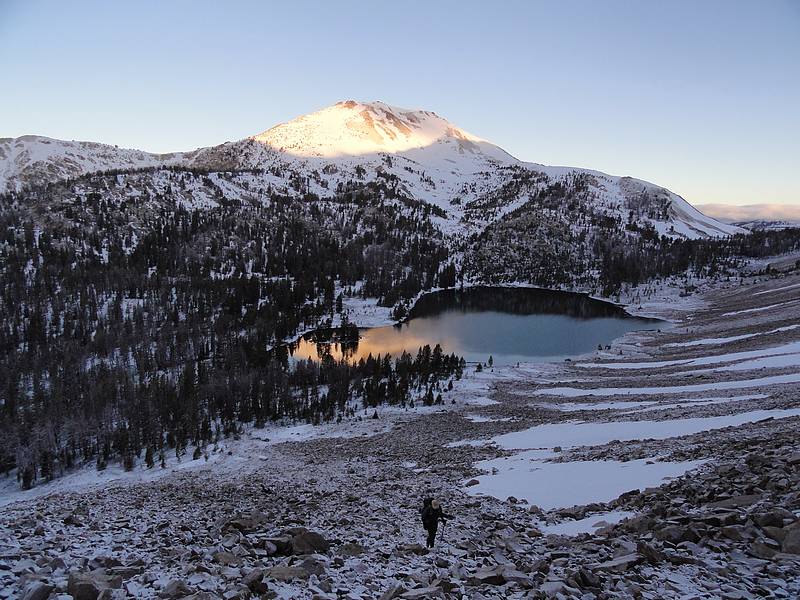
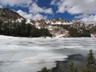
Castle Peak above frozen Lake 9477'.
|
Pat and a chilly creek crossing.
|
Our first view up the south face gully.
|
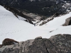
In the gully with about 1000 feet to go.
|
Nearing the saddle.
|
The last steep section.
|
Final stretch to the summit.
|
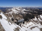
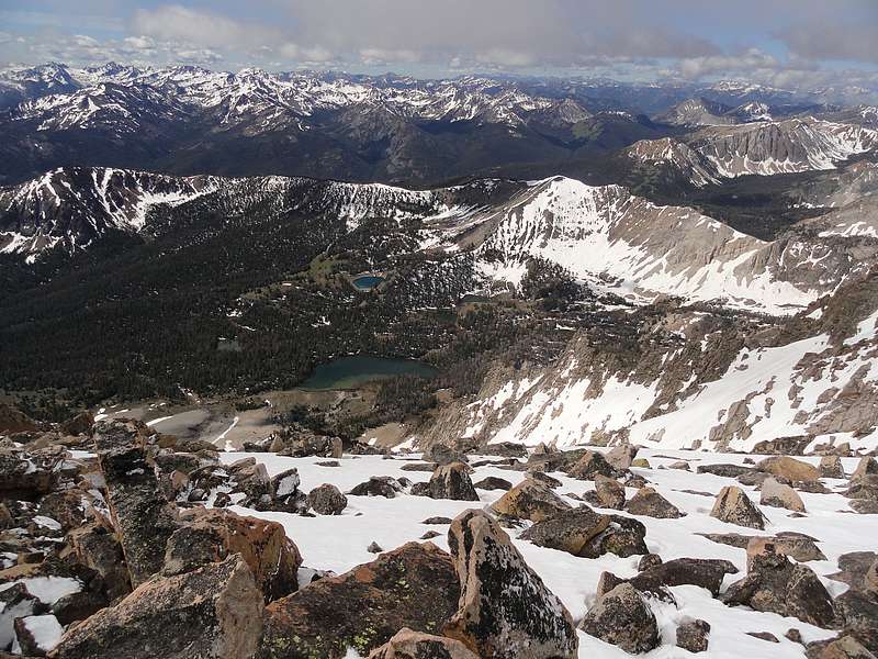
View of the northern White Clouds, Quiet Lake, and Serrate Ridge.
|

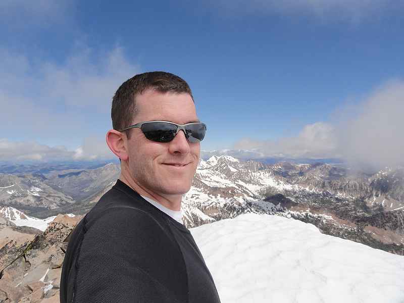
Dave on the summit.
|
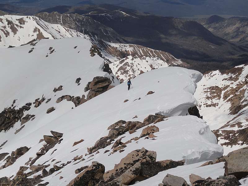
Pat starting the descent.
|
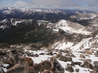
Chamberlain Basin from the summit ridge.
|
Plunge stepping down the top of the gully.
|
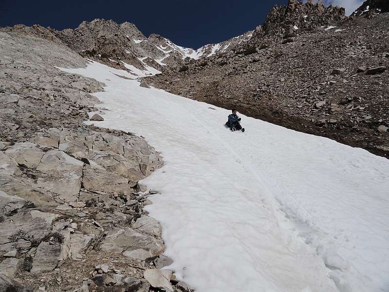
Finishing off a nice long glissade.
|
Heading back, but still some climbing to do to reach the ridge.
|

Pat below the waterfall at Lake 9477'.
|
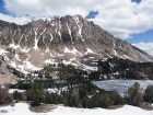
Castle Peak towering above upper Chamberlain Basin.
|

The final climb of the day, gotta go up and over that ridge.
|
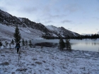
Returning to Washington Lake.
|
|