|
Mount Whitney is located in California’s Sierra Nevada Range, and is the tallest mountain in the contiguous United States. It is one of the most popular summits in the US, and as a result, there is a permit system in place to help prevent more massive crowds. The most popular route to the summit is a trail that starts from the Whitney Portal trailhead, and makes the summit reachable in a strenuous day hike of 22-miles roundtrip. There are also other more technically challenging route options to choose from as well.
Sean had applied for and obtained a pair of permits, and graciously invited me to join him for the climb. We had originally planned to tackle the Mountaineer’s Route, but as our departure date got closer, Sean suggested a more adventurous multi-peak traverse trip. I was nervous about whether the route would be too strenuous for me, but decided to suck it up and give it a shot. Our plan would be to climb Mount Carillon, then the classic scramble up the east ridge of Mount Russell, followed by Mount Whitney, and finally a quick scramble up Mount Muir.
We made the 12-hour drive from Boise to the Whitney Portal trailhead near Lone Pine, and got the last campsite at the upper campground. I’ve never seen so much signage about bear danger. Numerous precautions were encouraged, including storing food in bear lockers that were available at each campsite. In spite of all the signage, we didn’t see any bears in the area. We hit the sack before 9pm with hopes that camping at the trailhead elevation of around 8400’ would help us acclimate for the following day’s climb.
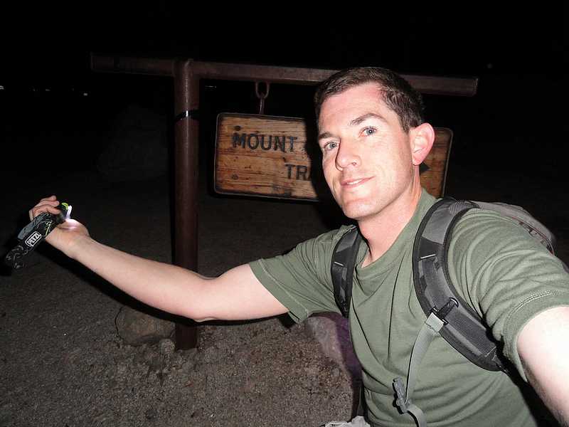
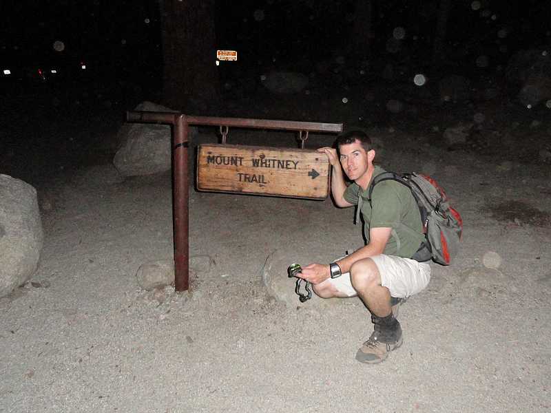
 The next morning we broke camp and left the trailhead at 5am with headlamps blazing. Surprisingly there weren’t many other hikers up and moving yet. We made our way up the trail, and then departed from the main trail at the second creek crossing to head up the North Fork of Lone Pine Creek. The trail made its way through the willows, and then up the “Ebersbacher Ledges”, which is a fun section just below Lower Boyscout Lake. At this point, we were treated to some great views of sunrise alpenglow shining on the east face of Mount Whitney. That sight alone made our early start worth the effort. From Lower Boyscout Lake, we left the trail and made our way up into the scenic cirque to the east of Mount Carillon. We were making good time and enjoying the scenery. Once at the top of the cirque, we stopped to fill our water bottles in the stream while taking in the views of the impressive south face of The Cleaver. From here, we made our way up the obvious gully toward the north ridge of Mount Carillon. The rock in the gully was a little loose, but not bad. The rock got more stable as we got higher, and it made for an enjoyable scramble to Carillon’s summit. The next morning we broke camp and left the trailhead at 5am with headlamps blazing. Surprisingly there weren’t many other hikers up and moving yet. We made our way up the trail, and then departed from the main trail at the second creek crossing to head up the North Fork of Lone Pine Creek. The trail made its way through the willows, and then up the “Ebersbacher Ledges”, which is a fun section just below Lower Boyscout Lake. At this point, we were treated to some great views of sunrise alpenglow shining on the east face of Mount Whitney. That sight alone made our early start worth the effort. From Lower Boyscout Lake, we left the trail and made our way up into the scenic cirque to the east of Mount Carillon. We were making good time and enjoying the scenery. Once at the top of the cirque, we stopped to fill our water bottles in the stream while taking in the views of the impressive south face of The Cleaver. From here, we made our way up the obvious gully toward the north ridge of Mount Carillon. The rock in the gully was a little loose, but not bad. The rock got more stable as we got higher, and it made for an enjoyable scramble to Carillon’s summit.
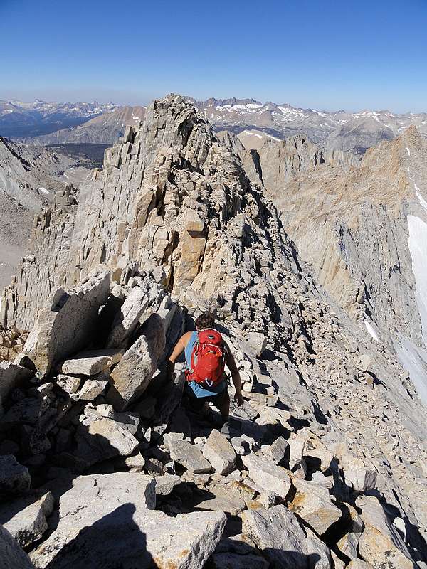
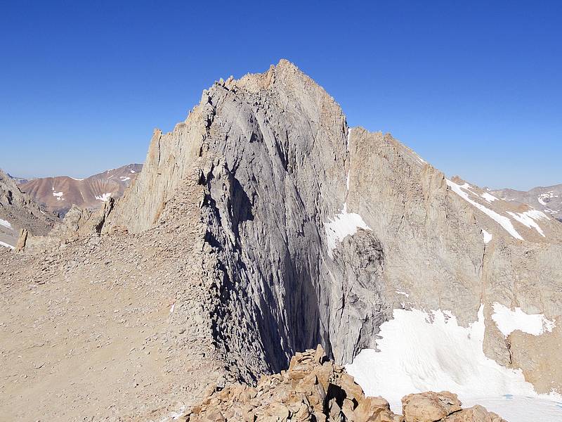
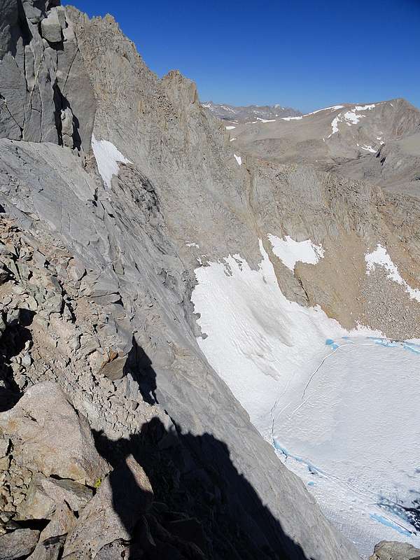
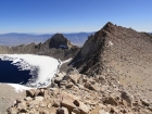
 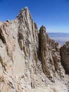 From Mount Carillon, we had good views of The Cleaver to the north, as well as Lake Tulainyo, the highest named lake in the contiguous US. More importantly, we got our first view of the route up the highly acclaimed east ridge of Mount Russell. We headed down the west ridge of Carillon, and then began making our way up Russell. As we climbed the ridge, the amount of exposure increased. The rock was stable and the climbing was easy, but a miss-step could lead to a long fall down the north face. This section was probably the highlight of the day, and we made our way up to the east summit, then over to the higher west summit. It was a blast. But we didn’t linger long, as we still had to figure out how to get off the peak, and down one of the south face gullies. Figuring out how to descend was the crux of the day. We searched for nearly 30 minutes, looking for the best possible option, and eventually decided that there was only one spot that would work. Sean went first, with the first 100 feet being the most challenging. He descended down a slot, through a notch, then down a ledge system to reach the base of the south face headwall. I followed by a slightly different route. Soon enough we reached to top of a more gently sloping talus filled gully. From here, the descent was easy, and we had a chance to watch some technical climbers on their way up the Fishhook Arête route. Very cool stuff. We stopped for lunch in the broad saddle between Russell and the north face of Mount Whitney. From Mount Carillon, we had good views of The Cleaver to the north, as well as Lake Tulainyo, the highest named lake in the contiguous US. More importantly, we got our first view of the route up the highly acclaimed east ridge of Mount Russell. We headed down the west ridge of Carillon, and then began making our way up Russell. As we climbed the ridge, the amount of exposure increased. The rock was stable and the climbing was easy, but a miss-step could lead to a long fall down the north face. This section was probably the highlight of the day, and we made our way up to the east summit, then over to the higher west summit. It was a blast. But we didn’t linger long, as we still had to figure out how to get off the peak, and down one of the south face gullies. Figuring out how to descend was the crux of the day. We searched for nearly 30 minutes, looking for the best possible option, and eventually decided that there was only one spot that would work. Sean went first, with the first 100 feet being the most challenging. He descended down a slot, through a notch, then down a ledge system to reach the base of the south face headwall. I followed by a slightly different route. Soon enough we reached to top of a more gently sloping talus filled gully. From here, the descent was easy, and we had a chance to watch some technical climbers on their way up the Fishhook Arête route. Very cool stuff. We stopped for lunch in the broad saddle between Russell and the north face of Mount Whitney.
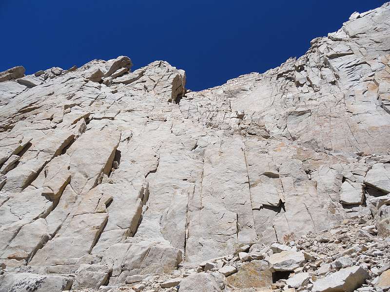
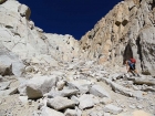
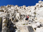
  The next obstacle was crossing the talus fields on Whitney’s north face. We basically angled up and over until reaching about the third rock rib, which provided some stable terrain to get us to the summit. I was starting to tire, but really felt surprisingly good considering we’d already completed nearly 8000 feet of elevation gain for the day. After crossing a small snowfield, we arrived on the summit plateau, and met up with the trail leading to the summit. We passed a couple other groups on their way down, but had the summit to ourselves once we arrived at the highpoint. After signing the summit register, and snapping some photos, it was time to head down the trail. Sean took a quick side-trip to scramble up the Keeler Needle, and I continued down the trail. The next obstacle was crossing the talus fields on Whitney’s north face. We basically angled up and over until reaching about the third rock rib, which provided some stable terrain to get us to the summit. I was starting to tire, but really felt surprisingly good considering we’d already completed nearly 8000 feet of elevation gain for the day. After crossing a small snowfield, we arrived on the summit plateau, and met up with the trail leading to the summit. We passed a couple other groups on their way down, but had the summit to ourselves once we arrived at the highpoint. After signing the summit register, and snapping some photos, it was time to head down the trail. Sean took a quick side-trip to scramble up the Keeler Needle, and I continued down the trail.
 We still had one more peak to climb, and I waited for Sean for a couple minutes at the spot where we needed to leave the trail in order to climb Mount Muir. Once he got there, we headed up through the talus for a while, and then reached the base of the summit block. The final scramble to the summit wasn’t a gimme, and there were just enough challenging moves to keep this peak off-limits for most casual hikers. It was a fun short scramble, and our fourth peak of the day. Great views from the summit. We still had one more peak to climb, and I waited for Sean for a couple minutes at the spot where we needed to leave the trail in order to climb Mount Muir. Once he got there, we headed up through the talus for a while, and then reached the base of the summit block. The final scramble to the summit wasn’t a gimme, and there were just enough challenging moves to keep this peak off-limits for most casual hikers. It was a fun short scramble, and our fourth peak of the day. Great views from the summit.
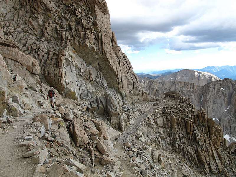
 Now all that was left was a 9-mile hike back to the trailhead. The upper section of the trail is well constructed, and the grade was pretty gentle as it made “99 switchbacks” down to the Trail Camp area, which was loaded up with a couple dozen tents and folks planning to climb Whitney the following day. We passed a couple other slower moving groups along the way, and I wondered how late it would be before they made it back to the trailhead. We set a steady pace, and only needed headlamps for the last mile, making it to the trailhead by 8pm. Now all that was left was a 9-mile hike back to the trailhead. The upper section of the trail is well constructed, and the grade was pretty gentle as it made “99 switchbacks” down to the Trail Camp area, which was loaded up with a couple dozen tents and folks planning to climb Whitney the following day. We passed a couple other slower moving groups along the way, and I wondered how late it would be before they made it back to the trailhead. We set a steady pace, and only needed headlamps for the last mile, making it to the trailhead by 8pm.
This day was an instant classic for me. We’d climbed four peaks in the High Sierra, including three 14ers, had the highest point in the lower 48 all to ourselves, and seen some amazing scenery. Our strenuous 15-hour day had both started and ended in the dark, covering over 17 miles and 8500 feet of elevation gain. I can’t begin to express how much I appreciate Sean inviting me along for this trip, and encouraging such an adventurous route. What an excellent day in the mountains. Now all that was left was to get a good night of sleep in order to prepare for our climb of Clyde Minaret the following day.
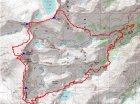
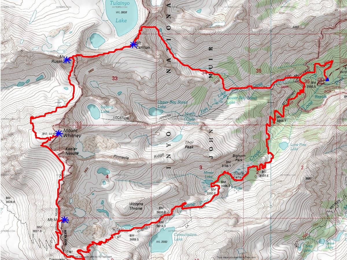
Map of our route. Covering 17.5 miles and 8700 feet of elevation gain.
|

5am start from the Whitney Portal trailhead.
|
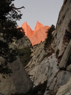
Sunrise on Mount Whitney and Keeler Needle as seen from the top of the Ebersbacher Ledges.
|

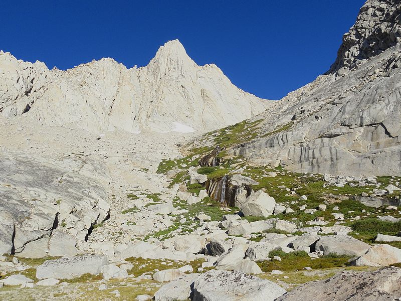
Heading into the very scenic Carillon cirque.
|
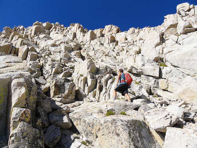
Sean making his way up the gully towards the Carillon/Cleaver col.
|
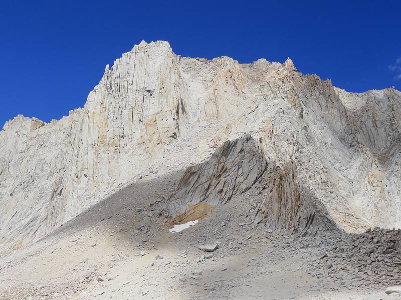
The Cleaver as seen from the northeast face of Mount Carillon.
|
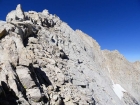
Making our way up the north ridge of Mount Carillon.
|

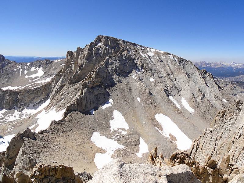
Mount Russell as seen from Mount Carillon.
|
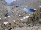
Looking back on Mount Carillon, The Cleaver, and Tulainyo Lake.
|

The steep north face of Mount Russell drops sharply to the frozen lake below.
|
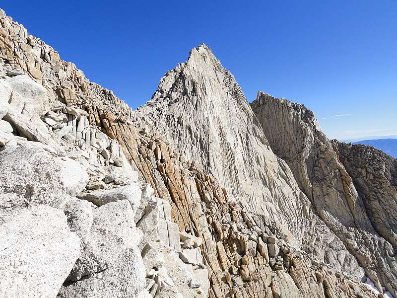
Climbing the awesome east ridge of Mount Russell.
|
Sean heading toward the summit of Mount Russell.
|

The north face of Mount Whitney as seen from Mount Russell.
|

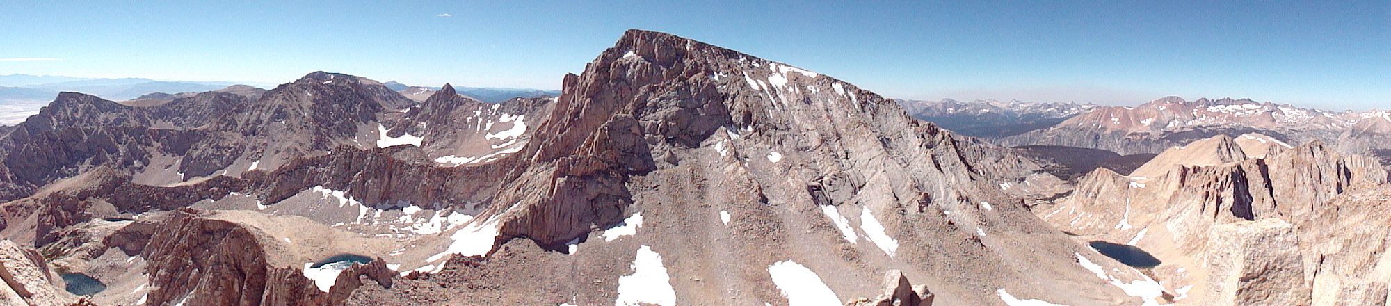
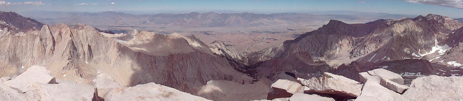
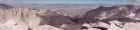
Panoramic view looking north from Mount Russell, with Mount Whitney in the center.
|
Looking down into our descent route off Mount Russell, into the south face gully.
|
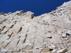
Headwall we downclimbed to descend from Russell.
|
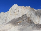
South face of Mount Russell.
|
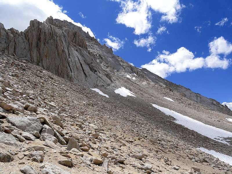
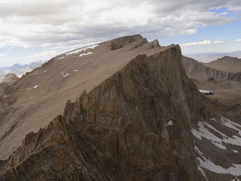
Looking across the north face of Mount Whitney.
|
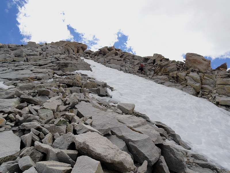
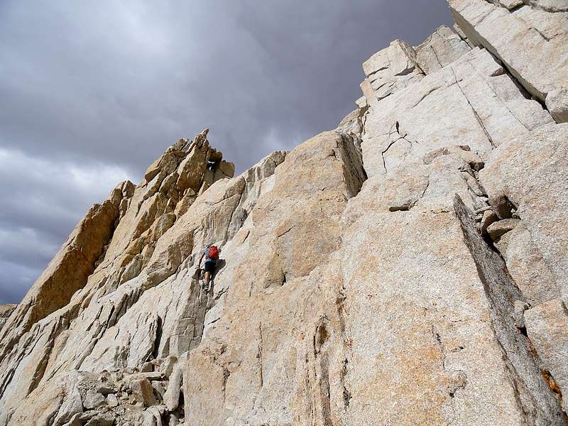
Sean climbing the north face of Mount Whitney.
|

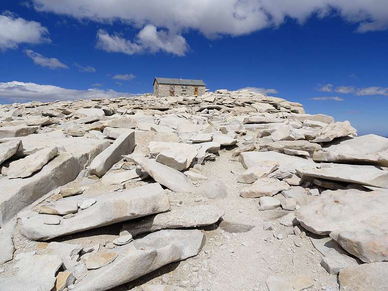
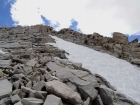
Nearing the summit of Mount Whitney.
|
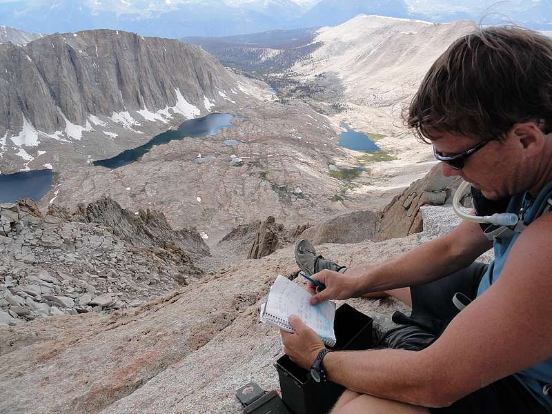
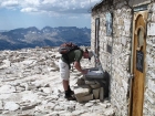
Dave signing the Whitney summit register. SeanD photo.
|
Panoramic view looking east from Mount Whitney, with Mount Russell on the far left.
|

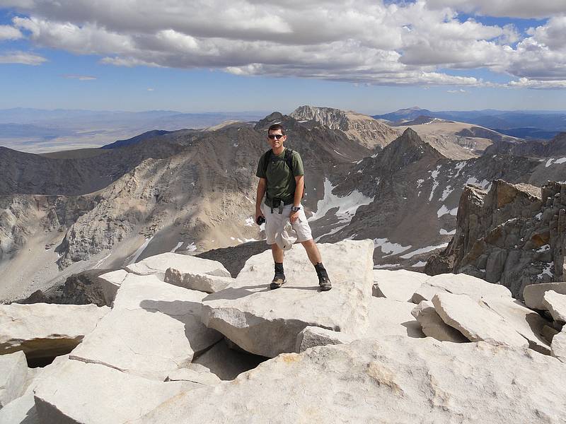
Dave on the summit of Mount Whitney, highest point in the continental US.
|
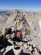
Sean making his way up Mount Muir.
|
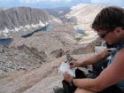
Signing the summit register on Mount Muir.
|

Mount Whitney from Mount Muir.
|
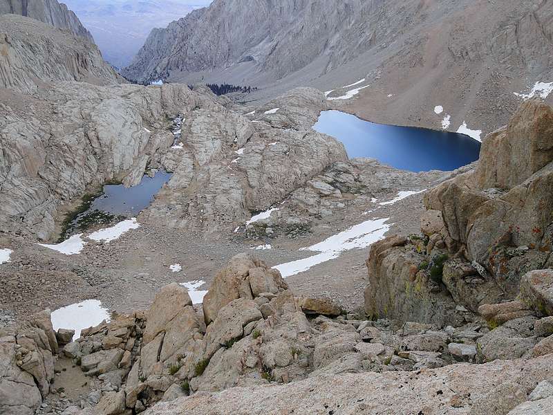
View down to Trail Camp, and a couple dozen tents amongst the rocks.
|
Dave descending the Whitney trail. SeanD photo.
|
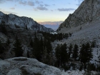
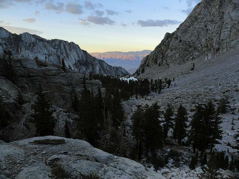
Lone Pine Lake in the distance, about to run out of light.
|

8pm finish at the Whitney Portal trailhead.
|
|