|
Big Baldy Ridge
An amazing adventure in the Frank Church Wilderness
to climb Big Baldy and nine other peaks
July 1-3, 2016
|
Related Links:
- IdahoSummits Trip Report
- Splattski Trip Report
- Adam Helman Trip Report
- SummitPost Page
- IdahoAClimbingGuide Info
- Trailhead Location
- Hillmap of our route
- Chilcoot Peak (8,998'): TL, LOJ, Map
- Pistol Rock (9,178'): TL, PB, LOJ, Map
- Baldy Ridge #5 (8,817'): TL, LOJ, Map
- Baldy Ridge #4 (9,109'): TL, LOJ, Map
- Baldy Ridge #2 (8,925'): PB, LOJ, Map
- Baldy Ridge #1 (8,999'): PB, LOJ, Map
- Big Baldy: TL, SP, PB, LOJ, Map
- Baldy Ridge #3 (9,160'): TL, LOJ, Map
- Trapper Mountain (8,982'): LOJ, Map
- Trapper Point (8,671'): LOJ, Map
|
Central Idaho’s Frank Church Wilderness is the largest wilderness area in the lower 48. It is wild, rugged, and vast. If you’re looking for a backpacking trip to help you appreciate those characteristics, the Baldy Ridge trail is highly recommended. The trail follows a high undulating ridge which offers up some great views of the surrounding terrain. The trail is also the preferred route to access a huge mountain called “Big Baldy”, which is the tallest peak in the area, and one of the more prominent peaks in Idaho. To me this mountain has always had very mythical qualities. Big, remote, and a challenging approach. Often talked about, but seldom visited. I was excited when Splattski invited me along on a 3-day backpacking trip to visit Big Baldy, and hopefully climb a bunch of other peaks in the area.
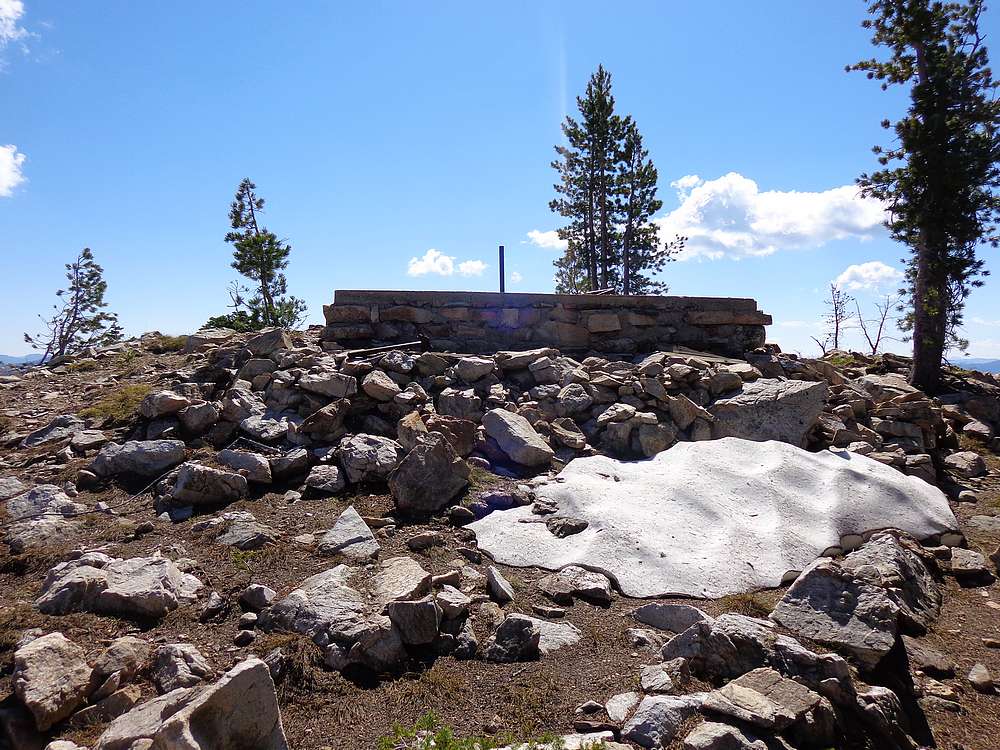
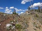
We met in Cascade, and then rode together for the 90 minute drive to the trailhead. Beware of downed trees across the road from Landmark onward, and having a chainsaw is highly recommended. The trail started climbing right away at the start of the hike, but we made good time to the ridge near Chilcoot Pass for our first view of Big Baldy, way in the distance. After a short hike north, we dropped our packs at the pass and made a quick hike up the trail the Chilcoot Peak. This would be our first of four summits of the day. We checked out the foundation of the old lookout tower, took some photos, and headed back down to the main trail.
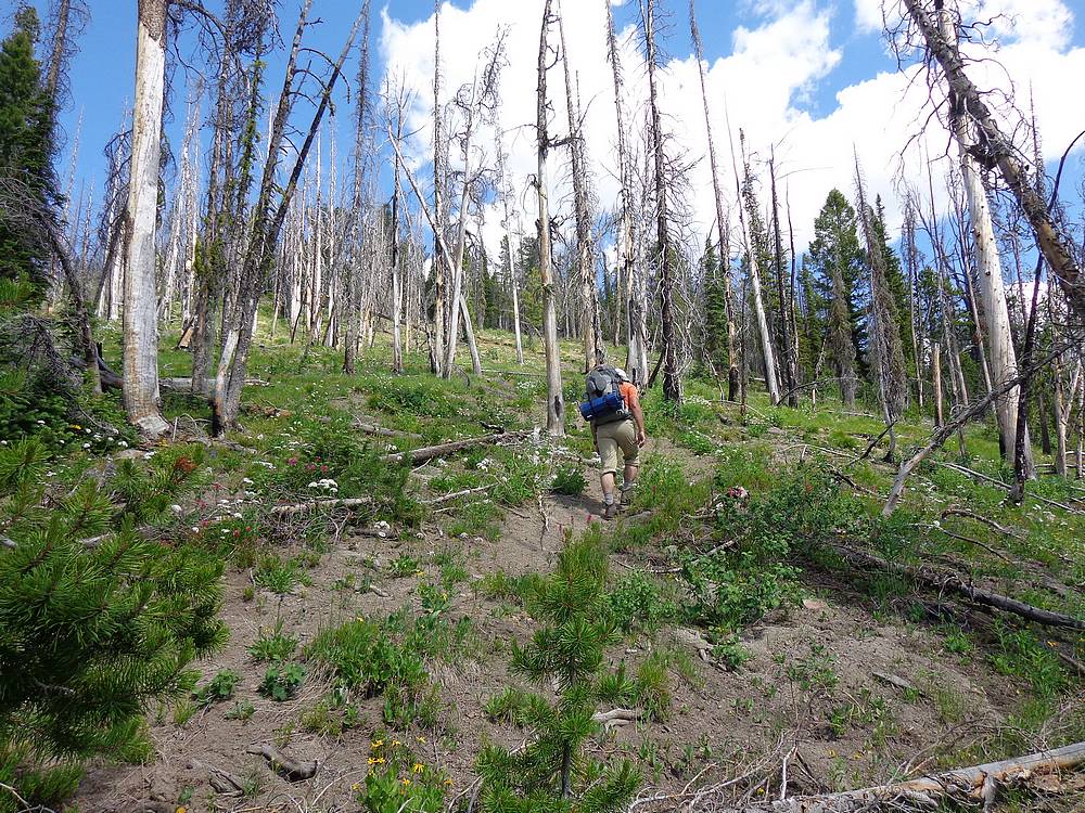
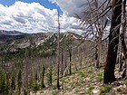
From Chilcoot Pass, the trail descends a few switchbacks into the basin below, and then onward to a small pond, which is the last reliable source of water before reaching Buck Lake 10 miles later. Just after the pond, the trail briefly follows an old mining road, and we then watched for a trail again heading northeast from the corner of a sharp switchback on the road. This section of trail seemed to have burned pretty hot during the big forest fires back in 2000, so there wasn’t not much shade until we reached the saddle between Trapper Mountain and Pistol Rock.
Our second peak of the day was Pistol Rock, which was really cool. We passed an elk on the ridge, and then made a short scramble to the summit where the views were excellent. (An ongoing theme for the trip.) We then backtracked to the saddle for some lunch, and then headed down to the east to rejoin the trail. The trail was on the north side of the ridge in this section, and we crossed several lingering snowbanks. After a little while, we left the trail again to tag our third summit, Peak 8817’ (Baldy Ridge #5).
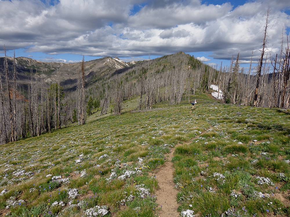
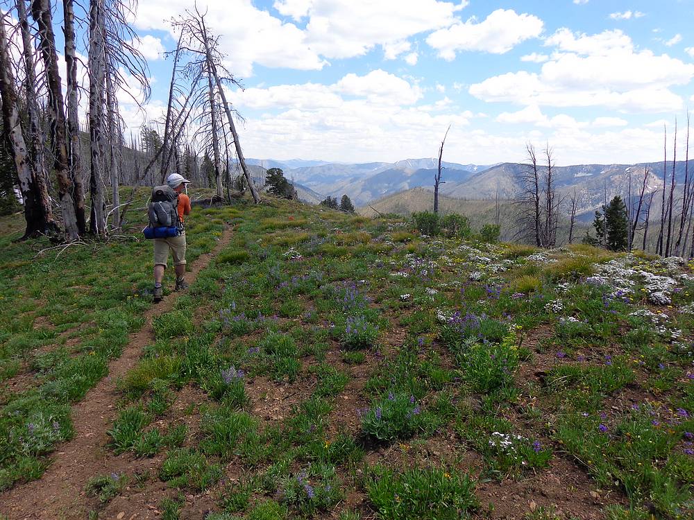
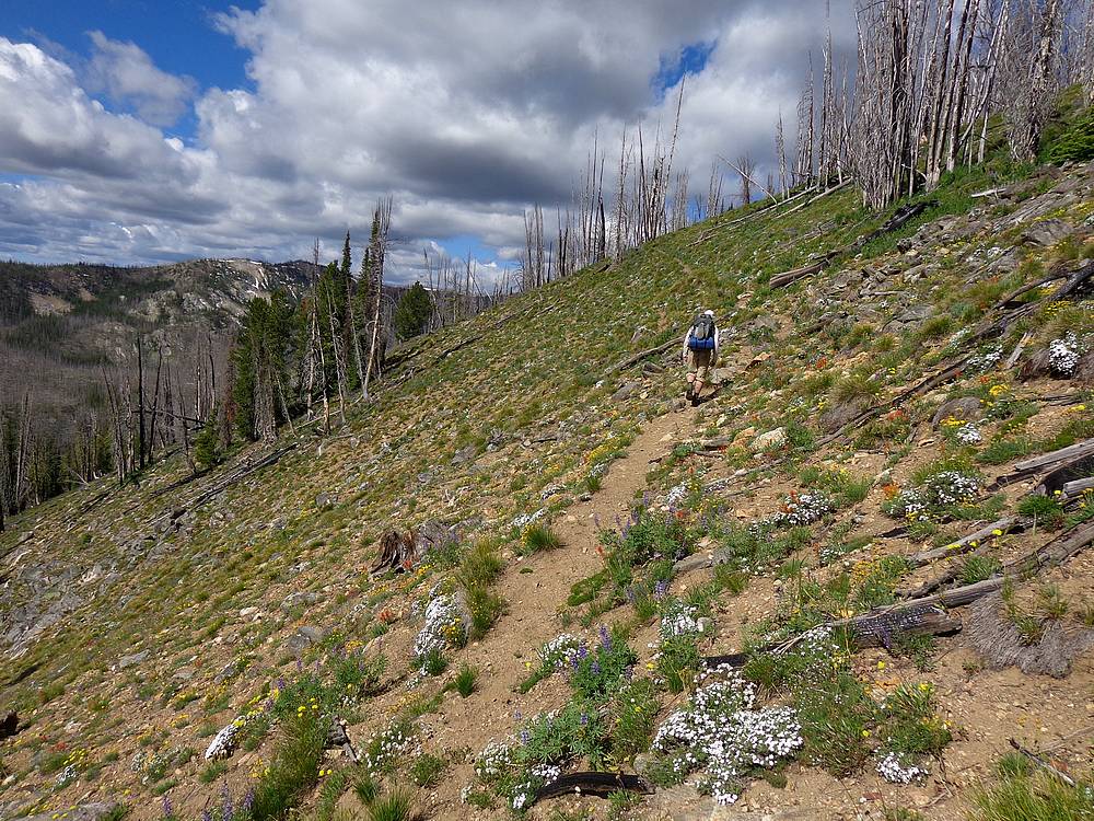
The next section of trail passed through some of the densest fields of wildflowers I’ve ever seen. All different colors and varieties of flowers made for quite the spectacle. Our spirits where high, but that was about to change. After following the ridge for a while, we descended the trail to a low saddle where the trail then headed steeply uphill. It was now after 4pm, and we were in the heat of the day. There was very little shade because of the burn, and the horseflies were everywhere. They literally swarmed around us as we hiked. And anytime we stopped, they would take the opportunity to try and steal a bite of our flesh. Possibly the most discouraging 30 minutes I’ve ever experienced while hiking. Horsefly Hill (or Hell). Fortunately it was pretty short lived, because the trail got less steep when we got back up on the ridge, and there was a nice breeze to blow away the flies.
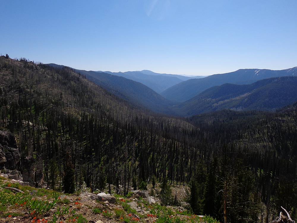
The section of trail heading southeast from Pt 8787’ was highly scenic, with the highpoint Peak 9109’ (Baldy Ridge #5), our fourth summit of the day. This was one of my favorite areas of the entire trip. It wasn’t long before we arrived at the saddle above Buck Lake, where we had to maneuver around a big snow cornice before reaching the steep switchbacking trail that would take us down to Buck Lake. The lake would be our basecamp for the next two nights. We arrived there about 6pm, tired but very satisfied. Estimated stats for the day were 14 miles and 4500’ gain, including side trips.
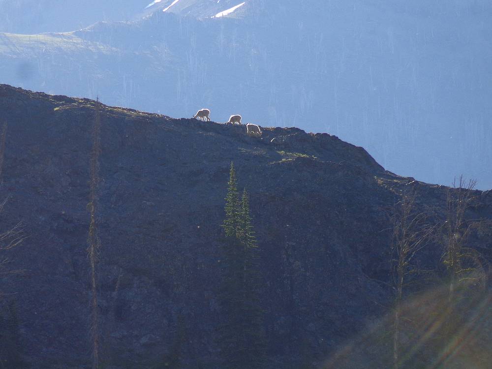
After setting up camp near the inlet stream, it was time for dinner, and watching Mountain Goats above us, two groups in opposite directions. I guess we didn’t have the place to ourselves after all.
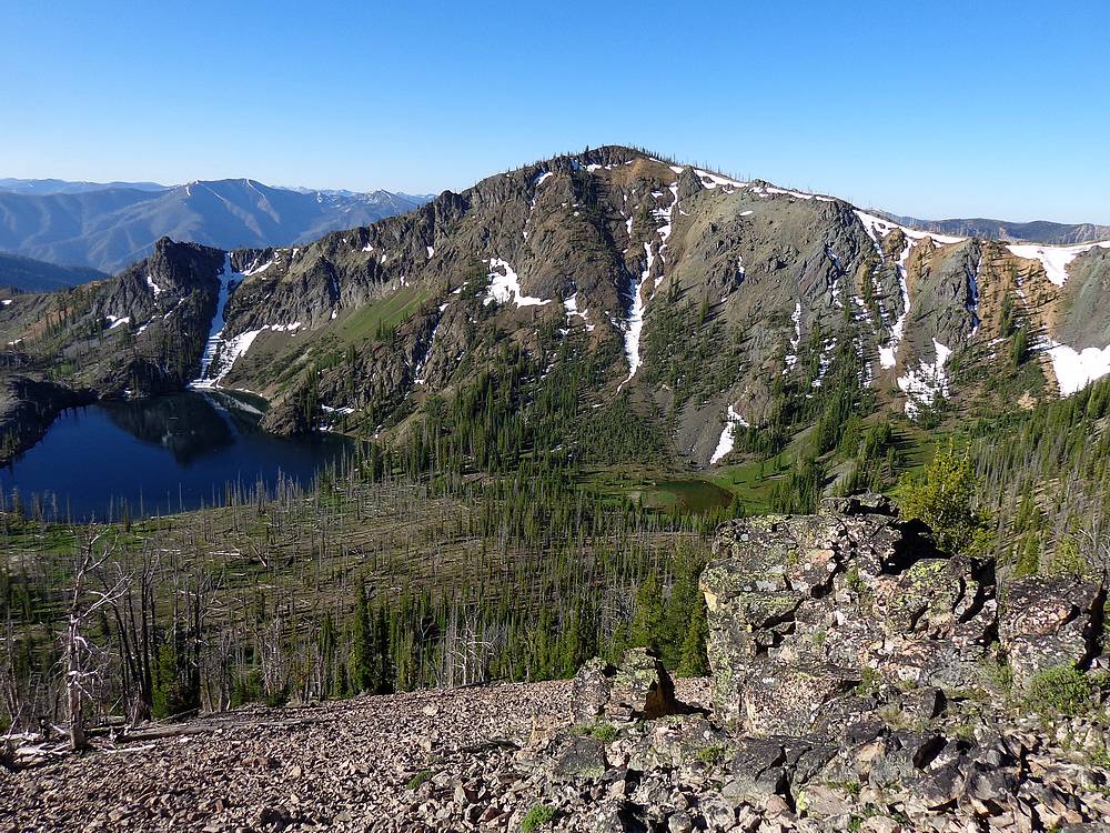
We awoke the next morning to blue skies, ready to head out for our main objective for the trip, Big Baldy. We took our time getting ready, and then headed north up a faint trail to the ridge, followed by a short scramble up Peak 8925’ (Baldy Ridge #2). From there we had great views over the ridge to the hard to reach Papoose Lake, as well as back down on our campsite at Buck Lake. From there, we continued east along the ridge until reaching the trail, which we followed down to a nice wooded saddle.
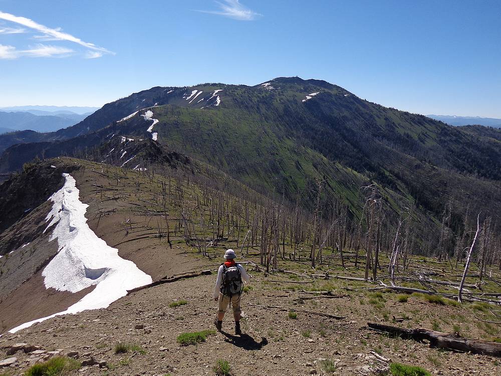
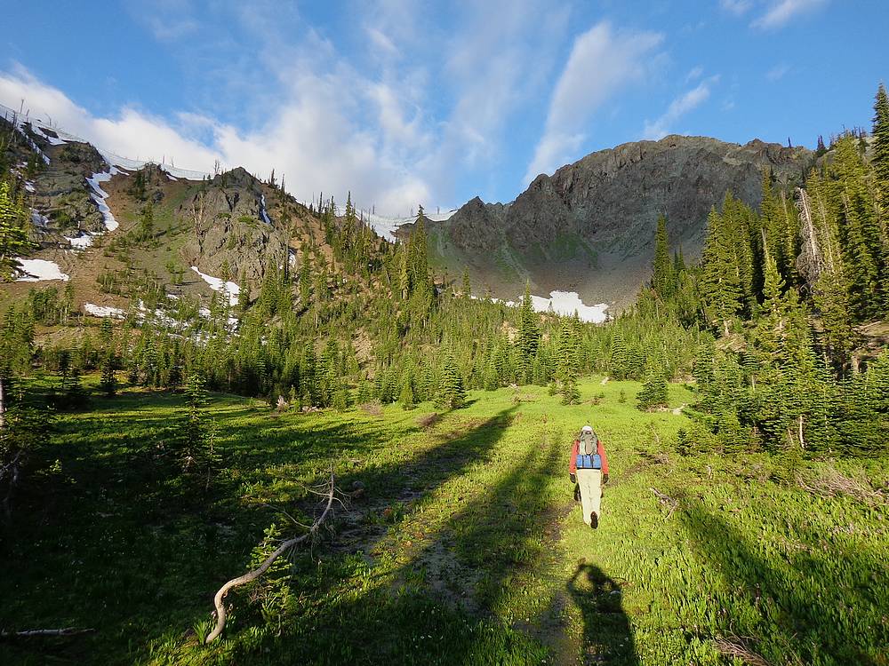
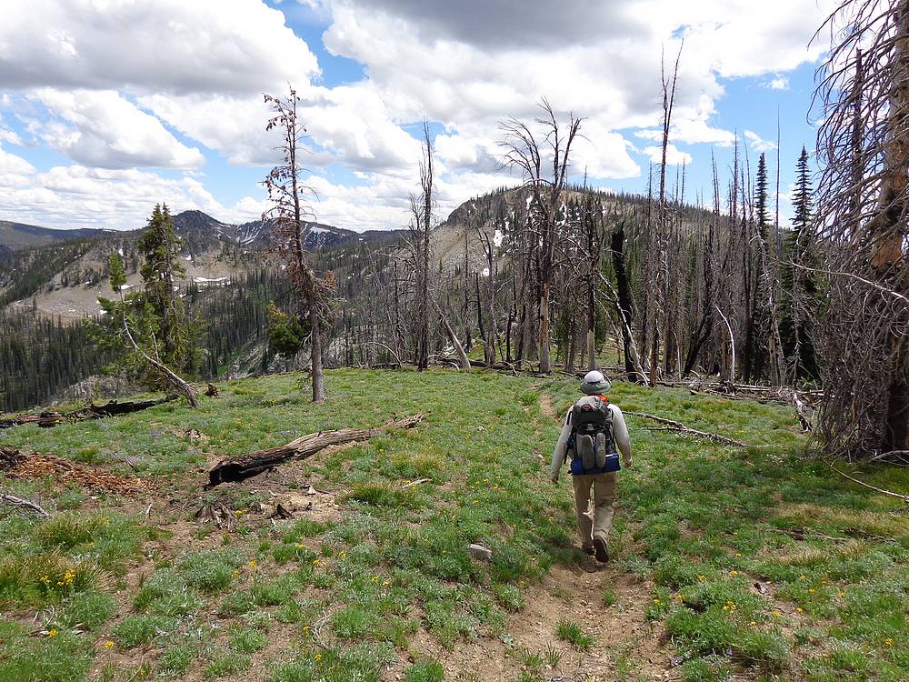
After a short break at the saddle, we got back to undulating, and followed the trail back up the ridgeline for more views, and a quick side trip to Peak 8999’ (Baldy Ridge #1), the last minor summit before Big Baldy. From then forward, it would be pretty open country, thanks to a combination of bald meadows, and burned areas.
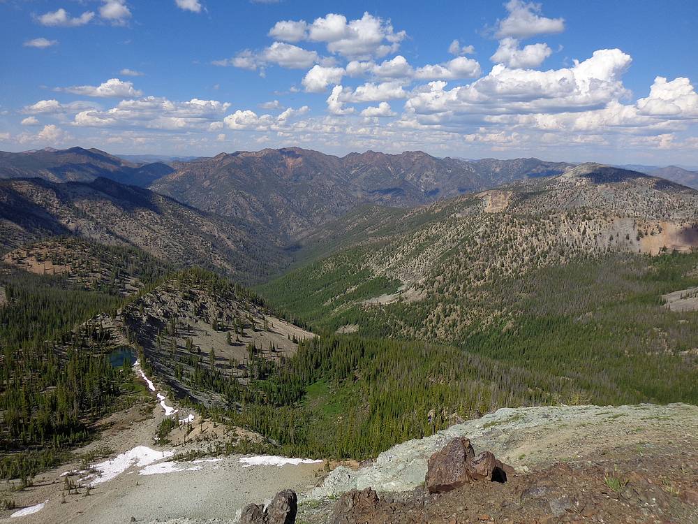
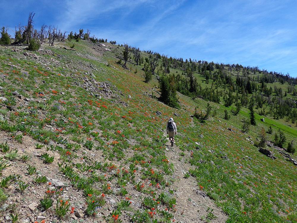
Once at the base of Big Baldy’s northwest ridge we had two choices. Either head off trail and take a direct route up the hillside, or continue on the trail around to the south side of the peak. Since we had extra time, we chose the scenic route and stuck with the trail. This ended up being a great decision, and we were treated with some huge open views, and more big fields of wildflowers. The map shows a couple trail junctions, but the only fork we founds was way over on the southeast side of the peak, where we met the trail climbing up from the Middle Fork Salmon River.
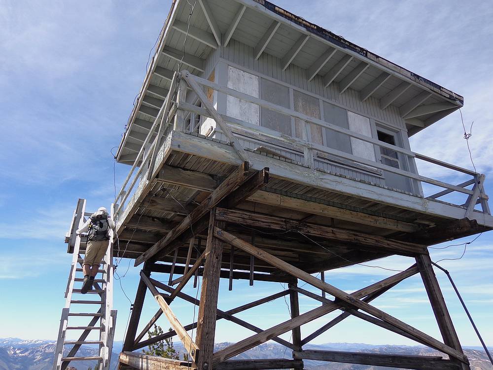
Eventually, the trail crested and we arrived at the lookout building on the summit of Big Baldy. We carefully climbed the stairs, walked around the catwalk, and could even see in to check out some of the gear and supplies inside. But we didn’t fully trust the structure, and climbed back down to enjoy our lunch near a benchmark, where we found a bottle with the summit register. Not many entries in this remote peak. It was about this time we spotted a bald eagle below us, circling the peak. Not bad lunchtime entertainment. Not to mention distant views of the Sawtooths, White Clouds, Bighorn Crags, and Lick Creek Range, among others.
After lunch, we made a more direct descent down to the northwest, and then followed the trail back to the saddle, where we took a shortcut down to the lake instead of reclimbing the ridge. Once back at Buck Lake, we took a quick and cold swim to wash off a few layers of dirt, sweat and sunscreen. Very refreshing. Then it was back to the campsite for some lounging, and watching the brook trout swim in the inlet stream. It was pretty entertaining, with the water so shallow that their fins were visible above the water, and they thrashed around wildly looking for a place to hide if we startled them. That evening, we turned in early in anticipation of a long day to hike back out to the trailhead. But not before enjoying a great sunset.
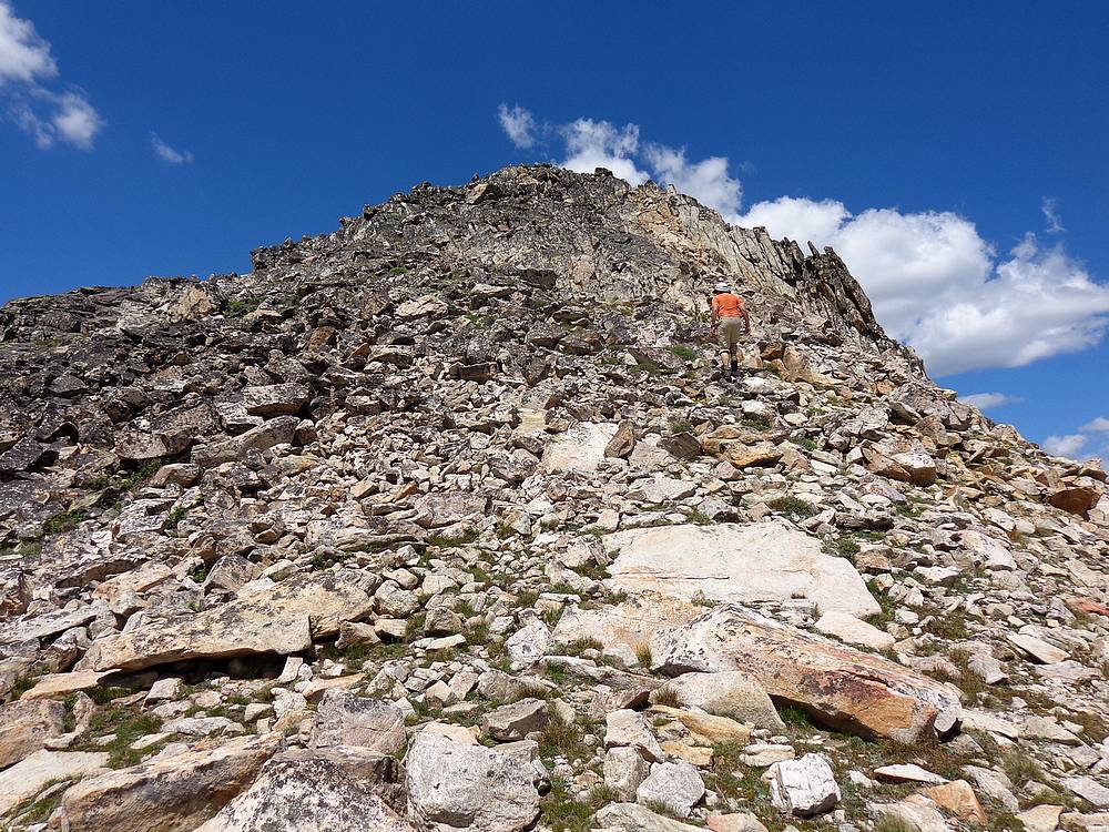
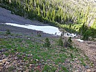
We were up by about 5am on the final day, and had packed up camp and hit the trail not long after 6am. Right off the bat, we had to do one of the bigger climbs of the day, up the switchbacks to the corniced saddle. It only took 30 minutes, but seemed longer. We dropped our packs at the saddle, and then made a quick dash up Peak 9160’ (Baldy Ridge #3), above Buck Lake. We hoped to get a close up view of the goats we’d been seeing the prior two days, but no luck.
The low morning sun made for some cool lighting on the mountains in front of us as we followed the high ridge, descended Horsefly Hill, and then did some “backpackers steeplechase” over downed trees while climbing back up onto the ridge again. Soon enough we were back in the wildflowers, with good views of Pistol Rock out in front of us. Then we stopped for lunch overlooking the old Springfield Mine, which had been abandoned back in the 50’s. The mining company left behind quite the mess, and we contemplated what could be done to help ensure future mines were actually cleaned up after they were played out.
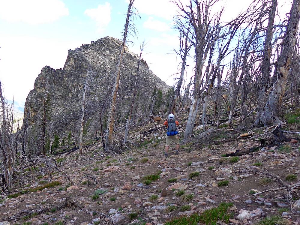
After lunch, it wasn’t long before we got back to the saddle between Pistol Rock and Trapper Mountain. We left the trail there, and headed up Trapper Mountain. The burn seemed more recent in this area, with more of a “scorched earth” feel to it. After a quick stop at the summit, we headed down to the west until we met the old mining road. Along the way, we scared up a big bull elk, which was very cool. At this point we had climbed nine peaks during the trip. Of course we couldn’t stop on an odd number, so we dropped our packs where the hiking trail met the mining road, and then headed north along the old road until reaching the saddle. From there we continued cross-country up “Trapper Point” (Peak 8671’). The peak itself wasn’t real impressive, but the views were good. Then we retraced our path back to our packs, just under 90 minutes round trip.
We were back on the trail at this point, and made a quick stop to pump water from the creek in the basin below Chilcoot Pass. All that was left was one final climb of the day up to the pass. Our pace was slow but steady as the afternoon sun was starting to heat things up. We exchanged high-fives there on the pass, and then made the mostly downhill hike back to the truck, where we arrived at around 3:30 after about 16 miles 5k feet of elevation gain on the day.
What a great trip. It was cool to have climbed 10 peaks in one outing, but the lasting memory I will have is the pure rugged beauty of this remote and vast area. Some really big country, and a true wilderness feeling for sure. Big Baldy didn’t disappoint.
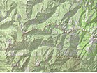
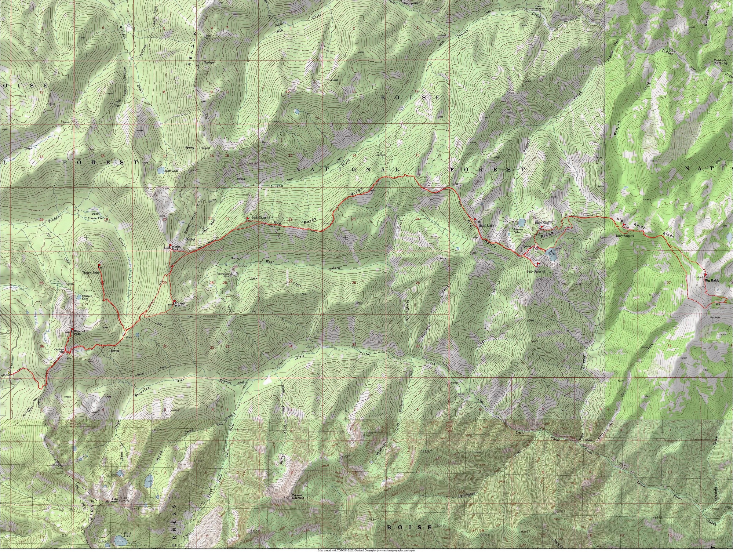
Map of the route, just under 40 miles and 12000' elevation gain round trip. (Its about 32 miles and 9k if just doing Big Baldy.) |
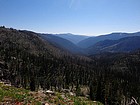
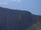
First distant view of Big Baldy from near Chilcoot Pass. |
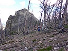
Lookout foundation on Chilcoot Peak. |
Descending Chilcoot Peak, headed back to the pass. |
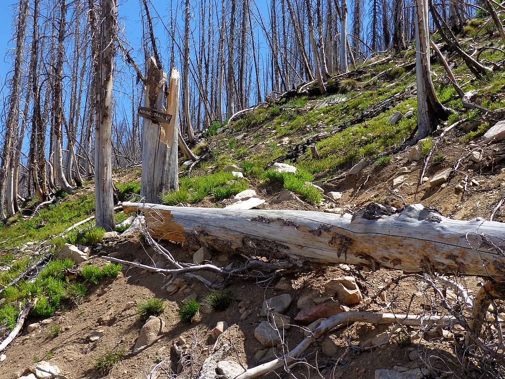
We had several good chuckles about this sign. Where does the hiking trail go? |
John and an elk below Pistol Rock. |

Nearing the summit of Pistol Rock. |
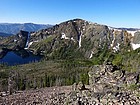
View east along the ridge from Peak 8817' (Baldy Ridge #5). |
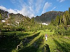
Tons of wildflowers along the ridge. |
Heading up the dreaded Horsefly Hill. |
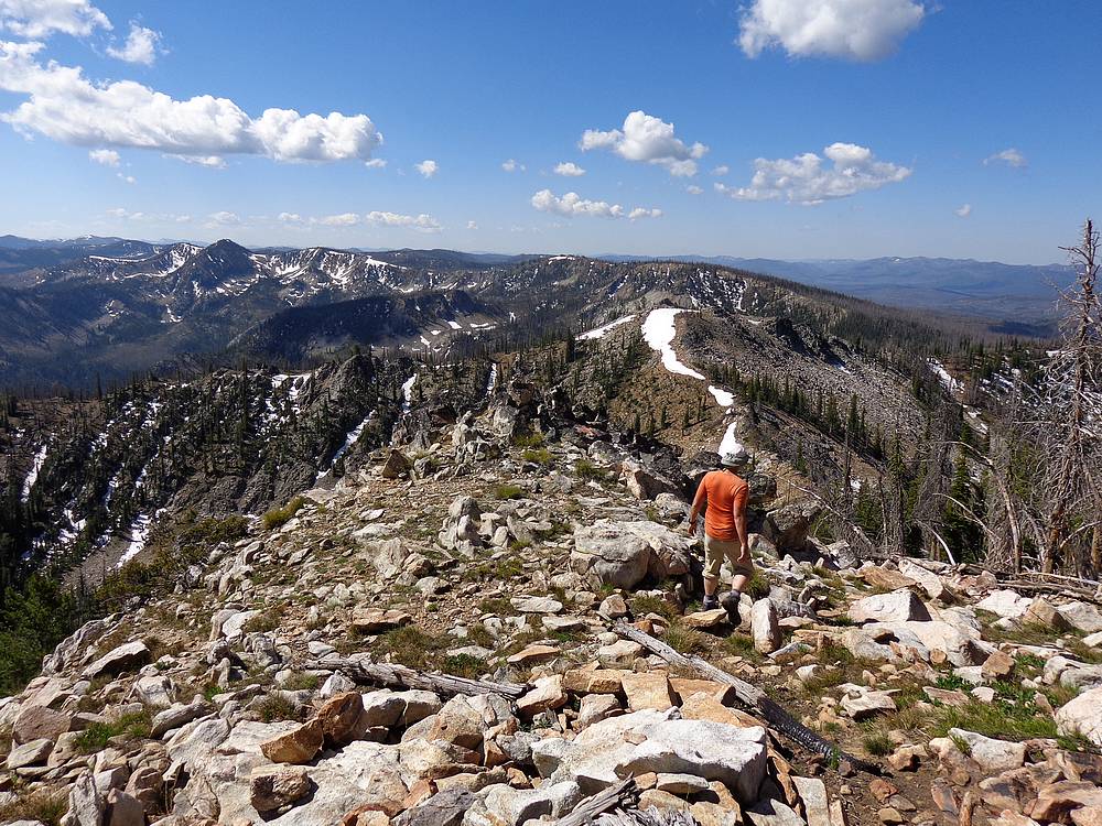
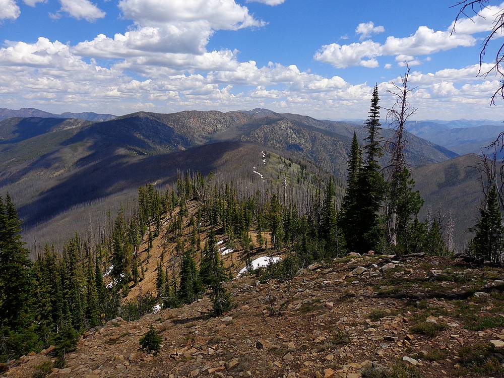
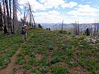
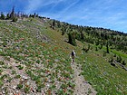
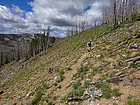
Fantastic views along the ridge, one of my favorite sections. |

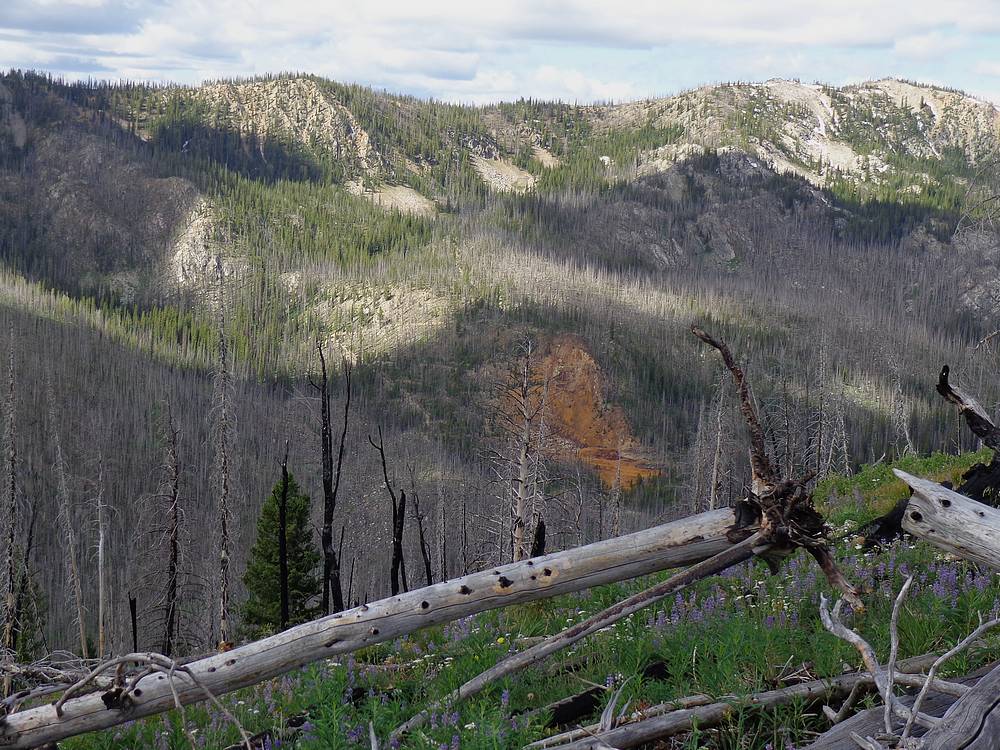
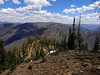
View northeast from Peak 9109' (Baldy Ridge #4). Red Ridge in the distance. |
Headed down the steep switchbacks to Buck Lake. |
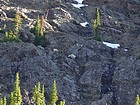
Mountain Goats above Buck Lake. |

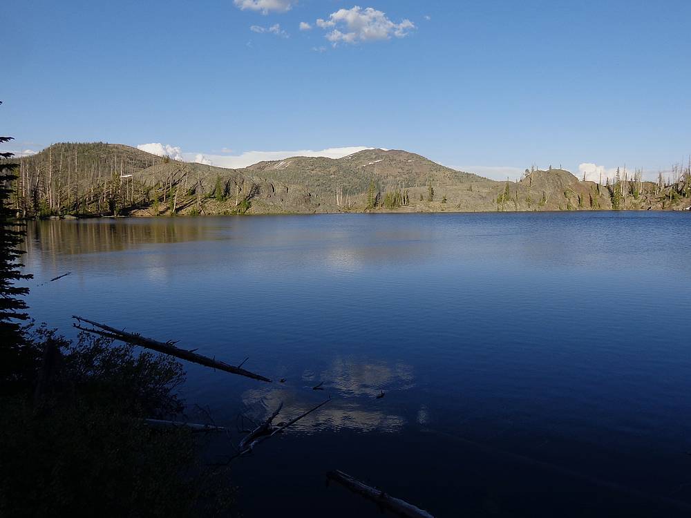
Evening view of Big Baldy from Buck Lake. |
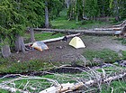
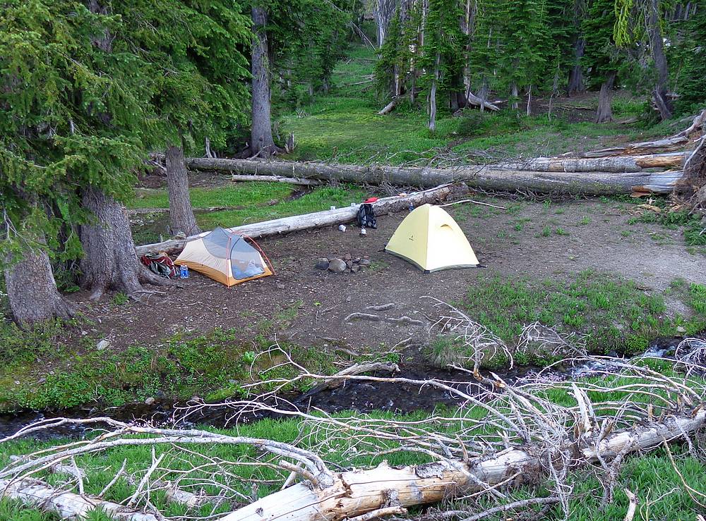
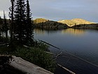
Our campsite next to the Buck Lake inlet stream. |

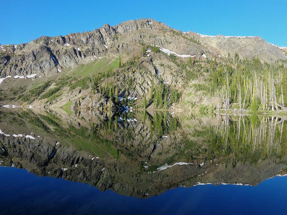
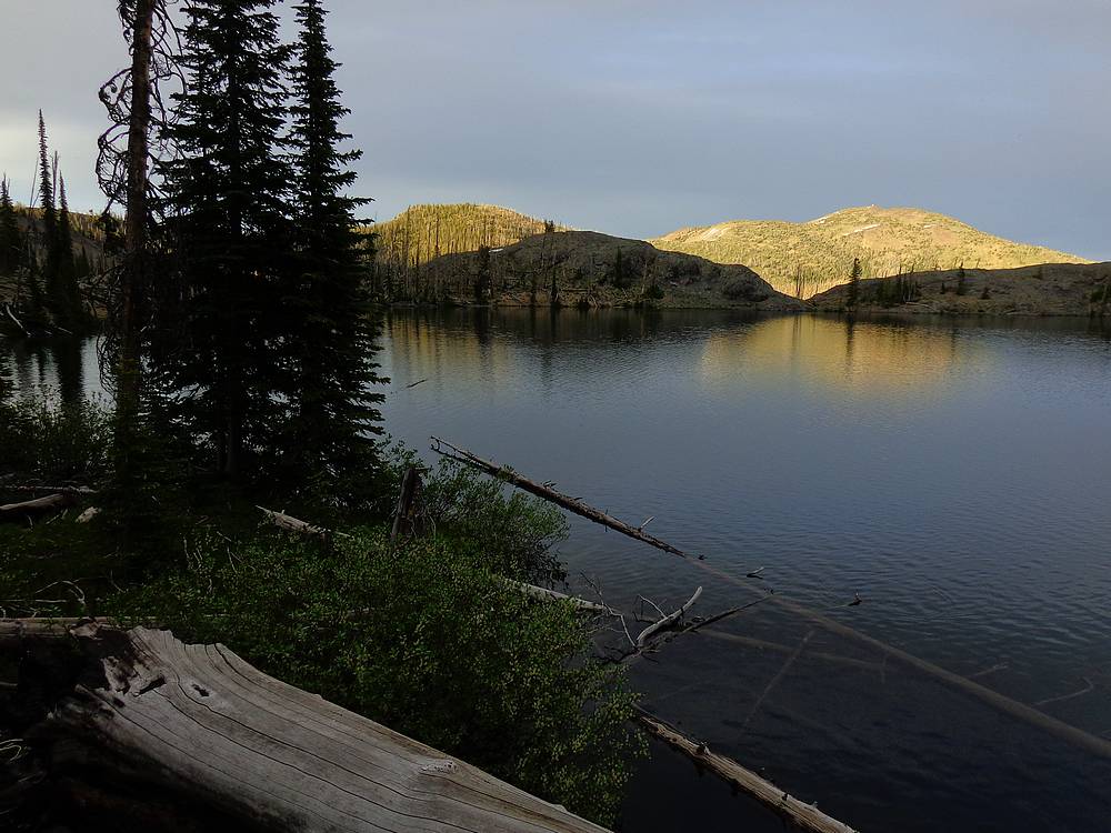
Morning reflection of Peak 9160' (Baldy Ridge #3) in Buck Lake. |
More goats on the far side of Buck Lake. |
View of Buck Lake from Peak 8925' (Baldy Ridge #2). |
Looking toward Big Baldy during our descent from Peak 8999' (Baldy Ridge #1). |
One of several huge fields of wildflowers on the trail south of Big Baldy. |
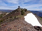
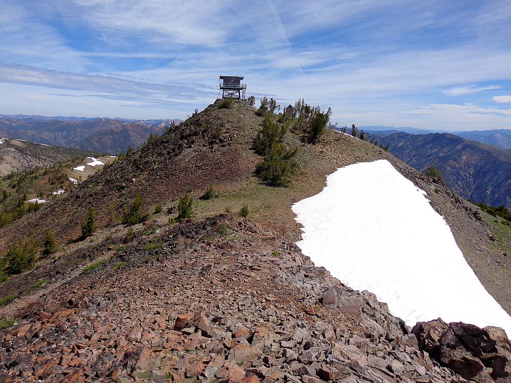
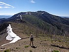
Nearing the summit of Big Baldy. |
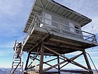
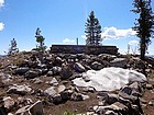
Carefully climbing the stairs on the Big Baldy lookout tower. |
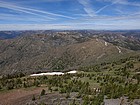
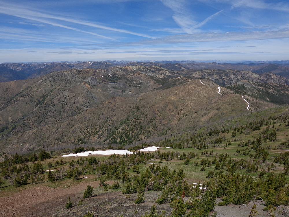
Looking back on Big Baldy Ridge from the lookout tower. We came a long way! |

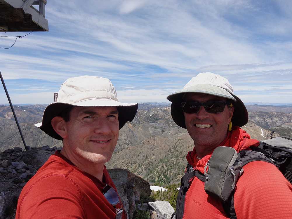
Big Baldy summit shot, Splattski style. |
Evening sunset on Big Baldy, from Buck Lake. |
Bright morning sun at the start of our day, looking forward to the cornice guarding the pass. |
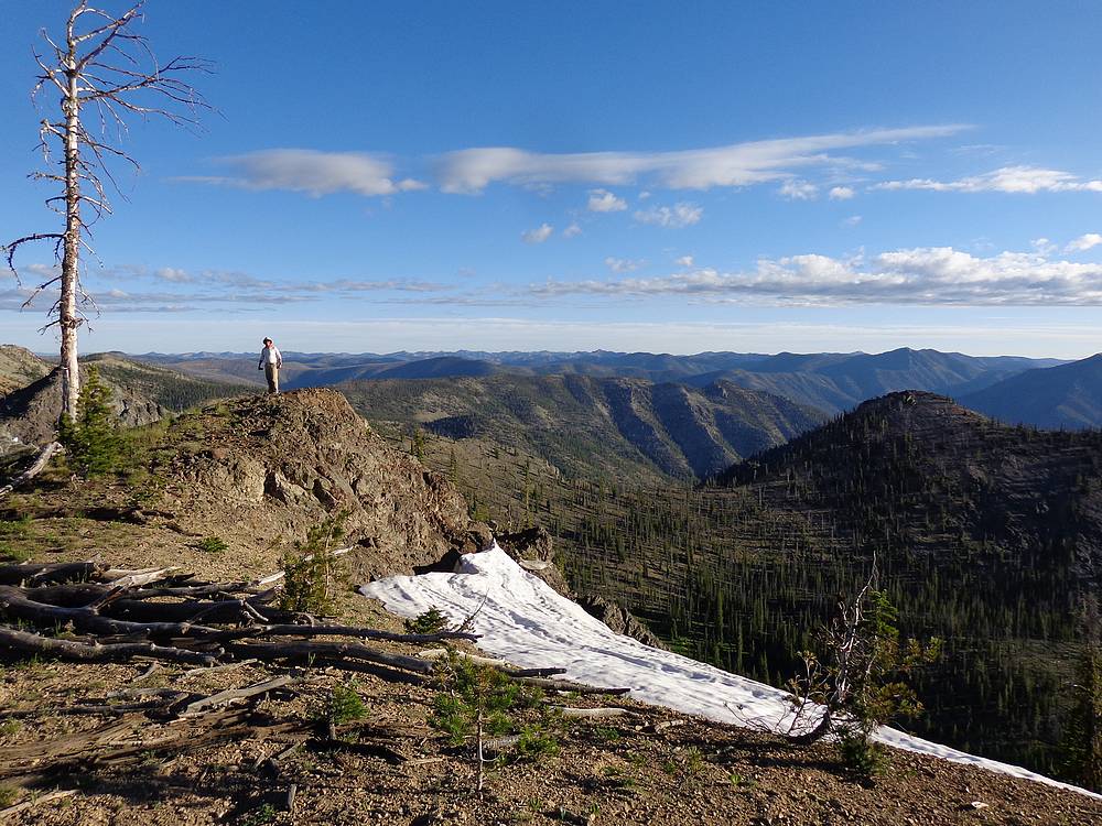
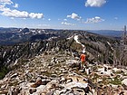
Great views from just below the summit of Peak 9160' (Baldy Ridge #3). |
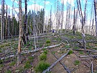
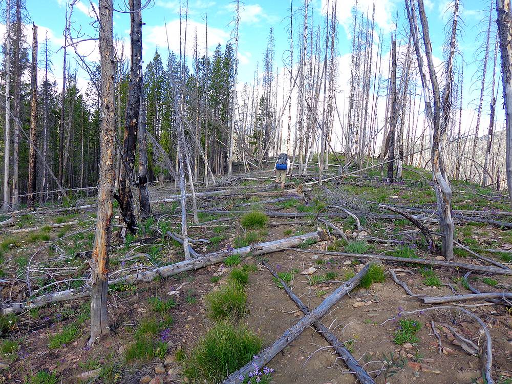
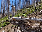
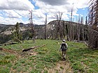
Backpackers steeplechase during the hike back. Lots more trees still to fall. |
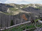
Looking down on the Springfield Mine from Baldy Ridge. Left in bad shape after being abandoned in the 50's. |
Did I mention the wildflowers? |
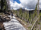
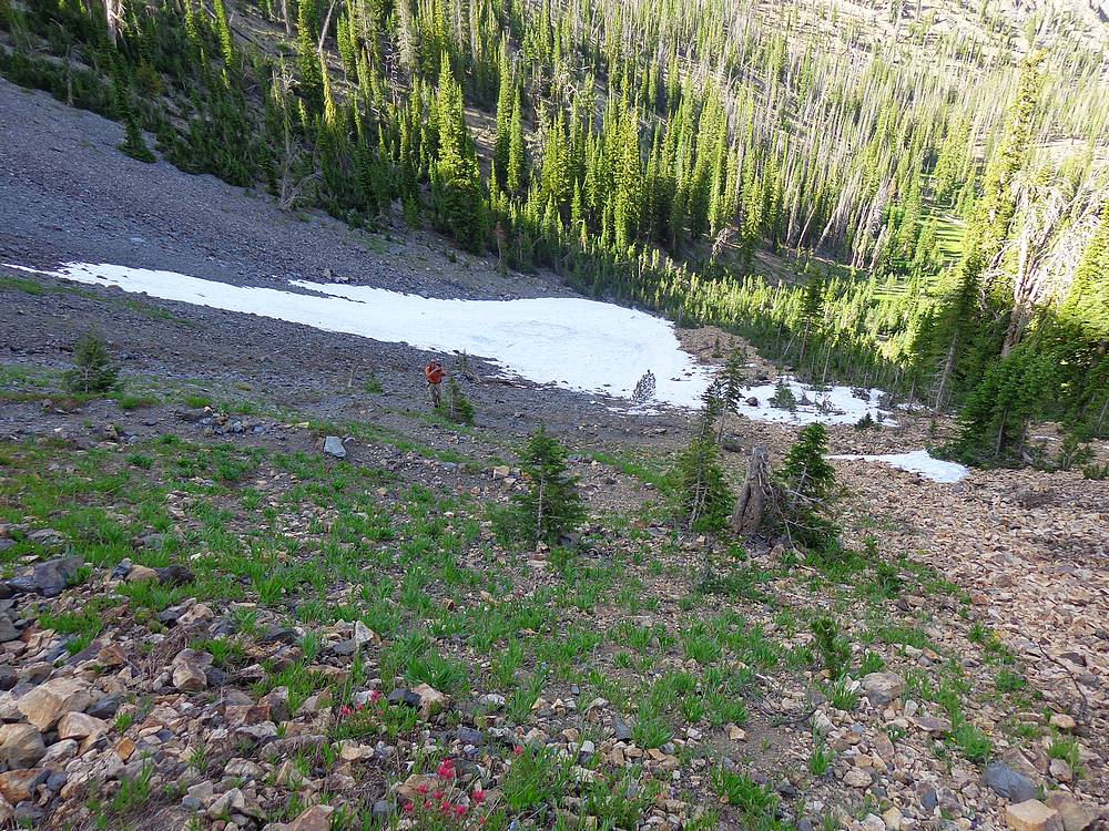
Still snowfields to cross on the shady northern side of the ridge. |
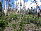
On the approach to Trapper Mountain. |
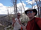
Summit shot on Peak 8671' (Trapper Point), our tenth summit of the trip! |
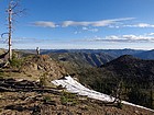
Back on the ridge near Chilcoot Pass, almost all downhill from here. |
 |
|