|
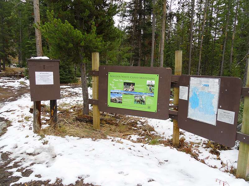
Lookout Mountain anchors a group of peaks located in the northwest corner of the White Cloud Mountains, not far from Stanley Idaho. The peaks are mostly forested, and are just under 10,000 in elevation. The easiest access is via the well-maintained Rough Creek trail, which goes all the way to the summit of Lookout Mountain. The trailhead has ample room for parking, and is easily accessible in a passenger car.
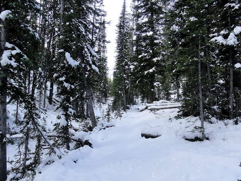
After some early season snowfall, Sean and I chose Lookout Mountain and some surrounding peaks as a destination since the route was safe with new snow, and was in an area neither of us had been to before. We made it to the trailhead by around 8:30, and were on our feet hiking shortly thereafter. The going was quick early on, and we made good time on our way up the trail that had obviously seen quite a bit of recent maintenance. It had been widened in several places, with wooden walkways added in marshy areas. As we climbed higher into the Rough Creek drainage, the snow got deeper. There was continuous snow coverage from about 8500’ and onward. Fortunately it was no more than about 4” deep at the point where the trail forked and we headed west toward “Rough Peak” (Peak 9654’). Soon enough we reached the saddle, then went cross-country for about three-quarters of mile to the summit. The peak itself wasn’t particularly rough, but it did have good views of both the Sawtooths and northern White Clouds.
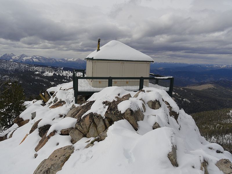
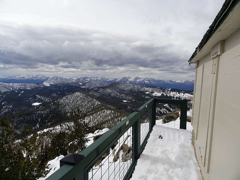
From the summit of Rough Peak, we retraced our steps back to the saddle, then up the trail toward Lookout Mountain. We were hoping that a bit of southern exposure would have provided us some dry ground, but the trail actually stayed mostly to the northern side of the ridge. This probably makes the trail shady and enjoyable on a hot summer day, but that didn’t work in our favor just after a snowstorm. But up we went in earnest. It was never too steep thanks to the well-constructed trail, but it did seem to take a quite a while to reach the top. Once at the summit, we checked out the views for a while, but the wind was howling so we decided to lift one of the flaps that covered the windows so we could take shelter from the weather. Of course it was pretty cold inside since the window covers prevented any sun from getting in. So after a quick lunch, we were anxious to get moving again to warm back up.
After Lookout Mountain, our third and final destination would be Robinson Bar Peak, located about a mile and a half to the northeast of Lookout Mountain. The rocky northeast ridge of Lookout Mountain made for slow going with about 6” of snow covering the gaps between the rocks. We had to take our time to prevent twisting an ankle or breaking leg. We crossed several false summits along the way to Robinson Bar Peak, and it was some pretty fun scrambling in spite of the slow going. By the time we finally reached the summit, it was snowing and blowing, so we didn’t stay long. Also, it was now 3:30 and it had taken us close to two hours to traverse the ridge, which meant we’d have to hustle to get back to the car before dark. It also meant we’d have to abandon plans to summit Prospect Point along the way.
So we backtracked along the ridge for a while, and then found a decent descent gully to drop into the Prospect Creek drainage. We got another good dose of snow-covered boulders along the way, but made it to the trees without incident. Next we contoured across the valley, then up to the low 9000’ saddle between Lookout Mountain and Prospect Point. From the saddle we headed northwest for a while, then made our way down next to an unnamed creak leading back to the trailhead. With all of the sloppy snow and wet brush, we were both pretty soggy by the time we reached the car, which was a welcome sight. We’d covered nearly 14 miles and 4500’ of elevation in 9.5 hours, not a bad days work.
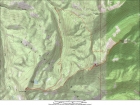
Map of our route, covering about 14 miles and 4500' gain round trip. |
Rough Creek trailhead. |

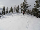
Heading up the snowy trail. |
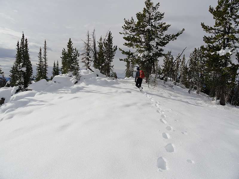
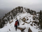
Sean nearing the summit of Rough Peak. |
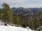
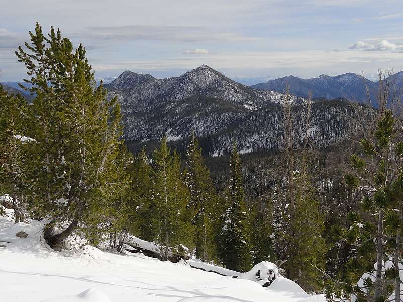
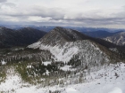
View of Lookout Mountain (center) and Robinson Bar Peak (left) from Rough Peak. |

Snowy northern White Clouds from the approach to Lookout Mountain. |
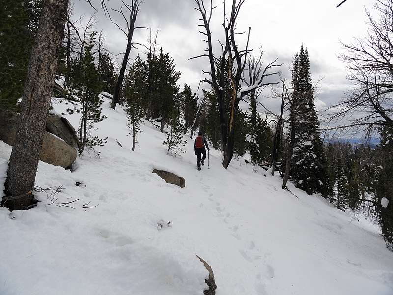
Sean on the trail to Lookout Mountain. |
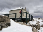
Newly painted lookout building on Lookout Mountain. |

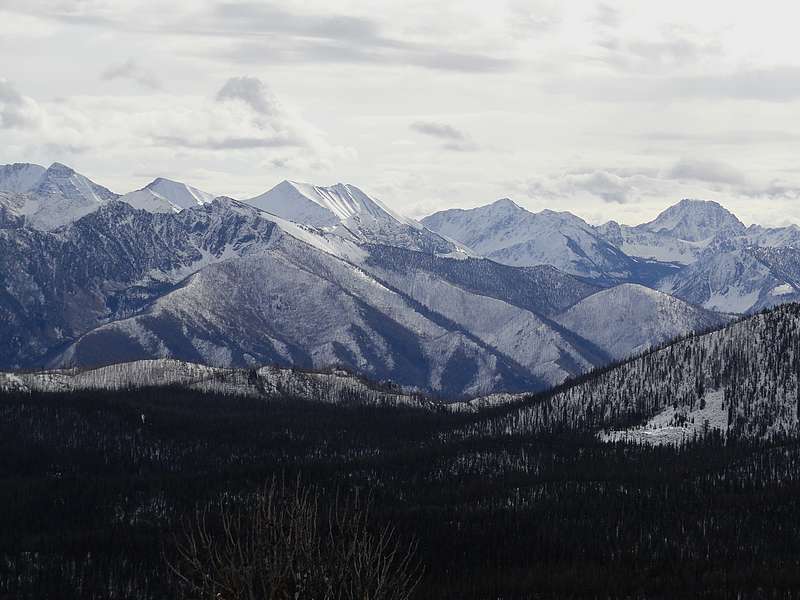
View of the Sawtooths from Lookout Mountain. |
Robinson Bar Peak as seen from Lookout Mountain. |
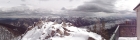
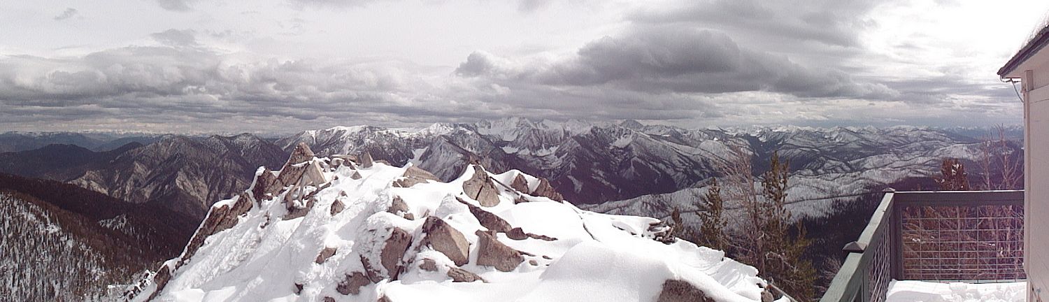
Panoramic White Cloud view from Lookout Mountain. |
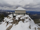
Another view of the lookout building. |
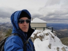
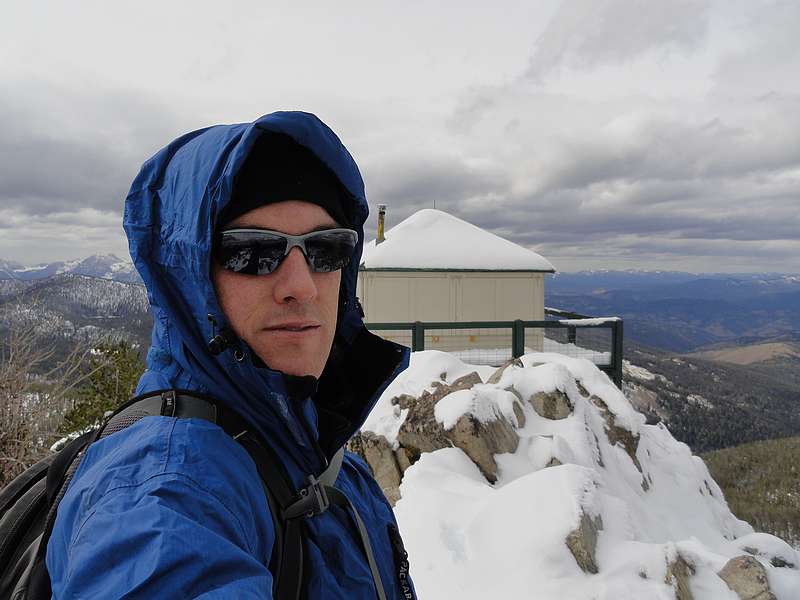
Dave on the summit of Lookout Mountain, splattski style. |
Sean on the ridge, nearing the summit of Robinson Bar Peak. |
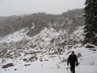
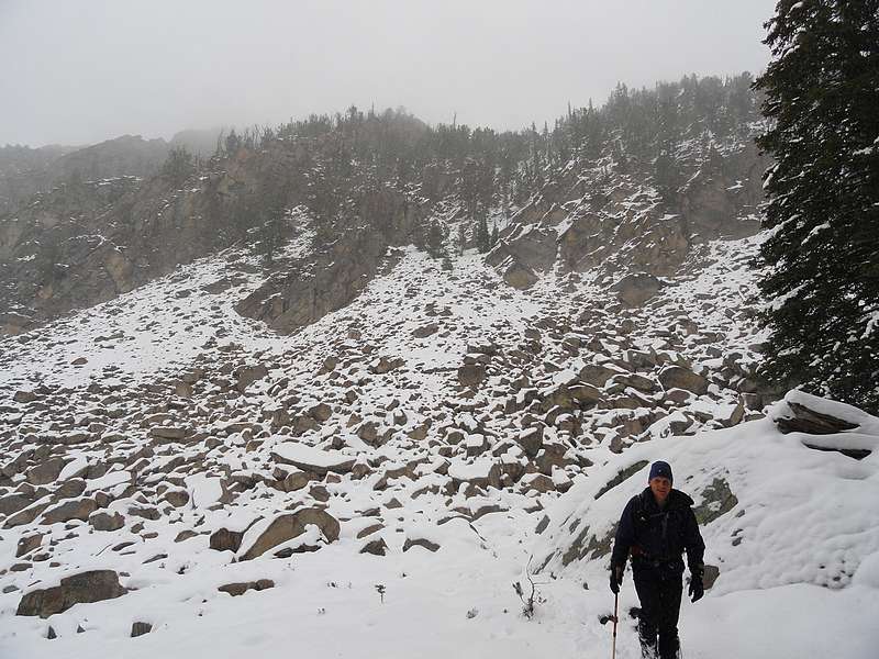
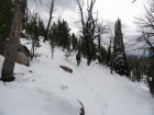
Bottom of the gully we descended on the way down. |
|