|
Sawtooth Peaks Loop
|
Related Links:
- Fadgen's Adventures - Trip Report
- Trailhead Location
- Our GPS Tracks
- Merritt Peak: TL, SP, PB, LOJ, Map
- Williams Peak: TL, SP, PB, LOJ, Map
- Thompson Peak: TL, SP, PB, LOJ, Map
- Mount Carter: TL, SP, PB, LOJ, Map
- Mount Limbert: TL, SP, PB, LOJ, Map
- Little Baron Peak: LOJ, Map
- Baron Peak: TL, SP, PB, LOJ, Map
- Moolack Mountain: TL, SP, PB, LOJ, Map
- Mount Regan: TL, SP, PB, LOJ, Map
|
The Sawtooth Mountains of central Idaho are home to some of the most scenic terrain in the state, and are a favorite mountain range for hikers, backpackers, and mountain climbers. There are many well-known backpacking loop trails in the Sawtooths. But with some creativity, you can also come up with some pretty amazing cross-country loops as well. But the Sawtooths are rugged country, so off trail travel doesn’t come easy, especially if you are looking to climb some peaks along the way. The following is trip report from an amazing four day cross-country backpacking loop in the Sawtooths. This was a strenuous outing, and only backcountry savvy hikers should consider a trip like this one.
Day 1 – Goat Lake, Merritt Peak, camp in Upper Goat Creek
With much anticipation, John Fadgen and I started hiking from the Iron Creek Trailhead, and made our way up the trail to Goat Lake. The trail was a nice warm-up, and we made good time until the infamous scramble section up to the lake. Goat Lake is gorgeous, and we took a brief lunch break there before heading south up the lingering snowfields into the basin above. Other than a bit of smoke in the air, it was looking like a beautiful day.
 Our first planned summit of the trip was Merritt Peak, known as one of the more interesting scrambles in the Sawtooths. And it didn’t disappoint! From the third lake above Goat, we made our way up a narrow gully, and soon enough we were scrambling up, over, and around small waterfalls. Very cool. Next up was the snow bowl, and a talus climb up toward the “grey dike” that ran somewhat parallel to the ridge. We probably gained the ridge too far southwest, which made for some interesting scrambling toward the summit. Up and around the west side of the peak, then a steep but stable gully, and it was time for the final airy class IV move to reach the highpoint. John went first, and I took his photo perched on the summit. Next it was my turn. My heart was pounding, especially on the way back when I made the mistake of looking down just before grabbing the first hold. Talk about a long way down! Our first planned summit of the trip was Merritt Peak, known as one of the more interesting scrambles in the Sawtooths. And it didn’t disappoint! From the third lake above Goat, we made our way up a narrow gully, and soon enough we were scrambling up, over, and around small waterfalls. Very cool. Next up was the snow bowl, and a talus climb up toward the “grey dike” that ran somewhat parallel to the ridge. We probably gained the ridge too far southwest, which made for some interesting scrambling toward the summit. Up and around the west side of the peak, then a steep but stable gully, and it was time for the final airy class IV move to reach the highpoint. John went first, and I took his photo perched on the summit. Next it was my turn. My heart was pounding, especially on the way back when I made the mistake of looking down just before grabbing the first hold. Talk about a long way down!
 The down climb off of Merritt was also a challenge, and we had to take our time. It was a relief when we finally made it back down to our packs. After a short hike up to the next lake, it was time to set up camp and get some rest. The upper Goat Creek Basin is an amazing place, and we soaked in the views while reveling in our success on Merritt Peak. The down climb off of Merritt was also a challenge, and we had to take our time. It was a relief when we finally made it back down to our packs. After a short hike up to the next lake, it was time to set up camp and get some rest. The upper Goat Creek Basin is an amazing place, and we soaked in the views while reveling in our success on Merritt Peak.
Day 2 – Williams Peak, Thompson Peak, Mount Carter, Mount Limbert, camp at Upper Fishhook Lakes
After a good night of sleep, it was time to head up the basin to the saddle between Williams and Thompson. Our packs felt heavy as we did occasional class III scrambling on the way up, but our spirits were high thanks to the constant distraction of amazing views along the way.
 Once at the saddle, we set our sights on Williams Peak. I’d read several reports of folks having trouble on Williams if you don’t choose the correct gully to reach the summit ridge. So we studied the south face for quite a while before heading up the loose rock that adorns the lower mountain. It was a relief to reach the summit ridge, and we enjoyed weaving between various towers along the way to the summit. There were a few pretty steep and exposed sections along the way, then a couple exposed class IV moves right before the summit. We enjoyed the views form the highpoint, and then retraced our path back to the saddle. Williams had taken a little longer than expected (2.5 hours RT from the saddle). Once at the saddle, we set our sights on Williams Peak. I’d read several reports of folks having trouble on Williams if you don’t choose the correct gully to reach the summit ridge. So we studied the south face for quite a while before heading up the loose rock that adorns the lower mountain. It was a relief to reach the summit ridge, and we enjoyed weaving between various towers along the way to the summit. There were a few pretty steep and exposed sections along the way, then a couple exposed class IV moves right before the summit. We enjoyed the views form the highpoint, and then retraced our path back to the saddle. Williams had taken a little longer than expected (2.5 hours RT from the saddle).
 Next up was Thompson Peak, which already had a few other folks on the mountain. Obviously a popular objective on a sunny Saturday. We hauled our packs across a big snowfield, then up boulders and talus to the saddle between Thompson and Mickey’s Spire. We dropped the packs there, and followed the obvious route from the saddle to the summit. The views from the top of Thompson were amazing, but we were behind schedule and didn’t stay long before heading back down to the saddle and our packs. Next up was Thompson Peak, which already had a few other folks on the mountain. Obviously a popular objective on a sunny Saturday. We hauled our packs across a big snowfield, then up boulders and talus to the saddle between Thompson and Mickey’s Spire. We dropped the packs there, and followed the obvious route from the saddle to the summit. The views from the top of Thompson were amazing, but we were behind schedule and didn’t stay long before heading back down to the saddle and our packs.
 After Thompson, we discussed and eventually decided to take our packs most of the way up Mickey’s Spire to avoid a nasty looking side-hill traverse to the Mount Carter saddle. Plus, that put us within striking distance of the summit of Mickey’s Spire. Once at the west end of Mickey’s summit ridge, we could see the highpoint to the east. It didn’t look far, but we were soon stifled by an ominous steep gully. Since we were a bit behind schedule, John said Mickey’s wasn’t high on his list, and I’d already climbed it a few years earlier, so we decided to skip it and head down. Heading down the ridge to Carter looked tricky, so we ended up doing part of the nasty side-hill traverse anyway. After Thompson, we discussed and eventually decided to take our packs most of the way up Mickey’s Spire to avoid a nasty looking side-hill traverse to the Mount Carter saddle. Plus, that put us within striking distance of the summit of Mickey’s Spire. Once at the west end of Mickey’s summit ridge, we could see the highpoint to the east. It didn’t look far, but we were soon stifled by an ominous steep gully. Since we were a bit behind schedule, John said Mickey’s wasn’t high on his list, and I’d already climbed it a few years earlier, so we decided to skip it and head down. Heading down the ridge to Carter looked tricky, so we ended up doing part of the nasty side-hill traverse anyway.
 It was nice to reach the gentle saddle east of Mount Carter. Our plan was to climb Carter, and then traverse the ridge southwest to Mount LImbert. This meant we had to haul our big packs up Carter. That section was a grunt in the afternoon sun, but we made it up Carter in only 20 minutes. We stopped on the summit just long enough for me to send an “all is well” text to my wife (gotta love Verizon coverage). It was nice to reach the gentle saddle east of Mount Carter. Our plan was to climb Carter, and then traverse the ridge southwest to Mount LImbert. This meant we had to haul our big packs up Carter. That section was a grunt in the afternoon sun, but we made it up Carter in only 20 minutes. We stopped on the summit just long enough for me to send an “all is well” text to my wife (gotta love Verizon coverage).
We headed south from Carter, but it wasn’t long before we encountered some towers on the ridge that looked tricky. If we weren’t carrying our big packs, it might have been worth a try to scramble around them. But we decide better safe than sorry, and circle back around to the saddle east of Carter, then descended into the valley east of Mount LImbert.
 From the base of Mount Limbert, we faced a quandary at the late hour of 5pm. The original plan was to carry our packs up and over Limbert’s southeast ridge, but it looked steep and loose. The book says a direct route to the summit was class III, but it looked steep as well. We opted for a slightly less steep climb toward the northeast ridge. That was a very painful 800’ of climbing after a long day, but we made it up to the ridge and then to the summit without issue. From the base of Mount Limbert, we faced a quandary at the late hour of 5pm. The original plan was to carry our packs up and over Limbert’s southeast ridge, but it looked steep and loose. The book says a direct route to the summit was class III, but it looked steep as well. We opted for a slightly less steep climb toward the northeast ridge. That was a very painful 800’ of climbing after a long day, but we made it up to the ridge and then to the summit without issue.
 The views from Limbert were impressive, but our minds were on our next challenge, how do we get around to the south side of the peak and then down to our planned campsite for the night? John spotted some goat trails crisscrossing the face below us, so down we went. We were hoping the goat trails would get us to a notch on the southwest ridge, and hopefully there wouldn’t be cliffs or anything guarding the backside of the ridge. Thankfully, everything worked out, and all that was left was a long descent to our campsite at an unnamed lake at northwest of Fishhook Creek. The views from Limbert were impressive, but our minds were on our next challenge, how do we get around to the south side of the peak and then down to our planned campsite for the night? John spotted some goat trails crisscrossing the face below us, so down we went. We were hoping the goat trails would get us to a notch on the southwest ridge, and hopefully there wouldn’t be cliffs or anything guarding the backside of the ridge. Thankfully, everything worked out, and all that was left was a long descent to our campsite at an unnamed lake at northwest of Fishhook Creek.
 We were beat after a long day of hiking, and the pristine lake was a welcome site. After setting up camp, I couldn’t resist a quick dive in the lake to clean up. It was “refreshing”! Next it was time for some dinner prepared by the light of headlamps, and a well-deserved night of sleep. We were beat after a long day of hiking, and the pristine lake was a welcome site. After setting up camp, I couldn’t resist a quick dive in the lake to clean up. It was “refreshing”! Next it was time for some dinner prepared by the light of headlamps, and a well-deserved night of sleep.
Day 3- Little Baron Peak, Baron Peak, Moolack Mountain, North Fork Baron Creek Headwaters, camp at Lake 8271'
We expected this day to be much easier the prior day. One serious climb with the big packs, a couple side peaks, and then mostly downhill to the next campsite. Well, easy is not the first thought that comes to mind when looking back. Maybe the fatigue from the prior two days just made it seem harder. Regardless, the scenery throughout the day was spectacular, so it’s hard to complain too much.
 Our first objective of the day was Peak 9854’ (“Little Baron Peak”). From our campsite, we studied a few lines up the south face, and eventually decided on one that would take us almost directly to the summit. The climb was a little loose in places, but not bad. I’d hoped to find a historic summit register on top, but there were no signs of prior visitors. The views were great, with Limbert looking impressive to the northeast, and Baron Peak (our next target) looking very prominent to the southeast. But the highlight was the view south which included Mount Ebert, Warbonnet, Monte Verita, Big Baron Spire, etc. After checking out the views, and some minor first aid on a gash in my hand, we headed back down. Our first objective of the day was Peak 9854’ (“Little Baron Peak”). From our campsite, we studied a few lines up the south face, and eventually decided on one that would take us almost directly to the summit. The climb was a little loose in places, but not bad. I’d hoped to find a historic summit register on top, but there were no signs of prior visitors. The views were great, with Limbert looking impressive to the northeast, and Baron Peak (our next target) looking very prominent to the southeast. But the highlight was the view south which included Mount Ebert, Warbonnet, Monte Verita, Big Baron Spire, etc. After checking out the views, and some minor first aid on a gash in my hand, we headed back down.
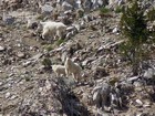
 We had some work to do after “Little Baron Peak”. First, we made our way over a low saddle to Lake 9189’ and topped off of water. From there, we headed west until reaching the talus filled cirque south of Baron Peak. The climb didn’t look fun, especially with the hot sun beating down on us. But we just put our heads down and slowly made our way up the talus slopes. Some mountain goats on the slopes across from us gave us a good reason to stop for a break. We did a little scrambling toward the top of the face, and gained the ridge at just over 10000’, where we stopped for a lunch break in the shade behind a lone alpine pine tree. We had some work to do after “Little Baron Peak”. First, we made our way over a low saddle to Lake 9189’ and topped off of water. From there, we headed west until reaching the talus filled cirque south of Baron Peak. The climb didn’t look fun, especially with the hot sun beating down on us. But we just put our heads down and slowly made our way up the talus slopes. Some mountain goats on the slopes across from us gave us a good reason to stop for a break. We did a little scrambling toward the top of the face, and gained the ridge at just over 10000’, where we stopped for a lunch break in the shade behind a lone alpine pine tree.
 After an extended lunch break, we left our packs and made a short but fun scramble to the summit of Baron Peak. The views were great in all directions, and it was a great vantage point to check out the peaks we had already climbed, as well as the peaks we still hoped to climb. It was a great spot to study the route up our next objective Moolack Mountain (Peak 10330’). The descent from Baron Peak down to our packs was straightforward, then we made a tricky traverse around the west side of the peaks before some scree/sand skiing down to the Baron/Moolack saddle. After an extended lunch break, we left our packs and made a short but fun scramble to the summit of Baron Peak. The views were great in all directions, and it was a great vantage point to check out the peaks we had already climbed, as well as the peaks we still hoped to climb. It was a great spot to study the route up our next objective Moolack Mountain (Peak 10330’). The descent from Baron Peak down to our packs was straightforward, then we made a tricky traverse around the west side of the peaks before some scree/sand skiing down to the Baron/Moolack saddle.
 Moolack Mountain was our next goal. John had climbed Moolack a few year prior via a different route. The south ridge would be new to both of us. After dropping west a couple hundred feet from the saddle to bypass cliffs, we began some tedious climbing up loose sand and scree. I ended up gaining the ridge sooner, and went over the top of some rocky sections. John was less lucky and instead traversed under the rocks on loose slopes. We met up on the ridge just before the summit block. From between the twin summits, the route to the highpoint wasn’t obvious, but John eventually followed a ledge across the face, then a tricky Class IV slot leading to the summit. After a short stay, it was time to head down. Not wanting to down climb the slot, we opted for a tedious loose traverse down the southwest face, and then made the climb back up to the saddle where our packs were waiting. Moolack Mountain was our next goal. John had climbed Moolack a few year prior via a different route. The south ridge would be new to both of us. After dropping west a couple hundred feet from the saddle to bypass cliffs, we began some tedious climbing up loose sand and scree. I ended up gaining the ridge sooner, and went over the top of some rocky sections. John was less lucky and instead traversed under the rocks on loose slopes. We met up on the ridge just before the summit block. From between the twin summits, the route to the highpoint wasn’t obvious, but John eventually followed a ledge across the face, then a tricky Class IV slot leading to the summit. After a short stay, it was time to head down. Not wanting to down climb the slot, we opted for a tedious loose traverse down the southwest face, and then made the climb back up to the saddle where our packs were waiting.
 From the Baron/Moolack saddle, we still had 4 miles of mostly cross-country travel to our next planned campsite, and it was already 5:30pm. So much for an easy day. But with some amazing terrain to explore around the headwaters of Baron Creek, our spirits were still high. The initial descent east was easy on steep but loose scree. Next we followed various snowfields down through the amazing cirque with huge cliffs all around us. Photos really can’t do this area justice. From the Baron/Moolack saddle, we still had 4 miles of mostly cross-country travel to our next planned campsite, and it was already 5:30pm. So much for an easy day. But with some amazing terrain to explore around the headwaters of Baron Creek, our spirits were still high. The initial descent east was easy on steep but loose scree. Next we followed various snowfields down through the amazing cirque with huge cliffs all around us. Photos really can’t do this area justice.
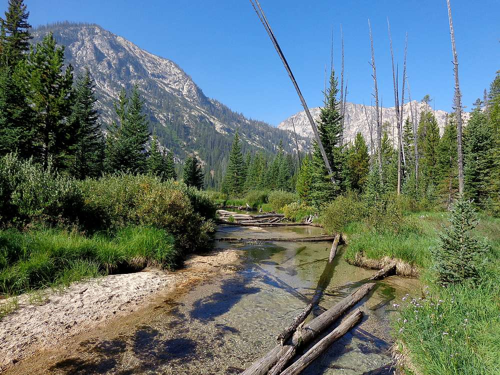
 After dropping down of the cirque, we found ourselves down in the trees. Our plan was to drop no lower than 7900’ in order to meet the trail on the other side of the valley. All in all, this went pretty well. The bushwhacking wasn’t bad, and we saw several elk and some amazing creek side scenery along the way. But the most memorable moment was when we were crossing a rotten log, John literally stepped on a hornet’s nest, and we both got stung a couple times while trying to make a hasty escape. After dropping down of the cirque, we found ourselves down in the trees. Our plan was to drop no lower than 7900’ in order to meet the trail on the other side of the valley. All in all, this went pretty well. The bushwhacking wasn’t bad, and we saw several elk and some amazing creek side scenery along the way. But the most memorable moment was when we were crossing a rotten log, John literally stepped on a hornet’s nest, and we both got stung a couple times while trying to make a hasty escape.
The trail was a welcome site when we finally happened upon it around 7:30pm. We were both totally whipped, but relieved. The next mile uphill to our campsite was a grind, and we were happy to reach Lake 8271’, soak our tired feet, and choke down some much needed dinner.
Day 4 – Mount Regan, Sawtooth Lake, back to the car
Neither of us got a great night of sleep, and we were both running very low on energy. But after some hemming and hawing, we convinced ourselves that bypassing Mount Regan was not an option. I’d climbed Regan several years ago, and remembered it as a classic. So after breaking camp, and filling our daypacks, it was time for the nearly 2000’ ascent.
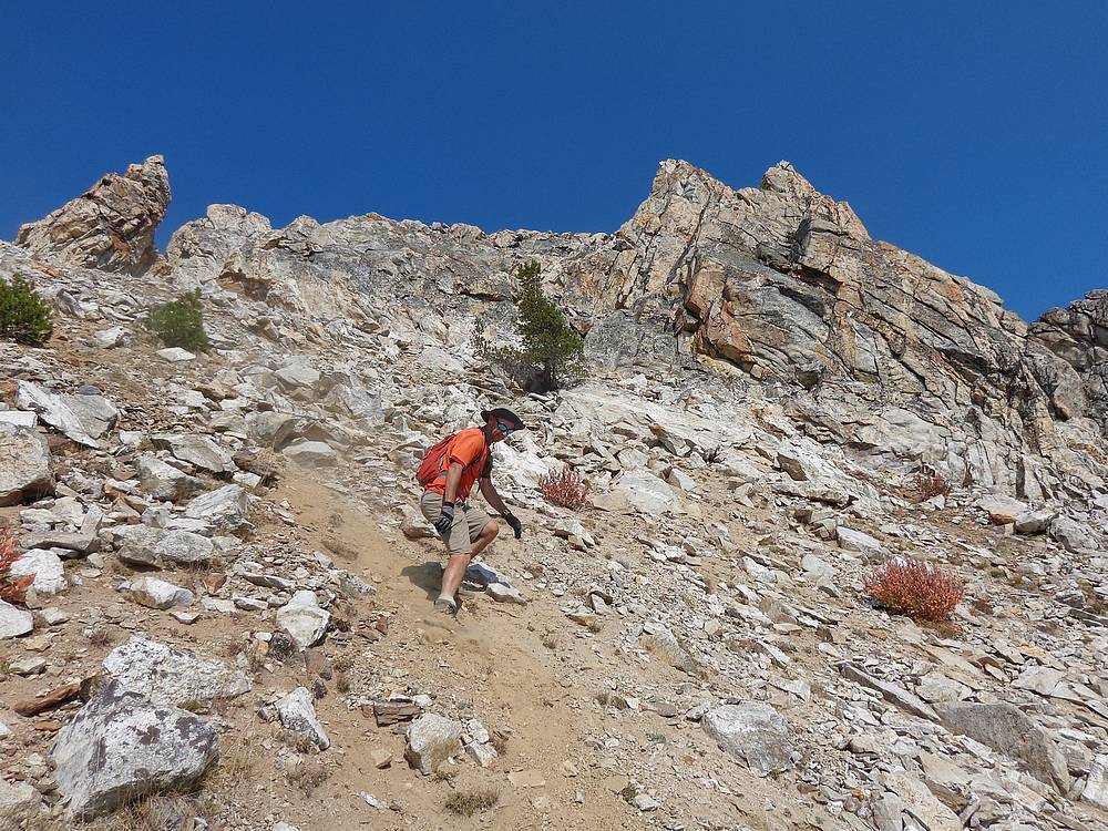
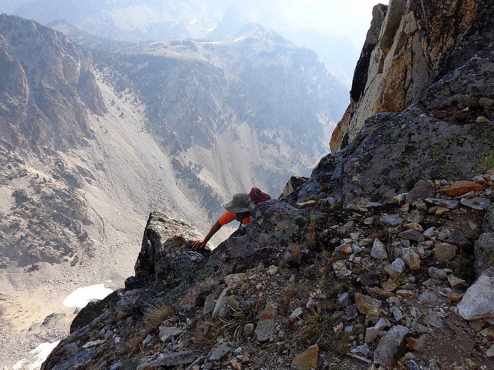
 We circled around toward the south side of the peak, and then up a steep gully. When it got steep, we found a ramp leading left to the ridge, and then followed the ridge a long way up to the base of the summit dome. This is where the climb really got interesting. Some ledges led us east out onto the nearly vertical face, then a somewhat concave slot led us upward, with a huge drop-off behind us. There were several exposed moves on the way up, and our adrenaline was pumping when we reached to top. We circled around toward the south side of the peak, and then up a steep gully. When it got steep, we found a ramp leading left to the ridge, and then followed the ridge a long way up to the base of the summit dome. This is where the climb really got interesting. Some ledges led us east out onto the nearly vertical face, then a somewhat concave slot led us upward, with a huge drop-off behind us. There were several exposed moves on the way up, and our adrenaline was pumping when we reached to top.
 Views from the summit of Regan were excellent, but we still had the hardest part still to go: The down climb! On the way down, things went well at first, but then we made a wrong turn that took us off course. Thankfully we made the good decision to climb back up to our last known point, and found the right way down. Definitely hard on the nerves and a relief when we finally made it off the face. The rest of the descent went smooth but seemed to take forever to finally get back to our campsite. Views from the summit of Regan were excellent, but we still had the hardest part still to go: The down climb! On the way down, things went well at first, but then we made a wrong turn that took us off course. Thankfully we made the good decision to climb back up to our last known point, and found the right way down. Definitely hard on the nerves and a relief when we finally made it off the face. The rest of the descent went smooth but seemed to take forever to finally get back to our campsite.
 Once finished with Regan, we had lunch and then followed the trail up and over to the amazing Sawtooth Lake. It took us half an hour to walk the length of the huge alpine lake, one of my favorite places on earth. Now all that was left was the switchbacks leading down past Alpine Lake, and eventually to Iron Creek. The trail was nice the rest of the way, and we made good pace back to the trailhead by 5pm. All that was left was cheeseburgers in Stanley and the drive home. Once finished with Regan, we had lunch and then followed the trail up and over to the amazing Sawtooth Lake. It took us half an hour to walk the length of the huge alpine lake, one of my favorite places on earth. Now all that was left was the switchbacks leading down past Alpine Lake, and eventually to Iron Creek. The trail was nice the rest of the way, and we made good pace back to the trailhead by 5pm. All that was left was cheeseburgers in Stanley and the drive home.
It’s hard to capture the magnitude of a trip like this in words or even photos. John and I had an extremely big adventure, and I couldn’t have asked for a better partner to join me on a trip like this. It takes a special kind of crazy… Round trip was about 35 miles, 14000’ elevation gain, and nine summits. (Base loop with no peaks would be about 23 miles and 7000' gain, but still very demanding off-trail travel.)
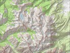
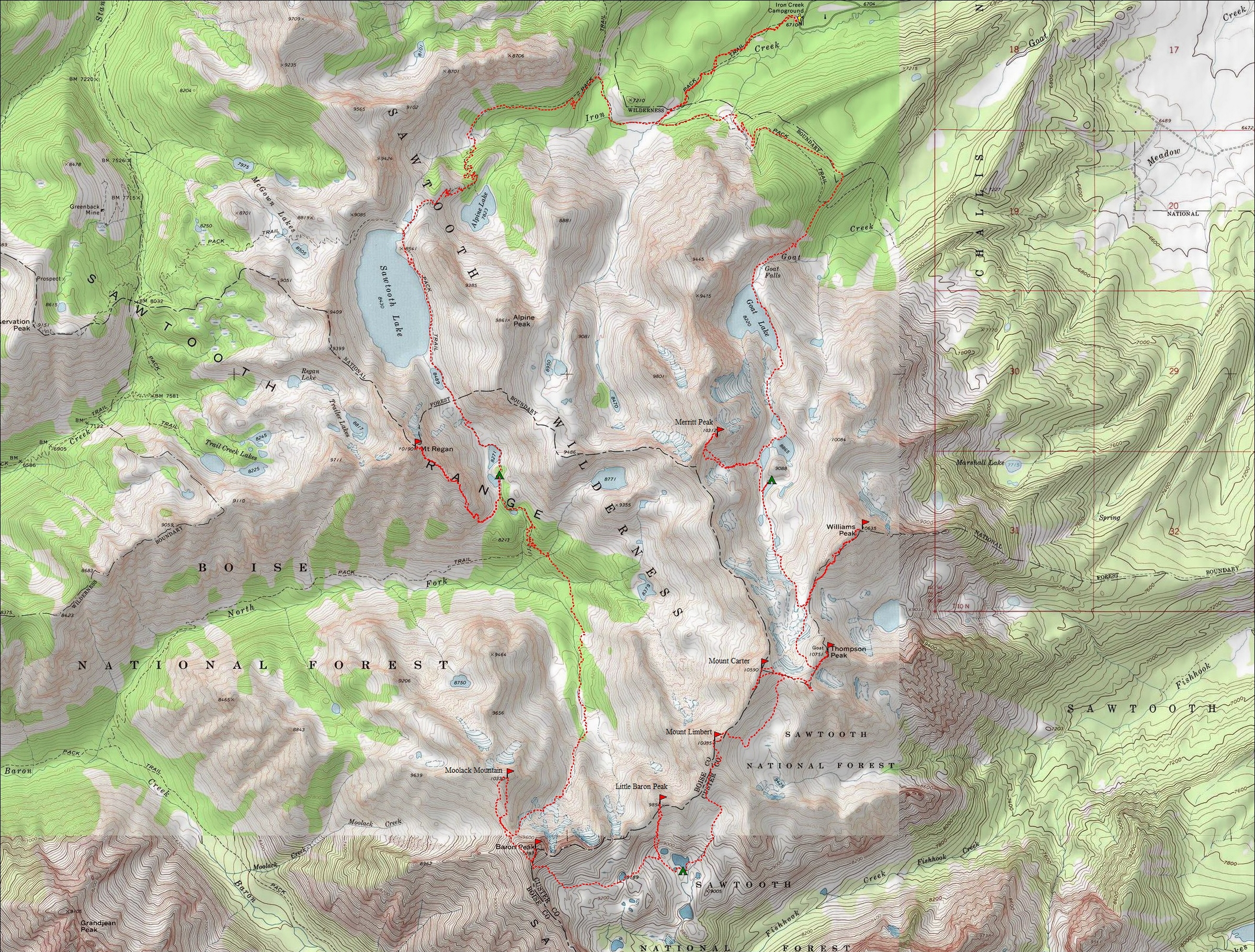
Map of our route, about 35 miles and 14000' gain round trip. We went clockwise. |
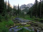
Beautiful meadow where the trail forks to Goat Lake. |
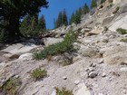
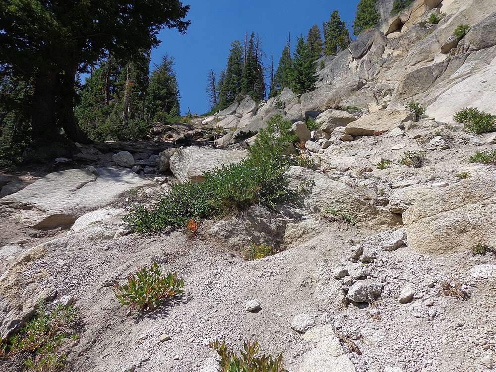
Steep "trail" to Goat Lake. |

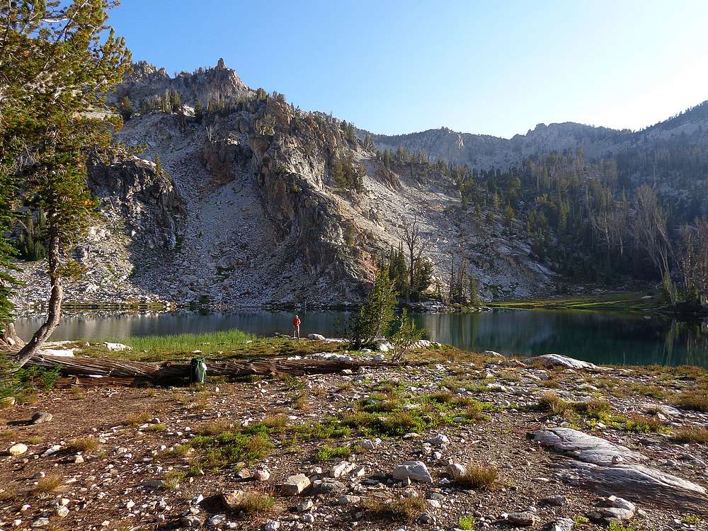
Goat Lake is a fantastic destination on its own. |
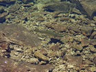
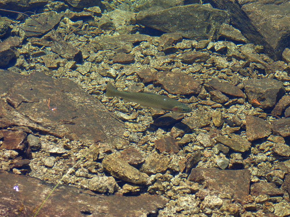
Trout swimming in Goat Lake. |
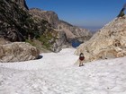
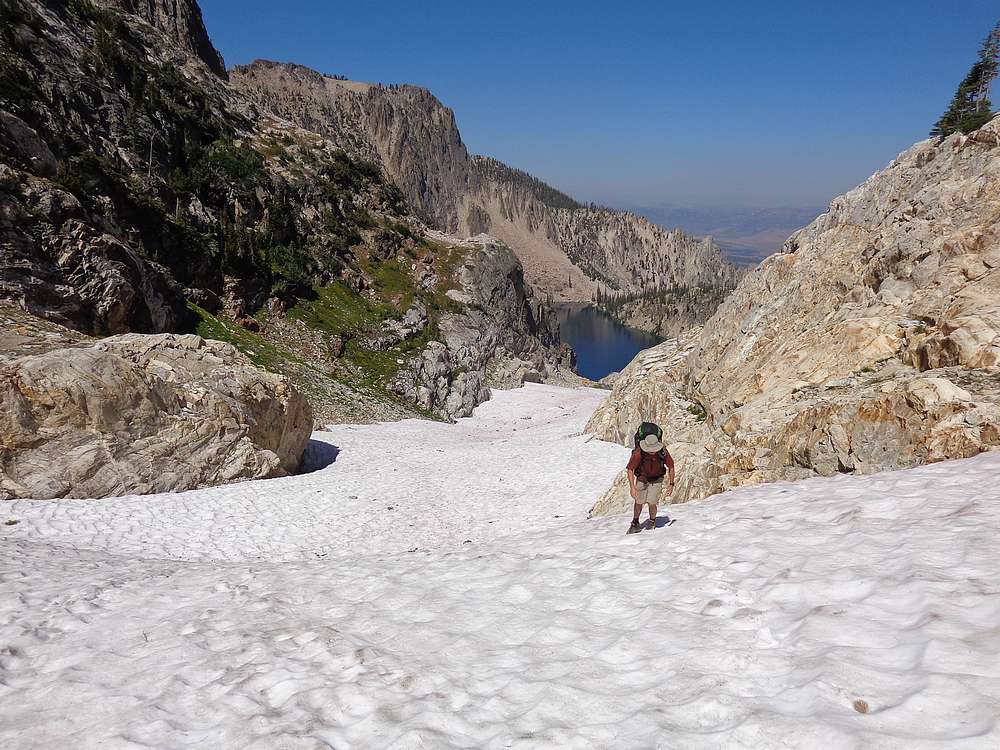
Climbing the snowfields above Goat Lake. |
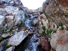
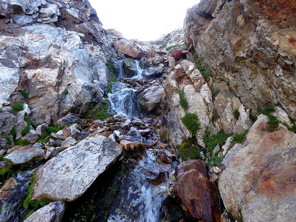
Waterfall climbing below Merritt Peak. |
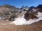
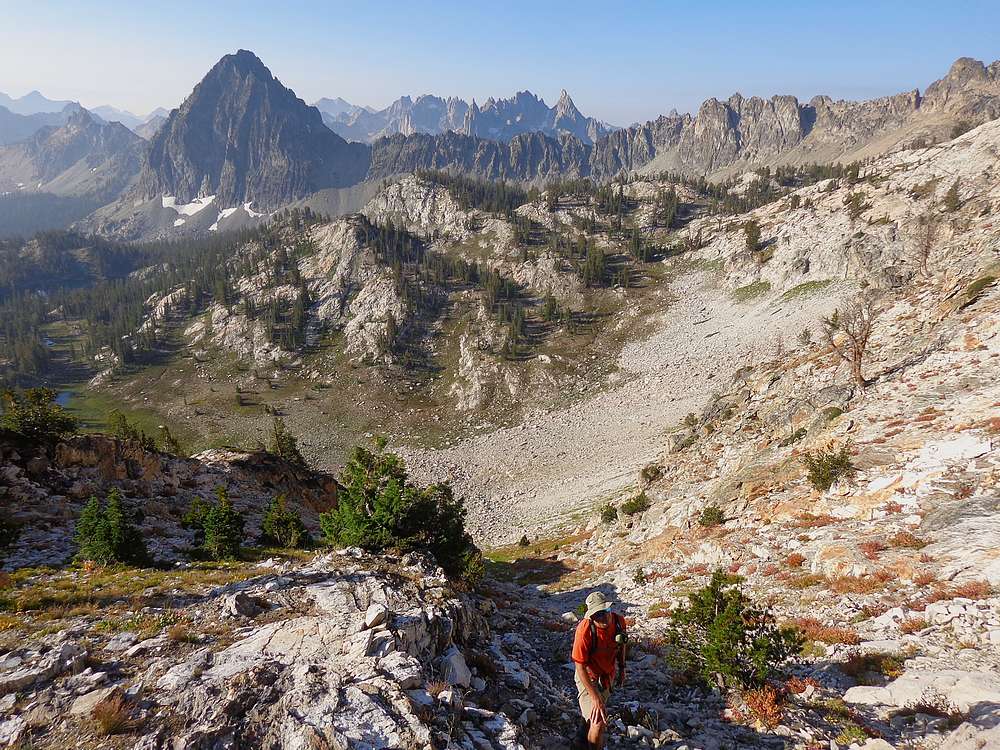
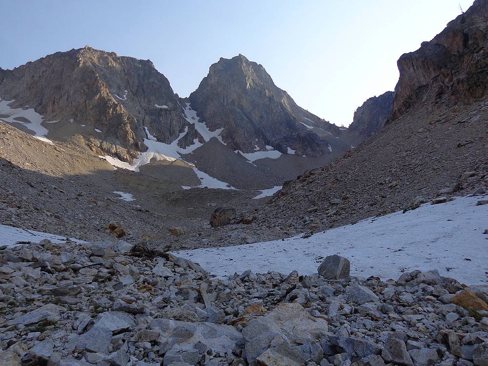
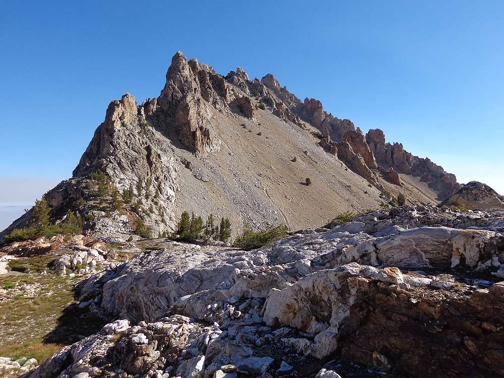
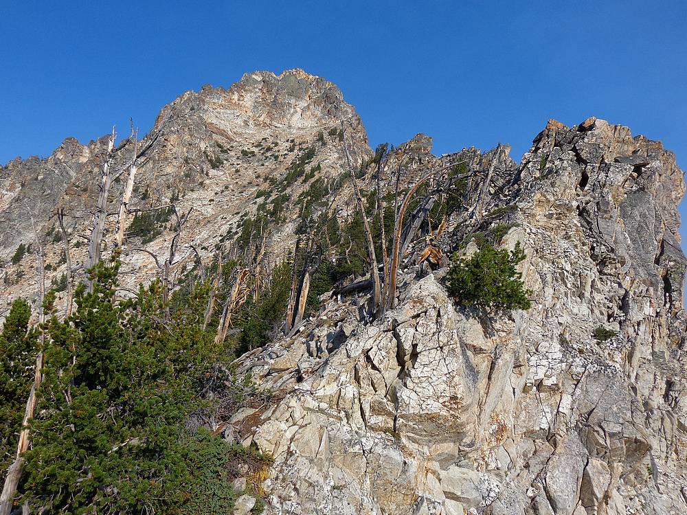
Snow bowl on the way to Merritt Peak, Thompson Peak in the background. |
Nearing the ridgeline on Merritt Peak. |
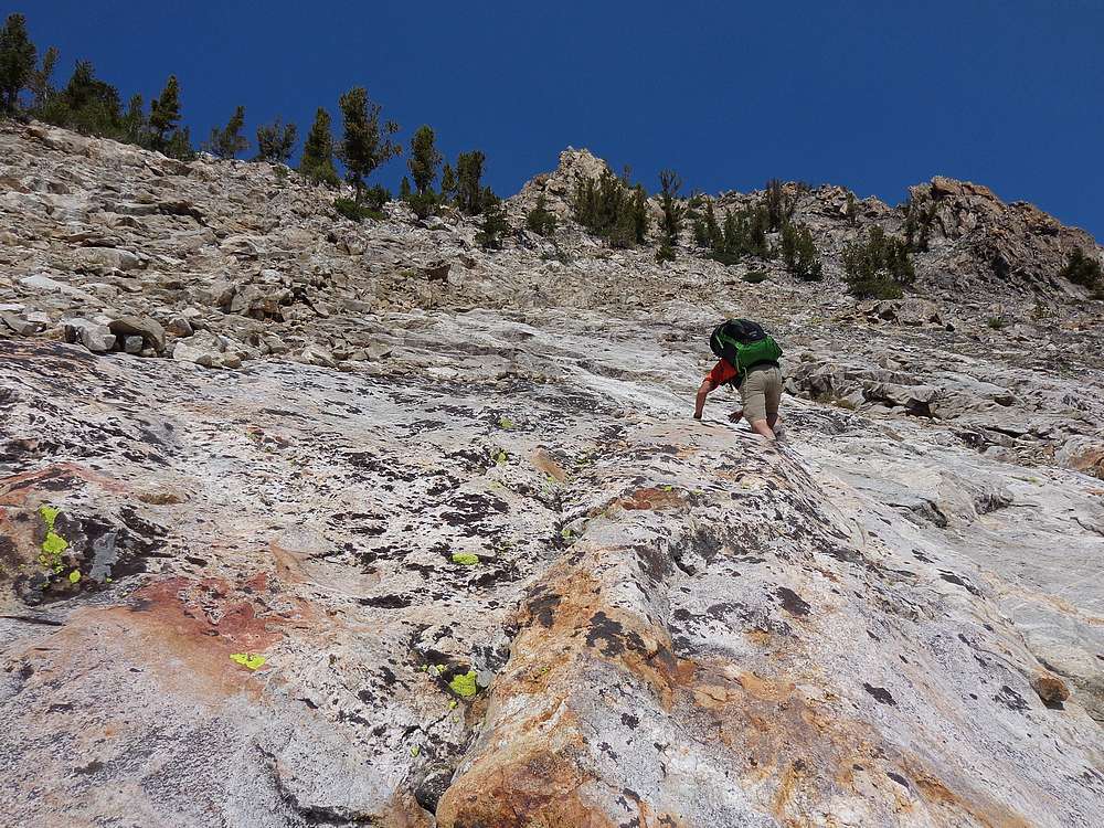
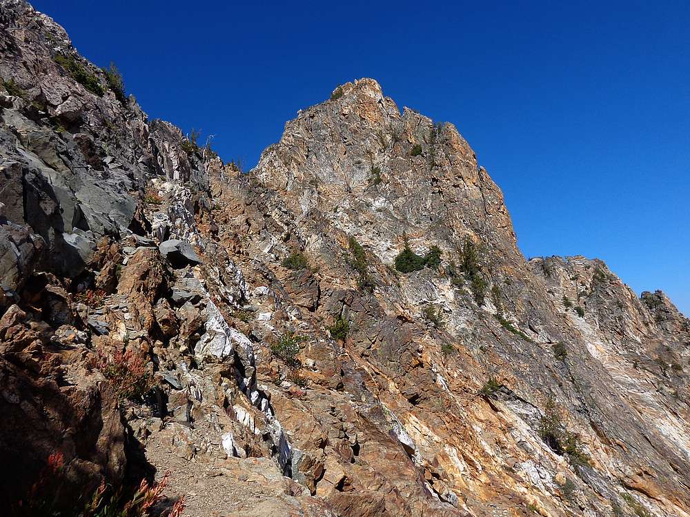
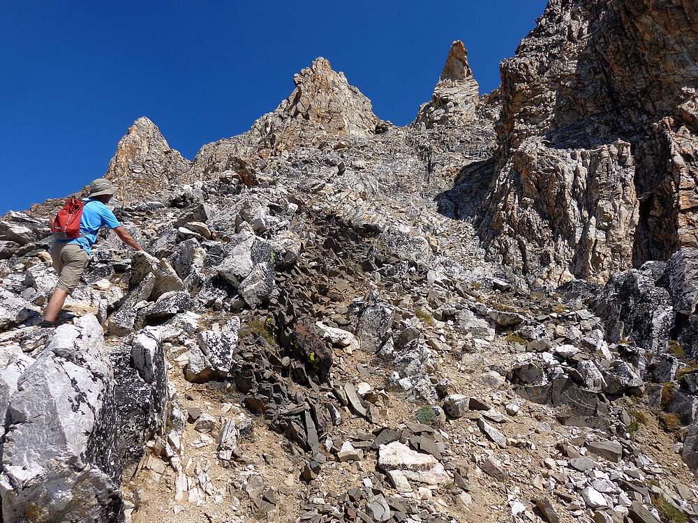
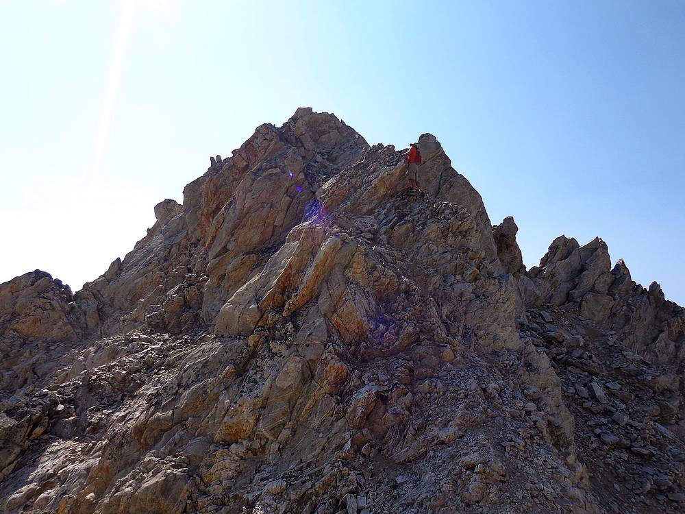
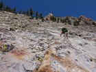
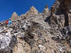
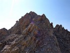
Steep gully to the summit block of Merritt Peak. |
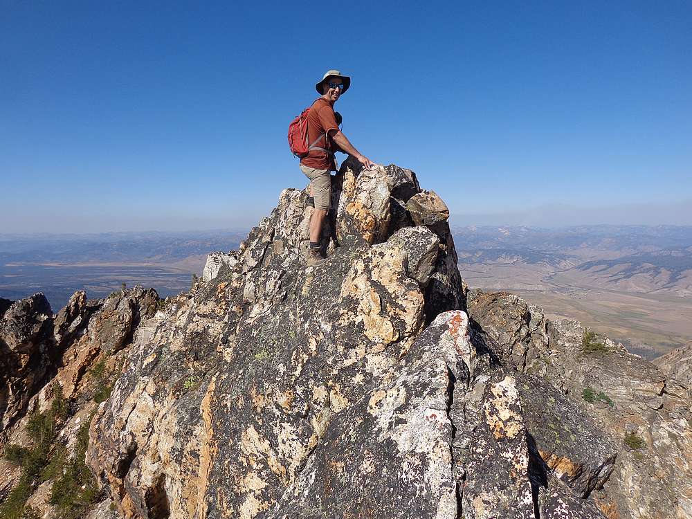
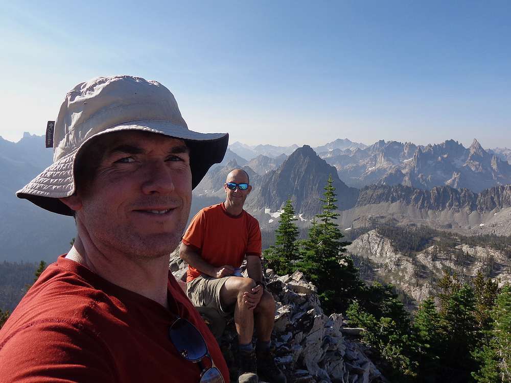
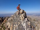
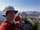
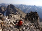
John perched on the airy summit of Merritt Peak. |

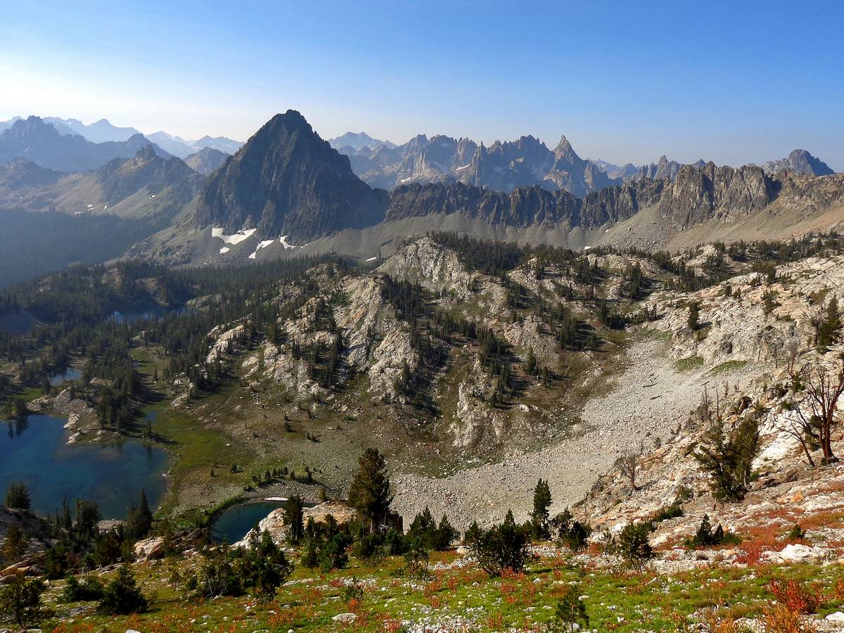
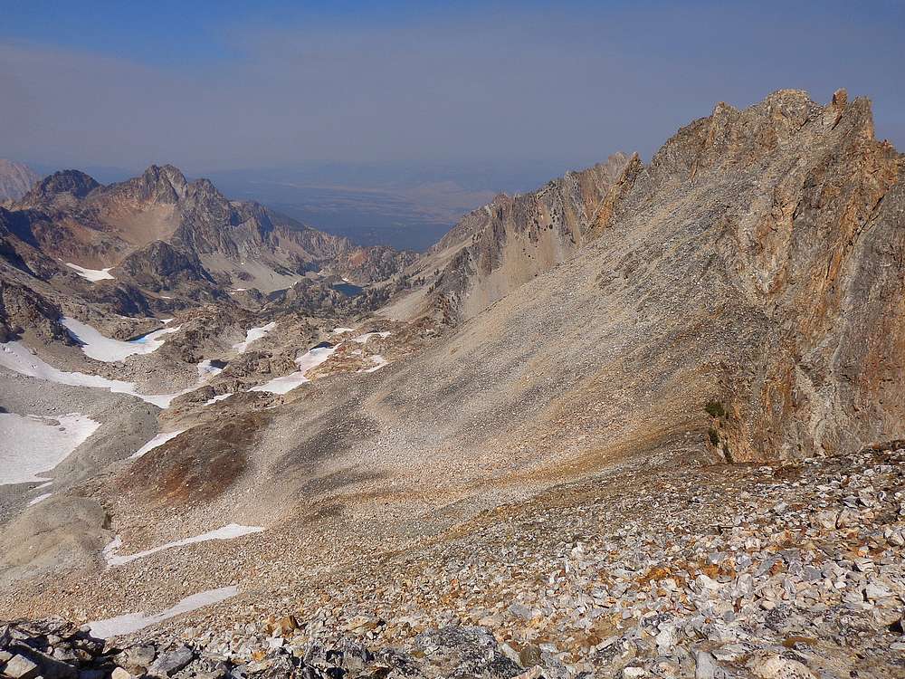
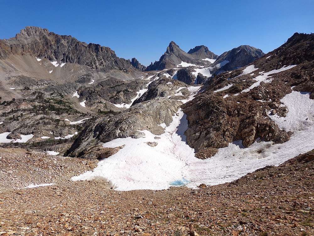
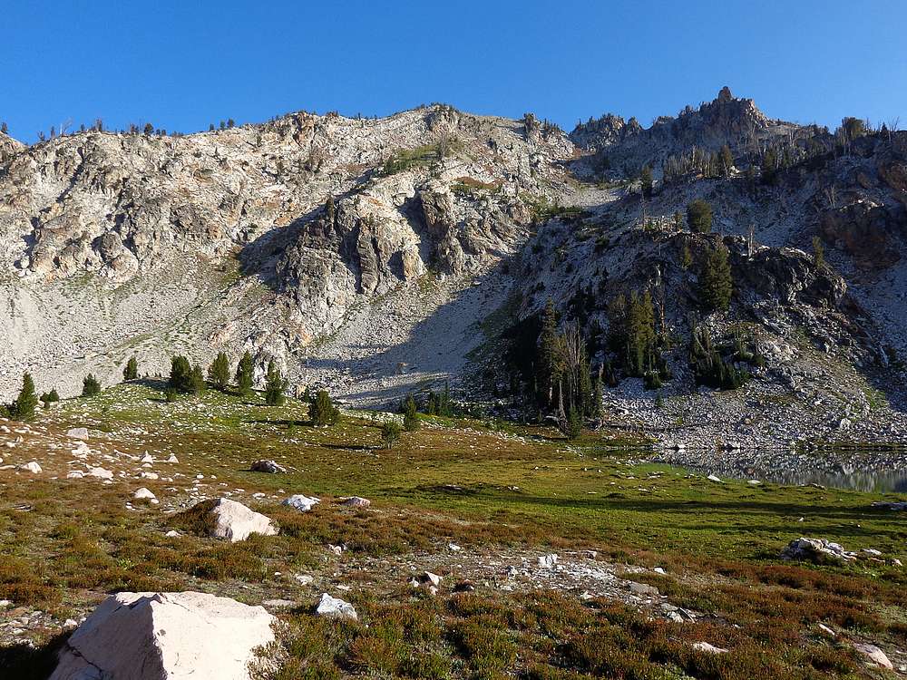
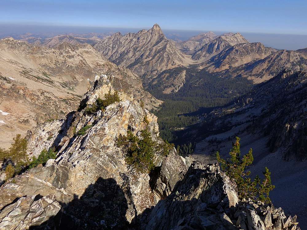
Upper Goat Creek drainage from Merritt. |
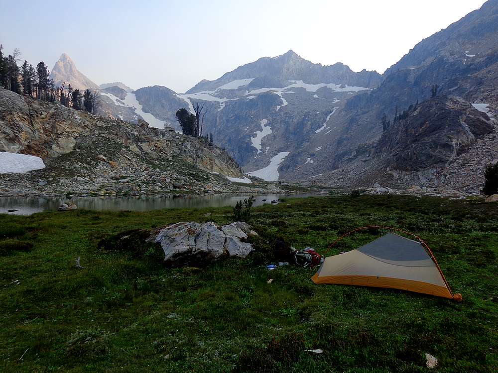
Our campsite in the upper Goat Creek drainage. |
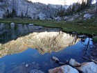
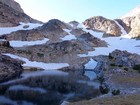
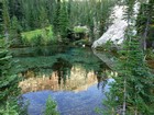
Morning reflection of Merritt from our campsite. |
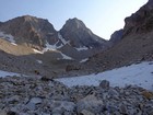
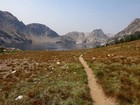
About to head up to the Williams/Thompson saddle. |
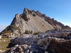
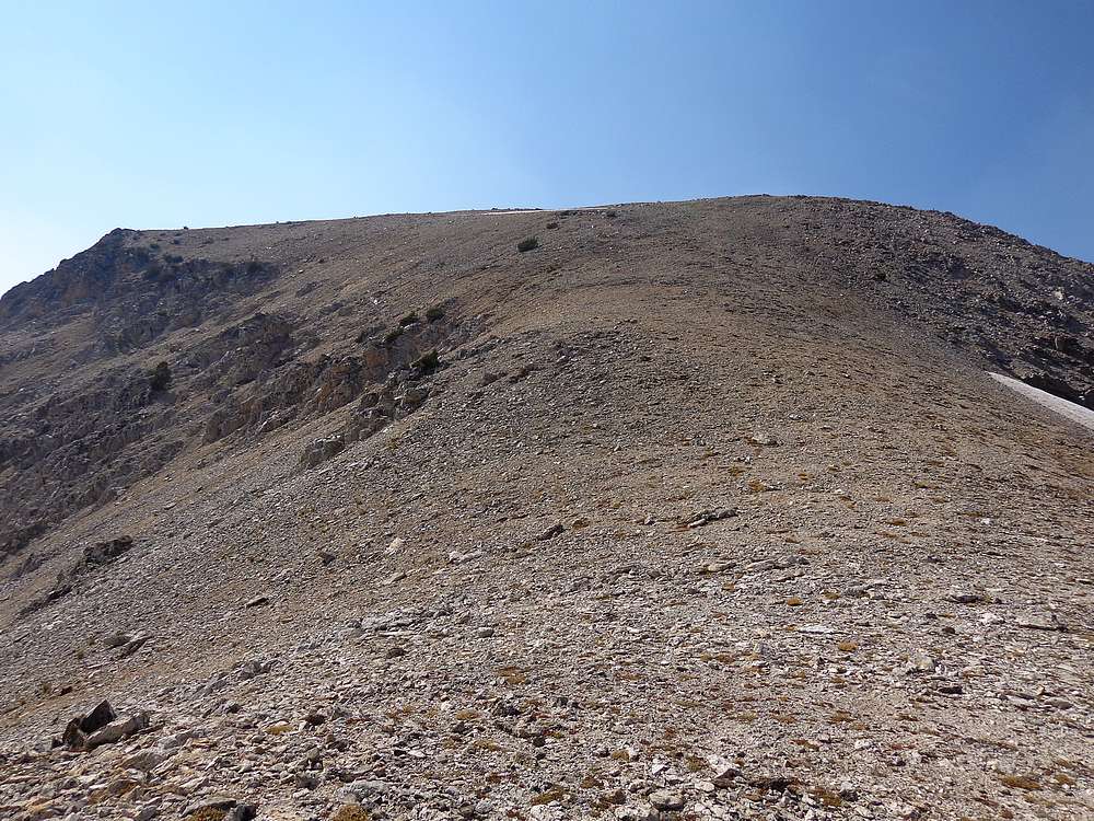
Williams Peak from the saddle. We headed for the trees in the upper middle of the face. |
On our way up Williams, Thompson Peak in the background. |
Nearing the summit of Williams Peak. |

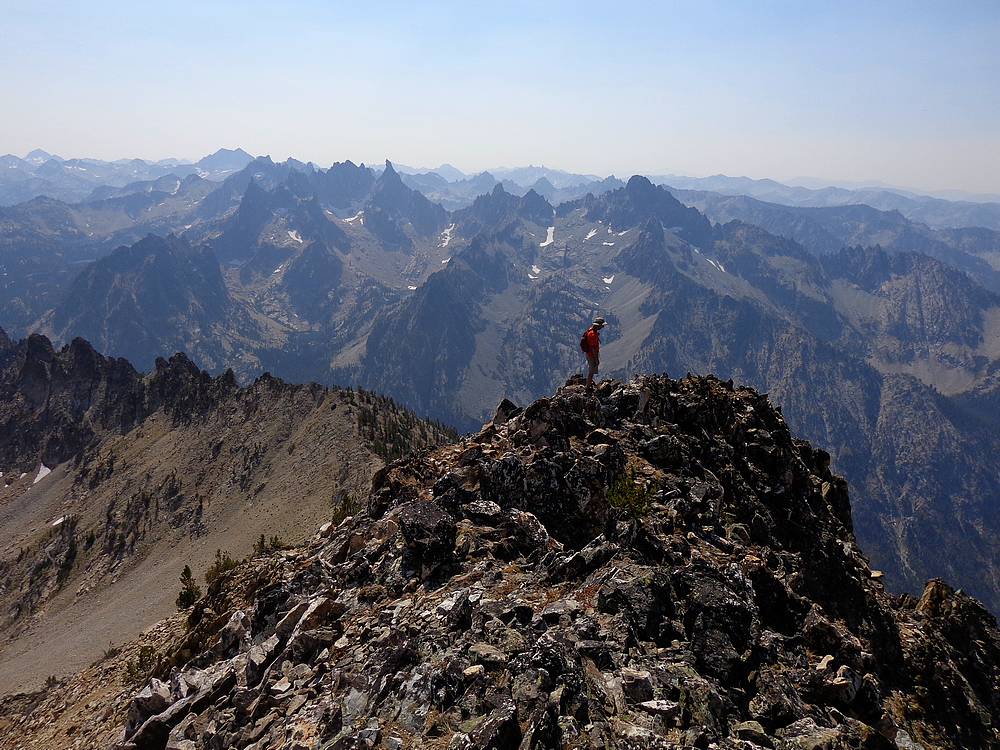
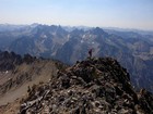
Williams Peak summit shot. |
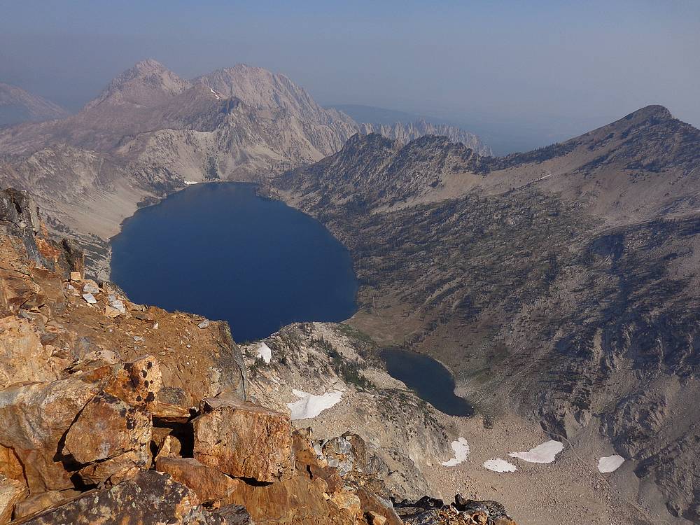
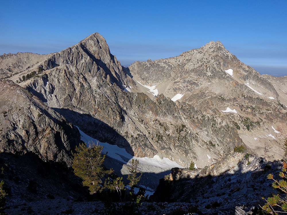
Upper Goat Creek drainage from Williams, including Regan and Merritt. |
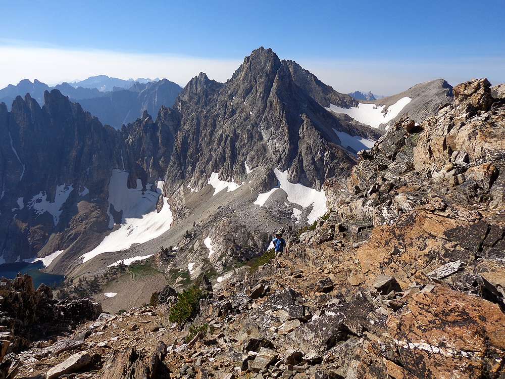
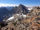
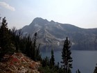
Our next objective, Thompson Peak, highest in the Sawtooths. |
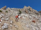
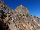
Final scramble section up Thompson Peak. |

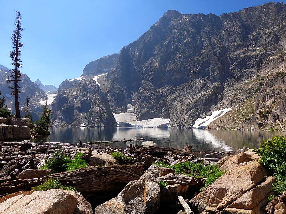
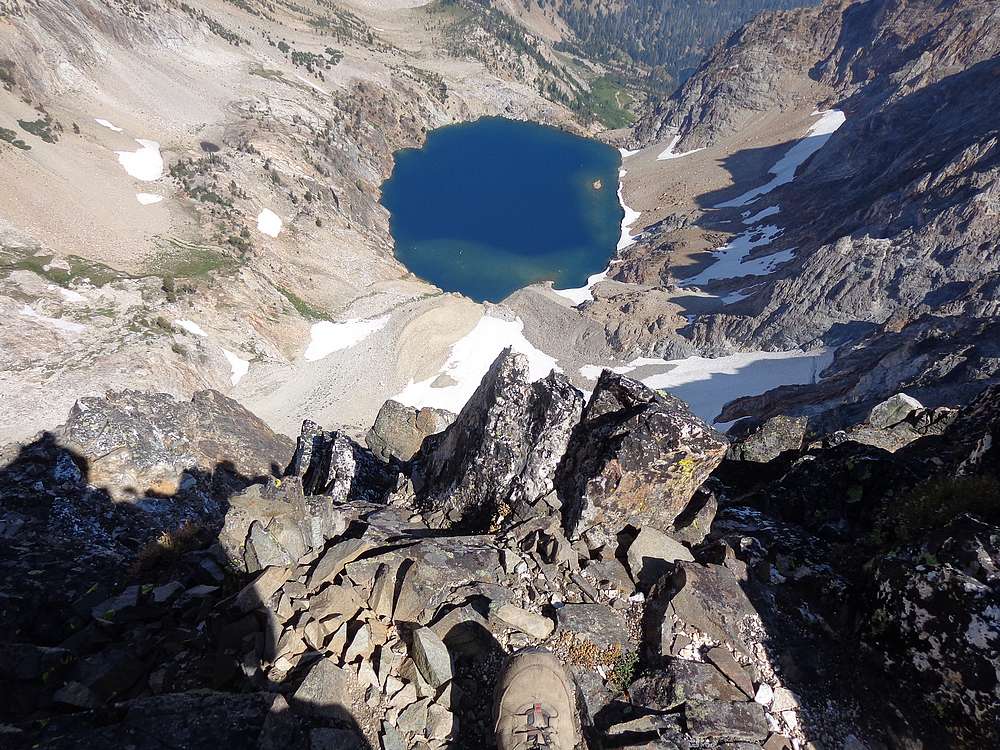
Long way down to the lake below Thompson. |
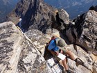
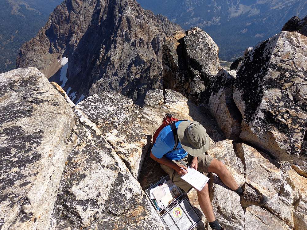
John signing the Thompson summit register. |
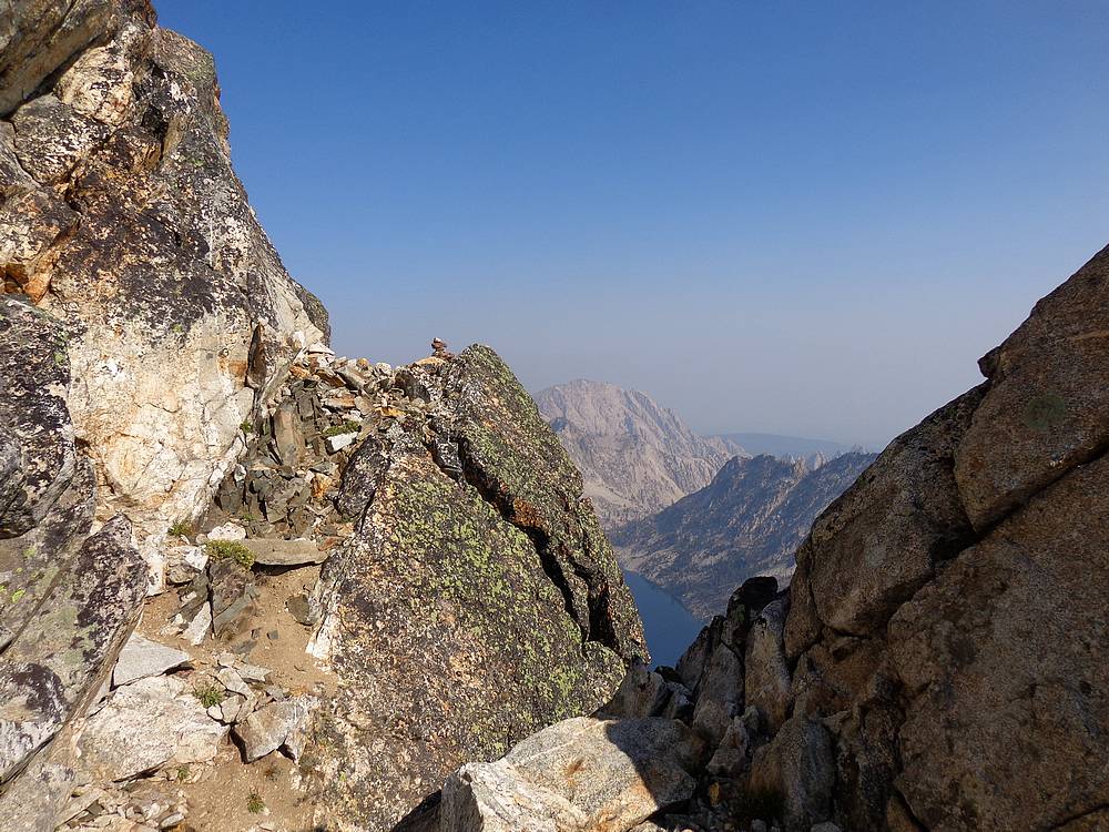
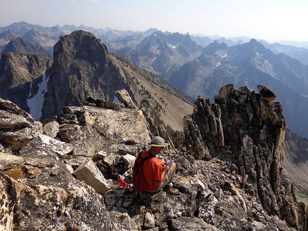
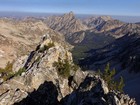
View south from just below the summit ridge of Mickey's Spire. |
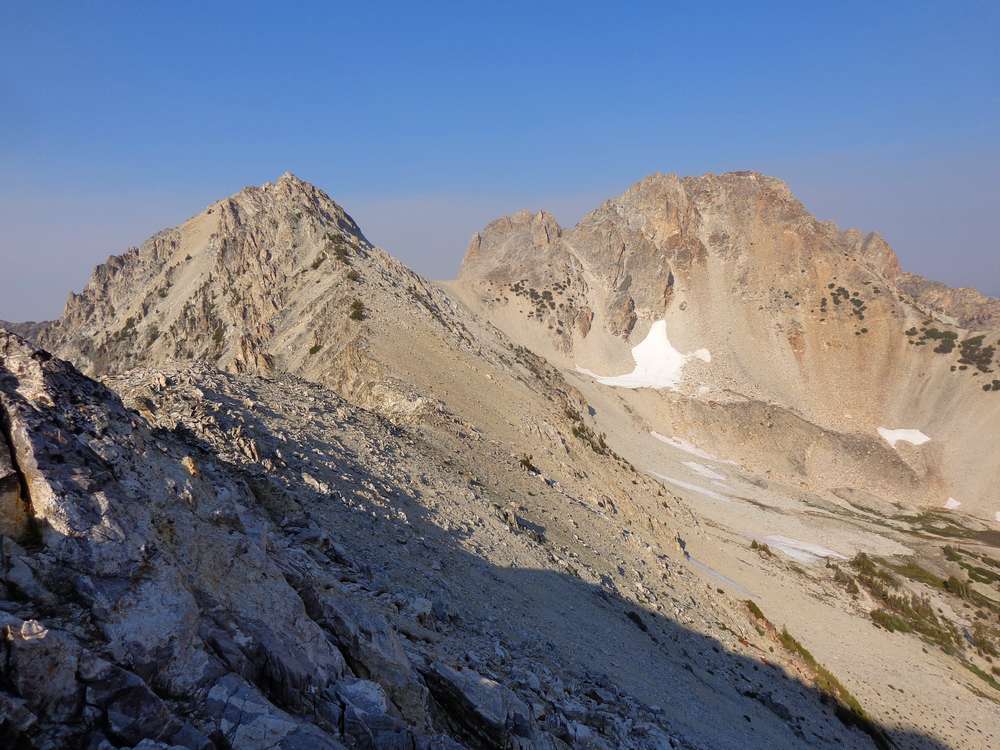
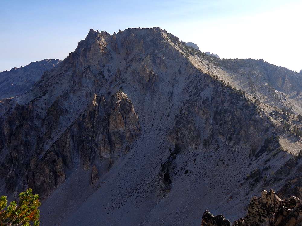
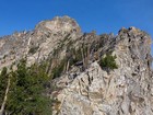
Mount Carter was our only easy summit of the trip. |
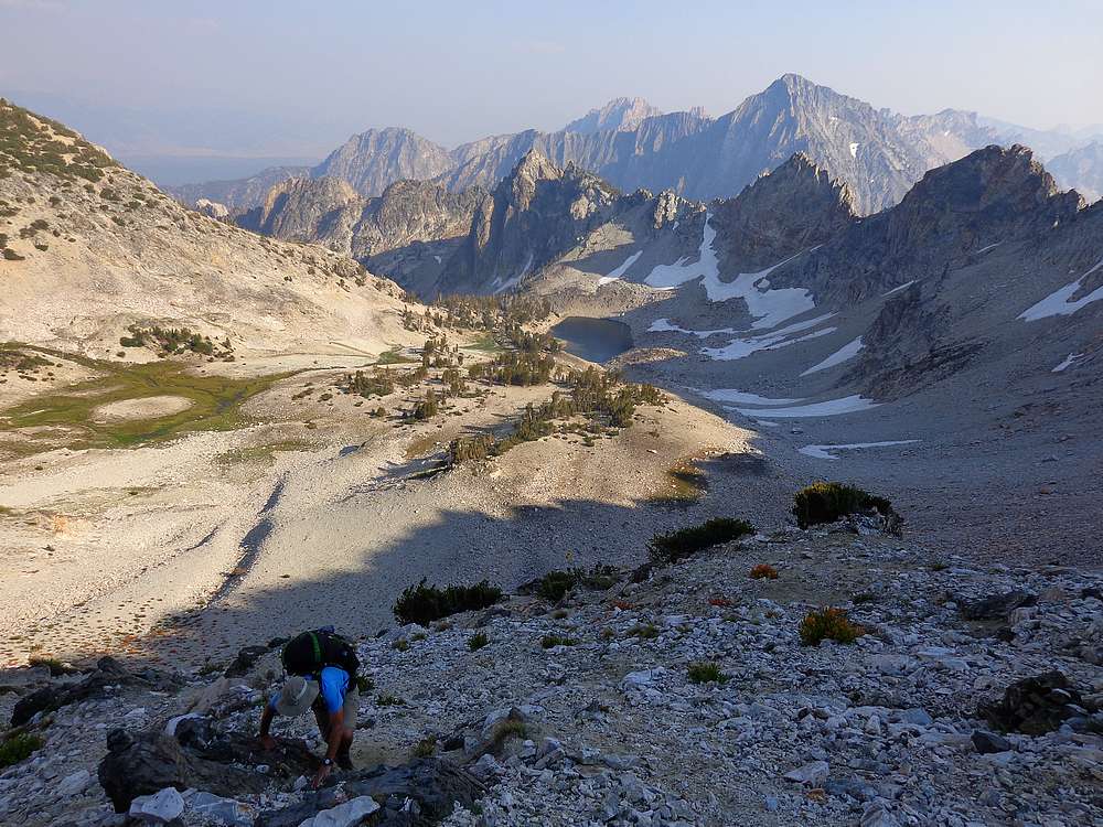
Scrambling up and out of the Limbert valley. |

Carter looks like real peak from Mount Limbert. |
Looking down our descent line from the summit of Mount Limbert. Our target was the highest trees on the lefthand ridge. |
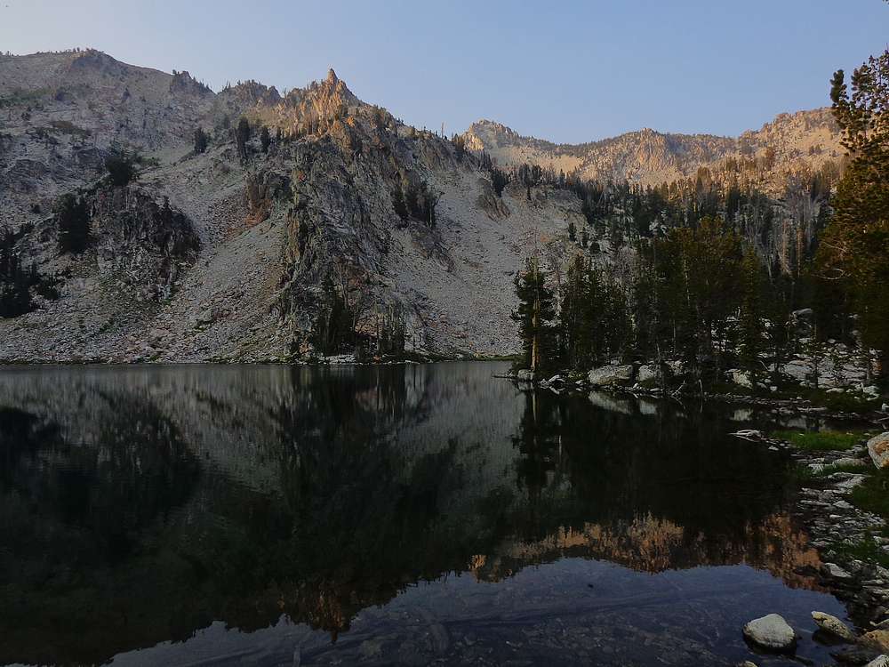
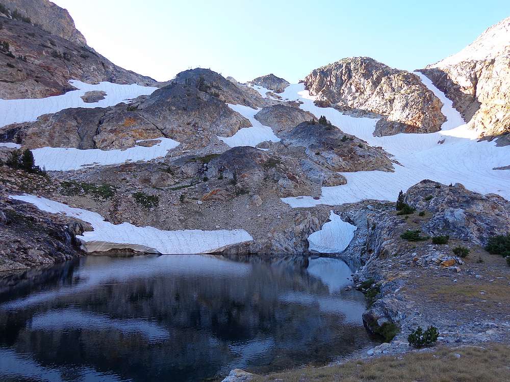
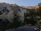
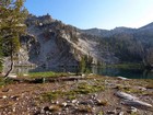
Our campsite at an unnamed lake above Fishhook Creek, Limbert in the distance. |
Morning view from our campsite. |

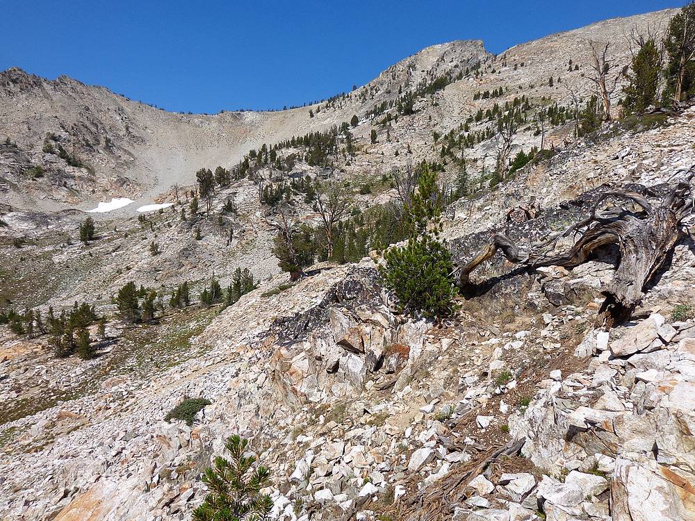
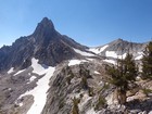
South face of "Little Baron Peak". We climbed the left gully. |
Climbing Little Baron Peak, Mount Ebert and Monte Verita in the background. |

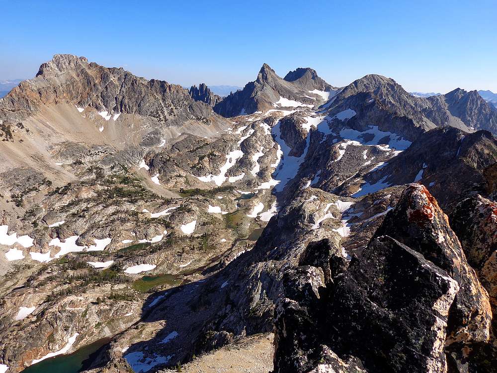
Baron Peak and Moolack Mountain from Little Baron. |
Mount Limbert from Little Baron. |
Little Baron summit shot. |
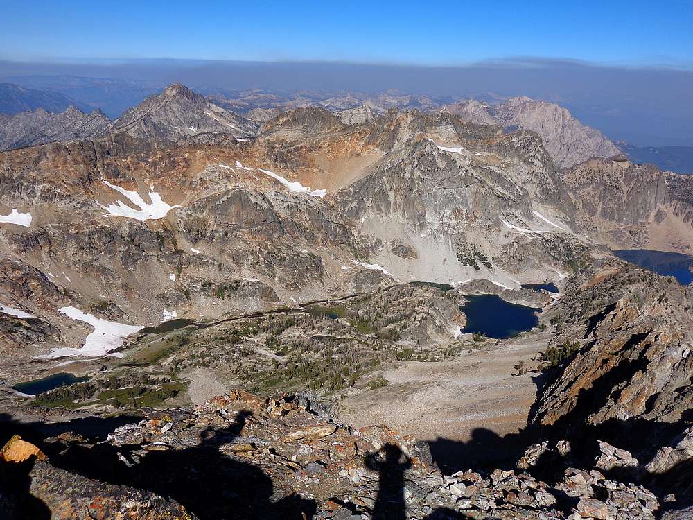
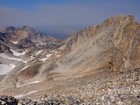
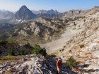
Upper North Fork Baron Creek from Little Baron Peak. Mount Regan and Alpine Peak in the background. |
We had to haul our packs up the south face of Baron Peak. |
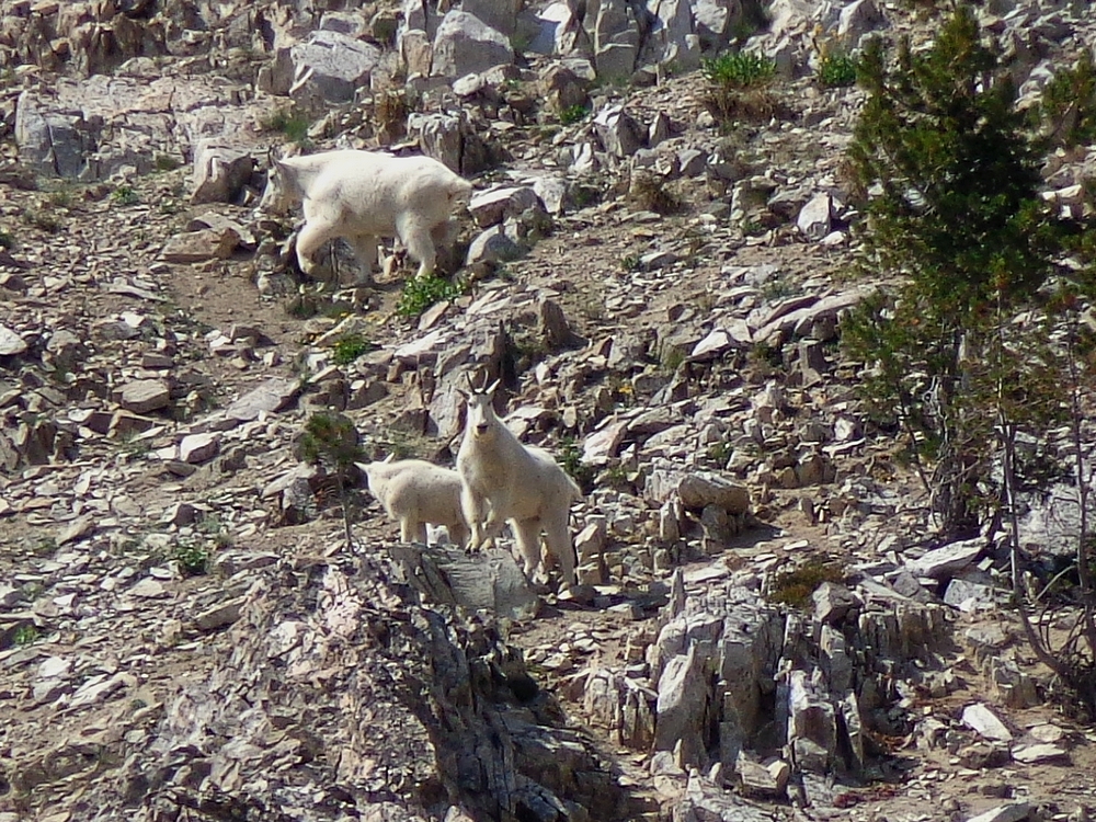
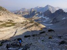
Mountain Goats south of Baron Peak. |
Steep climbing with big packs. |
Leaving the summit of Baron Peak, Warbonnet in the background, Rakers in the distance. |
John trying to find a way up the Moolack Mountain summit block. He eventually found a slot going up from the notch on the left. |

The class IV slot leading to the summit of Moolack Mountain. |
Signing the Moolack summit register. |
Plenty of boot skiing on the way down the south face of Moolack. Good way to wear out a pair of boots. |
More boot skiing heading east from the Baron/Moolack saddle. |
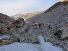
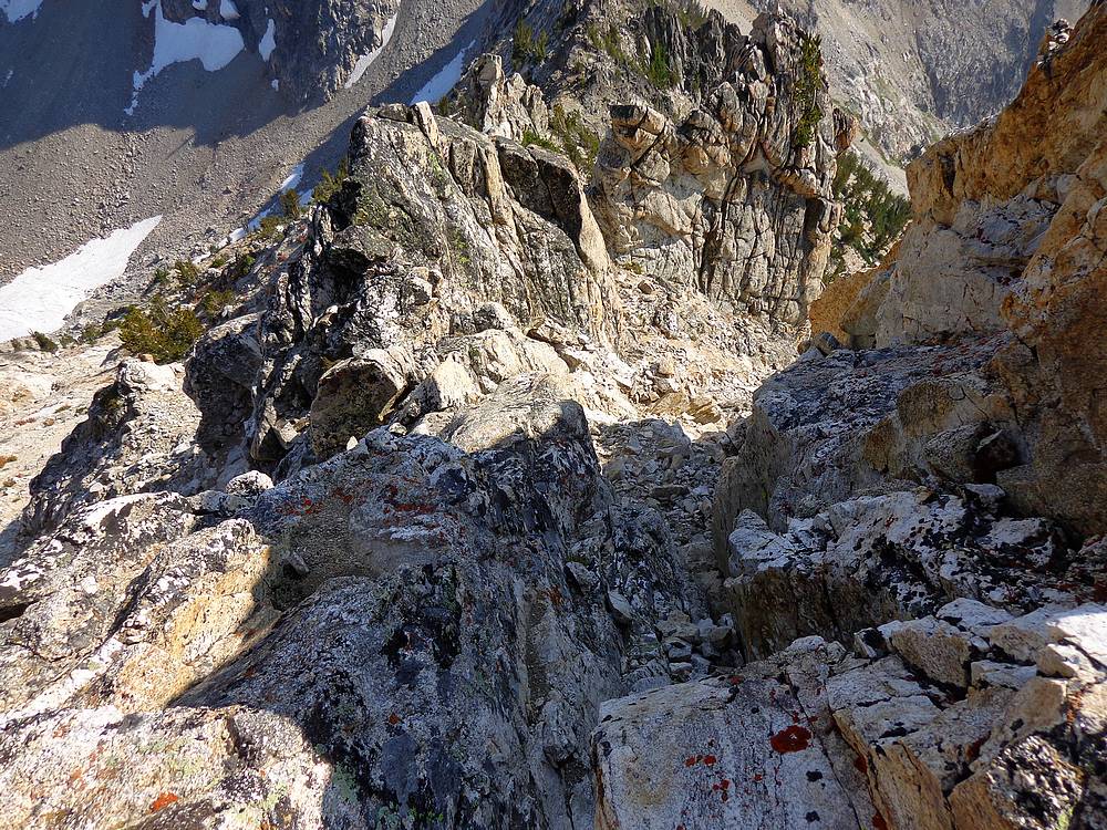
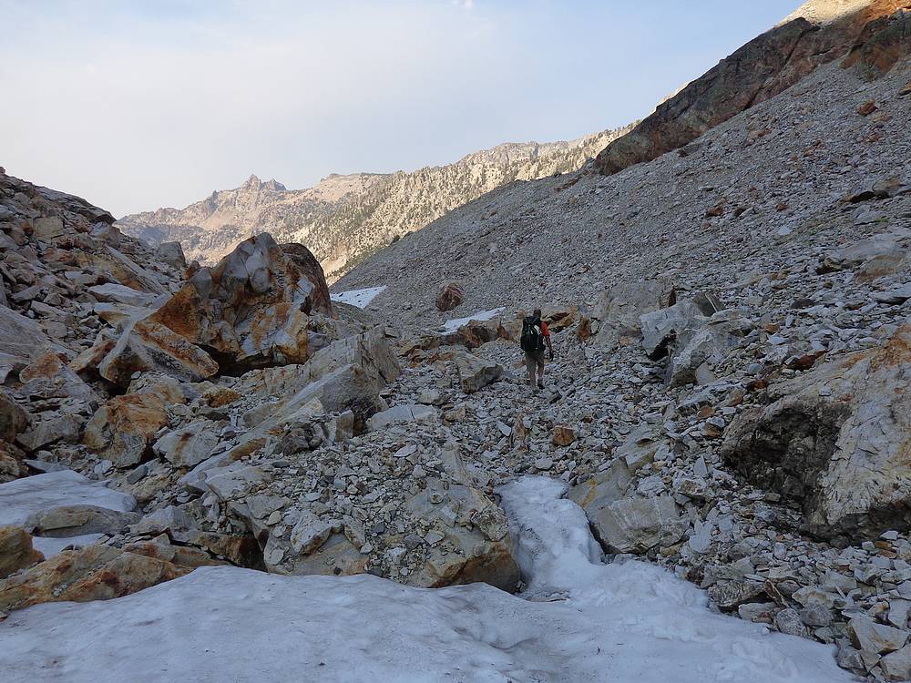
Making our way through debris in the cirque north of Baron Peak. |
Amazing cirque north of Baron Peak. |
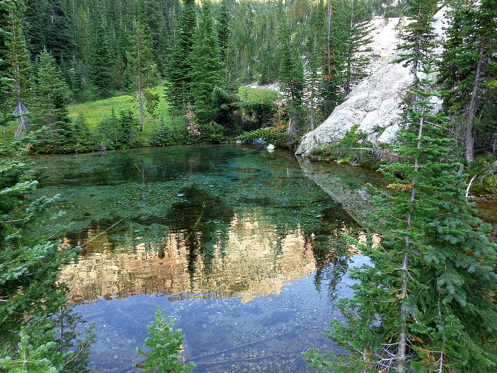
Incredibly clear water near the headwaters of North Baron Creek. |
Fantastic creek side views on remote North Baron Creek. |
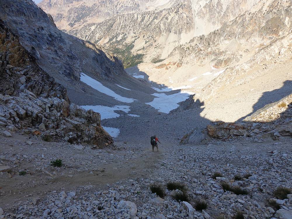
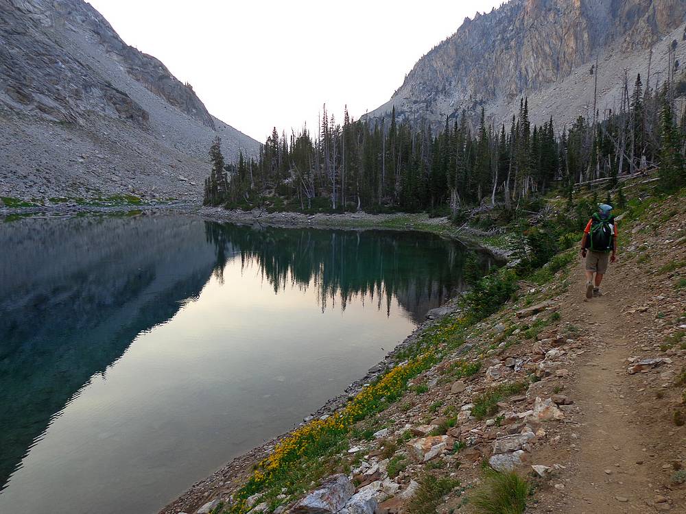
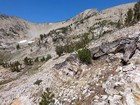
Finally nearing our campsite at Lake 8271'. |

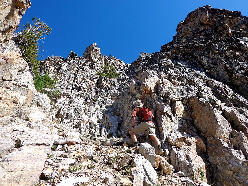
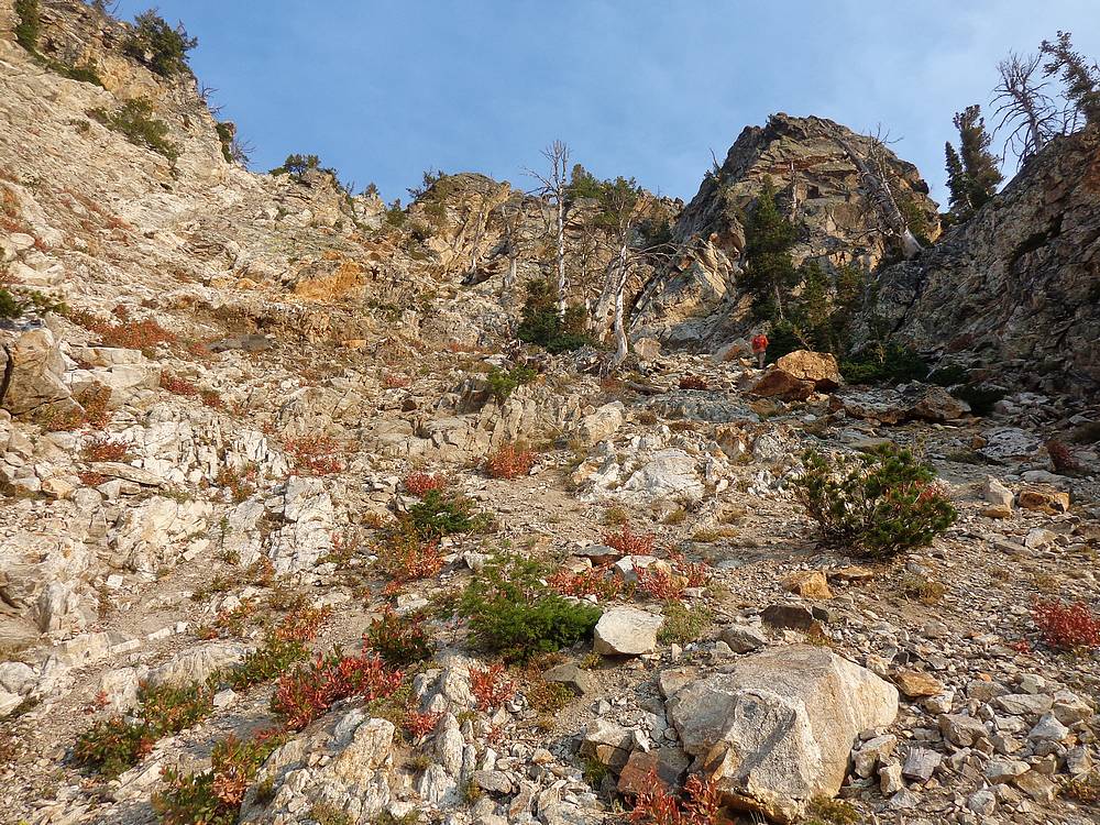
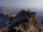
Starting up the southeast gully on Mount Regan. |
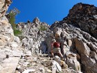
Heading up the ridge toward the Regan summit block. |
This cairn marks the ledge leading out onto the exposed east face of Mount Regan. |

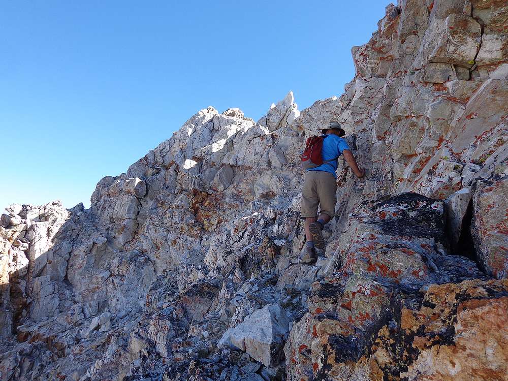
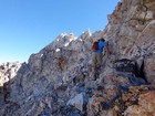
John on the way up the east face of Mount Regan. |
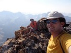
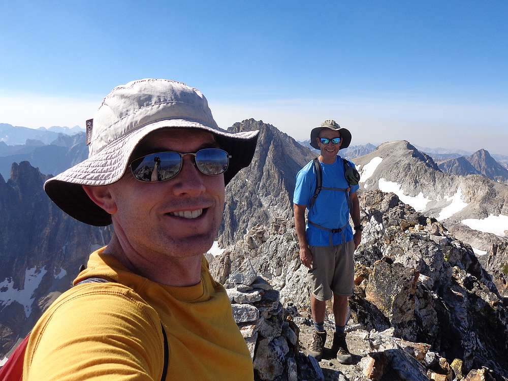
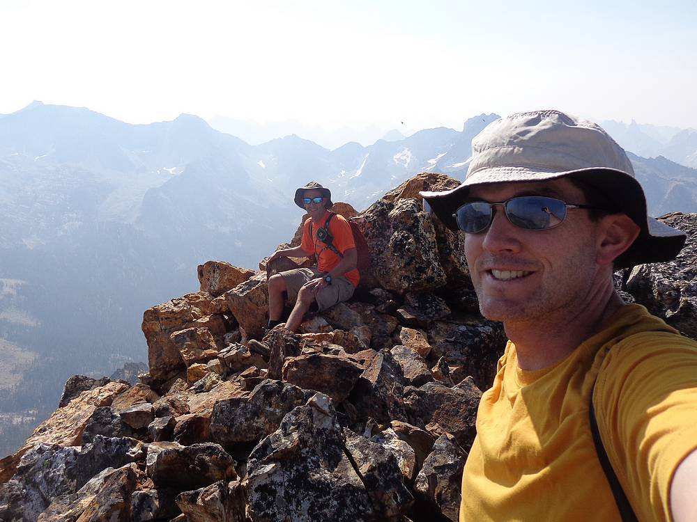
Mount Regan summit shot. No time to relax, gotta figure out how to get down this thing. |
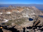
Sawtooth Lake from Mount Regan. |
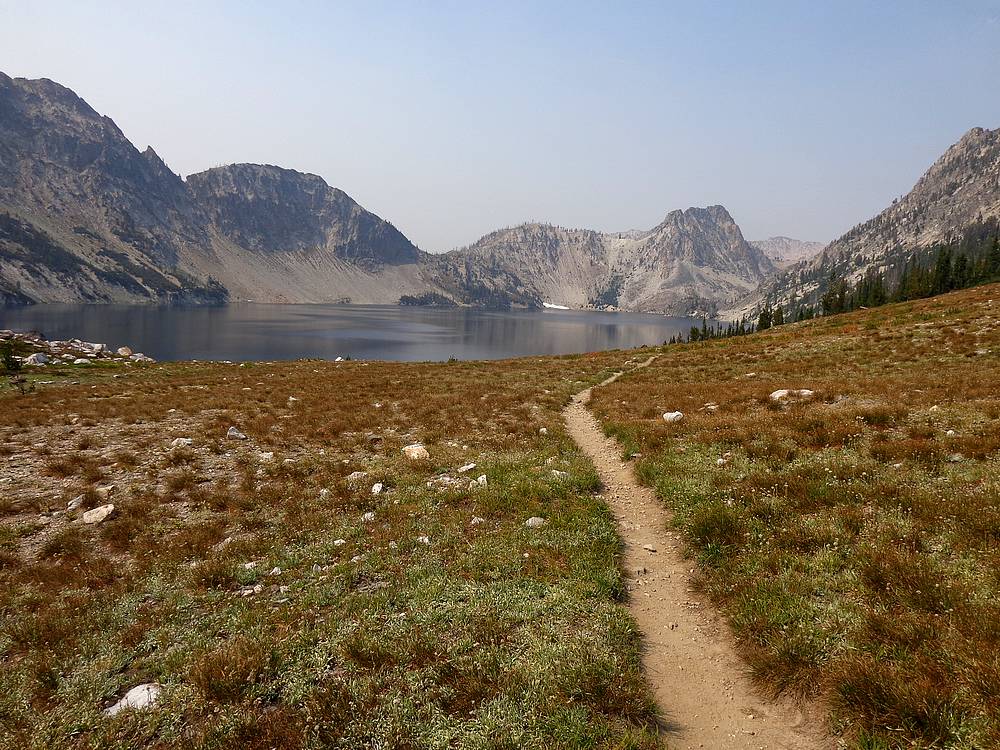
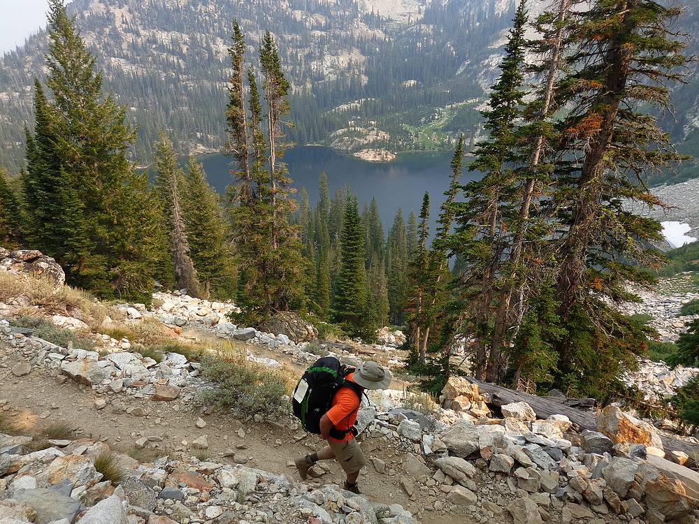
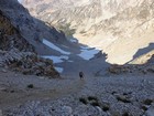
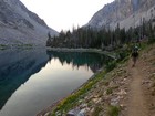
Approaching Sawtooth Lake from the south. |
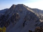
Mount Regan from Sawtooth Lake. |

Descending the switchbacks above Alpine Lake. |
|
|
|