|
Dickey Peak is located in eastern Idaho’s Lost River Range, north of Mackay and not far from Mount Borah, the highest mountain in Idaho. Dickey is well known for its abundant talus and scree. That loose rock can make it a treacherous climb much of the year, but a little snow and ice helps hold things together, making it a more enjoyable climb in early or late winter.
Sean and I made the four-hour drive from Boise, and were fortunate to find dirt roads with fairly minimal snow coverage allowing us to drive all the way to the base of the mountain. I’d been mentally prepared to have to hike all the way from the highway, but we lucked out and made it to 7000’, near Poison Spring. After a short debate and deciding to leave the snowshoes in the car, we began making our way up the hill toward Point 8310’. The hiking was steep from the get go, and we made a slow but steady pace up the open hillside. The grade relented for a little while on the lower ridge, but we were quickly back to huffing and puffing from about 8400’ on up. Fortunately for us the weather was great. Barely a cloud in the sky, minimal wind, and temps in the low 20’s. Pretty mild conditions for December.
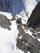
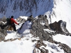
Up we went, with open views of the false summit above us. As we got higher, there was more and more loose rock, but just enough snow to hold it mostly together. The last couple hundred feet to the false summit would have been very tedious without the thin layer of snow. As we got higher, we studied Dickey’s south ridge from a distance to try to determine the best way up. It looked pretty steep, and there was no clear route up the ridge. As we descended from Point 10858’ down to a flat saddle, we decided to tackle a broad gully that went up the right-hand side of the ridge. As we got closer, it seemed more and more doable. The rock was quite loose, but there were just enough firm holds to allow for some fun and safe class 3 scrambling. Sean let me take the lead, and I climbed to a spot where I stayed put for a while to keep from rolling rocks down on him as he made his way up the gully.
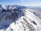
Once at the top of the gully, there was a fun ridge leading to the highpoint. The summit views on this clear and sunny December day were excellent. We could see Hyndman Peak and Devil’s Bedstead in the Pioneers, Mystery Peak in the Boulders, Castle Peak in the White Clouds, Bell Mountain and Diamond Peak in the Lemhi’s, and of course Mount Borah and friends very close to us to the south.
There wasn’t much wind, but it was still cold enough that we didn’t linger long on the summit before heading down. The descent was a little more challenging than the climb up. There were a couple tricky moves along snow-covered rocks on the upper ridge. Then finding holds in the gully section made for slow careful going. Once back down to the saddle, we could relax knowing the hard part was behind us. From there we climbed back up to Point 10858’ for a quick lunch break. Sean had some sort of energy GU, while I had my normal PB&J and some homemade hot apple cider. (I obviously have much better taste in food than Sean.) From there we made a quick descent back down to the car. Round trip time was 6 hours for our 6-mile day.
Some people would say you’d have to be crazy to go mountain climbing on a cold day in December. I’d say you’re crazy not to get out in the mountains on a beautiful sunny day like this one. We had a great climb in rugged country, with excellent scenery and some fun scrambling mixed in. Pretty hard to beat if you ask me.

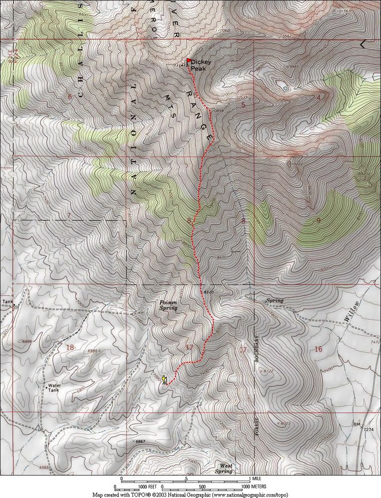
Map of our route, 6 miles round trip with 4300' elevation gain.
|
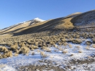
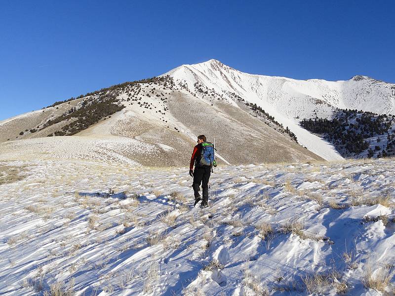
View of Dickey Peak from the trailhead near Poison Spring.
|

Sean on the lower section of the ridge.
|

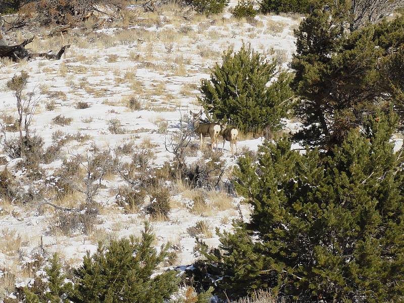
Deer we saw on the way up.
|
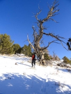
Sean passing by an old snag.
|
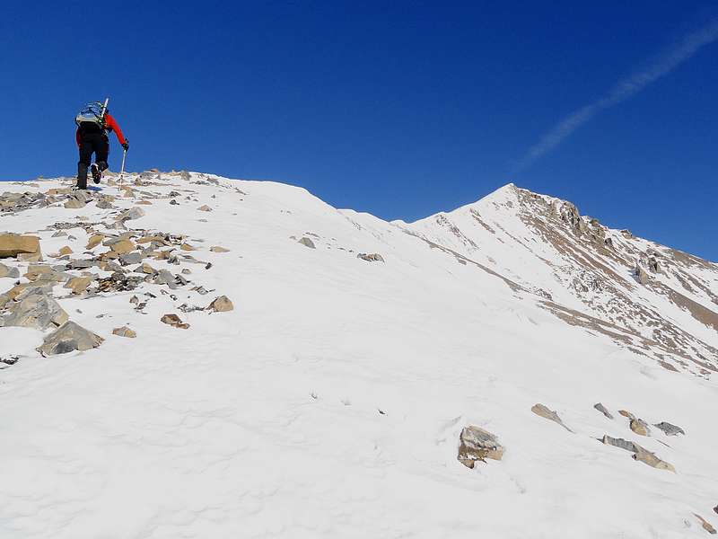
Making our way up through the talus, partial covered in snow.
|
First view of the summit of Dickey Peak, on the left.
|
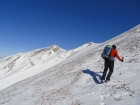
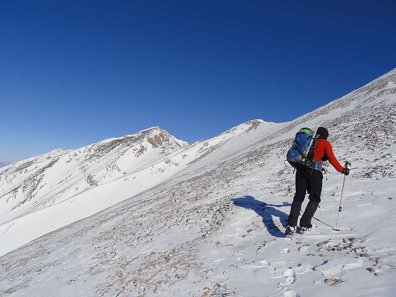
Climbing toward the false summit.
|
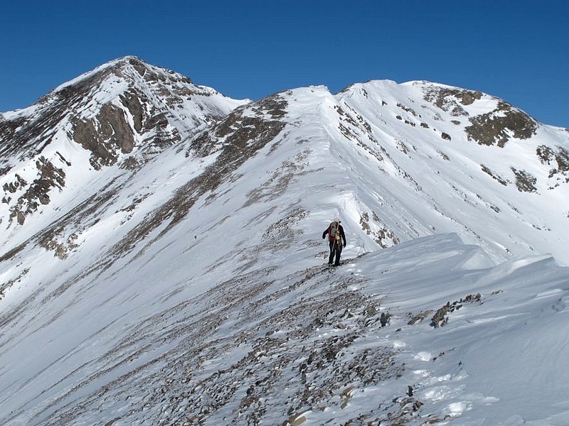
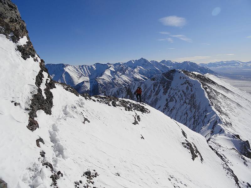
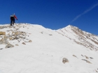
Dave on the ridge below Point 10858'. SeanD photo.
|
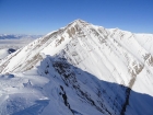
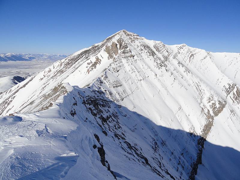
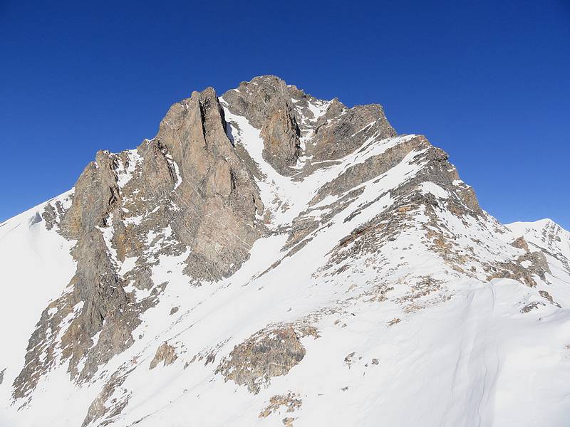
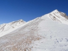
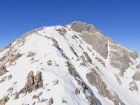
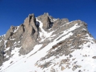
Great view of Dickey Peak's south ridge and impressive east face.
|

This gully was the crux of our climb up the south ridge.
|

Sean nearing the base of the gully, Mount Borah in the background.
|

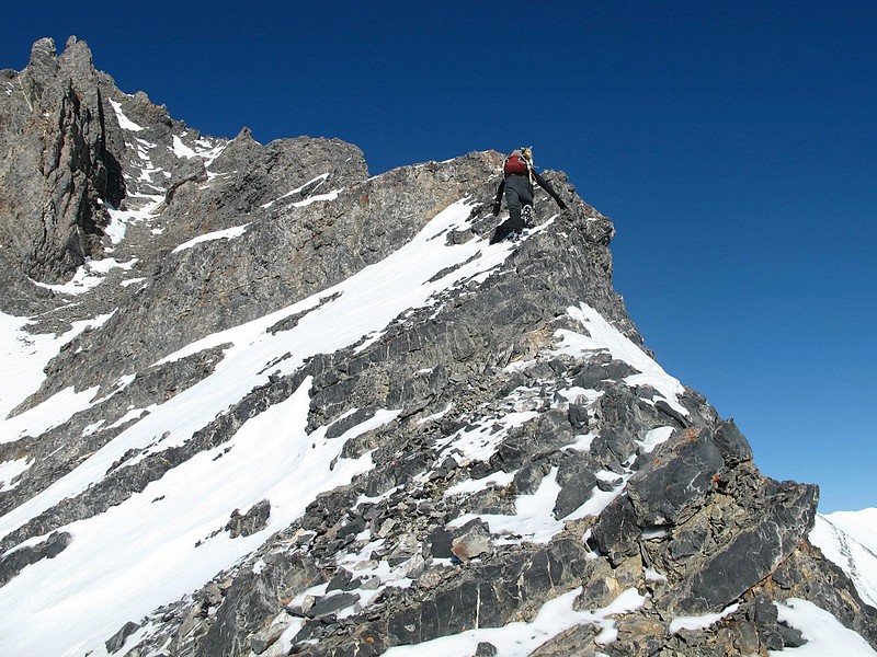
Dave starting up the steep section just below the gully. SeanD photo.
|
View from the top of the gully, Sean trying to find stable rock.
|
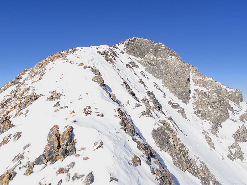
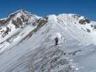
The final ridge to the summit of Dickey Peak.
|
Sean nearing the summit of Dickey Peak, Borah Peak in the background.
|
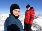
Summit photo, Splattski style.
|
Scoping out our descent route.
|
One last view looking back at the gully.
|
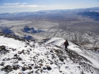
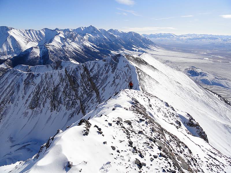
Descending the ridge, with the Big Lost River valley below.
|
|