|
Nevada’s Jarbidge Mountains are known for being rugged and very remote. They are located not far from the Idaho border, near the historic turn of the century mining town of Jarbidge. The highest peak in the range is the Matterhorn, a very prominent peak that anchors a string of ten thousand foot peaks along the west edge of the Jarbidge Wilderness Area. In spite of its remoteness, the Matterhorn sees at least a handful of summit visitors each year thanks to its status as Nevada’s 15th most prominent peak. It is also the highest peak in the Columbia Basin, south of the Snake River.
Michael suggested heading south to Nevada where the snow coverage was even sparser than in Idaho. We bounced around a few ideas, and settled on the Matterhorn. Michael, Splattski, and I left Boise at about 4:30am and made it to Jarbidge in about 4 hours following the long dirt “Clover 3 Creek Road” from Bruneau. All was quiet as we passed through town, and we made it up the road to about 6700’ before pulling over. It was cold, but the snow coverage was thin as we wandered up the trail for a while before heading cross-country. We started up the ridge on the south side of Snowslide Gulch. Not too much brush to contend with, but plenty steep. Once at about 8500’ the snow got too deep for us and we donned snowshoes. On we went, grinding our way up slowly toward Point 9224’ where we got our first view of the Matterhorn and the adjacent peaks. The steepness relented for a short time, and then it was back to work. We headed straight up for the most part, trying to take advantage of some elk tracks that made the climbing slightly easier. The climbing was hard, but the weather was excellent and the scenery was great.
We had a great view of the north face of the Matterhorn from the ridge at around 10300’. With only 500’ more of climbing and minimal snow coverage, we left our packs at the saddle to make a quick dash to the summit. Unfortunately, the tough climb had taken a lot out of us, so our dash wasn’t so quick. Once on the summit, we took some photos, read the summit register, and peered down the steep north face. It was hard to believe how little snow was on the surrounding peaks in the middle of winter.
From the Matterhorn, we dropped back to the saddle for a quick lunch break. My PB&J and hot apple cider hit the spot! Next we continued north along the ridge with a climb of less than 400’ to the next peak, appropriately named “Square Top for its long flat summit ridge. From there we descended again, making slow but steady pace to Jumbo Peak, which was another climb of less than 400’. From here, Jarbidge Peak was within striking distance. But after some quick calculations we decided that we’d probably end up bushwhacking back to the car in the dark if we went for it. The days are short in January, and this was no place to be after dark, especially with the Tsaw-haw-bitts in the area. Better safe than sorry, time to head down.
So down we went, following Jumbo Peak’s west ridge back into the valley. The top section of the ridge was steep loose talus, and we feared a long tedious descent. Fortunately the talus relented after a few hundred feet, and we had smooth sailing back to the trail. We made it back to the car by just after 5pm, tired, satisfied, and thankful that we hadn’t gotten greedy and went for a fourth peak. All in all a great day exploring a new area. Hard to believe we were able to climb three 10ers in January. Good call Michael!
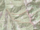
Map of our route, 8 miles round trip with 5000' elevation gain.
|
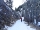
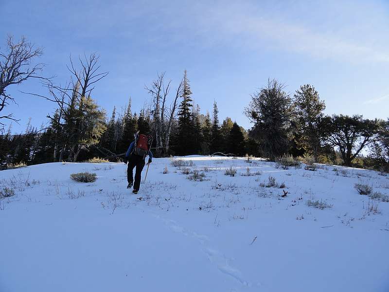
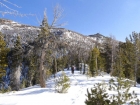
Starting up the Jarbidge River trail.
|

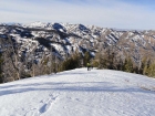
Grinding our way up the lower slopes.
|
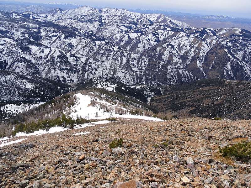
Some great views as we near 9000'.
|
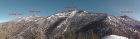
Panoramic view from Pt 9224'.
|
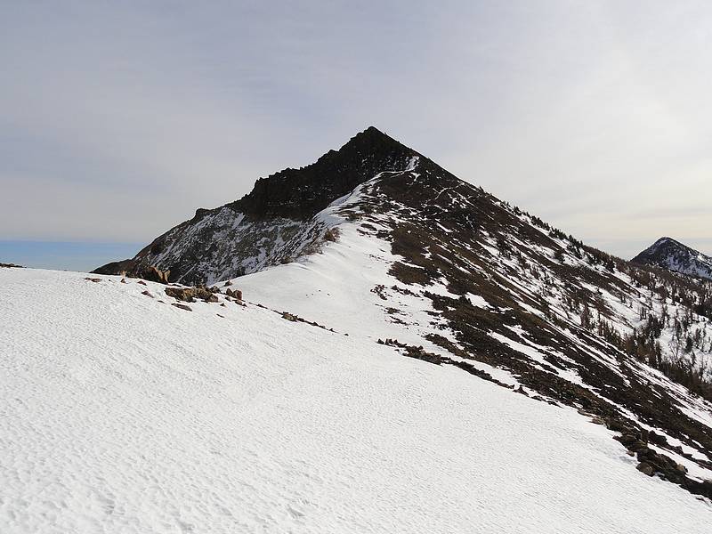
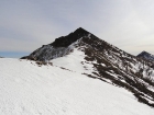
View of Matterhorn just after leaving Pt 9224'.
|
Matterhorn's northwest ridge from the saddle.
|
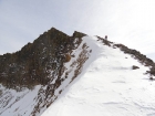
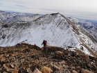
View of Matterhorn's big north face, John on the ridge.
|
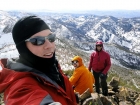
Splattski style shot from the summit of Matterhorn.
|
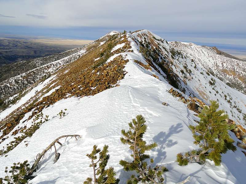
Looking back at Matterhorn on our way up Square Top.
|
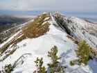
The long summit ridge of Square Top.
|
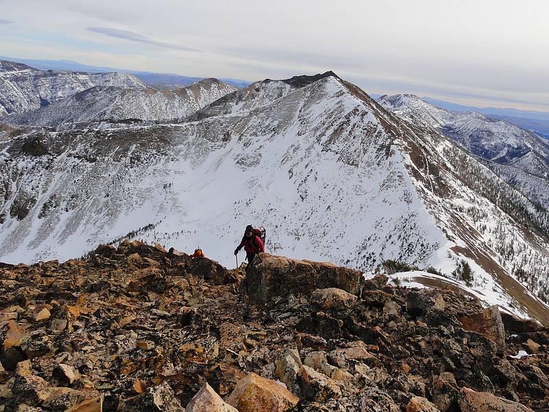
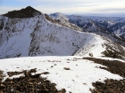
View north of Jumbo Peak, from Square Top.
|
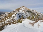
Nearing the summit of Jumbo Peak, Square Top in the background.
|
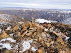
Summit cairn on Jumbo Peak, Jarbidge Wilderness in the background.
|

Our descent ridge from Jumbo Peak, Gorge Gulch on the right.
|
|