|
Lorenzo Peak is located in the Boulder Mountains north of Ketchum Idaho. For mountain climbers, spring is probably the best time to visit the Boulders, while there’s still a blanket of snow covering the famously loose rock that the range is known for. Lorenzo is a hulk of a peak that may not always stand out when seen from the highway, but it is very impressive when viewed from other nearby peaks.
After a pessimistic weather forecast scared us away from some other more distant destinations, we chose Lorenzo Peak because it was a little closer to home. Michael, Sean, and I left Boise a little after 4am, and were making our way across the Big Wood River at Billy’s Bridge by just after 7am. Thanks to some beta from Splattski and George, we knew we needed to climb the ridge to the west side of the drainage that dropped from the west side of the peak. The hiking was pretty flat for the first half-mile, as we made our way north to the mouth of the gully. We stayed near middle of the small valley until about 7600’, and then climbed up the slopes to west. Not too far above this, we got to see a mountain goat scampering off into the trees.
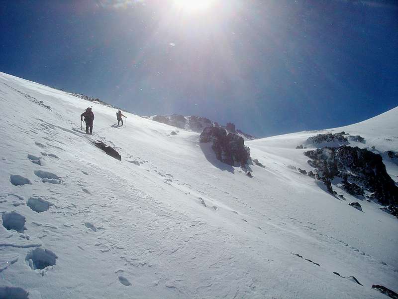
It wasn’t too much farther before we had to put on the snowshoes as bare ground became scarce. We continued up the slopes, and then began angling back towards the valley once at a little over 9000’. We probably should have angled sooner to prevent some heinous snowshoe side hilling.
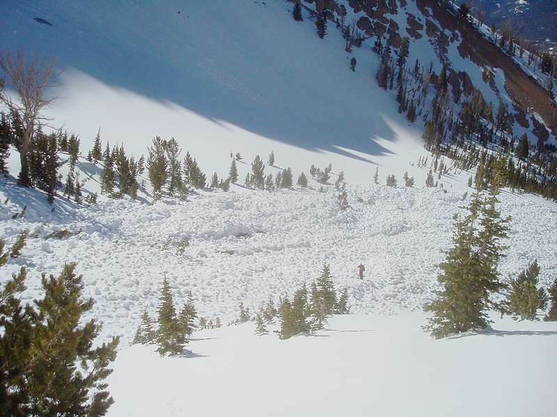
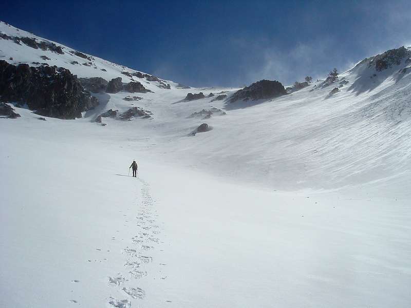
Once in the valley, we were greeted with a huge swath of avalanche debris, probably the biggest slide I’ve ever seen. But the snow was in good shape today, thanks to some recent cooling, so we continue onward. By now, we were enjoying some great scenery, with snow-covered ridges on both sides, and spindrift blowing off the rock shelf in front of us. At around 9800’, it was time for crampons. The snow was supportive, and we made good progress up and over the shelf into to upper basin. Once in the upper basin, we could see an unobstructed line to the summit, directly up the west face. Sean led the way, with Michael close behind. I was in the rear, and was feeling the effects of the elevation. My pace was a little slow, and I took advantage of the many photo opportunities to stop and catch a breath. The occasional wind gusts were good excuses for rest stops as well, as I paused to plant both feet and clutch my ice axe. Climbing the face was a lot of work, but well worth the effort. The final summit ridge was very cool, and the views from the top were awesome. Barely a cloud in the sky, and surrounded by huge snow capped peaks, it was great to be in the high country. Although the combination of the elevation and the exertion of the climb made it a little hard to stomach my PB&J today, which was a rarity for me.
We made quick work of the descent. Sean and Michael were able to plunge step their way down the face, while I took off my crampons and enjoyed a nice long glissade down into the upper basin, and another one down the shelf section. We wandered down the valley to check out the avalanche debris, then headed west at about 8700’ for some post-holing through the trees. We made it back to the car by a little after 3pm, which left plenty of time for a stop at KB’s before heading home. A great end to a great day in the mountains.
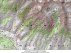
Map of our route, 7 miles round trip and 4400' elevation gain. |
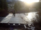
Crossing Billy's Bridge. |
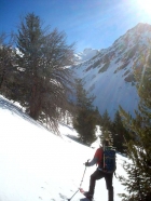
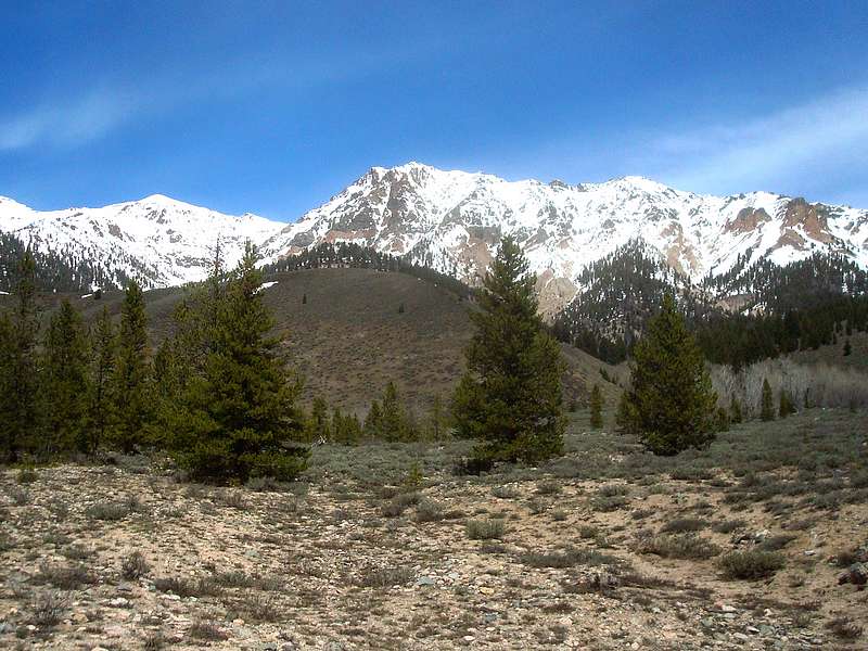
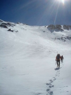
An early view of the summit of Lorenzo Peak. |
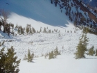
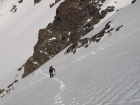
Sean on the avalanche debris. |
Michael making his way up through the basin. |
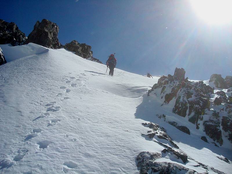
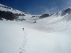
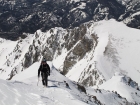
Climbing the shelf towards the upper basin. |

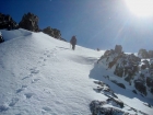
Almost over the shelf. |
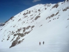
At the base of the final climb up the west face. |
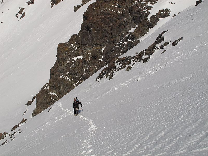
Dave climbing the west face. SeanD photo. |
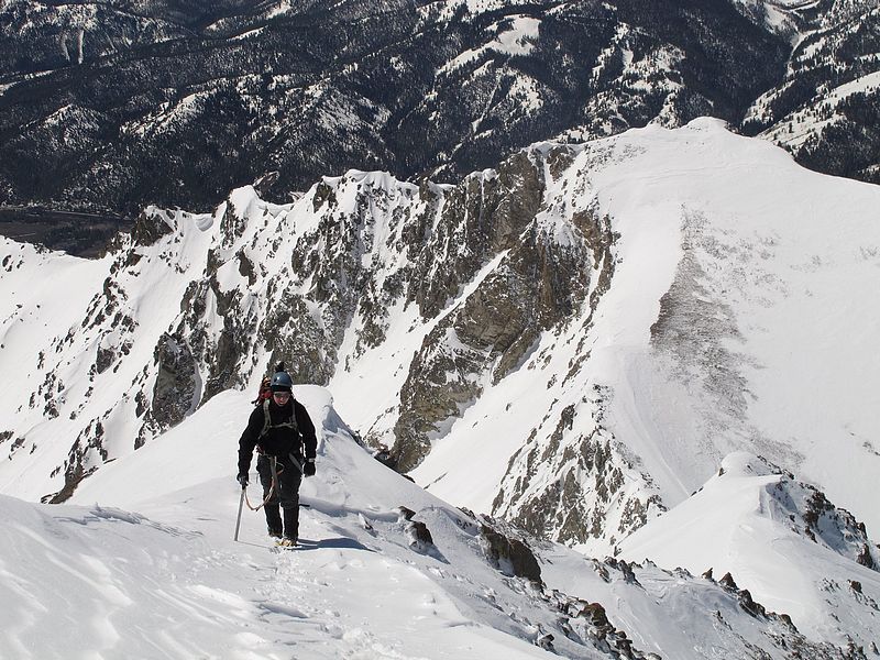
Dave nearing the summit or Lorenzo Peak. SeanD photo. |
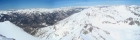
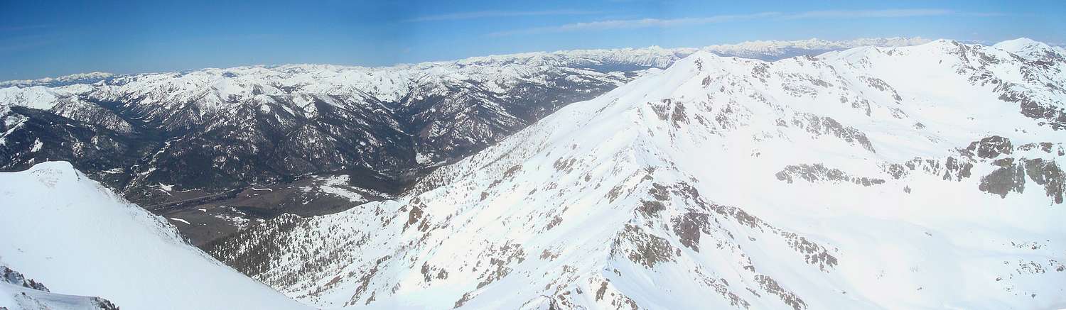
Summit pano looking west towards Easley and Cerro Ciento. |
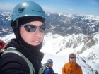
Splattski shot from the summit. |
Michael and Sean descending next to my glissade path. |
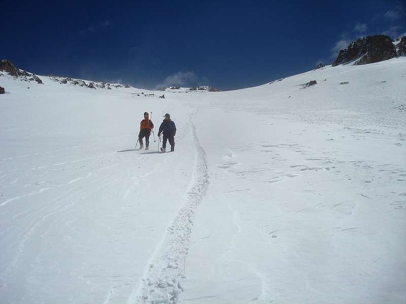
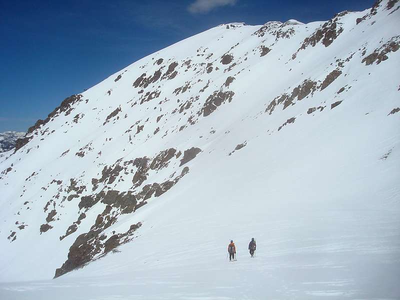
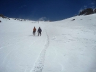
About to leave the upper basin |

One last look back at Lorenzo Peak, summit just visible on the right. |
|