|
Cougar Basin Backpacking
|
Related Links:
- Splattski Trip Report
- Dave's Photo's: 1, 2, 3, 4, 5, 6
- SummitPost Page
- Trailhead Location
- My GPS Tracks
- Cougar Peak: TL, LOJ, Map
- Bum Creek Peak: LOJ, Map
- Center Ridge #1: TL, LOJ, Map
- Center Ridge #2: TL, LOJ, Map
- Snowslide Peak: TL, LOJ, Map
- Center Mountain: LO, TL, PB, LOJ, Map
- Cougar Basin Peak: LOJ, Map
- Catherine Ridge #1: LOJ, Map
- Catherine Ridge #2: LOJ, Map
- Marble Mountain: TL, PB, LOJ, Map
|
Cougar Basin is located on the west side of central Idaho’s vast Frank Church Wilderness. The area is accessible from the Lick Creek Trailhead, a couple miles south of Big Creek and Edwardsburg. Cougar Basin is home to Bear Lake and a couple other alpine lakes, and is just under 8 miles from the trailhead. The area makes for a great basecamp to explore surrounding terrain.
Day 1 – Cougar Peak & Ersa Minor (Bum Creek Peak side trip)
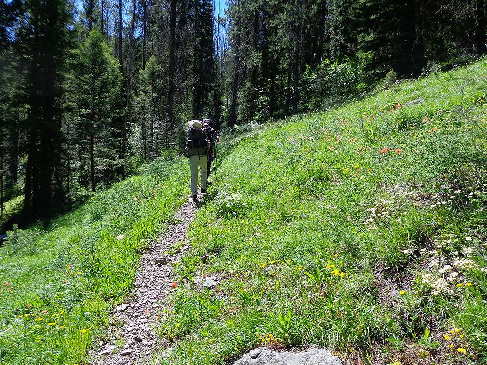
I left Boise at 5am, met John (and Ruby) and Dave in McCall, then a quick stop in Yellow Pine to pick up Jeff. From there, we drove up and over Profile Gap and made it to the Lick Creek trailhead and were hiking by 11am.
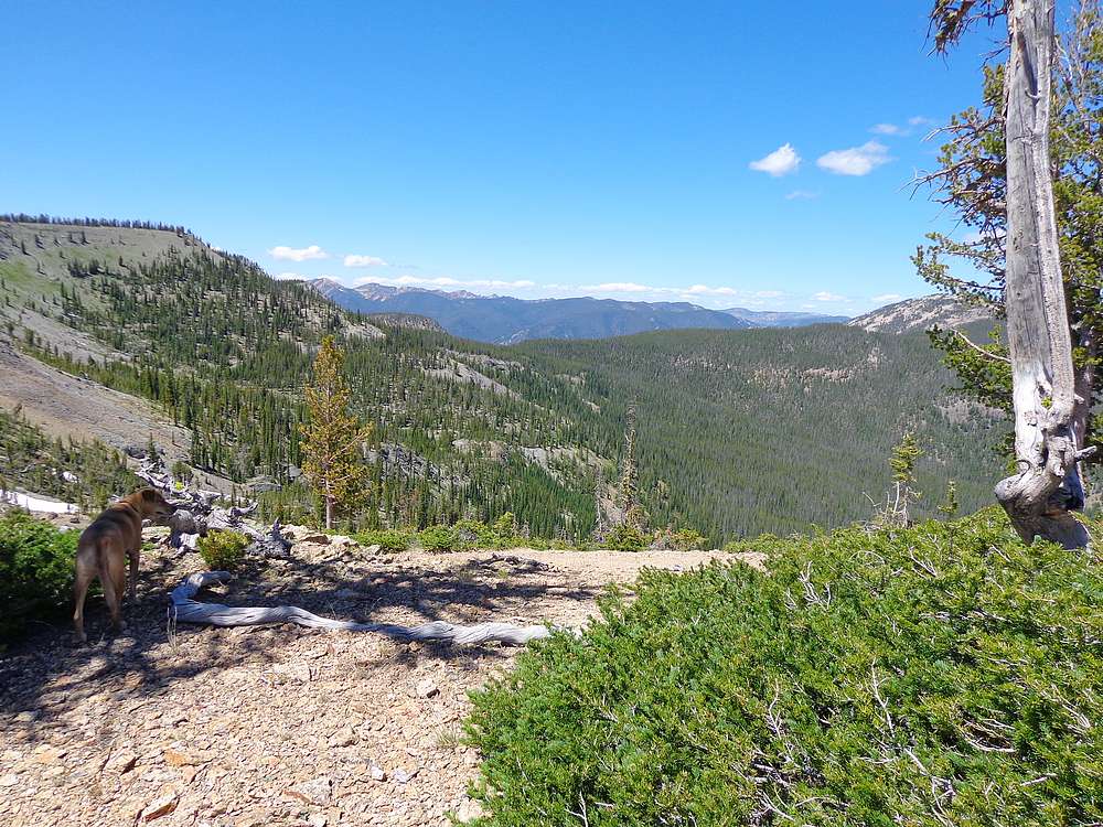
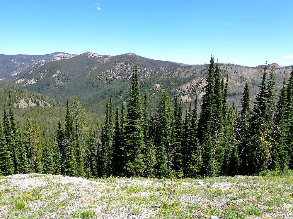
It was a beautiful morning to be in the mountains. The trail started uphill in a hurry, but fortunately it was mostly shady as we made our way through the forest. After 3 miles and 2500’ of climbing, the views opened up after crossing a saddle above marble creek. Not long after, the trail crested divide with big views looking south into Cougar Basin.
 The trail drops from the divide, and then re-climbs to Bear Lake. But we decided to go cross-country up and over Cougar Peak instead since it was similar distance and elevation gain. No obstacles on the way up Cougar Peak, and we enjoyed the views from the summit before continuing along the ridge to a saddle west of Bear Lake. At this point we split up, with John and Dave descending to find a campsite, and Jeff and I continuing south to tag another peak. The trail drops from the divide, and then re-climbs to Bear Lake. But we decided to go cross-country up and over Cougar Peak instead since it was similar distance and elevation gain. No obstacles on the way up Cougar Peak, and we enjoyed the views from the summit before continuing along the ridge to a saddle west of Bear Lake. At this point we split up, with John and Dave descending to find a campsite, and Jeff and I continuing south to tag another peak.
From the saddle west of Bear Lake, Jeff and I set our sights on Peak 8803’ (“Bum Creek Peak”). From a distance, we couldn’t tell if the rock ridge would be doable. We went south briefly, then southwest toward the peak. Once on the east ridge, we could see the climb was going to work out and we were on the summit shortly thereafter.
 We were pretty pooped by the time we backtracked to the saddle where we’d dropped our big packs. But looking down at the unnamed upper lake (John dubbed it “Ursa Minor”), we could see the others had set up camp on the east side of the lake, so not too far to go. After descending to the lake, setting up camp, and having some dinner, we all settled in for a well-deserved night of sleep. We were pretty pooped by the time we backtracked to the saddle where we’d dropped our big packs. But looking down at the unnamed upper lake (John dubbed it “Ursa Minor”), we could see the others had set up camp on the east side of the lake, so not too far to go. After descending to the lake, setting up camp, and having some dinner, we all settled in for a well-deserved night of sleep.
Day 2 – Center Mountain Ridge
The objective for day two was a long hike along the ridge to Center Mountain. If things went well, we’d be able to tag a total of four peaks. After breakfast, we donned daypacks and hit the trail. First dropping 200’ cross-country to Bear Lake, and then dropping another 400’ down the trail to a wildflower filled meadow.
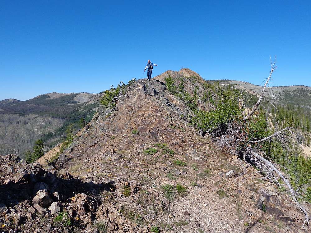
 After climbing the 800’ up to the divide, we expected to find a trial heading east to Center Mountain, but had to just follow our noses instead. Soon enough, Peak 8421’ came into view. The pointy summit looked interesting, and ended up being a fun scramble, in particular the descent of the rocky east ridge. After climbing the 800’ up to the divide, we expected to find a trial heading east to Center Mountain, but had to just follow our noses instead. Soon enough, Peak 8421’ came into view. The pointy summit looked interesting, and ended up being a fun scramble, in particular the descent of the rocky east ridge.
Once down off the first peak, we did actually find a good stretch of ancient trail to guide us through the forest, just in time to head cross country up Peak 8860’. We climbed the mellow south slopes of this peak, with had great views looking over the steep north face toward Snowslide Peak.
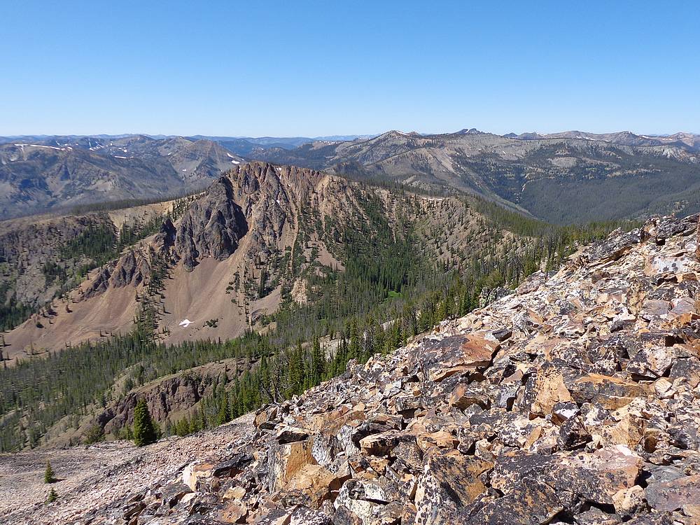
 Next up was Snowslide Peak, which we dubbed “the best lunch spot in Valley County”. Hard to disagree with great views in all directions from the summit of this rugged peak. From here, Center Mountain was calling use, but we were a bit short on water, for Ruby in particular. So John and Dave reluctantly headed back, while Jeff and I continued along the ridge. Next up was Snowslide Peak, which we dubbed “the best lunch spot in Valley County”. Hard to disagree with great views in all directions from the summit of this rugged peak. From here, Center Mountain was calling use, but we were a bit short on water, for Ruby in particular. So John and Dave reluctantly headed back, while Jeff and I continued along the ridge.
After a few careful moves descending from Snowslide, Jeff and I continued onward to Center Mountain. We were treated to some excellent views looking north from the summit, with layers and layers of ridges spread out in the distance. We could also see evidence there had once been a lookout on the summit, so it was fun to sit in the shade and soak in the views while pondering the history of this summit.
On the way back, we were able to top off our water bottles on from a stream flowing from a melting snowfield, which gave us energy for the long 8 mile hike back to basecamp. We made it back to camp tired but satisfied.
Day 3 – Ridge walk South of Catherine Lake, Cougar Peak Stargazing
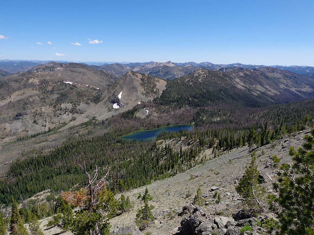
With a couple big days already complete, day 3 was more flexible depending on our motivation levels. Our first objective was “Cougar Basin Peak”, which forms and impressive backdrop to the basin. After descending to the saddle south of Bear Lake, were we were able to find an old trail that headed up to the saddle south of the peak. The views from the saddle were fantastic, and even better views from the summit.
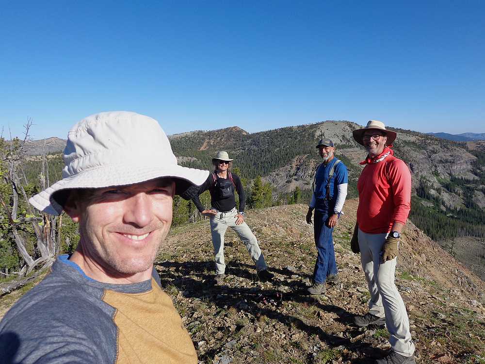
 Next, we headed south along the ridge, and surprisingly the trail mostly did too. After several ups and downs, we climbed to the summit of Peak 8979’. Now it was decision time. We had passed a couple lakes down in the basin below us that looked enticing. But there was also another peak further along the ridge. So we split in our normal groups again and parted ways. Dave and John would try their luck fishing the lakes, and Jeff and I would try for the peak. Next, we headed south along the ridge, and surprisingly the trail mostly did too. After several ups and downs, we climbed to the summit of Peak 8979’. Now it was decision time. We had passed a couple lakes down in the basin below us that looked enticing. But there was also another peak further along the ridge. So we split in our normal groups again and parted ways. Dave and John would try their luck fishing the lakes, and Jeff and I would try for the peak.
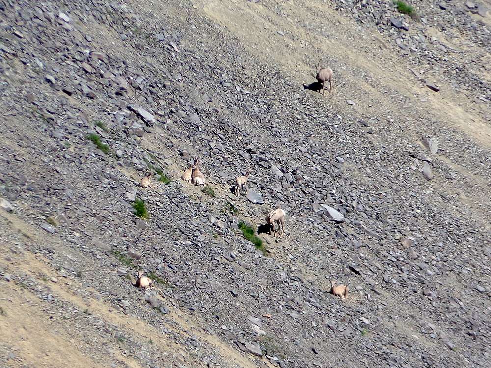
Jeff and I made good time headed south, with a brief stop to check out a herd of bighorn along the way. From the southernmost point on the ridge, we could see a rocky spine that would need to be dealt with as we curled around the basin to the northeast. All in all, that section went well, and added some adventure to an already adventurous day.
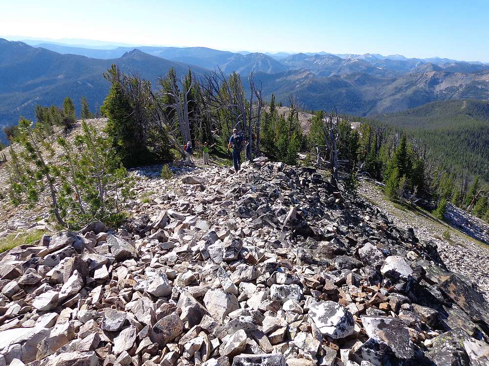
It was getting warm by the time we reached Peak 8840’, so lunch in the shade was a welcome break. But we couldn’t rest long since we still had six miles of backtracking to cover before getting back to camp, grabbing dinner, and preparing for the grand finale of the day.
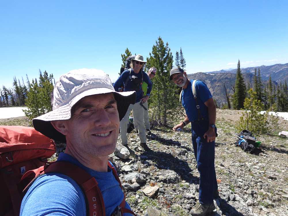
 Dave is quite the photographer, and came up with an idea to camp on top of Cougar Peak the last night of our trip. It offered us a chance for unobstructed views of the Comet Neowise, the milky way, a gazillion starts. So after dinner, we broke camp and made the climb to the top of Cougar Peak. Dave is quite the photographer, and came up with an idea to camp on top of Cougar Peak the last night of our trip. It offered us a chance for unobstructed views of the Comet Neowise, the milky way, a gazillion starts. So after dinner, we broke camp and made the climb to the top of Cougar Peak.
Other than a few mosquitos (OK, a ton of mosquitos), this was an amazing experience. Dave woke us at midnight, and were up for over an hour checking out the stars. Truly fantastic and memorable to say the least. (See Dave’s page for exceptional photos.)
Day 4 – Marble Mountain, Lick Lake, and back to the trailhead
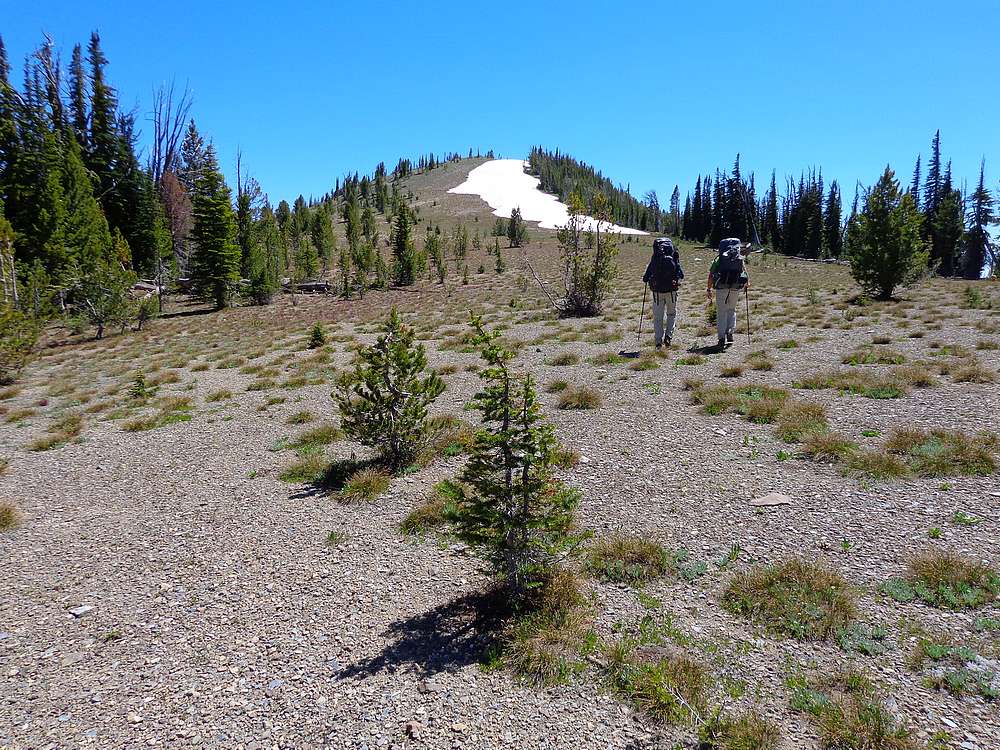
The mosquitos were still thick when we woke up, so we decided to descend down Cougar Peak a ways for a trailside breakfast. After breakfast, we made our way along the trail to the saddle above Marble Creek. Here we dropped our packs and set sights on Marble Mountain, the final peak of the trip.
 The ridge leading to Mable Mountain was gentle and forested for the most part. Closer to the summit we emerged from the trees for some great views, and some snowfields for Ruby to cool off in. The summit was a great place to survey all the ground we’d covered the prior three days. Big country! The ridge leading to Mable Mountain was gentle and forested for the most part. Closer to the summit we emerged from the trees for some great views, and some snowfields for Ruby to cool off in. The summit was a great place to survey all the ground we’d covered the prior three days. Big country!
 From Marble Mountain, we backtracked to the trail saddle, and then descended to Lick Lake for a lunch break and a little fishing. Now all that was left was the hike back to the trailhead. Our barking dogs (hot feet, not Ruby) were relieved when we were back to the truck and had wrapped up the hike. From Marble Mountain, we backtracked to the trail saddle, and then descended to Lick Lake for a lunch break and a little fishing. Now all that was left was the hike back to the trailhead. Our barking dogs (hot feet, not Ruby) were relieved when we were back to the truck and had wrapped up the hike.
It had been an amazing four day adventure. Great to get to know some new friends, and explore new terrain. The main highlight for me was midnight stargazing from a mountain top. My total stats added up to almost 53 miles hiked and 17,000 feet of elevation gain. Oh yeah, and 10 peaks summited!
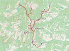
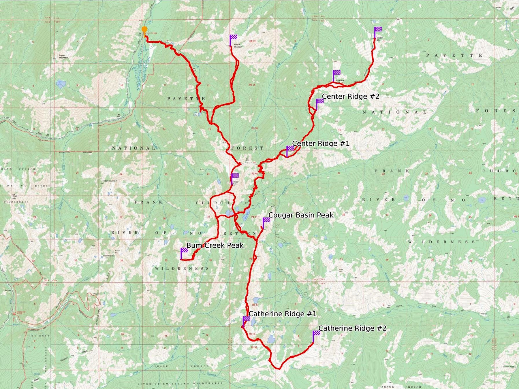
Map of the route, 53 miles and 17000' gain round trip. We spent 4 days and 3 nights. |
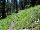
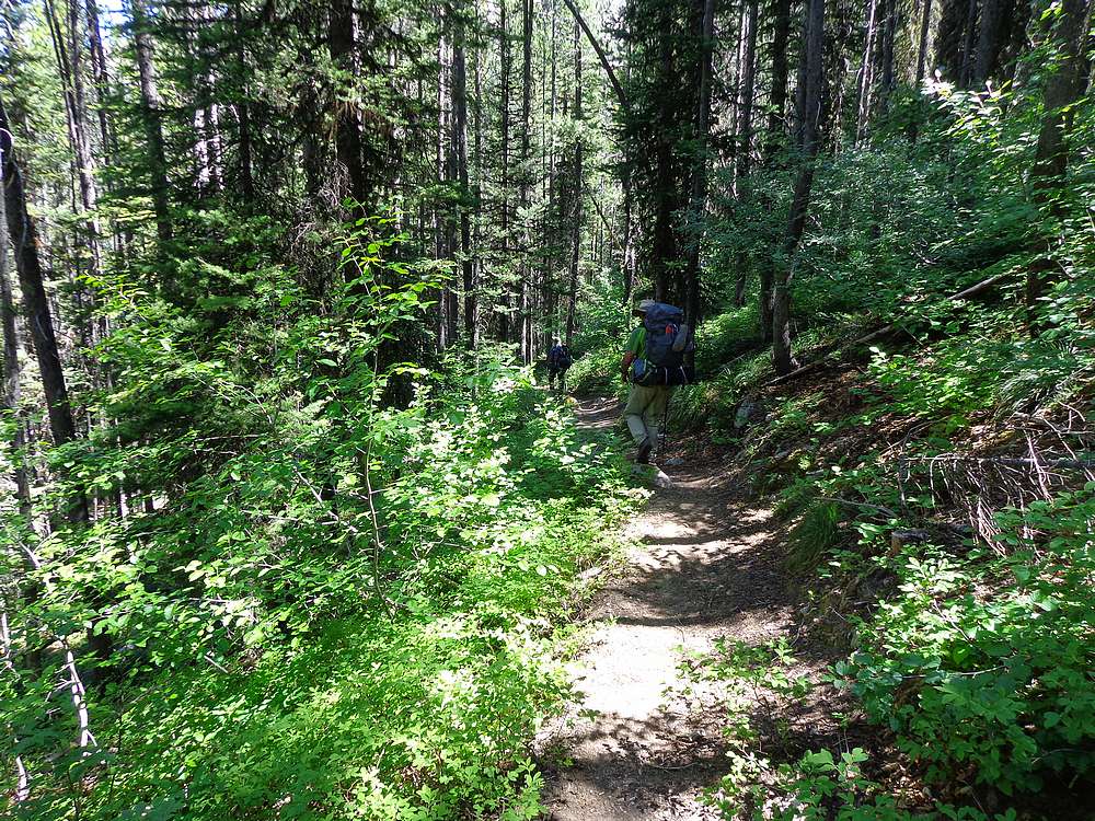
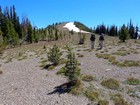
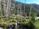
Early in the hike up Lick Creek. |
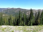
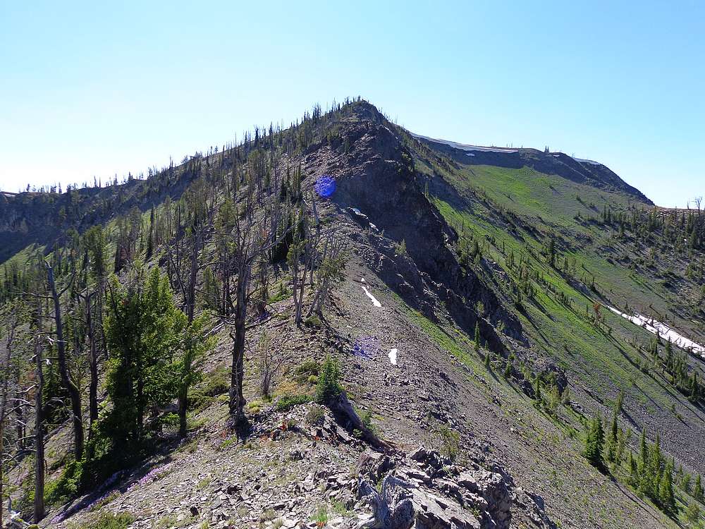
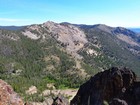
Center Mountain Ridge above the Marble Creek drainage. |
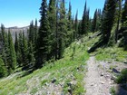
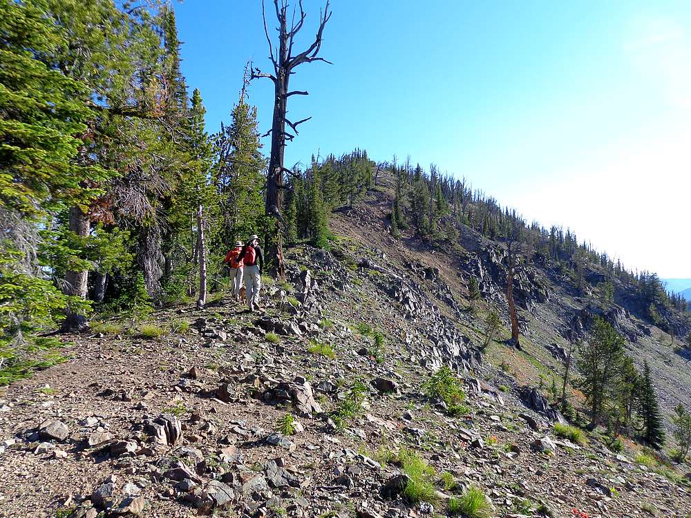
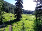
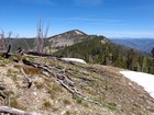
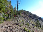
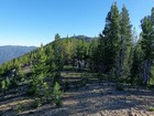
The trail was very scenic, especially up high. |
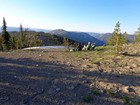
Ruby looking back on the saddle above Marble Creek. |
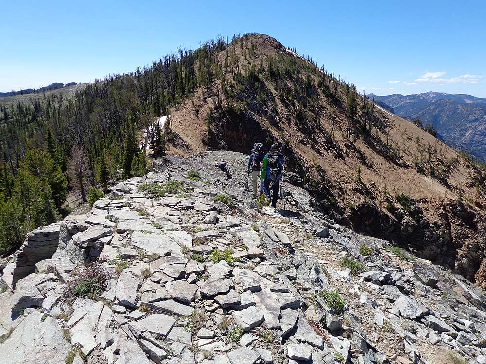
Heading up Cougar Peak. |
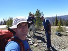
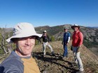
Group shot on the summit of Cougar Peak. |
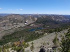
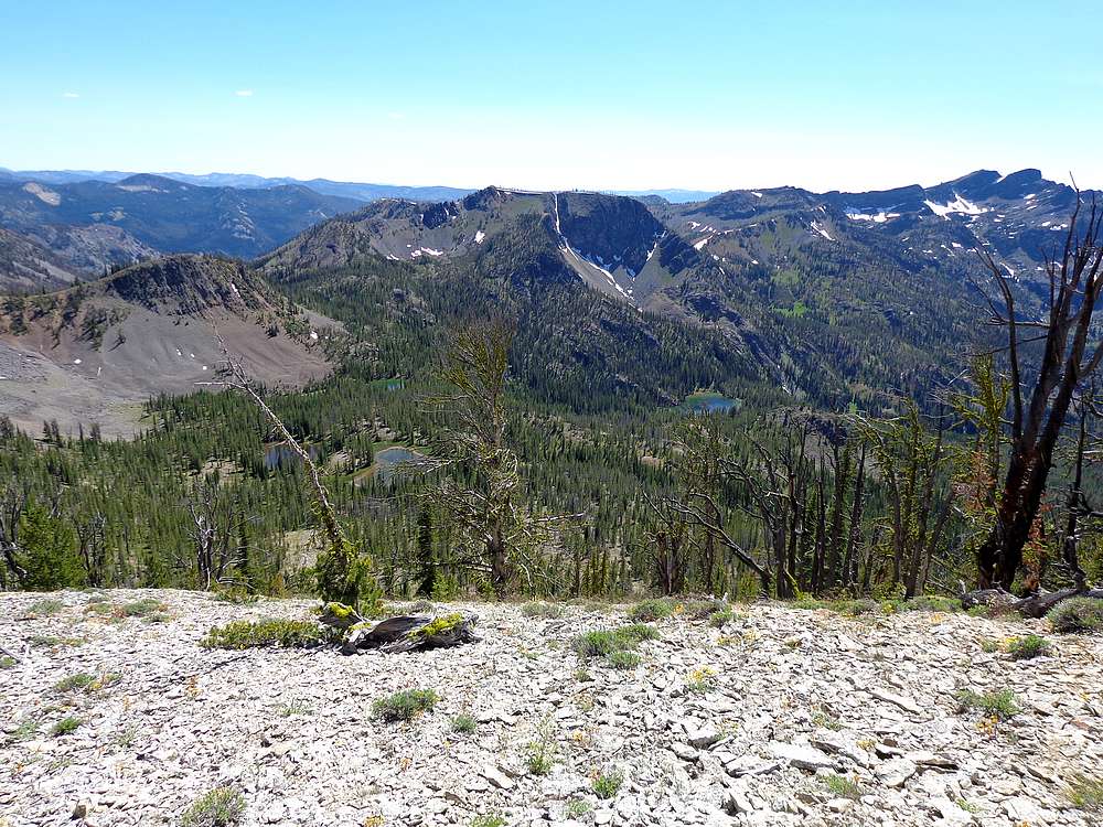
Bear Lake from Cougar Peak. |
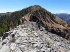
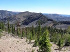
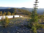
Circling the ridge above Cougar Basin. |
"Bum Creek Peak" just above skyline, The Needles are on the right. |
Looking down that Cougar Basin Lakes from the saddle to the west. |
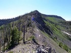
East ridge of Bum Creek Peak. |
Nearing the summit of Bum Creek Peak. |
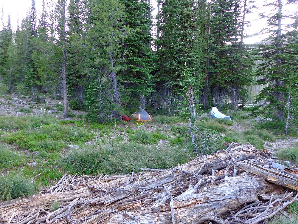
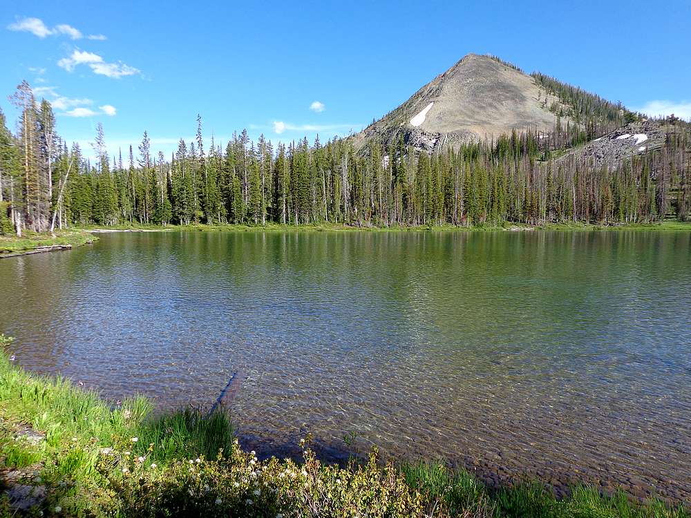
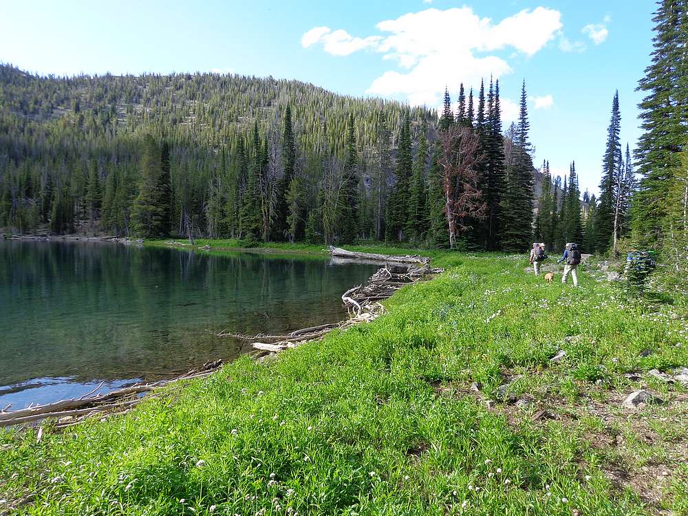
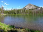
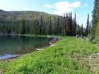
Our camp for two nights at "Ursa Minor", smaller lake above Bear Lake. |

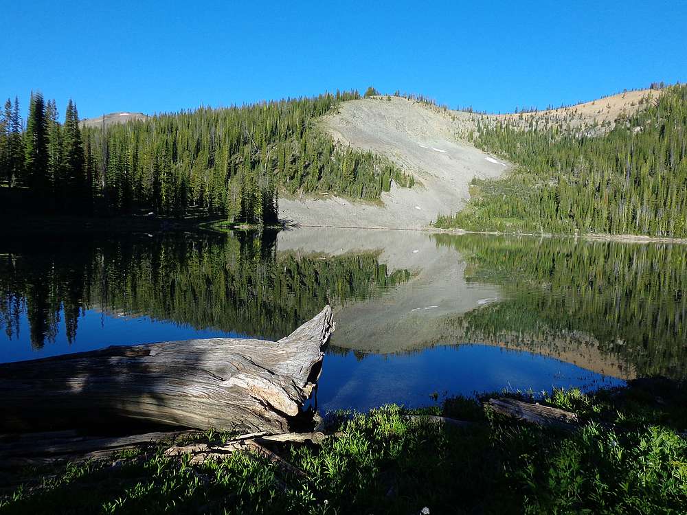
Morning reflection on the lake from near our campsite. |
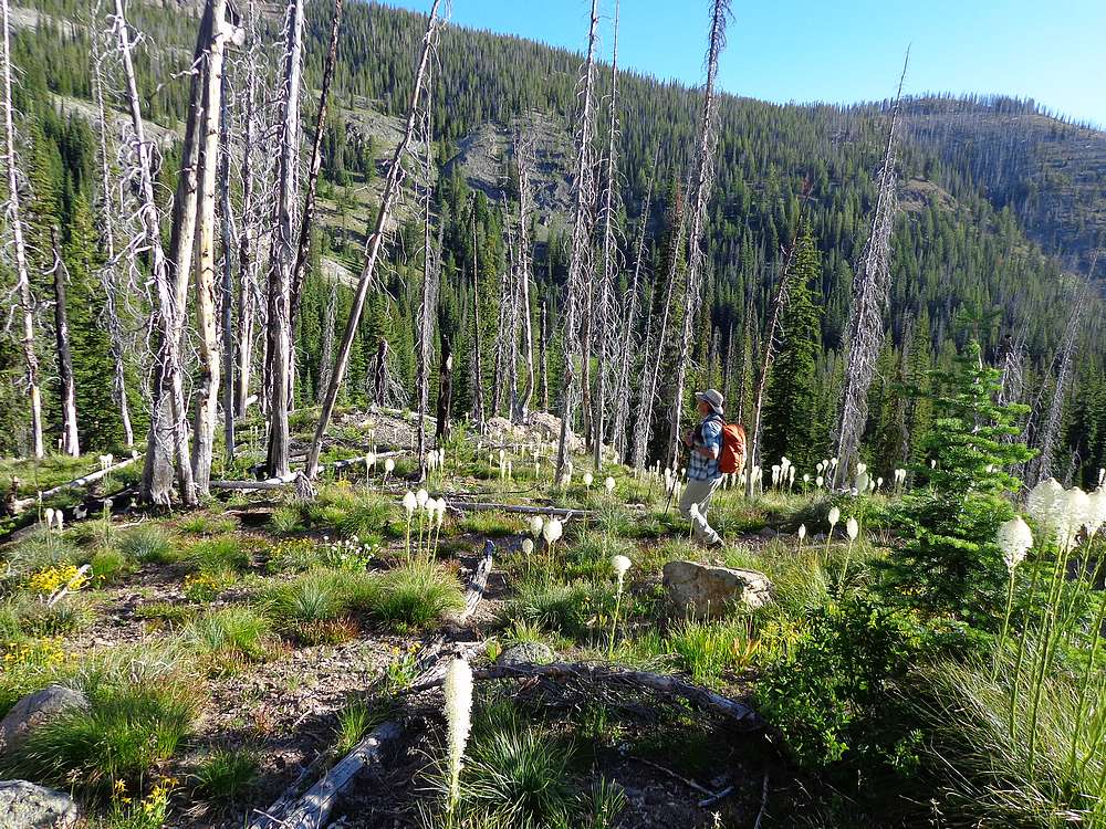
Descending through bear grass below Bear Lake. |
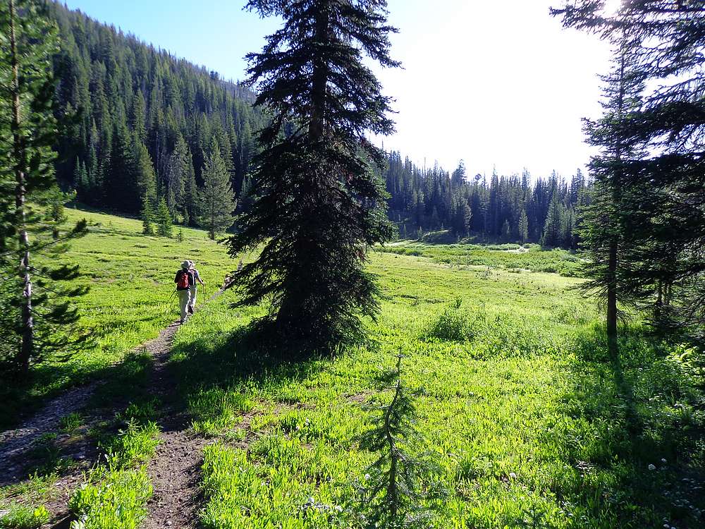
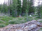
Pretty meadow near the Catherine Lake trail junction. |
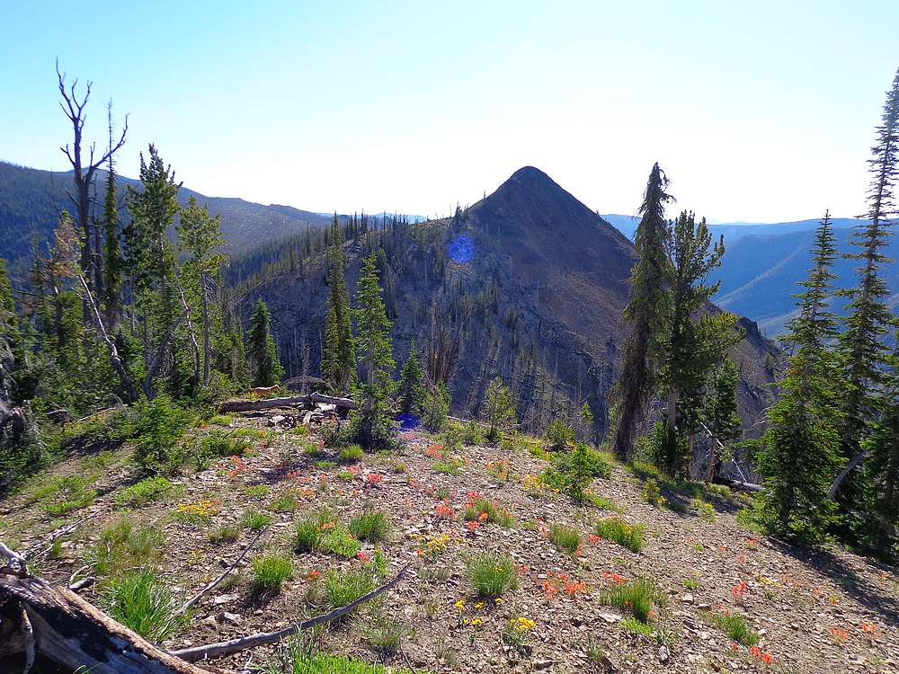
Wildflowers and the pointy first peak on the ridge to Center Mountain. |

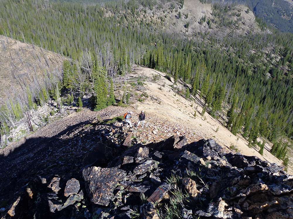
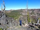
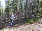
Contemplating the scramble section on the pointy peak. |
Tiptoeing down the pointy peak. |
Rare area where we could actually find the Center Mountain trail. |
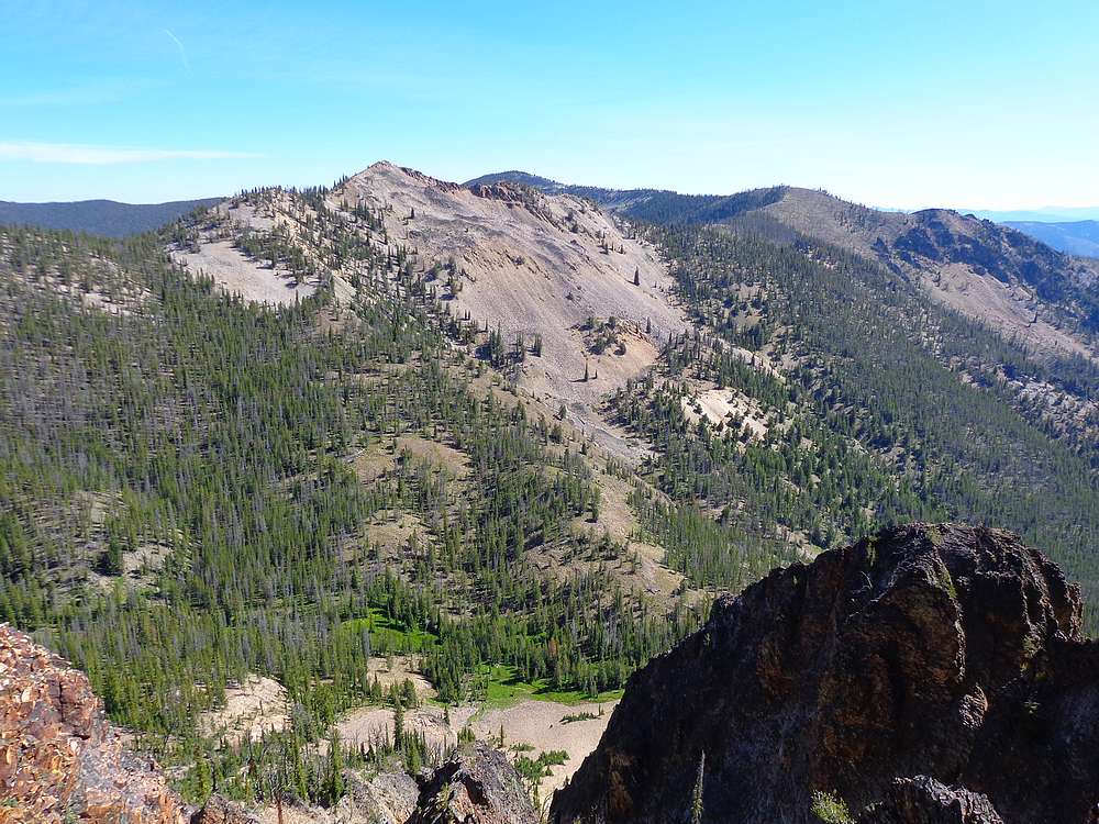
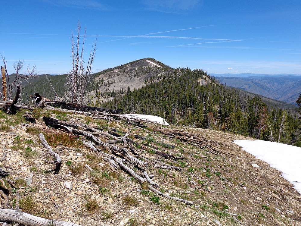
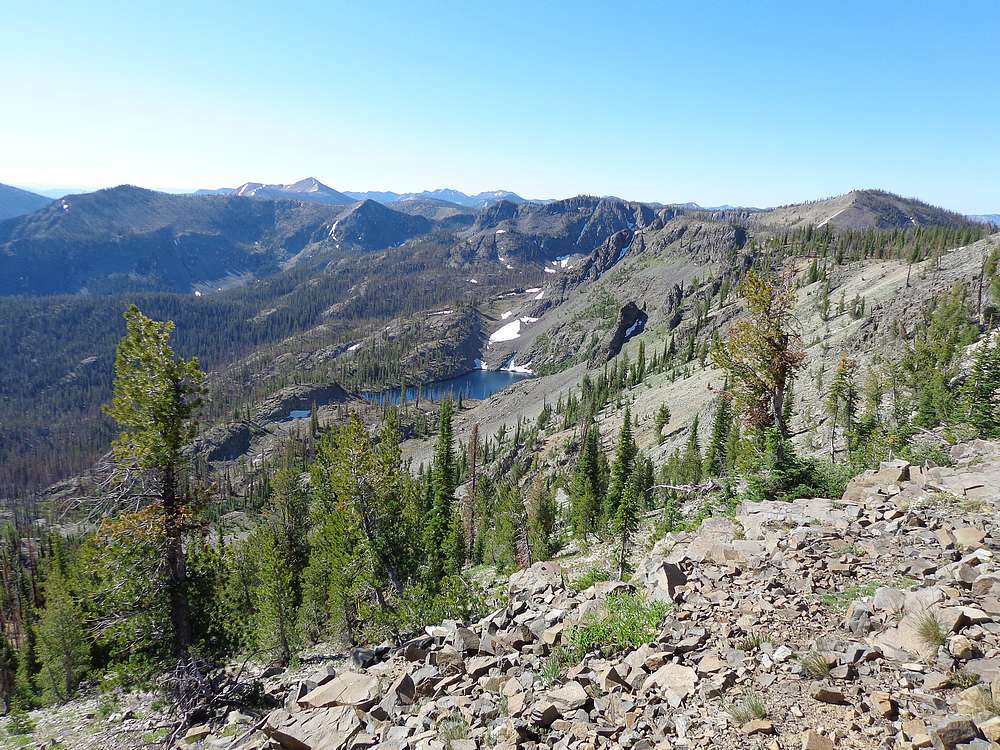
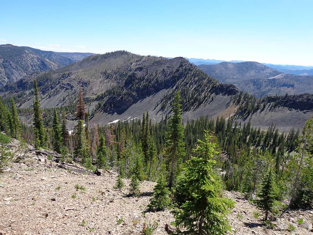
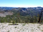
Looking northeast from Peak #2 toward Snowslide Peak and Center Mountain. |
Snowslide Peak summit view. Peak #2 looks impressive from this angle. |
Heading toward Center Mountain. |
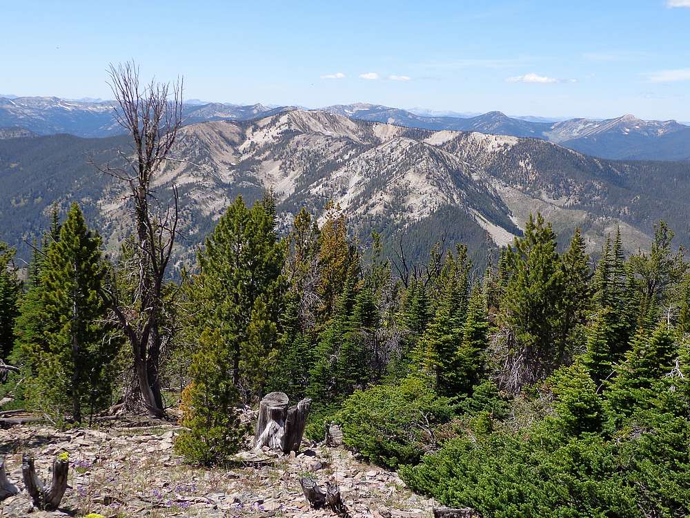
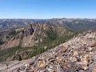
Layers and layers of mountains visible from Center Mountain. |

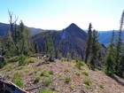
Marble Mountain from Center Mountain. |
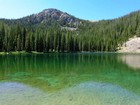
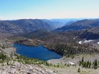
Cougar Basin Peak from Bear Lake. |
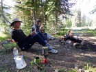
Enjoying some dinner and witty (in our own minds) conversation. |
Heading up Cougar Basin Peak from the south. |
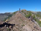
Group shot on the summit of Cougar Basin Peak. |
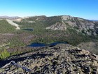
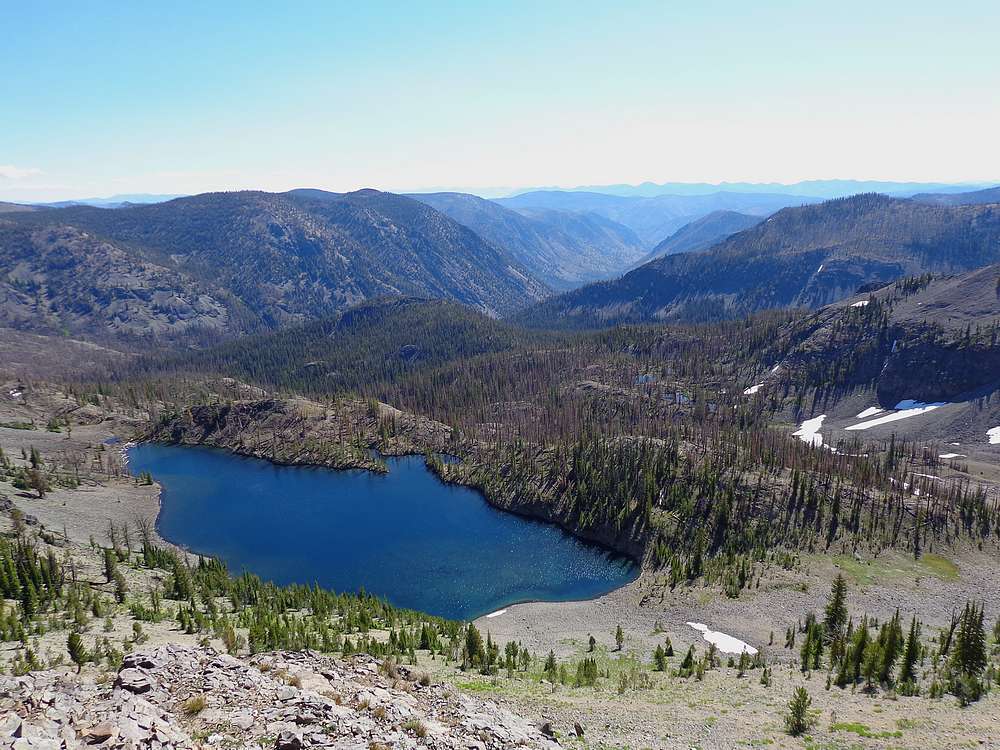
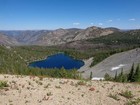
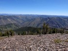
The lakes in Cougar Basin from Cougar Basin Peak. |

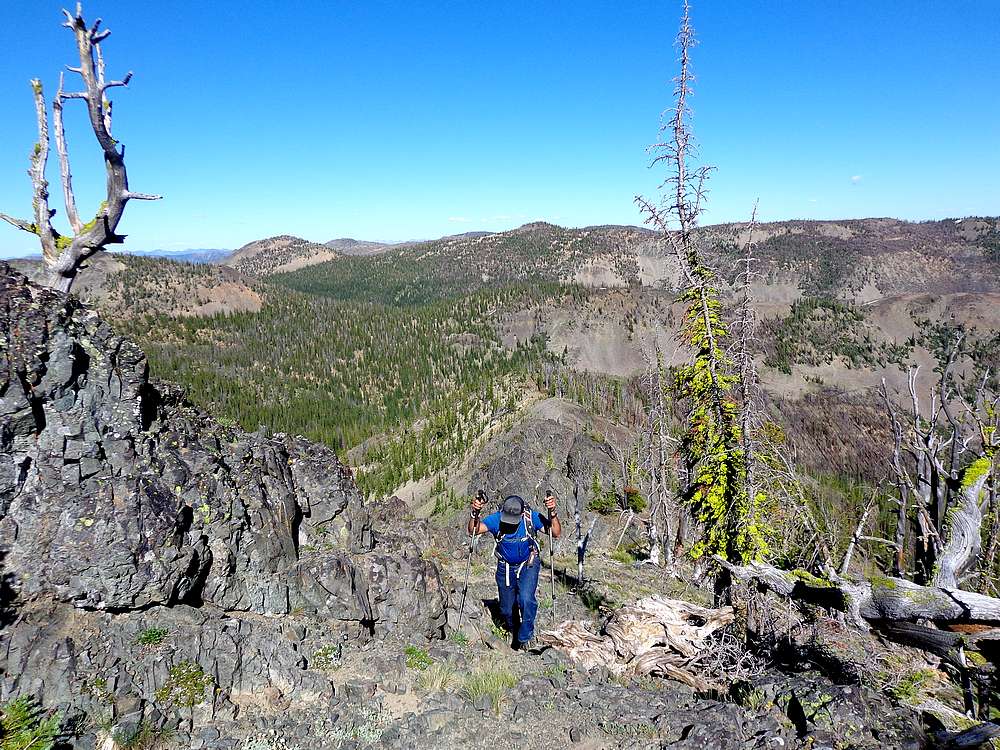
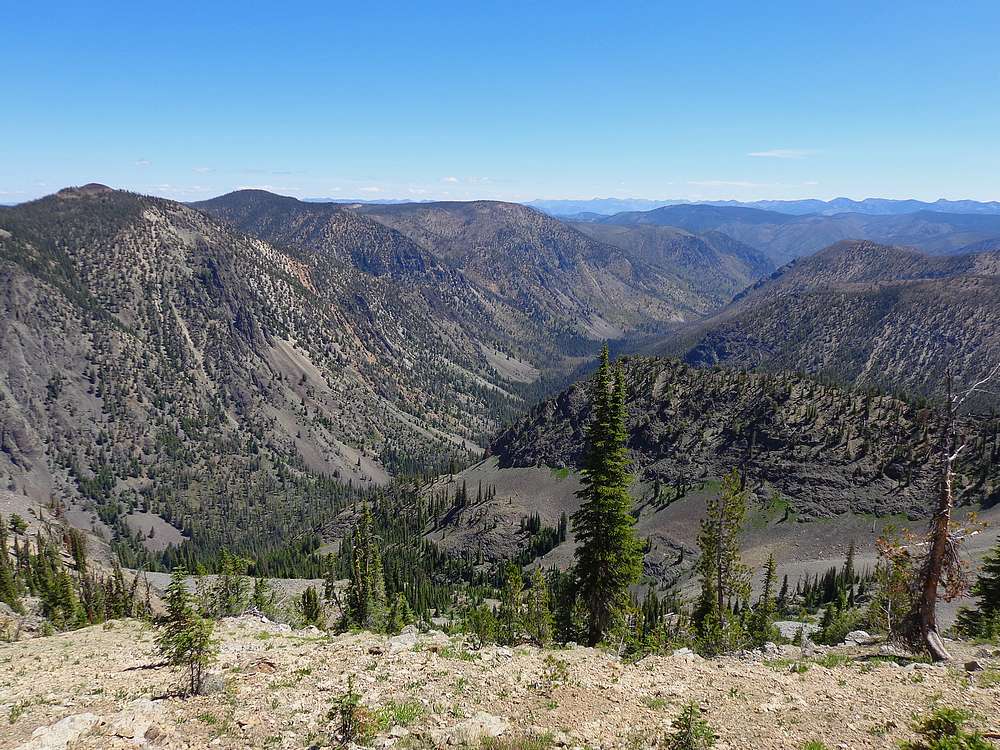
Rugged terrain at the headwaters of the West Fork Monumental Creek. |
Looking up Peak 8979'. |
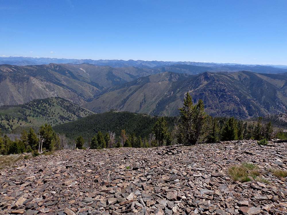
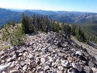
Summit view from Peak 8979' looking down the West Fork Monumental Creek. |
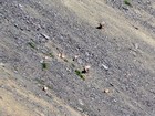
Group of bighorn sheep lounging above one of the lakes. |
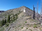
View toward Peak 8840'. |

Summit view from Peak 8840' looking down the West Fork Monumental Creek. |
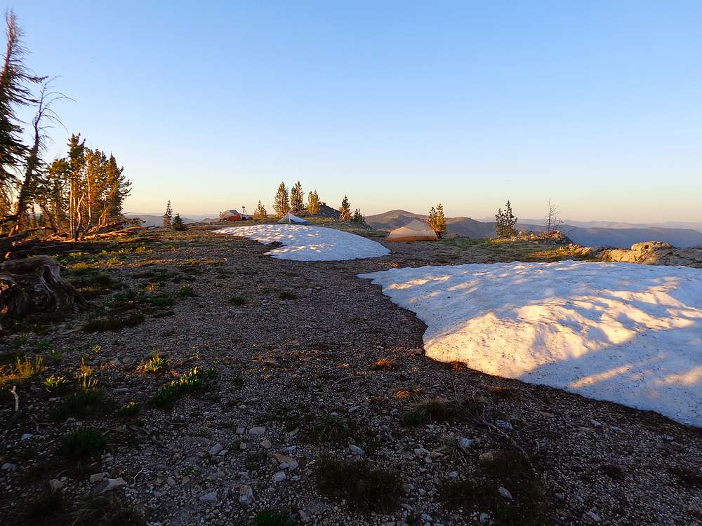
Leaving the lake after dinner to head up Cougar Peak. |
Settling in to watch the sunset from Cougar Peak. |
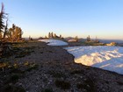
Our camp on the summit of Cougar Peak. |
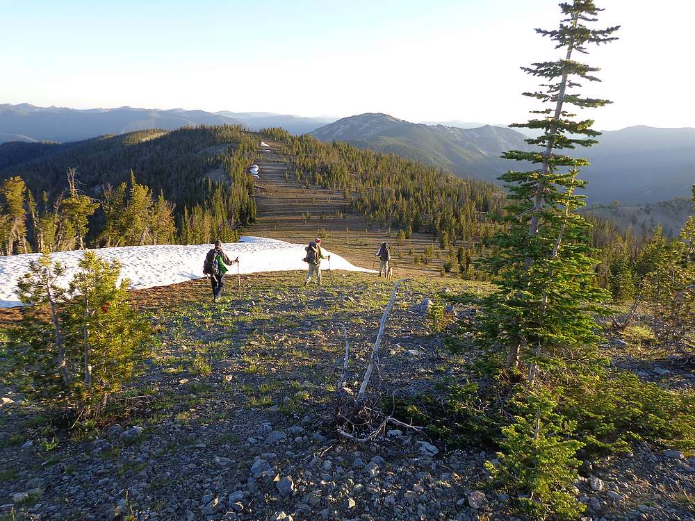
Morning descent from Cougar Peak. |
Making our way along the ridge to Marble Mountain. |
Leaving the summit of Marble Mountain. |
Lick Lake. |
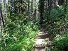
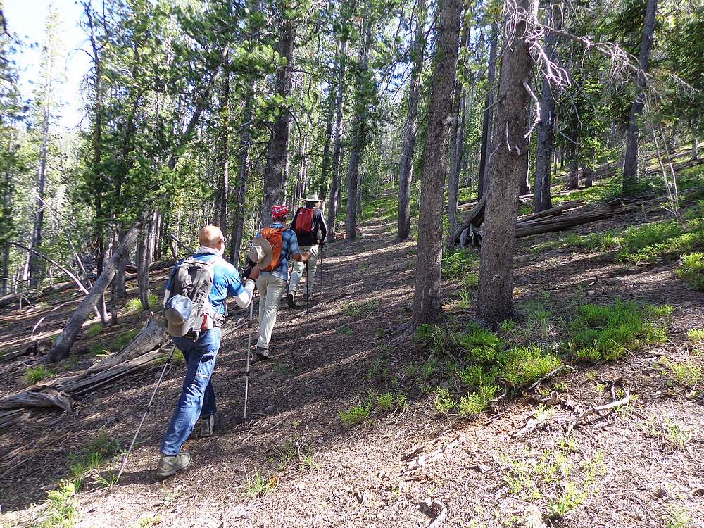
Heading back to the trailhead. The trail is steep but shady. |
|
|
|