|
Curtis Lake is located in the Boise National Forest, east of the town of Cascade. Its about 6 miles round trip to reach the lake, which makes for a good day hike, or a nice short overnight backpacking destination. The trail is unique in that it’s not a maintained Forest Service trail. It is a little faint and hard to follow in a few sections, which adds to the adventure. In most places there is an abundance of surveyors flagging hanging on branches to mark the way. The trail is a good mix of sun and shade, and there is plenty of scenery along the way to this seldom-visited lake.
I was looking for a good overnight backpacking trip to do with my sons, ages 6 and 8. Ideally it would be a lake at least two miles one way, but less than 1000 feet of elevation gain. I found Curtis Lake from one of Scott Marchant’s Hikers Guides, and it met the criteria perfectly.
After a two and a half hour drive from Boise, we were on our feet and hiking by about 5 pm. The first part of the hike is on an old jeep road that is starting to grow over. (It is now closed to motor vehicles.) One of the steeper sections of the entire trip is just as you leave the trailhead. As I was sweating my way up that section, I was thinking it might be about time the boys start carrying some of their own weight. With three sleeping bags and a 4-person tent, my pack for these short father-son trips now weighs in at over 50 lbs, and is so tall that its looks like we must be going on an expedition trek to Everest basecamp or something.
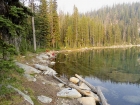
The views early in the hike were very nice, with just enough late season wildflowers left to add some color. We even had a chance to watch two large hawks soaring above us on the updrafts. After about three-quarters of a mile, the jeep road ended, and we entered the trees, with plenty of colored flagging marking the way. The trail descends briefly, then climbs again for a while up to about 7800’ before making a steep descent down to a very scenic small lake. The boys and I took a nice break here, checking out the lily pads and the numerous frogs living in the lake.
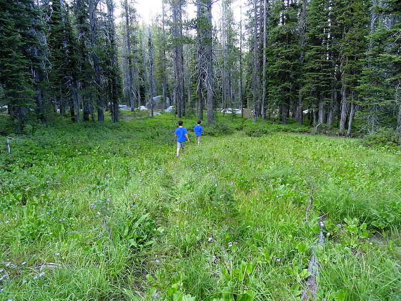
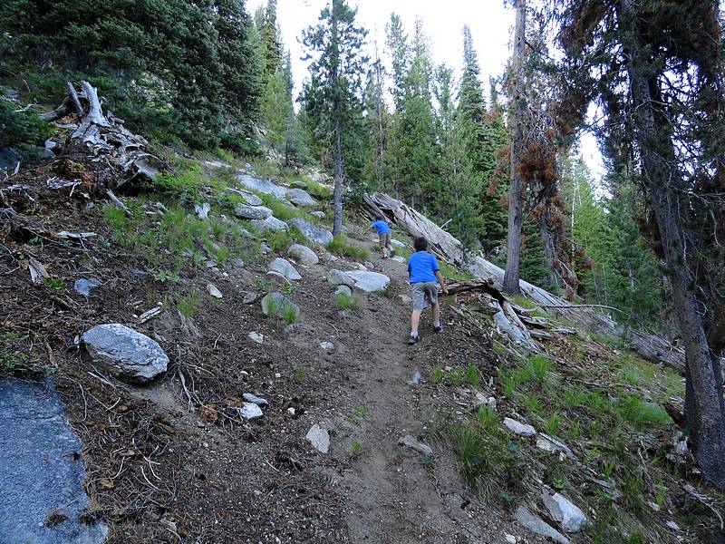
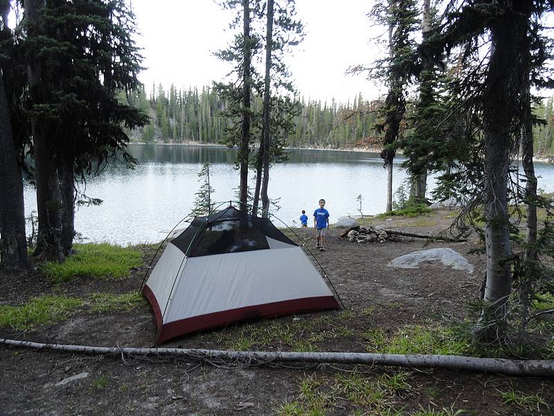
After our break, we continue along the mostly flat trail, which weaved its way through some nice open meadows. Soon enough we were descending again, and the trail was kind of hard to follow, but there were just enough flagging to keep us on course. Eventually we got to the base of the steep section leading up the hillside toward Curtis Lake. The boys motored their way up, in spite of having to grab on with their hands in a few places to keep from sliding down. Then we got to hillside overlooking the lake. The good sized round lake is encircled by forest for the most part, but there are several good campsites and we chose one on the south side of the lake. While I set up the tent, the boys had great fun throwing rocks in the lake. Then it was time to turn in, and we stretched out in the tent waiting for the stars to come out. I think we may have even seen a few before dozing off.
We awoke to a cool morning with some forest fire smoke that had drifted in during the night. After partaking of some homemade muffins that mommy had sent with us, we discussed our return hike options. It was decided that we’d take a cross-country route back to the car, and climb Alpine Mountain along the way. It was the same distance and only slightly more elevation gain as the trail. It would be a little extra work because of the bushwhacking, but would be well worth it with the great views and a summit adventure.
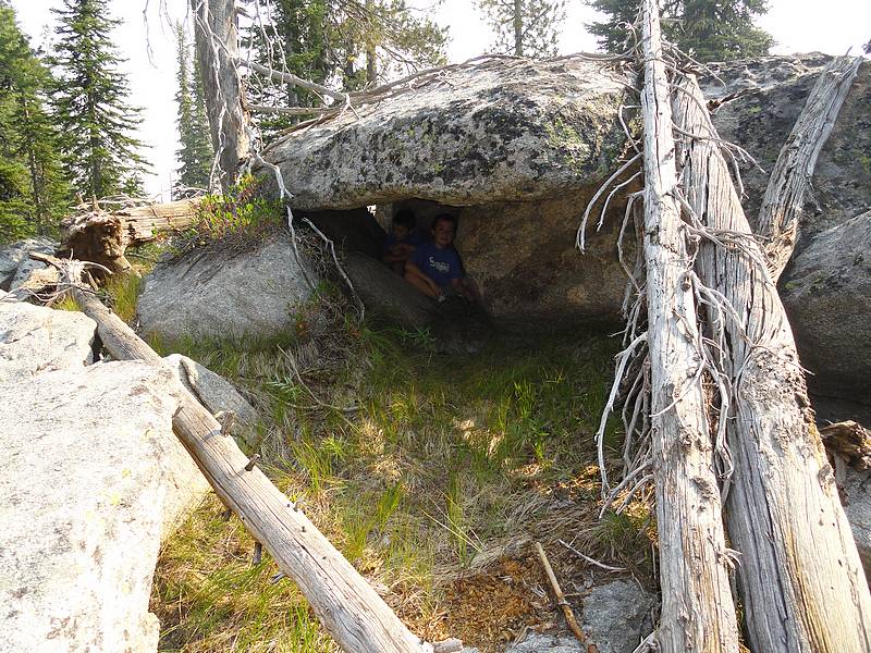
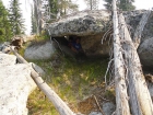
So up the trail we went, veering off into the forest to the west instead of descending down into the valley. The undergrowth was thin and the bushwhacking was easy as the boys took turns leading the way up the ridge. There were a couple false summits along the way, one of which had a cool cave under a granite slab that kept us entertained for a while. After about a mile of cross-country travel, we made it to the summit of Alpine Mountain. On the summit, we didn’t have great views because of the smoke, but we did find a great place for a granola bar break and a brass benchmark from 1953. We were also joined by a big hawk that swooped in and landed on a dead tree just across from us. I’m sure it was coming in for a closer look to see what the ruckus was about. You’d think the bird had never seen a summit celebration before…
Probably the hardest section of the trip was the ridgeline south of Alpine Mountain. There were quite a few small rock towers that we had to get around, and the slopes on either side of the ridge were pretty steep, so our pace was slowed. We found a nice shady grassy shelf on the hillside that made for a good lunch spot. We all agreed that were almost certainly the first humans to ever stop and cook quesadillas in that exact spot.
After lunch, it was a little more sidehill treachery, then back to the ridgetop for easier going. Pretty soon we were angling our way through the forest around point 8007’, and then down to rejoin the trail. The boys took quite a few rest stops from this point on as the afternoon sun beat down on us, and tapped our remaining strength after the exhaustive bushwhacking. But we made it back to the car in good spirits. Our spirits got even higher after stopping for ice cream on the way home.
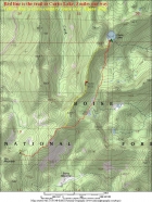
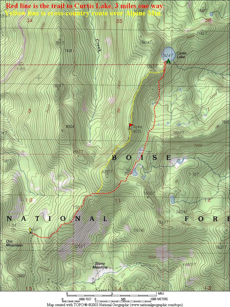
Map of our route, 6 miles round trip 1500' of gain. |
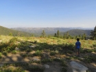
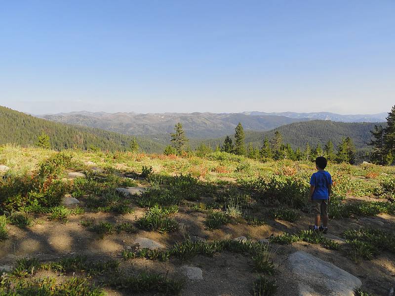
Great open views early in the hike.
|
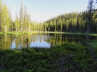
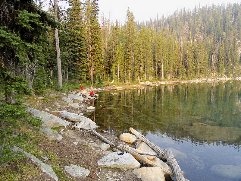
This small lake along the way made for a great rest spot.
|
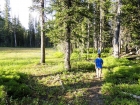
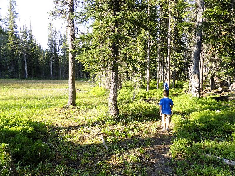
Hiking through the forest next to a meadow.
|
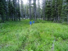
More meadows along the trail.
|

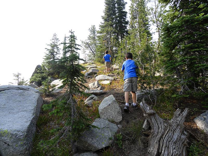
Making the steep climb up to Curtis Lake. |
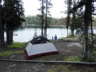
Our campsite at Curtis Lake. |
Playing by the lake in the morning. |
Taking a shady break on the ridge. |

Nearing the summit of Alpine Mountain. |
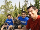
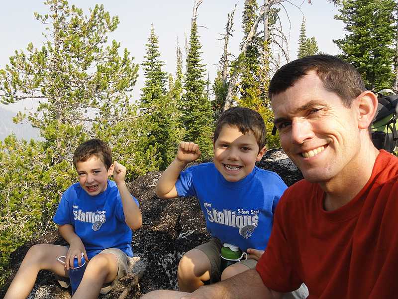
Summit celebration.
|
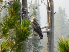
Close up of a hawk that landed on a nearby snag. |
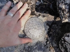
Benchmark from 1953.
|
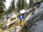
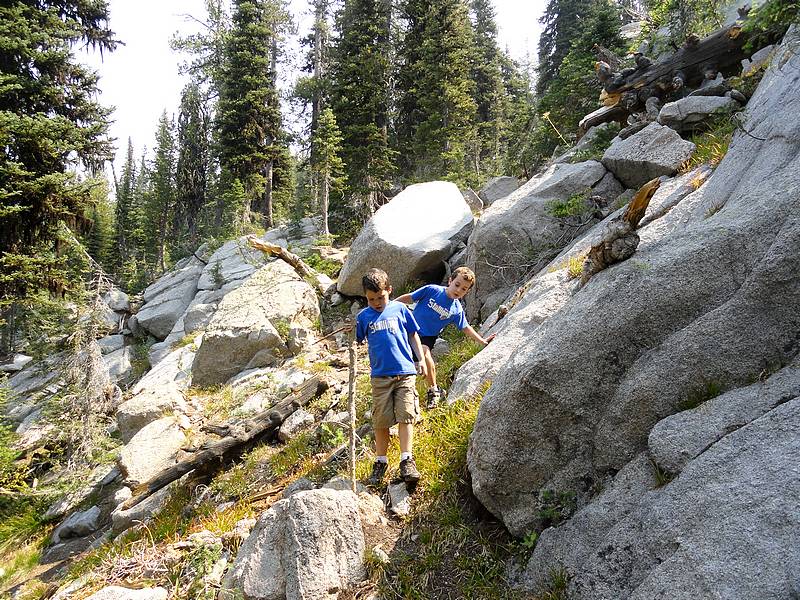
Navigating a rocky section south of Alpine Mountain. |

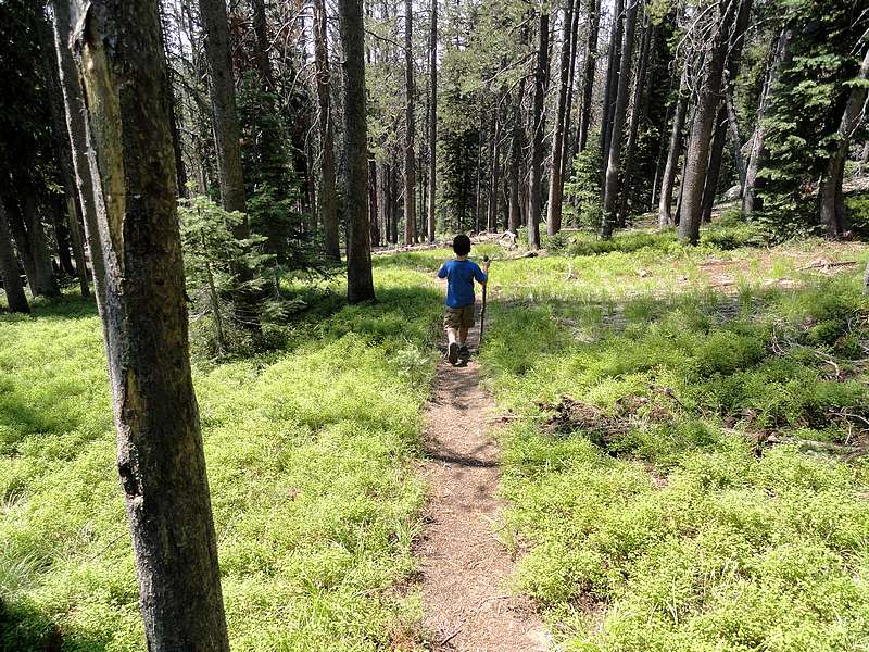
Back on the trail heading home.
|
|