|
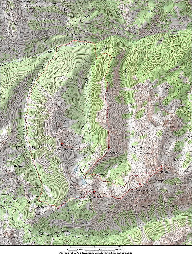
The “Germania Divide” is a group of 13 unnamed peaks at the southern edge of the White Cloud Mountains, on the fringe of the Boulder Mountains. This pocket of peaks forms a divide between the Germania Creek drainage to the north, and the East Fork Salmon River to the south. These obscure peaks are highly scenic but seldom climbed, which make them a great place to go for some solitude. My goal for this solo trip was to visit three new ten-thousand foot peaks at the west end of the divide, and maybe add in a couple other repeats peaks too.
After a four-hour drive from Boise, I reached the Galena Gulch trailhead at about 11pm Saturday night. Along the way I’d stopped to take some low-light photos of the orange glow of the Halstead forest fire burning outside of Stanley. It was pretty surreal. Fortunately, there was little to no smoke in the White Clouds. After a good night of sleep in the back of the Durango, I was up by 5:30. But I wasn’t alone. A couple archery hunters pulled up on trail bikes and parked a short distance away. They didn’t have their headlamps on, but I could hear them wading through the underbrush to find the trail. They didn’t say a word, probably hoping I was headed elsewhere. So after a quick breakfast, I hit the trail at a brisk pace. It was a bit eerie knowing my silent companions were somewhere out in the dark in front of me. After a couple miles I caught up with them, and they were less than thrilled that my headlamp had apparently scared off a bull elk they were stalking. After a short discussion, they let me pass by. A short time later, I spotted a 6-point bull elk in an open meadow ahead of me. It hung around for at least 5 minutes before wandering off into the timber, and would been a pretty easy target for my camo-covered companions. I don’t hunt, and don’t have any problems with folks who do, but I was glad the elk survived another day.
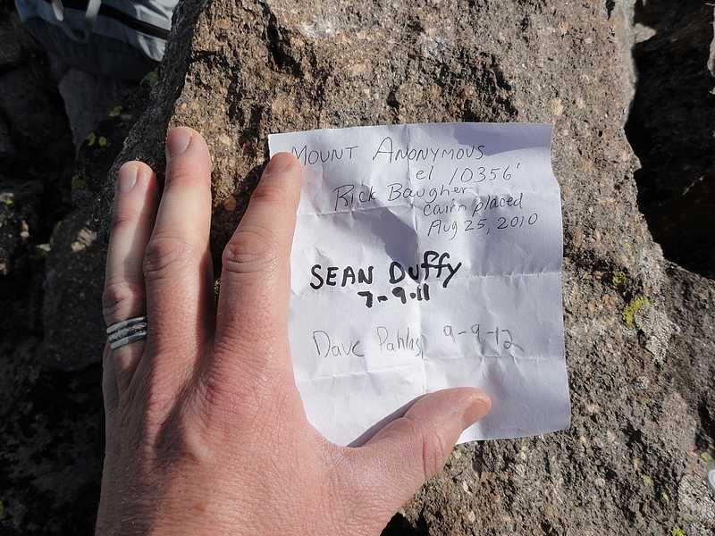
Soon enough I reached the end of the valley at the top of Galena Gulch, and the trail made a couple steep switchbacks to the southwest before angling back to the east. Once at the saddle above the East Fork Salmon River, I left the trail and headed west through open country, making the short hike to the small lake just west of Simpson Peak (Peak 10378’). From the lake I angled north to the saddle overlooking Deer Lakes, then followed the ridge to the summit of Simpson Peak. In spite of how easy this peak is to reach, there was only one other signature in the register since Splattski and I had climbed the peak almost four years earlier. After taking in the views for a short while, I made a quick scree descent down the west ridge. It was open country and easy traveling for the next half-mile until I reached a crumbling rock tower at the base of the east ridge of Mount Anonymous (Peak 10356’). Both sides of the tower looked loose and treacherous, but I chose the north side since it looked slightly less steep. It ended up being not quite as bad as it looked, and I was back on the ridge in about ten minutes. Next was a short climb to the broad summit area, where I found a cairn and a register with two entries from familiar names.
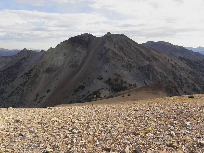
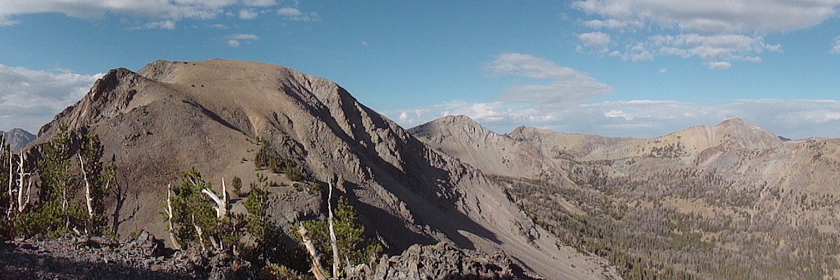
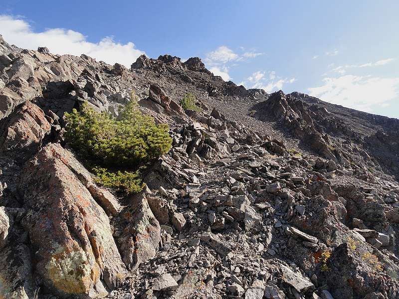
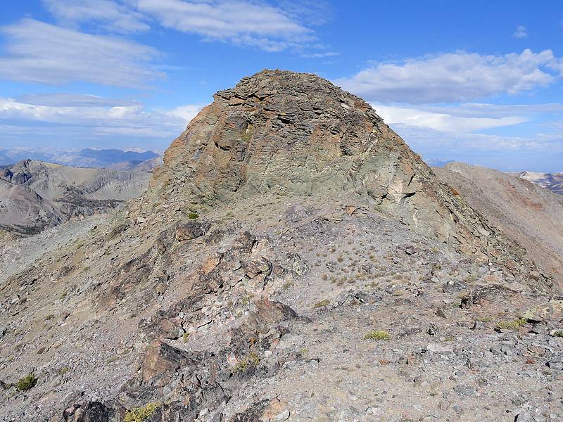
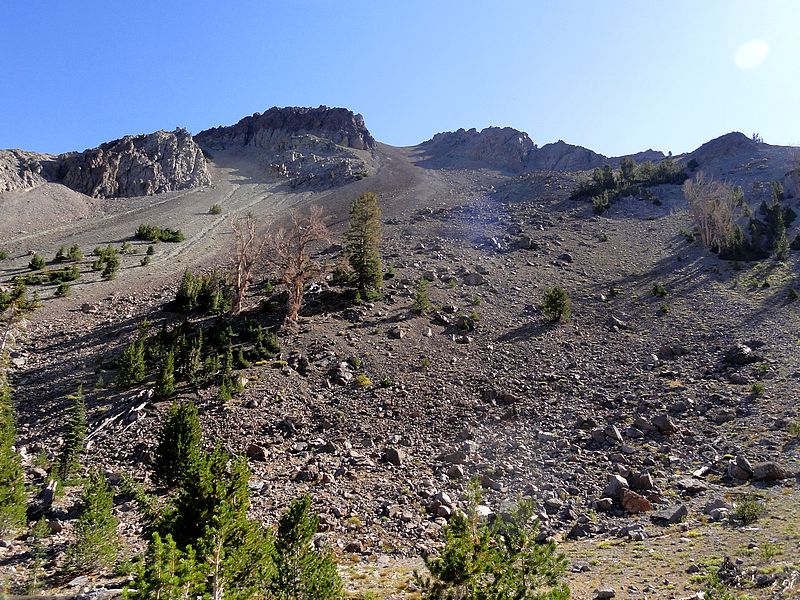
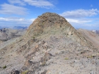
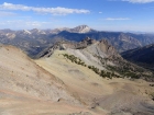
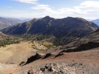
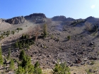
From Mount Anonymous, I studied the approach to my next objective, Alta Peak (Peak 10640’), which is guarded by scree and talus on both its west and south sides. I also spotted a group of four mountain goats down in the saddle between the two peaks. So with camera in hand, I started hiking down toward them. They showed surprisingly little interest in me until I was within about 50 years of them, at which point they got up and wandered off away from the ridgeline. After a short snack break, I decided to tackle the south side of Alta Peak, away from the gigantic scree gully that defines the west side of the peak. Fortunately there were a few goat trails to follow, but the rock was very loose and the going was slow. Before not too long I reached the 10621’ point elevation, followed by a short fun class 3 scramble up the summit block. Again I found a register with the same two familiar names. The summit of Alta Peak was a great vantage point for viewing Castle Peak, Glassford Peak, and the other peaks on the Germania Divide. But I couldn’t linger for long, since I still had quite a bit of ground to cover.
The huge scree gully made for a quick thousand-foot descent off of Alta Peak. My next target was Deer Lakes. I wanted to contour around the valley, trying to minimize the elevation loss. It looked like the 9600’ contour was about where I needed to be. So I side-hilled my way around Mount Anonymous toward the headwaters of MacRae Creek. I started finding faint game trails after a while, which made for a little easier progress. In the end, I only had to climb about 300 feet up to Deer Lakes, where I stopped to pump some water and eat a PB&J.
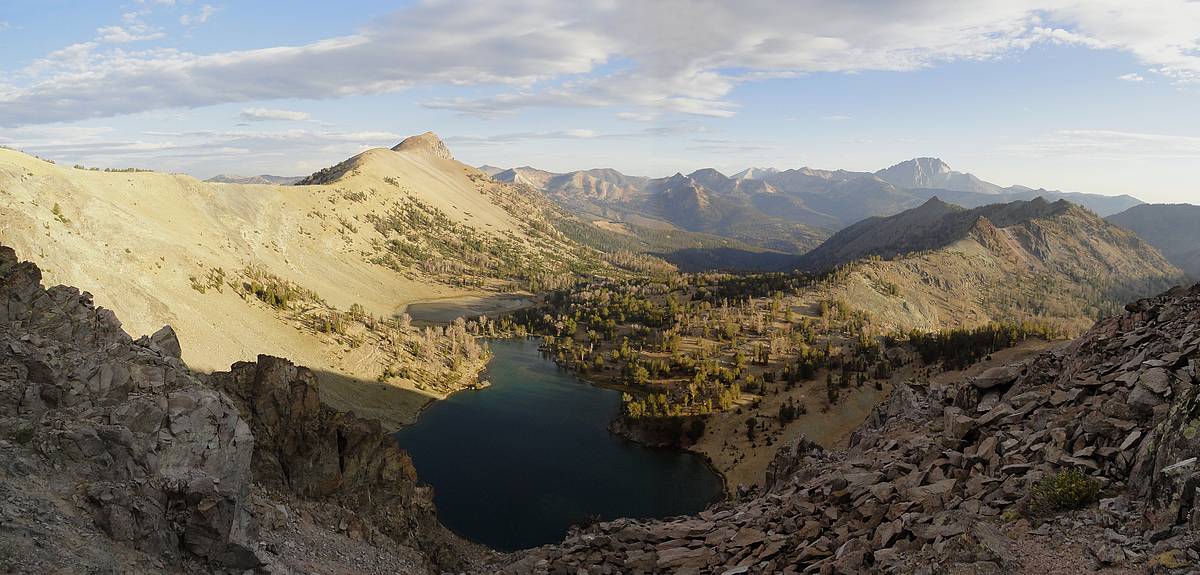
Deer Lakes is a very scenic setting, with very little sign of human disturbance. Simpson Peak and the adjacent cliffs make for a beautiful backdrop. And the fish jumping in the clear lake made me wish I had my pole with me. After lunch, I packed up and started toward the final summit of the day, MacRae Peak (Peak 10008’). The peak is the highpoint of the ridge between MacRae Creek and Deer Creek, only about 400’ above Deer Lakes. The ridge starts off pretty broad, but gets narrower on the way to the summit. I ended up contouring around a few cliffy areas along the way. Once on the summit, I found “no sign of prior summit visitation”, but I suspect hunters or fishermen had probably climbed it previously since it is less than a mile from Deer Lakes.
At about this time I started hearing thunder in the distance, with black clouds starting to roll in from the west. So I hustled down the ridge, anxious to get to some terrain that was a little more protected from the weather. The rain came in the form of light but steady drizzle. Luckily in only lasted about 20 minutes, just long enough to make me a little soggy. No worries though, it was all downhill from here.
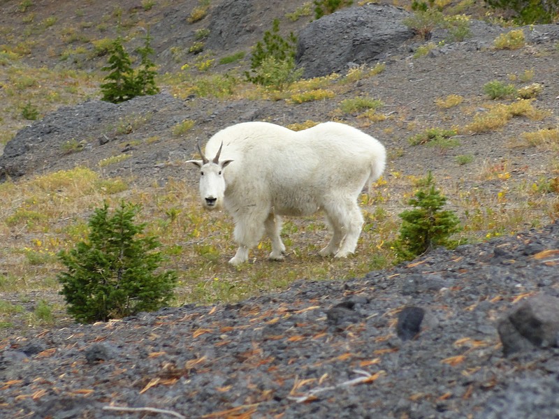
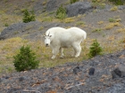
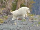
While descending the ridge, I was lucky enough to meet a mountain goat not more than 20 yards in front of me. He didn’t see me at first, and I was able to get quite a few photos of him. Once he did see me, he took his time clearing a path for me. We stared each other down for a while, and at one point he actually took a couple very slow deliberate steps straight toward me. I got the feeling he wanted to let me know who was actually in charge of the situation. Eventually he sauntered slowly away, off the ridge out of site. He was probably the burliest goat I’d seen, and definitely the longest encounter I’d had with a goat at that close of range. A very cool experience.
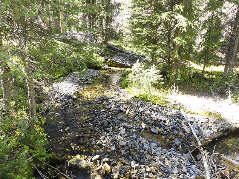
But the clock was ticking, and I still had some ground to cover. I continued down the ridge. It was open terrain at first, but as I got down into the trees there was quite a bit of brush and deadfall to deal with. Further down, I was able to follow an elk trail for a while, which made for easier travel. But it didn’t last long, and I was soon back into dense brush and a ton of deadfall. It was very slow going for a quarter mile or so until I popped out of the trees and reached the Germania Creek trail. The trail was a welcome sight, and I cruised back to the car.
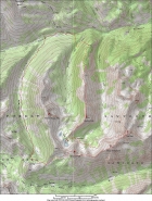
Map of the route, done counter clockwise. 15 miles round trip with 5200 elevation gain. |
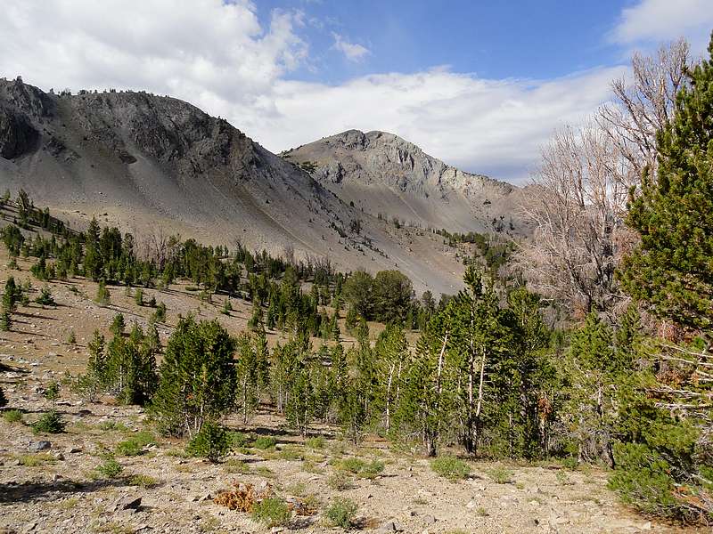
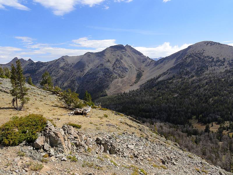
Gladiator Peak and the Boulder Mountains from the western slopes of Simpson Peak. |
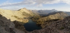
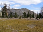
View looking down at Deer Lakes from the west ridge of Simpson Peak. |
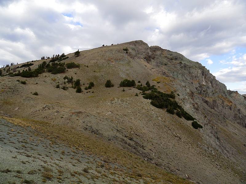
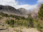
Looking back on the gentle east ridge of Simpson Peak. |

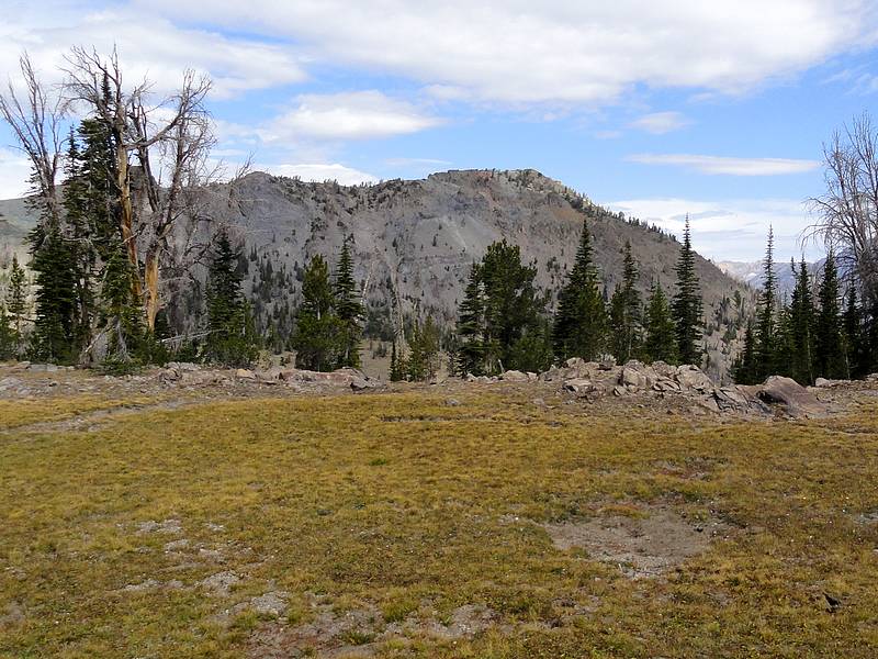
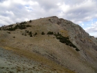
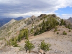
Alta Peak from Mount Anonymous. |

Mount Anonymous summit register. |
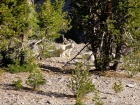
Goats resting in the saddle between Alta and Anonymous. |
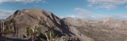
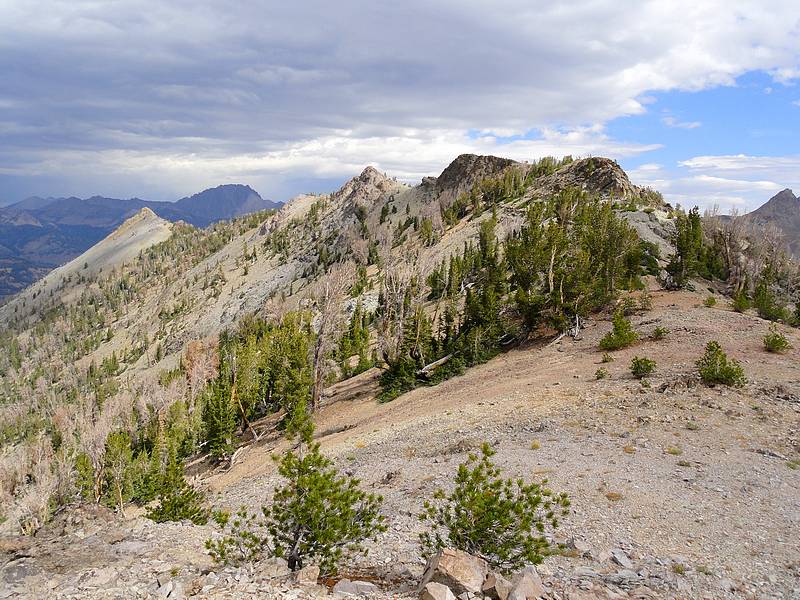
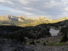
Panoramic view west from the lower slopes of Alta Peak. |

Scree covered southwest face of Alta Peak. |
Fun class 3 summit block of Alta Peak. |
Alta Peak summit register. |

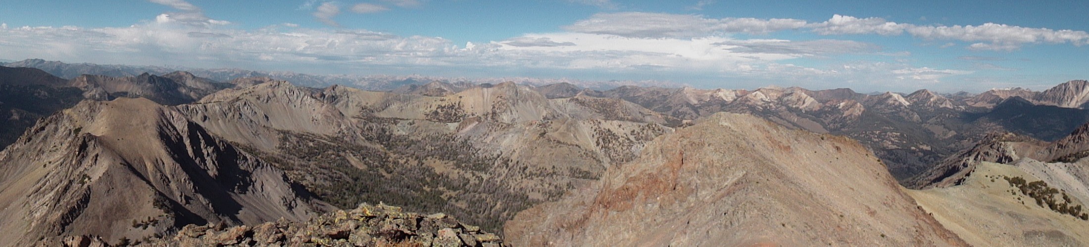
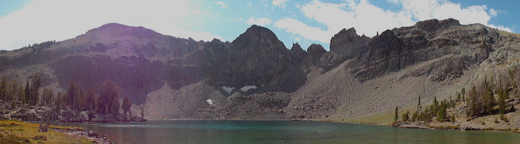
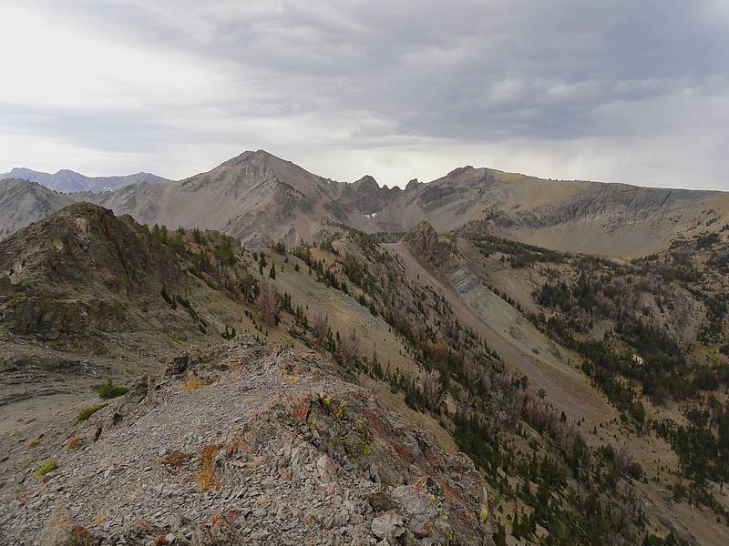
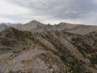
Alta Peak summit pano, spanning from Anonymous to Castle. |
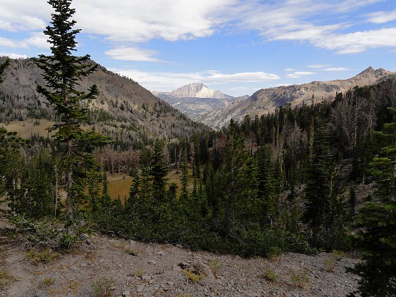
The headwaters of Alta Creek, Castle Peak in the background. |
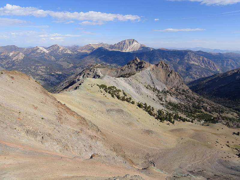
Mittel Germania Peak (10705') from Alta Peak. |
This scree gully on the west face of Alta Peak made for a quick descent. |
East face of Simpson Peak from the valley below. |
Southeast face of MacRae Peak from across the valley. |

Good view of Castle Peak above MacRae Creek. |

Simpson Peak above Deer Lakes. |

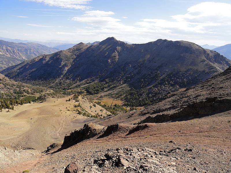
Alta Peak from the south ridge of MacRae Peak. |
View toward the summit of MacRae Peak, Castle Peak in the background. |
Storm brewing behind me over Simpson Peak. |
Mountain Goat posing, 20 yards away. |
Probably the burliest mountain goat I've seen. |
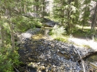
Deer Creek meandering through the trees. |
|