|
Thompson Peak
Thompson Peak is the tallest mountain in central Idaho’s Sawtooth Range. It’s an attractive and distinctive looking summit that is visible from both the valley floor and other surrounding mountains. Thompson’s summit spire is easily distinguishable amongst the other tall peaks that form the skyline of the Sawtooths. Because of its status as a range highpoint and close proximity to the very popular Redfish Lake, Thompson definitely see’s is share of visitors. But an attempt to climb this peak shouldn’t be taken likely. It is a long hike requiring off-trail navigation skills, and some exposed scrambling en route to the summit.
Thompson had been high on my wish list for quite a while, so when Sean suggested it as we bantered around ideas for peak to climb, I was immediately interested. Plus there are a handful of other nearby peaks that can be combined with Thompson to create a multi-peak day. The main appeal for Sean was Anna’s Pinnacle, which is on the short list of peaks in the Sawtooths that he had yet to climb. So plans were set to do a three-peak loop including Thompson, Mickey’s Spire, and Anna’s Pinnacle. I was stoked.
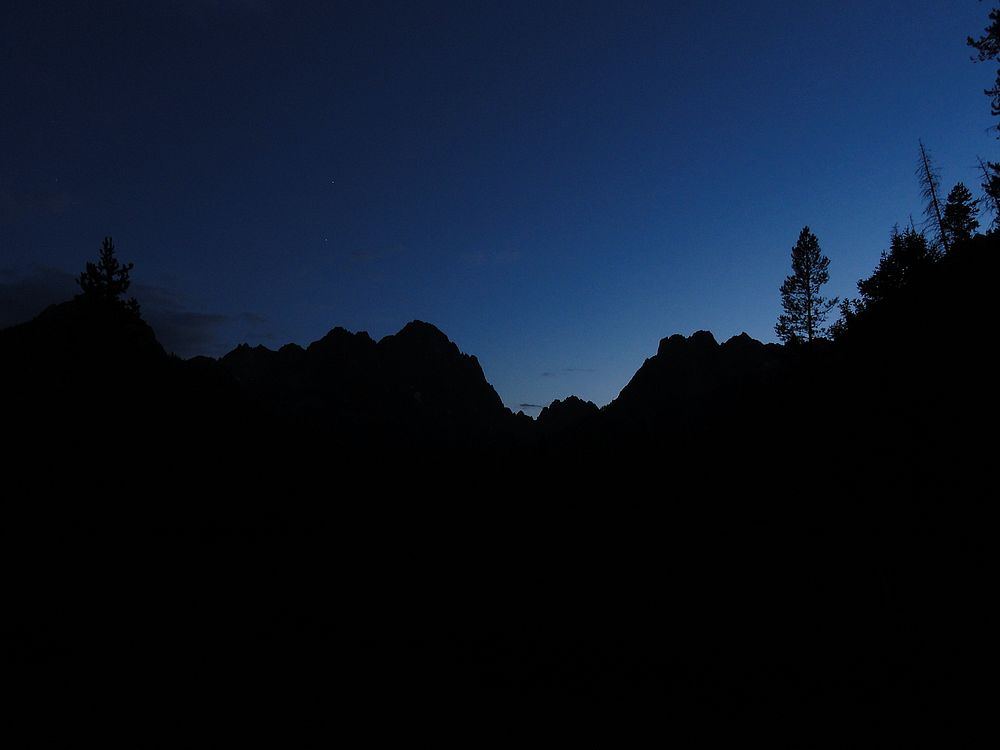
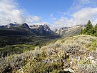 We arrived at the Redfish backpacker’s parking lot at 8am and started up the Alpine Way trail. Skies were clear for the moment, and we enjoyed excellent views looking down on the Fishhook drainage as the trail made its way up the moraine. After covering about four miles in a leisurely 90 minutes, we arrived at the 8000’ level where the climber’s trail leaves the main trail. We arrived at the Redfish backpacker’s parking lot at 8am and started up the Alpine Way trail. Skies were clear for the moment, and we enjoyed excellent views looking down on the Fishhook drainage as the trail made its way up the moraine. After covering about four miles in a leisurely 90 minutes, we arrived at the 8000’ level where the climber’s trail leaves the main trail.
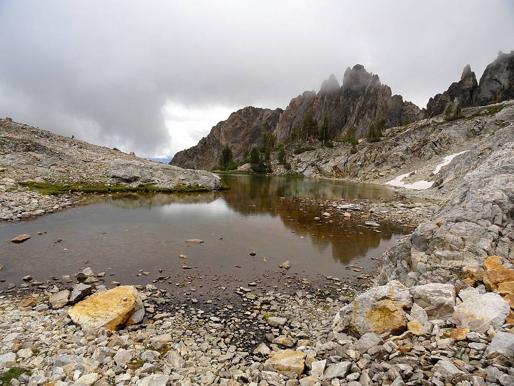
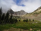 The climber’s trail is well used and easy to follow, but a little steep in places. Soon enough we arrived at the 9000’ lake, but Thompson was shrouded in clouds, so we couldn’t our destination. The lake is very scenic, and a worthy backpacking destination all on its own. But we didn’t linger long before making our way up to the base of the headwall at around 9600’. At some point we saw a couple hikers above us, and ended up following their scramble route up the left side of the headwall. The climber’s trail is well used and easy to follow, but a little steep in places. Soon enough we arrived at the 9000’ lake, but Thompson was shrouded in clouds, so we couldn’t our destination. The lake is very scenic, and a worthy backpacking destination all on its own. But we didn’t linger long before making our way up to the base of the headwall at around 9600’. At some point we saw a couple hikers above us, and ended up following their scramble route up the left side of the headwall.
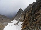
Once at the saddle above the headwall, the route curls to the south, around the west side of Thompson Peak. From here we had great views looking down at Goat Lake to the north. This section involves a bunch of talus and boulder hopping. The easiest option is to head for the saddle south of Thompson, which is the low-point on the ridge between Thompson and Mickey’s Spire. But we took a more direct route.
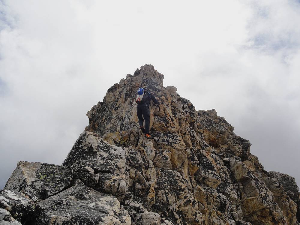
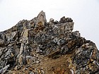 As we approached Thompson’s summit block, some light snow flurries set in. It felt more like October than August. Not sure if it was by accident or not, but we ended up a bit more to the west side of the summit, which led us up a gully that provided access to the north ridge route. Sean used that route to summit, but I chickened out on one very exposed move near the top. I just didn’t trust the friction between my hiking boots and the wet rock, so instead I circled back down around the summit block and up the easier south gully. About this time we also helped coach the hikers we’d seen earlier on their way to the summit. Still engulfed in clouds, we had almost no views, but it still felt good to stand at the top of the Sawtooths. It took us about five hours to reach the summit. As we approached Thompson’s summit block, some light snow flurries set in. It felt more like October than August. Not sure if it was by accident or not, but we ended up a bit more to the west side of the summit, which led us up a gully that provided access to the north ridge route. Sean used that route to summit, but I chickened out on one very exposed move near the top. I just didn’t trust the friction between my hiking boots and the wet rock, so instead I circled back down around the summit block and up the easier south gully. About this time we also helped coach the hikers we’d seen earlier on their way to the summit. Still engulfed in clouds, we had almost no views, but it still felt good to stand at the top of the Sawtooths. It took us about five hours to reach the summit.
 We retreated to the saddle between Thompson and Mickey’s Spire to escape the weather and have a lunch break. Next up was a quick scramble up the north side of Mickey’s, followed by a traverse of the summit ridge in order to reach the highpoint near the east end of the ridge. The clouds had lifted by now, so we were rewarded with great views from the summit of Mickey’s Spire. Thompson was staring us right in the face, and the views to the south were excellent too. We retreated to the saddle between Thompson and Mickey’s Spire to escape the weather and have a lunch break. Next up was a quick scramble up the north side of Mickey’s, followed by a traverse of the summit ridge in order to reach the highpoint near the east end of the ridge. The clouds had lifted by now, so we were rewarded with great views from the summit of Mickey’s Spire. Thompson was staring us right in the face, and the views to the south were excellent too.
At this point, we had tagged two summits, but the real adventure was just beginning. On the way up, we’d been studying the terrain to try and figure out how to make our way over to Anna’s Pinnacle, which is a cool looking spire on Mickey’s east-ridge. Our plan was to drop off the north face of Mickey’s Spire, then attempt to traverse eastward to the saddle between Mickey’s and Anna’s.
So down Mickey’s north face we went. The face was steep, and the rock was loose in places, so we took our time. Plus there was a light dusting of snow that had accumulated during the earlier squall, so the low fourth class down-climbing had our full attention.
 After traversing to the east for a while, we reached a cliff that dictated it was time to rope up and rappel. We really couldn’t see too far below, but the short rope we were carrying meant that we’d likely have to do multiple rappels. It ended up being three, and a couple of those took some pretty creative anchoring on Sean’s part. The last one included a short free-rappel section that was very cool. After traversing to the east for a while, we reached a cliff that dictated it was time to rope up and rappel. We really couldn’t see too far below, but the short rope we were carrying meant that we’d likely have to do multiple rappels. It ended up being three, and a couple of those took some pretty creative anchoring on Sean’s part. The last one included a short free-rappel section that was very cool.
Once the rappels were complete, it was a short scramble up to the saddle west of Anna’s Pinnacle. From here, we finally had an up close view of the route up Anna’s, which looked like a low fifth class shallow chimney straight up from the saddle. Sean led and was quickly up on the summit ridge, and I followed. It was a short pitch, and Sean only had to place a couple pieces of protection on the way up. We opted to leave the rope behind for the summit ridge, which was exposed fourth class but stable rock.
 As we neared the summit of Anna’s Pinnacle, a huge rainbow had formed over the Sawtooth Valley, which made for a cool setting. There was a small pile of rocks on top, but no register. We snapped a few photos, and then prepared for the down climb, which included re-crossing the airy summit ridge and one short rappel back to the saddle. As we neared the summit of Anna’s Pinnacle, a huge rainbow had formed over the Sawtooth Valley, which made for a cool setting. There was a small pile of rocks on top, but no register. We snapped a few photos, and then prepared for the down climb, which included re-crossing the airy summit ridge and one short rappel back to the saddle.
From the saddle between Anna’s and Mickey’s we descended toward the south, down into a verdant hanging valley on the north fork of Fishhook Creek. The upper part of the descent was a broad gully with a few cliffy sections to negotiate. Lots of talus down low. It was nice to reach the creek, but it was starting to get late and we still had a lot of work to do.
 The bushwhacking back down into the main Fishhook drainage was arduous, with a steady diet of dense brush with soggy ground seemingly everywhere. This section seemed to take forever, and it was starting to get dark, but Sean somehow managed to guide us right to the trail. Once back at the photographers point at the head of the meadows, the sun was down, and we had to dig our lights out for the final couple miles of trail back to the car. The bushwhacking back down into the main Fishhook drainage was arduous, with a steady diet of dense brush with soggy ground seemingly everywhere. This section seemed to take forever, and it was starting to get dark, but Sean somehow managed to guide us right to the trail. Once back at the photographers point at the head of the meadows, the sun was down, and we had to dig our lights out for the final couple miles of trail back to the car.
It had been a great day in the mountains, and a fantastic adventure. We summited 3 peaks, covered 14 miles and gained 4800 feet of elevation in about 14 hours round trip. The only downside is that we didn’t make it back to Stanley before the town closed down for the night. So the two of us very hungry hikers had to get by on just a couple of granola bars for sustenance on the way home.
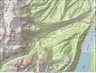
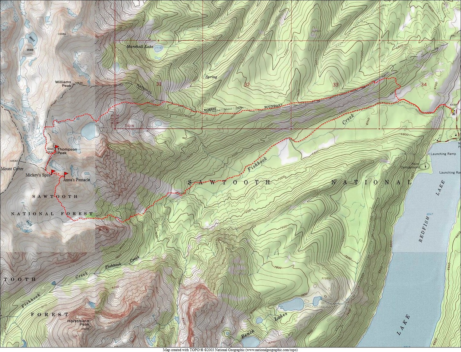
Map of our route, 14 miles and 4800' elevation gain round trip. |
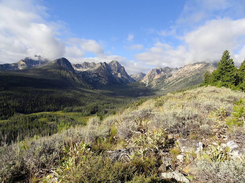
Early view of the Fishhook Creek drainage from the Alpine Way Trail. |
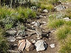
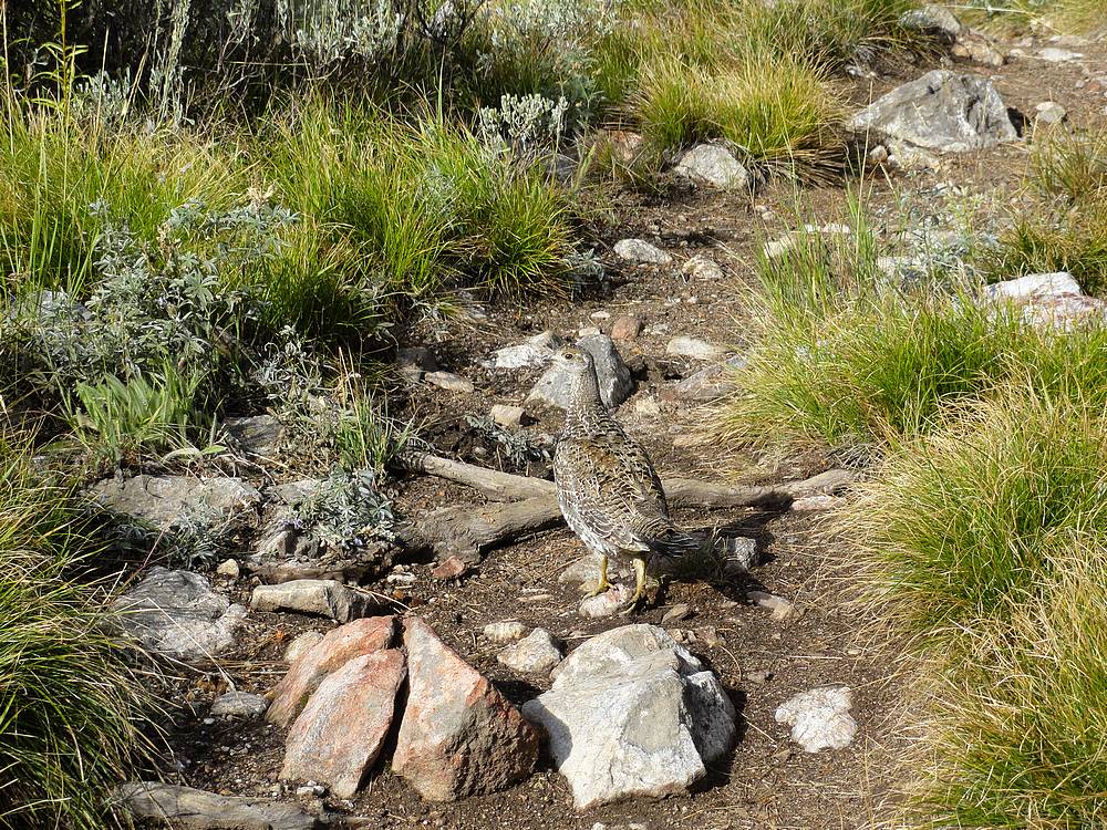
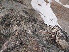
Grouse taking its time crossing the trail in front of us. |
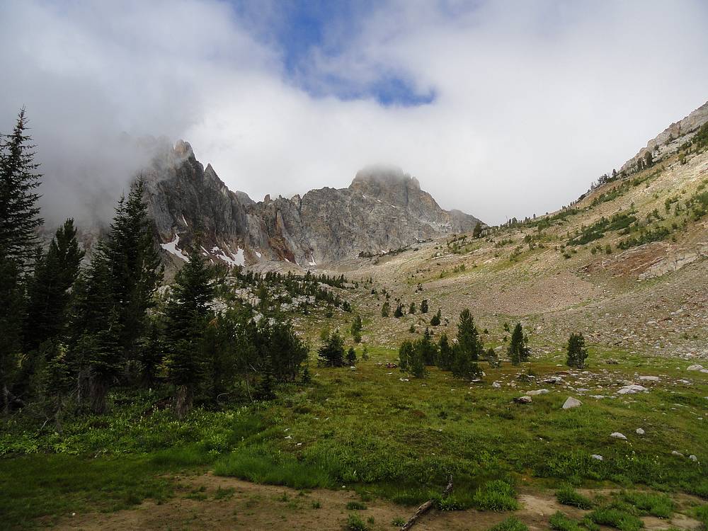
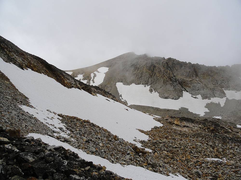
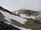
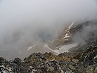
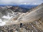
Off trail and heading toward Thompson with its head in the clouds. |
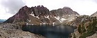
Panoramic view of Thompson Lake. |
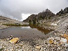
Looking back across the tarn above Thompson Lake. |
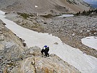
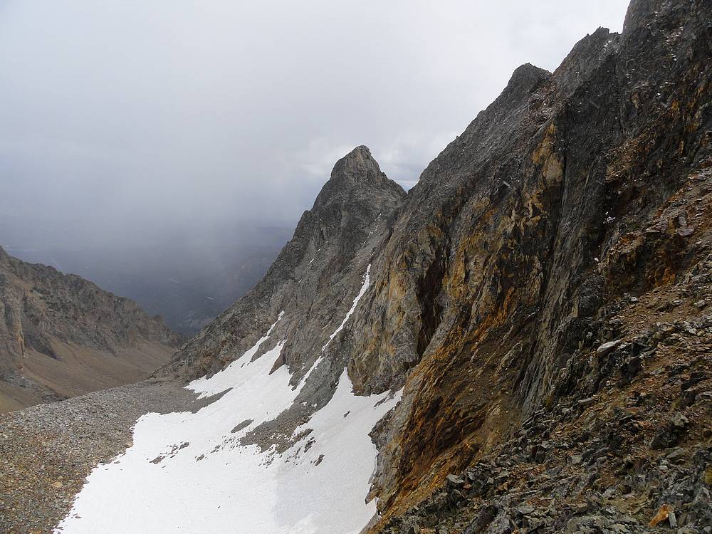
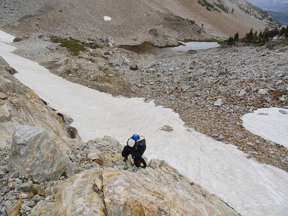
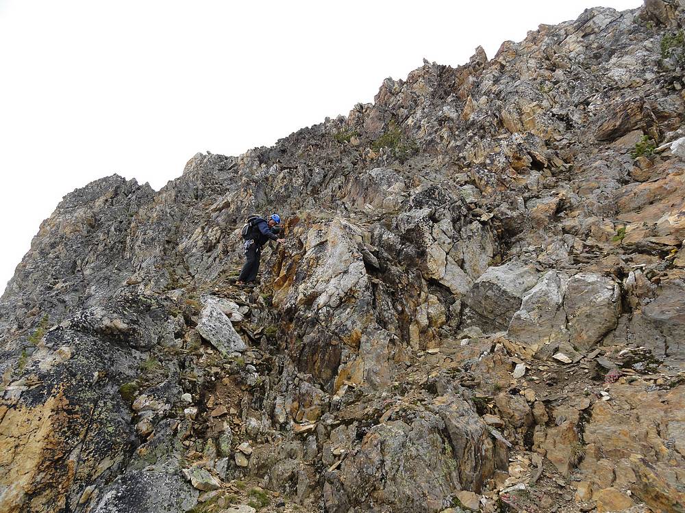
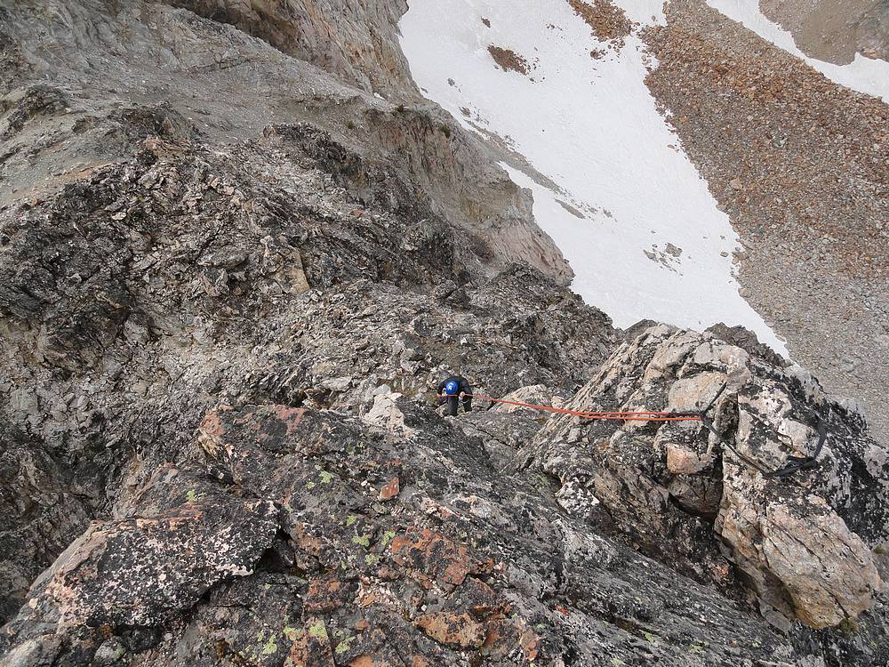
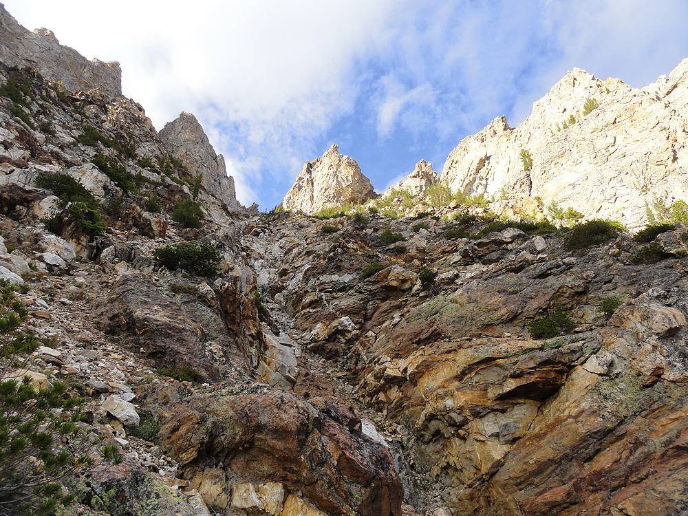
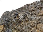
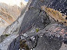
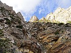
Scramble section below the Thompson-Williams saddle. |
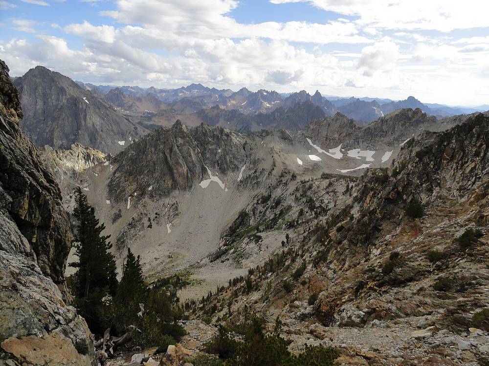
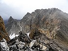
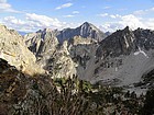
Talus and boulder section, Mount Carter in the distance. |
View of Anna's Pinnacle and Mickey's spire from the slopes of Thompson Peak. |
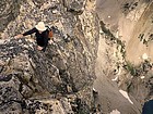
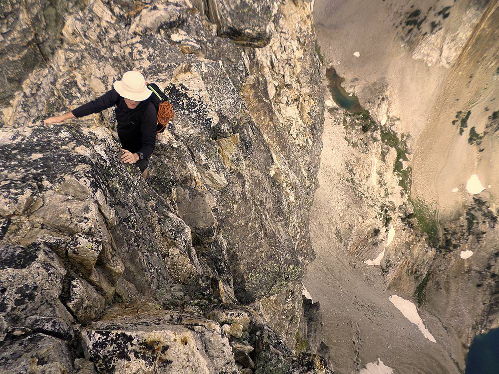
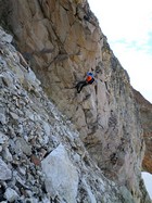
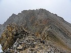
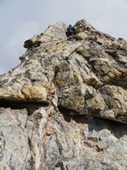
Lots of exposure on the north ridge of Thompson Peak. SeanD photo. |
Sean on the north ridge of Thompson Peak. I chickened out and circled around to the standard route. |
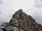
Final scramble to the summit of Thompson Peak from the south. |
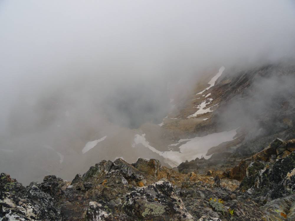
Summit view of Thompson Lake through the clouds. |
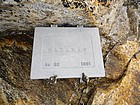
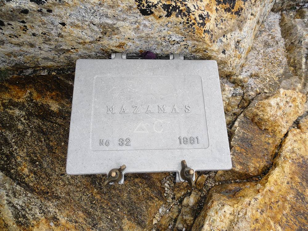
Thompson Peak register box placed by the Mazamas. |
Dropping down to the Thompson-Mickey's saddle. |
Looking across the north face of Mickey's Spire at Anna's Pinnacle. |

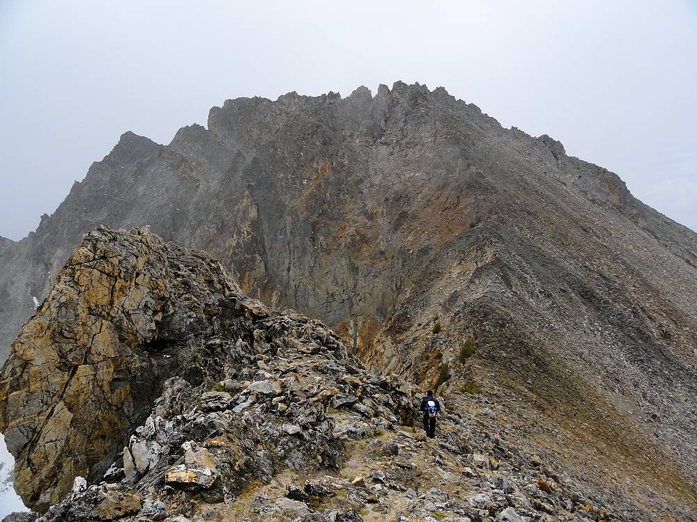
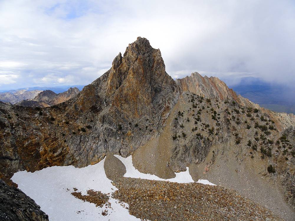
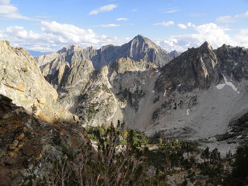
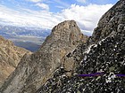
South side of Thompson Peak from the approach to Mickey's Spire. |
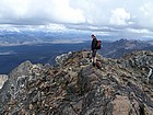
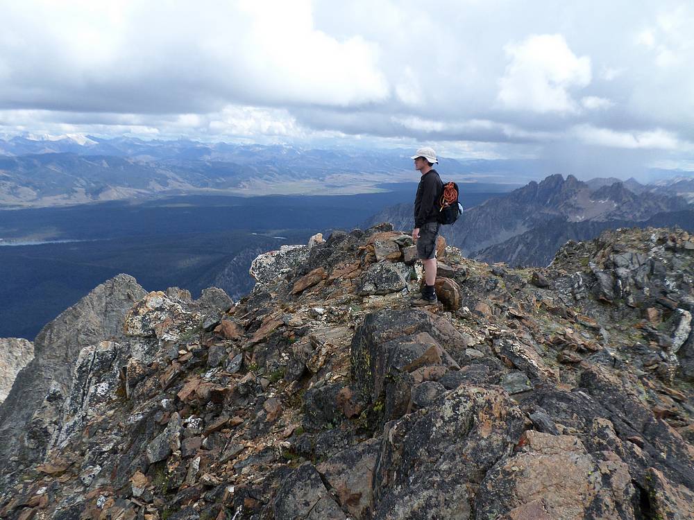
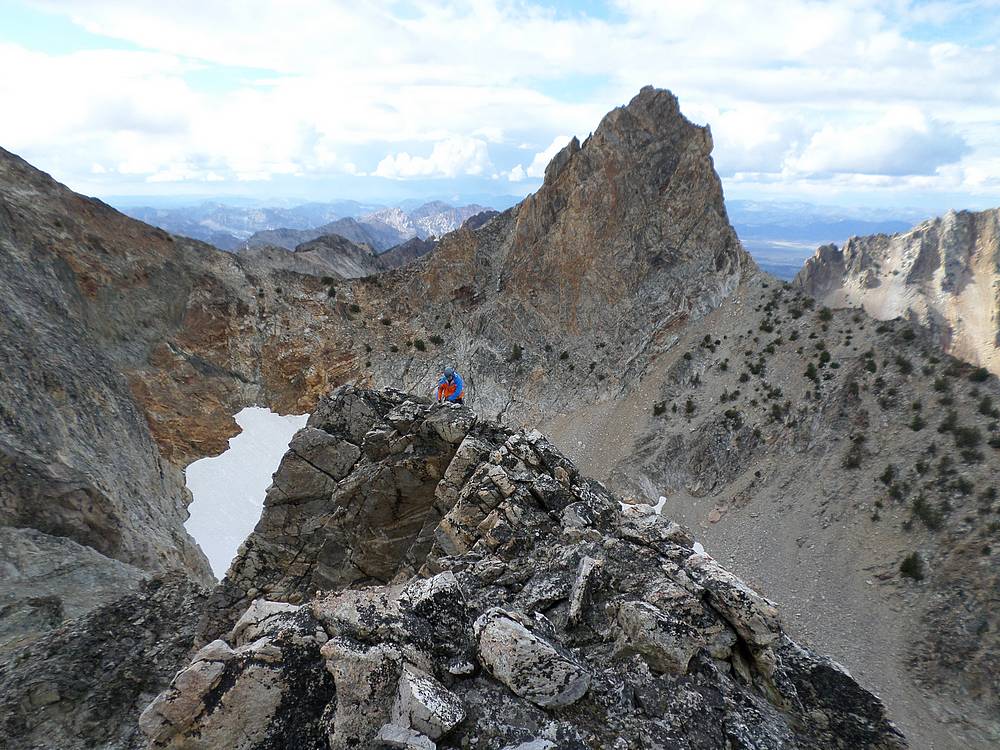
Dave on the summit of Mickey's Spire. SeanD photo. |
Making our way up Mickey's Spire with the Goat Lake drainage far below. |
Carefully making our way down and across the north face of Mickey's Spire. |
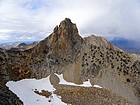
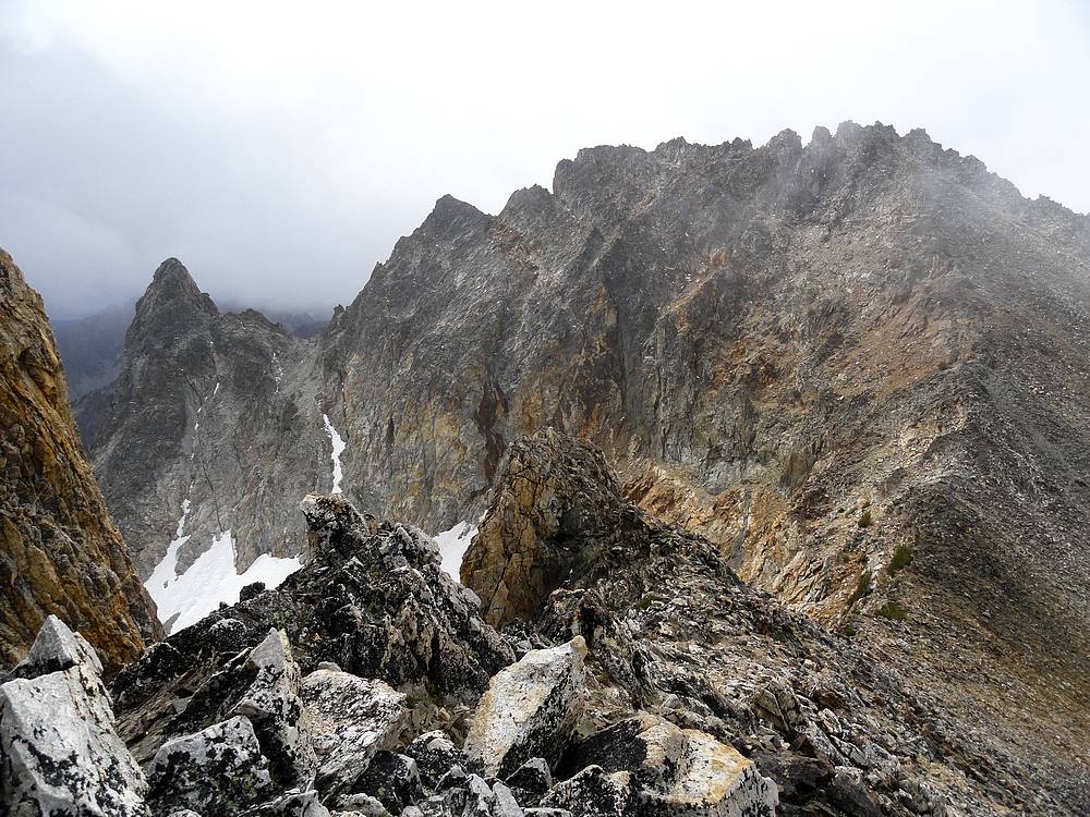
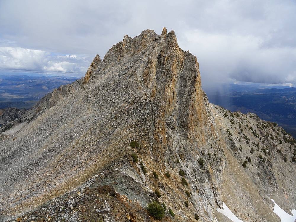
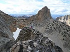
Unique view of Thompson Peak from the southeast. |
Anna's Pinnacle from one of our rappel stations on the north face of Mickey's Spire. |
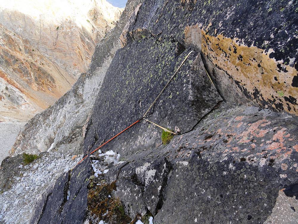
Wild rappel anchor on the north face of Mickey's Spire. |
Free rappel on the north face of Mickey's Spire. SeanD photo. |
Sean making his way up the technical section of Anna's Pinnacle. |
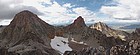
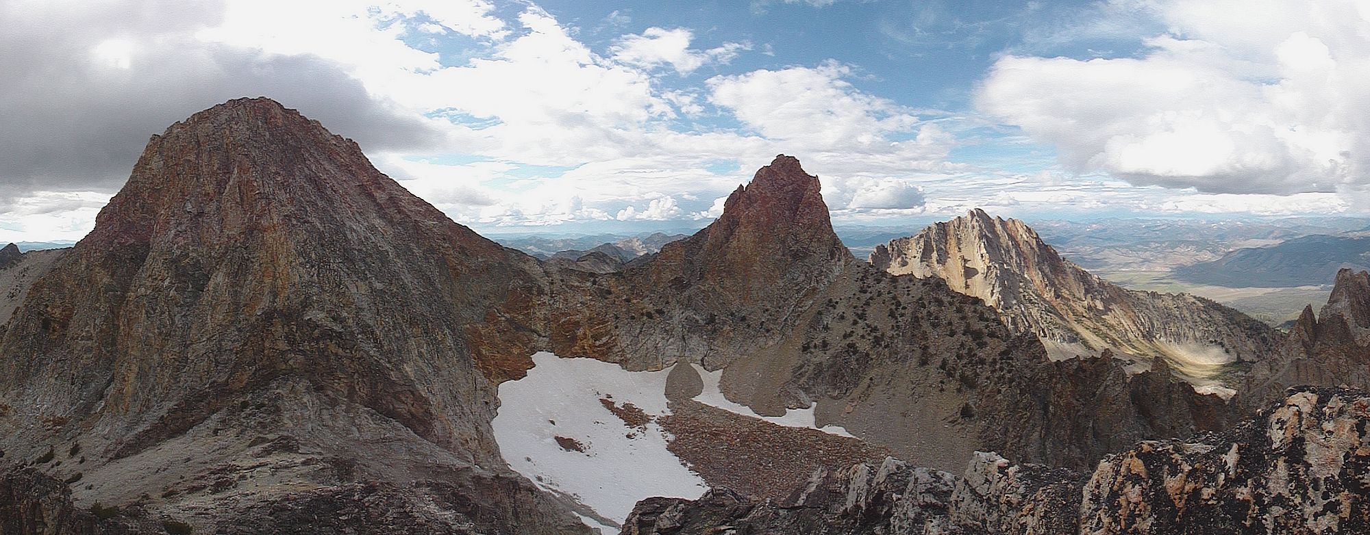
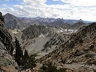
Panoramic view of Mickey's, Thompson, and Williams from Anna's Pinnacle. |
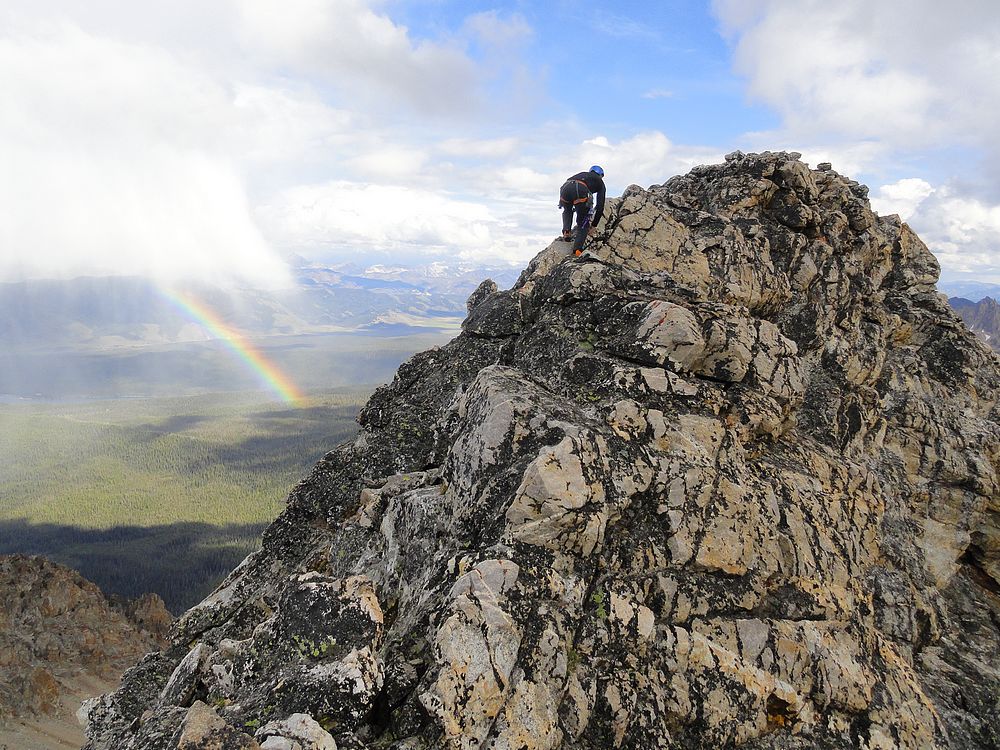
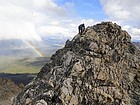
Sean nearing the summit of Anna's Pinnacle, rainbow below. |
Dave nearing the summit of Anna's Pinnacle, Thompson in the background. |
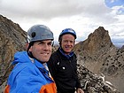
Anna's Pinnacle summit shot. |
Sean rappelling off Anna's Pinnacle. |
Amazing view of the southern Sawtooths during our descent. |
Typical conditions in our descent gully south of Mickey's and Anna's. |
View of Heyburn and Horstmann on our way down. |

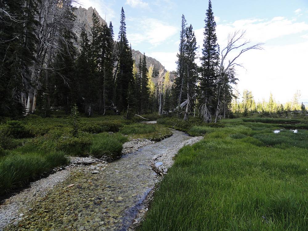
Nice scene on the "North Fork" Fishhook Creek. |
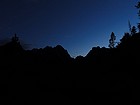
Last light at the Fishhook Creek meadows. |
|