|
Pegasus Peak is located in the northeast corner of the Pioneer Mountains, near Copper Basin. It is the highpoint of a rugged ridge that separates the two forks of Fall Creek, and towers above the highly scenic Surprise Valley. Even though Pegasus has a lofty rank as the 30th highest peak in Idaho, it is still an obscure mountain that is seldom climbed.
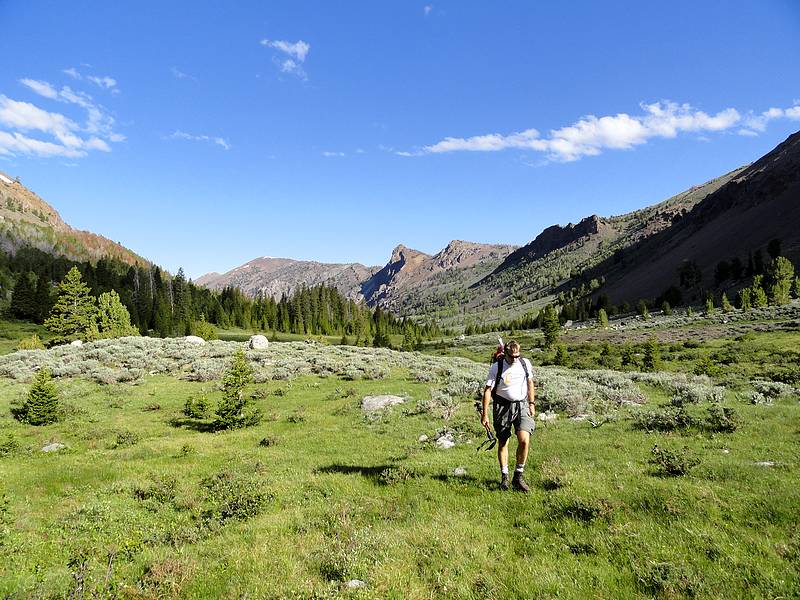
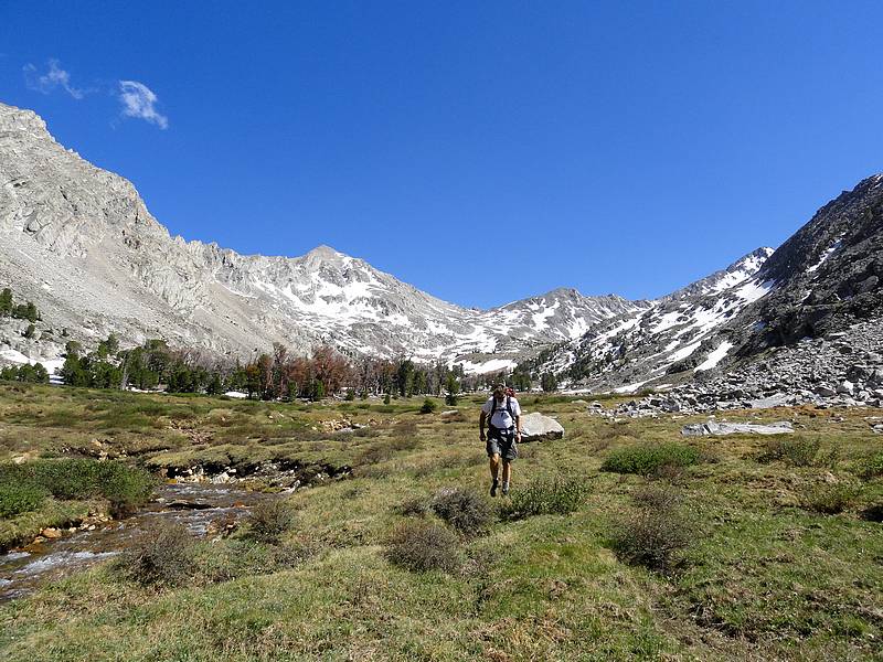
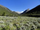
Steve and I drove over Friday night, and then set up camp in the dark at the Fall Creek trailhead, near the mouth of Wildhorse Canyon. Morning came quickly, and we were on our feet and hiking by 6am. We followed the scenic main trail for about 2 miles, then headed east up the trail toward Left Fork of Fall Creek. The trail was a little faint in places, but still easy to follow. Before not too long, we arrived at swollen creek crossing. Fortunately, Steve had brought along some water shoes. He crossed, and then tossed them back to me so I could use them. The water was ice cold, and would have been pretty tough to cross without the sandals. We reached the mouth of the Left Fork Fall Creek valley, and left the trail at around 8900’. There were a number of access points to gain the ridge, but we stayed in the valley for quite a while, enjoying the excellent views of the surrounding peaks. There was lots of animal sign, and we passed a dozen elk not far from our path.
  As we made our way up the valley, Pegasus came into view, and the east ridge looked like a nice direct route to the summit. We continued on until we were next to Big Black Dome (on our left) then veered to the right, and headed up the small valley north east of Pegasus. Once at around 9900’, we climbed the talus to the south, and made our way up to a scenic shelf lake for a snack break. From here, we eyed a couple lines to gain the ridge. We had axe and crampons, but I was suspicious that the snow would be too soft. Up we went to the base of the snowfields. The snow wasn’t bad, but the adjacent rock seemed stable, so we elected to take a dry route to the ridge. The rest of the climb was a walk-up, and we set a steady pace and made it to the summit by 12:30. As we made our way up the valley, Pegasus came into view, and the east ridge looked like a nice direct route to the summit. We continued on until we were next to Big Black Dome (on our left) then veered to the right, and headed up the small valley north east of Pegasus. Once at around 9900’, we climbed the talus to the south, and made our way up to a scenic shelf lake for a snack break. From here, we eyed a couple lines to gain the ridge. We had axe and crampons, but I was suspicious that the snow would be too soft. Up we went to the base of the snowfields. The snow wasn’t bad, but the adjacent rock seemed stable, so we elected to take a dry route to the ridge. The rest of the climb was a walk-up, and we set a steady pace and made it to the summit by 12:30.
 The summit views were nothing short of spectacular. We had a clear view of the Lost River Range to the northeast, and were surrounded by jagged and snowy Pioneer Peaks in most other directions. The valleys below were lush and green. Scenery like this is hard to beat. The summit views were nothing short of spectacular. We had a clear view of the Lost River Range to the northeast, and were surrounded by jagged and snowy Pioneer Peaks in most other directions. The valleys below were lush and green. Scenery like this is hard to beat.
But our day was far from finished. Our next objective was Peak 11600’, to the south. It is separated from Pegasus by almost a mile of rugged ridgeline. From Pegasus, we could tell there would be many obstacles along the way, but we decided to give it a try and see how far we could get. So we descended a rotten gully, crossed through a notch on the ridge to the east side, angled across a series of shelves, angled back up to the ridgeline, and repeated that cycle a couple more times. Eventually we made a ridge crossing just before the second to last tower on the ridge, then made a few creative rock-climbing moves to get to the top of that tower. Unfortunately, there was a ton of exposure on the other side, so we had to descend to the east side of the ridge again. Here we met some cliffs bands that blocked our way and forced us to drop a couple hundred feet more. We could see a rotten gully angling its way back up, but it looked like there were still a few more cliffs to get around, and that one final menacing tower up on the ridge. So after two hours on the ridge, we reluctantly called it quits. We’d made a strong effort, but the clock was not on our side.
 The next order of business was figuring out how to get down. After some discussion, we began descending a steep gully toward Surprise Valley. We couldn’t tell for sure whether or not it would cliff out farther down, so we traversed across for a while to get a better look. We still couldn’t see all the way to the bottom, but it seemed promising, so down we went. One side of the gully had some towers that were at least a couple hundred feet high, and there were some steep cliffs on the other side as well. It was a dramatic setting, and we made our way carefully down, taking nearly an hour to descend to the valley floor. The next order of business was figuring out how to get down. After some discussion, we began descending a steep gully toward Surprise Valley. We couldn’t tell for sure whether or not it would cliff out farther down, so we traversed across for a while to get a better look. We still couldn’t see all the way to the bottom, but it seemed promising, so down we went. One side of the gully had some towers that were at least a couple hundred feet high, and there were some steep cliffs on the other side as well. It was a dramatic setting, and we made our way carefully down, taking nearly an hour to descend to the valley floor.
 We finished the day by hiking out through the stunningly beautiful Surprise Valley, then down the steep switchbacks to Fall Creek. From there it was 3.5 miles of hiking to get back to the trailhead by 7pm. We’d been on our feet for 13 hours, and covered 15 miles and about 5100’ of elevation gain. It had been a fantastic day. I was very impressed with the area. We’d reached one high summit, and faced some fun but challenging ridgework after that. A second summit had not been in the cards, but the day was very rewarding nonetheless. I’m sure I’ll be back to visit this area again in the future. We finished the day by hiking out through the stunningly beautiful Surprise Valley, then down the steep switchbacks to Fall Creek. From there it was 3.5 miles of hiking to get back to the trailhead by 7pm. We’d been on our feet for 13 hours, and covered 15 miles and about 5100’ of elevation gain. It had been a fantastic day. I was very impressed with the area. We’d reached one high summit, and faced some fun but challenging ridgework after that. A second summit had not been in the cards, but the day was very rewarding nonetheless. I’m sure I’ll be back to visit this area again in the future.
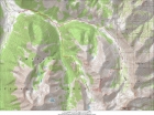
Map of our route, 15 miles round trip and 5100' elevation gain.
|
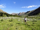
Steve entering the Left Fork Fall Creek valley.
|
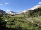
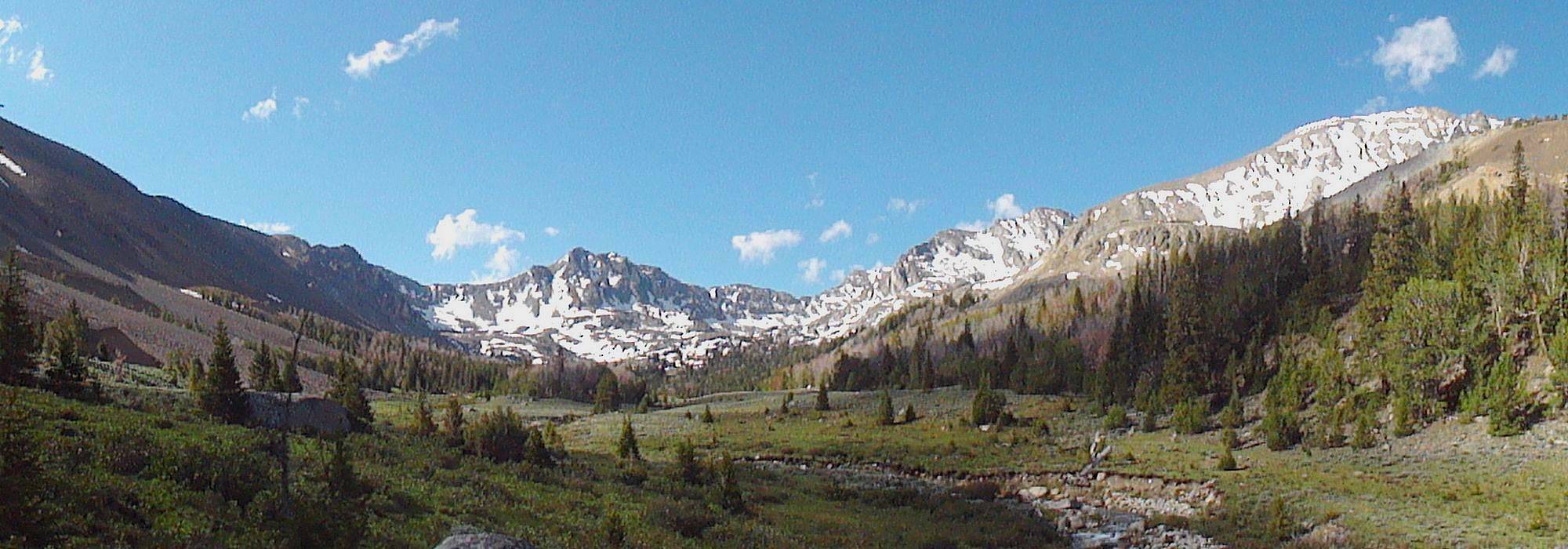
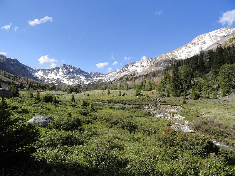
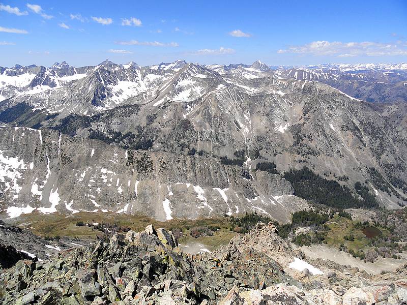
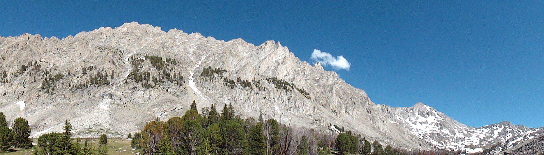
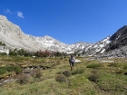
View up Left Fork Fall Creek.
|
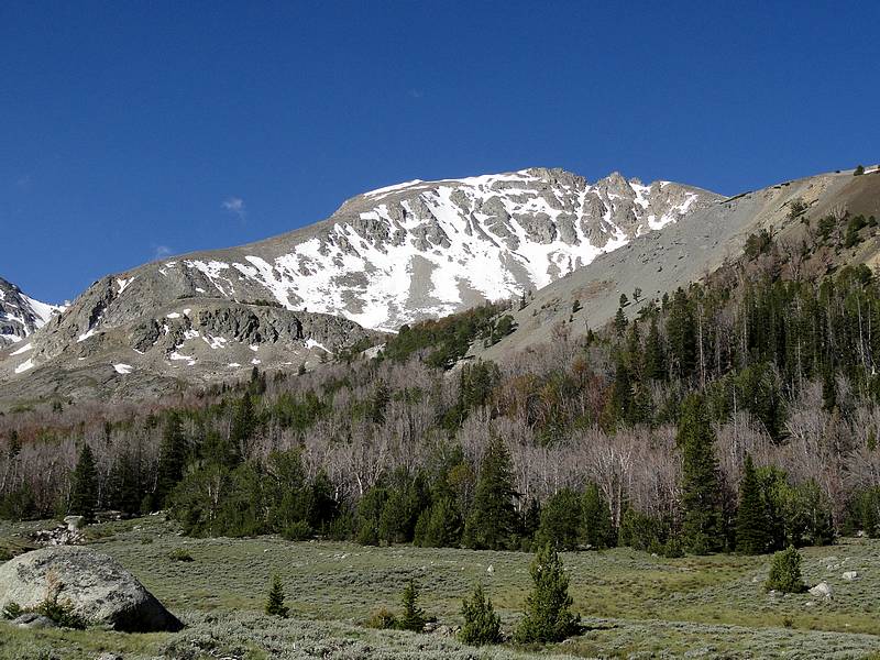
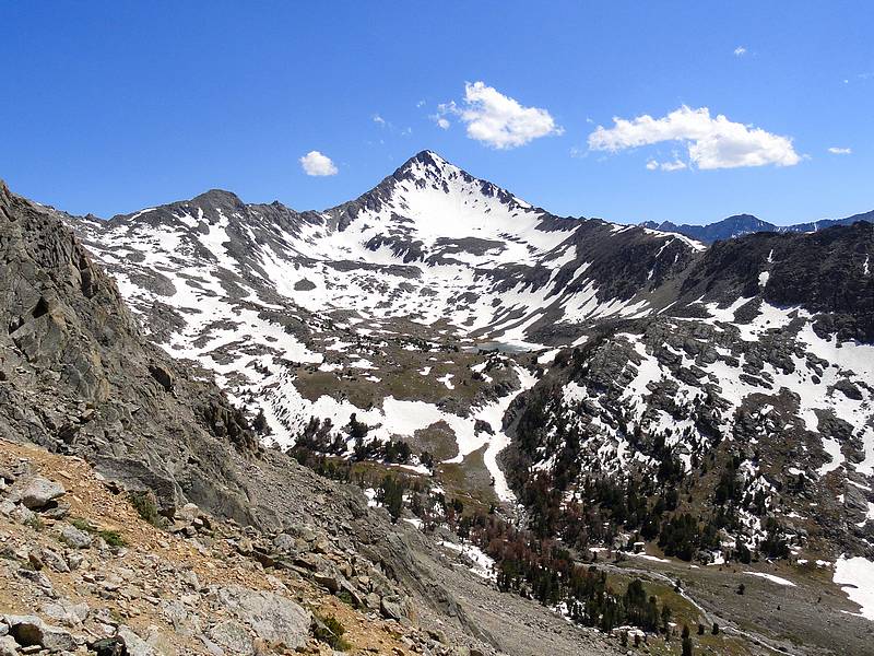
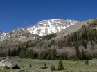
Pegasus Peak from the northeast.
|
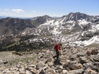
Steve climbing toward the east ridge of Pegasus Peak, Lost River Range in the distance.
|
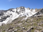
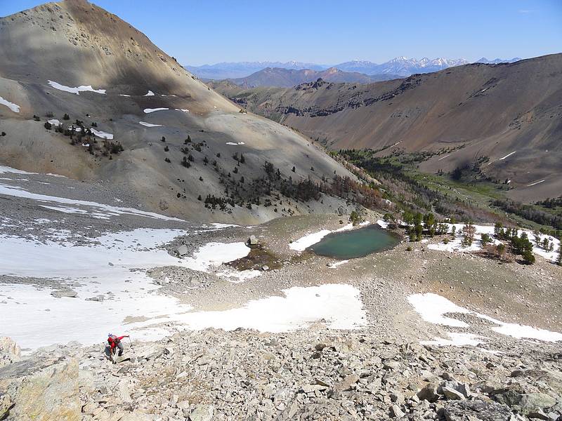
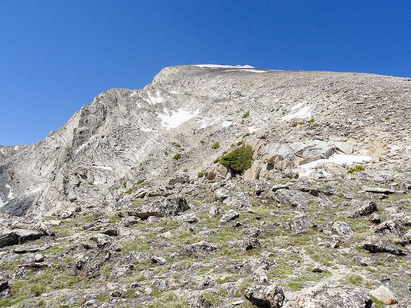
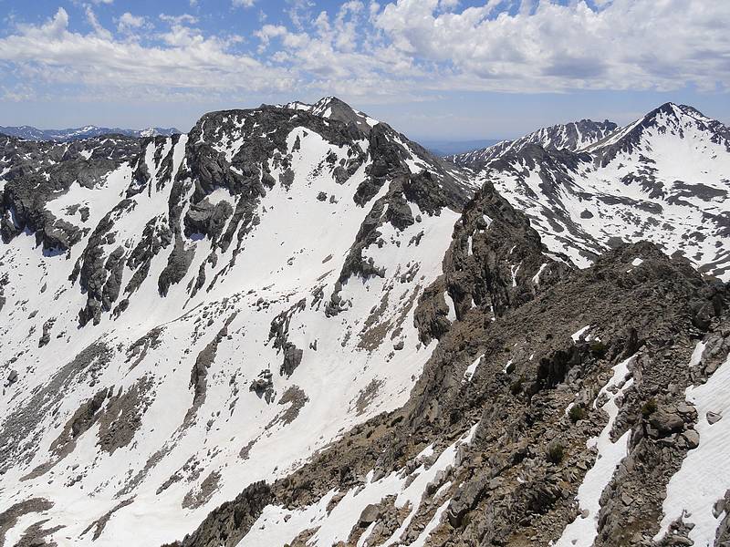
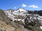
North face of Peak 11600' from the east shoulder of Pegasus.
|
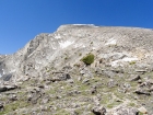
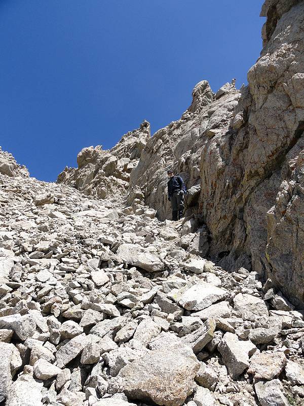
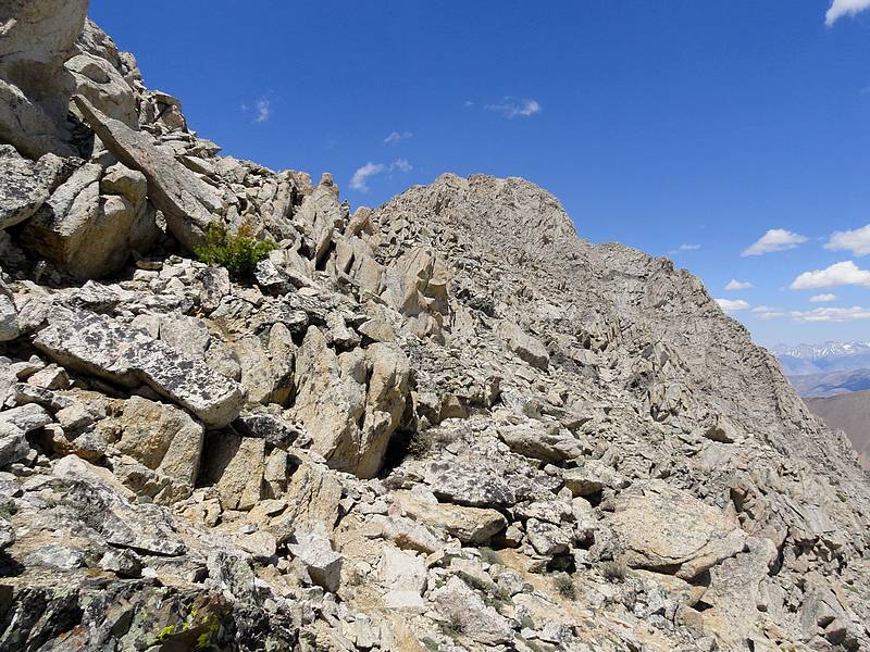
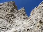
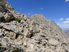
Looking up the east ridge of Pegasus.
|
Steve climbing the east ridge, Pyramid Peak in the background.
|
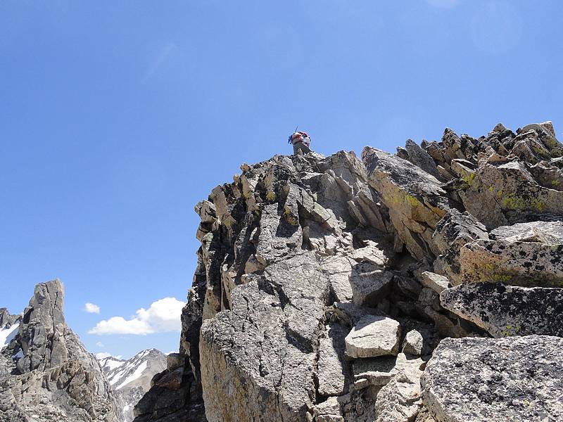
Steve arriving at the summit of Pegasus Peak.
|

Fantastic Pioneer views from the summit, Surprise Valley below.
|

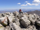
Me on the summit, splattski photo.
|
Downclimbing the first gnarly gully.
|

View south along the ridge to Peak 11600'.
|
Looking back north toward Pegasus.
|

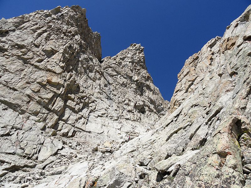
Steve nearing the top of the second to last tower. The final scary tower is on the left.
|
Our descent gully, Steve is in there somewhere.
|
Great view of Standhope Peak as we dropped into Surprise Valley.
|
Steve hiking out of Surprise Valley, Altair Peak is just left of center.
|

Pegasus Peak from Surprise Valley.
|
A final view of Standhope and friends from the Fall Creek trail.
|
|