|
Decker Loop - Sawtooth Backpacking
|
Related Links:
- Fadgen's Trip Report
- Trailhead Location
- Grand Mogul: SP, PB, TL, LOJ, Map
- Daves Peak: SP, HII, TL, LOJ, Map
- Huckleberry Peak: TL, LOJ, Map
- Decker Peak: SP, PB, TL, LOJ, Map
|
Central Idaho’s Sawtooth Mountains are home to many excellent and well known backpacking loops. But if you have a little creativity and are willing to invest in a few miles of off-trail hiking, you can also put together some great loop trips through lesser-known terrain. One such loop is the “Decker Loop”, which starts at the Redfish Lake inlet, and circles around Decker Peak, before returning to the trailhead via the Redfish Lake Creek trail. Throw in a side trip to the Finger of Fate Lakes, and this one boasts scenery right up there in comparison to some of the more famous Sawtooth loops.
Through much discussion, JohnF and I came up with this great loop passing through quite a bit of terrain we hadn’t seen. And it also put us within striking distance of several great peaks to climb. Ken was trusting of the itinerary as usual, maybe too trusting…
Day 1: Redfish to Decker Creek via Alpine Way Trail (Side trip up Grand Mogul)
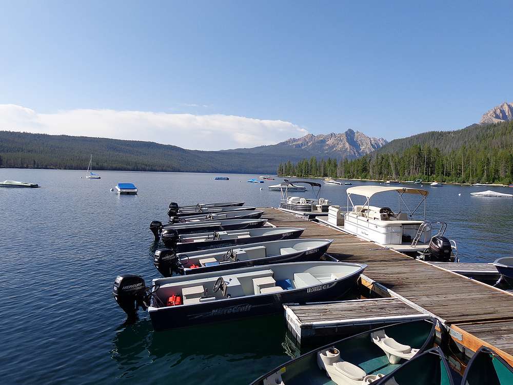
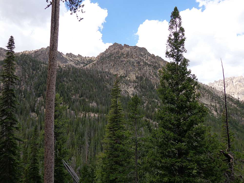
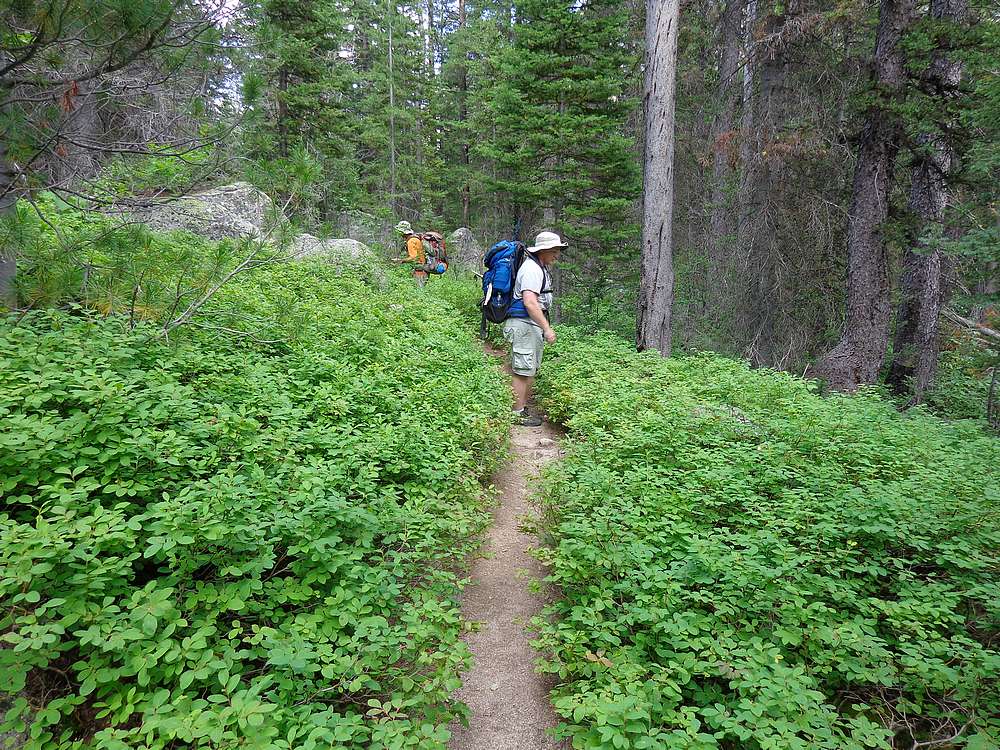
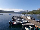
We made it to the Redfish backpacker’s parking lot just before 9am, and were on the shuttle boat shortly thereafter. After the boat ride, which saves almost 5 miles of hiking each way, we hit the Alpine Way Trail heading south along the lakeshore. The early part of the trail is in lush forest, and was highlighted by huckleberries to snack on and a Pileated Woodpecker working on an old snag. But soon enough, the trail starts climbing up into the more typical lodgepole pine forests that typify the lower elevations of the Sawtooths. The trail was pleasant, but didn’t offer much in the way of views.
After about three miles of hiking, we dropped our packs at about 8100’ elevation for lunch. Ken waited here while John and I headed for the Grand Mogul, our first peak objective. We dropped steeply off the side of the trail, crossed two small streams, and then began climbing up the east side of the peak. It was forest at first, then some boulder hopping above the 8500’ pond, followed by sand and scree, and finally the scramble section for the last few hundred feet to the summit.
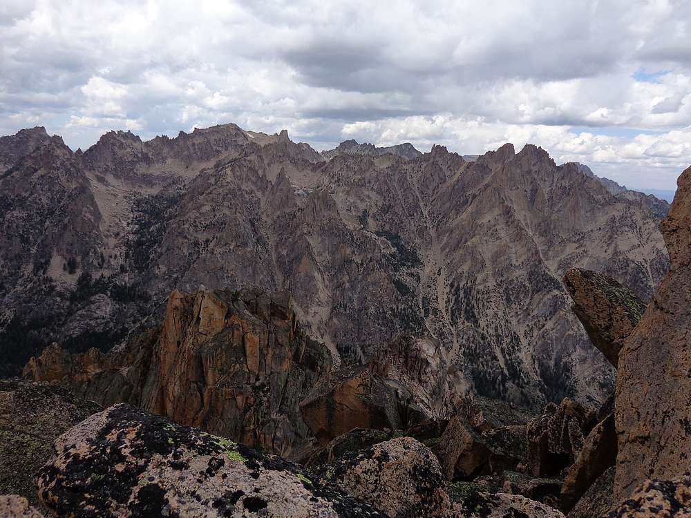
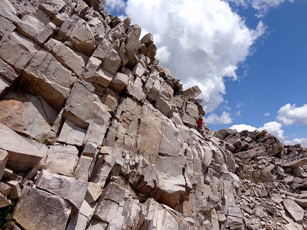
The scramble section on the Grand Mogul was great, with plenty of route-finding along the way. We ran into another group on their way up, and weaved our way up through granite slabs and boulders to the summit. The views were great, but storm clouds were building, so we didn’t stay long. On the way down, we did our best to separate ourselves from the other group who kept yelling “ROCK” about every thirty seconds.
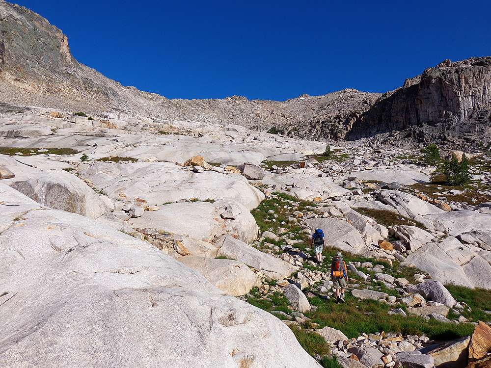
It took us about three hours round trip to get back to the trail where Ken was waiting. At about that time, the rain started, so we busted out the ponchos and hunkered under the trees waiting for the storm to pass. When the rain stopped, it was time to hoist our packs and hit the trail again. The next four miles of trail was mostly a flat wander through the lodgepole until we reached Decker Creek, where we stopped to pump water and have a snack.
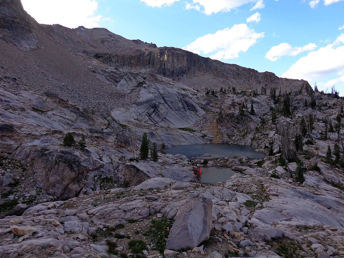
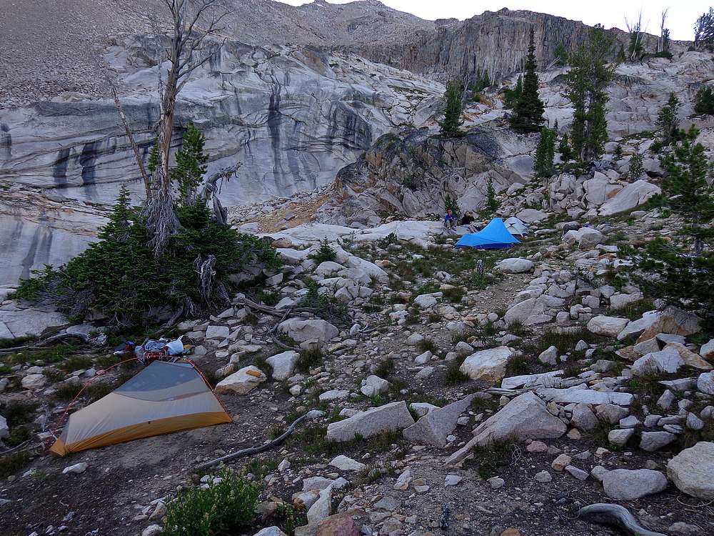
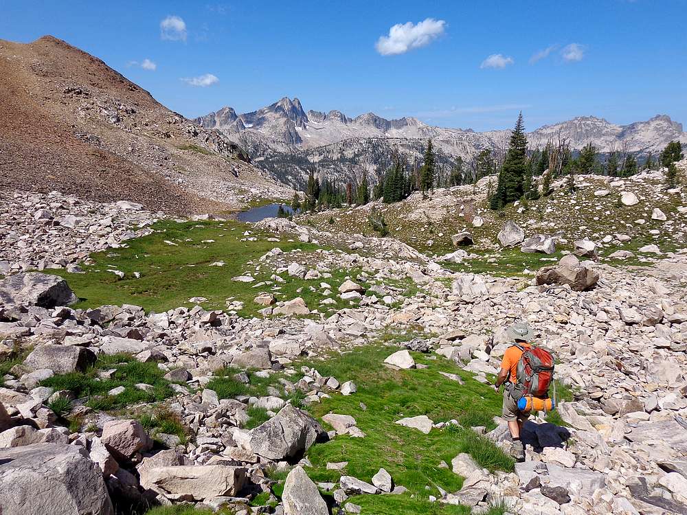
After crossing Decker Creek, we hiked up the trail a half mile or so, and then hung a right at about 8500’ and went cross-country. The bushwhacking wasn’t bad, and we made a flat traverse past a marshy area, across a low rise, through a boulder filed, and then finally to a small lake at the base of the “Huckleberry Wall”. There had been some discussion earlier about going to one of the higher lakes, but since it was nearing 7pm and we were a little pooped, it was an easy call to stop and make camp at this nice and remote little lake. After setting up the tents, Ken went to work carving a wooden spoon to take the place of the spork he’d left at home. A man of many skills no doubt.
Day 2: Finger of Fate Lake, Dave’s Peak, Huckleberry Peak
The next morning we broke camp and made the half mile climb up to the 9200’ saddle overlooking the Finger of Fate. It was a fantastic vantage point. We dropped our heavy packs here, and converted to daypacks for some exploring. Our main objective for the day was Dave’s Peak (10579’), but we also expected to see some amazing lakes and terrain along the way.
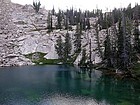
From the saddle, we descended to the highly scenic lake below the Finger of Fate, the third highest lake in the string. Here we stopped for a snack while watching a pair of climbers getting ready to start the Open Book route on the Finger. From the lake, we headed south and then traversed around the south side of the Finger along some easy to follow ledges. After that, we climbed huge glacially polished slabs before reaching a beautiful little lake southwest of the finger.
The first little lake was very pretty, but the next one up was just plain fantastic. (My friend Erik had understandably nicknamed this one “Fantastic Lake”.) We soaked in the view at Fantastic Lake for a while before making the short climb to the highest lake. Here we had lunch while eyeballing the aptly named Arrowhead on the ridge above us.
After lunch, John and I started up Dave’s Peak while Ken explored closer to the lakes. We headed southwest from the upper lake, and began climbing a rock rib and then talus. The false summit is visible from below, and we crested the ridge just to the south of it.
From the ridge just south the false summit of Dave’s Peak, we had a great view of Profile Lake far below, and some nasty steep jumbled rock staring us in the face. We descended briefly, then traversed westward along ledges. After a while we saw a good looking ledge that headed up, so that’s where we went. Unfortunately, this just took us to a very exposed perch on the ridge, with no way to reach the summit, so back down we went.
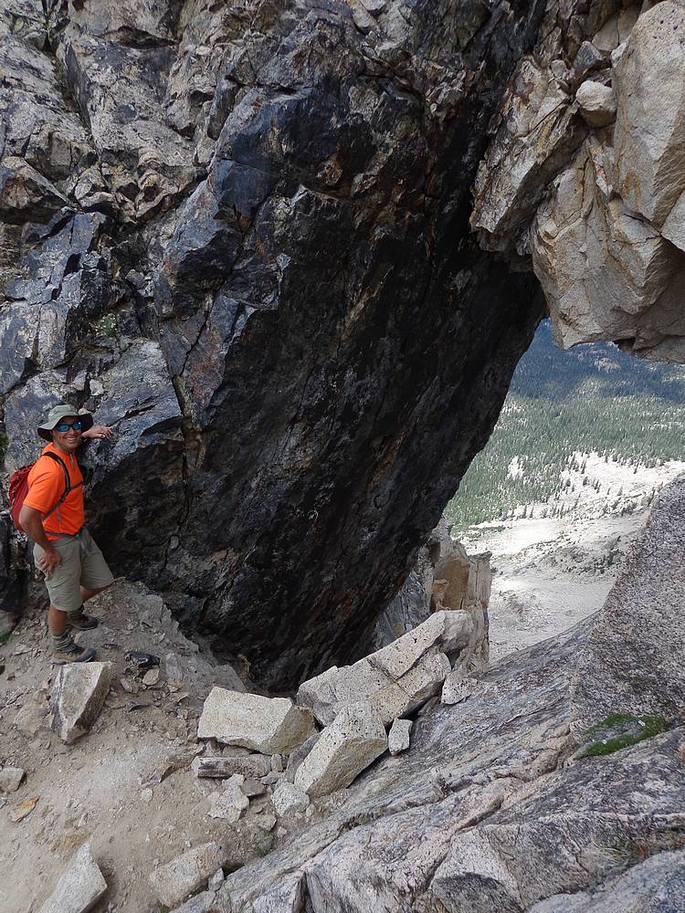
We continued west along the south face of the peak, with occasional brief but exposed class 4 moves along the way. At one point I heard John shriek with excitement and later caught up to him where he was looking through a massive hole in the peak. I’d say it was about 10’ wide by 15’ tall by 10’ thick, with about 15’ of rock above the hole. It was very cool. (This hole is visible from Cramer Lakes if you look carefully.)
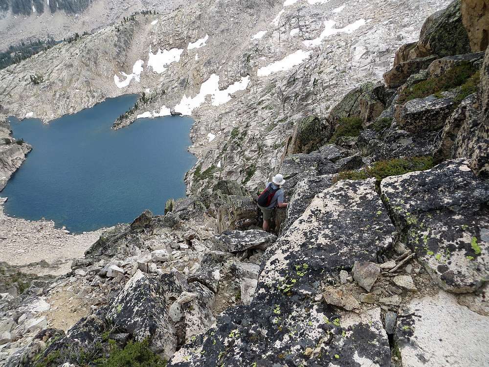
The last section of the climb was super exposed, and we made it to the summit just in time to hear some goats scampering down the other side. We later spotted them a long way below us. The scramble up had been a blast, but we still had to find our way back down. We carefully retraced our steps back across the face, and down the slopes to the lake where we met back up with Ken.
On the way back, we decided to cross the ridge west of the Finger of Fate so we could check out the upper “Finger of Fate Lakes”. The upper lakes felt very remote and were quite scenic, so I’m glad we went that way. Although it was much more work that the way we’d gone up.
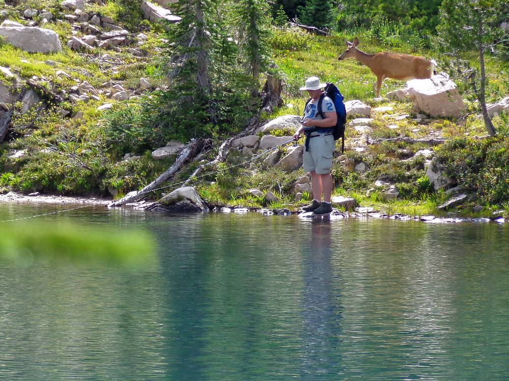
Once back down to Finger of Fate Lake #3, Ken stayed to fish (he caught a bunch) and watch another group of climbers on the finger, while John and I headed up to try “Huckleberry Peak’ (9583’). So we hiked back up to the 9200’ saddle where we’d left our packs earlier, and then headed east up the ridge.
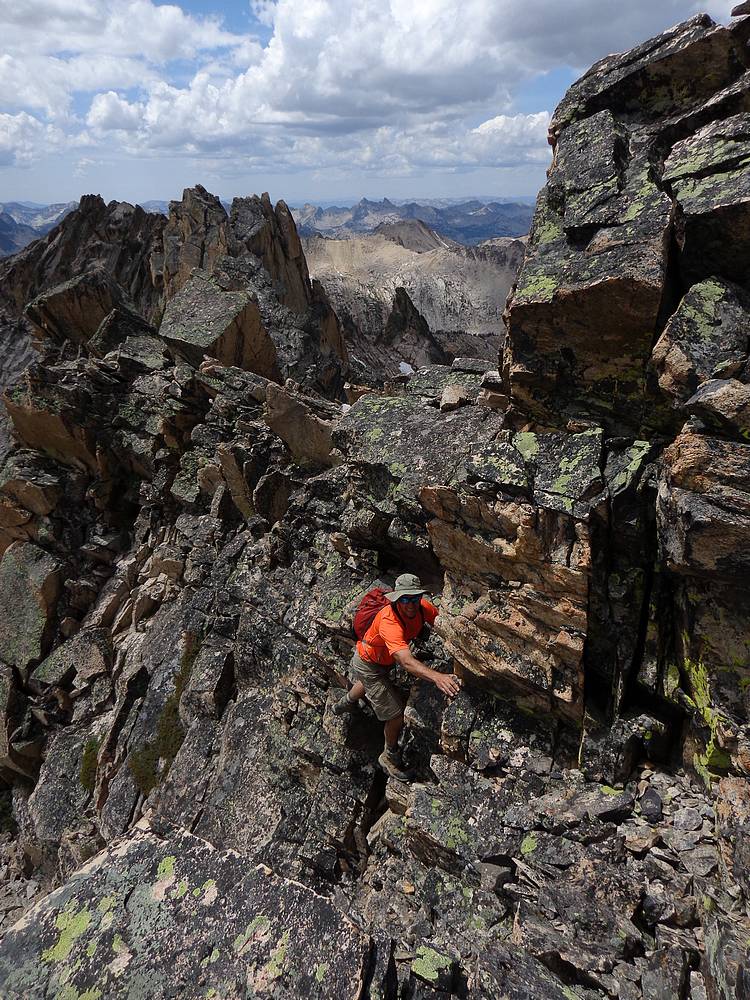
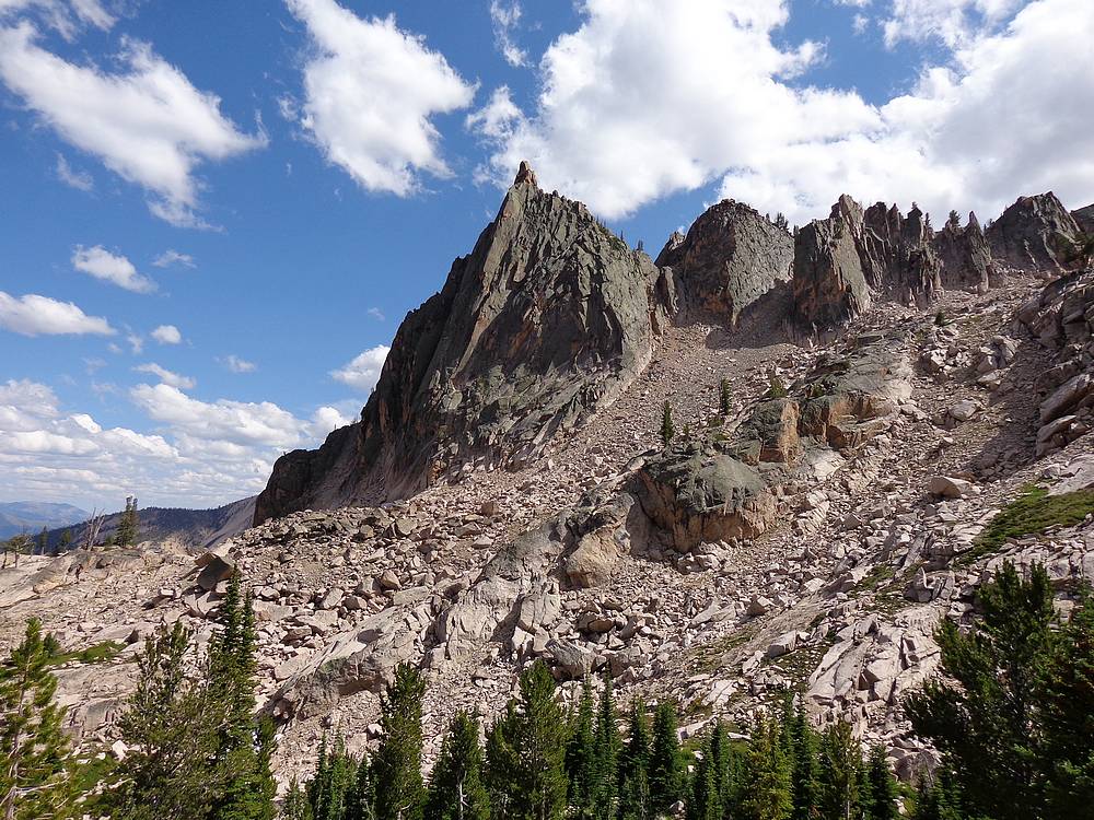
Huckleberry Peak ended up being quite the adventure. We could tell from below that it wasn’t going to be a picnic. The south side of the ridge was guarded by cliffs, and the north side had all sizes of loose rocks. But we just took our time pick our way up through the loose stuff along the north side of the ridge. Near the summit, the rock got steep and was guarded by some shrubs and small trees that we had to shimmy around and through. The very top was big vertical slabs, but we were able to get just high enough to touch the top. We made it up, but it wasn’t easy. And the down climb was nearly as challenging.
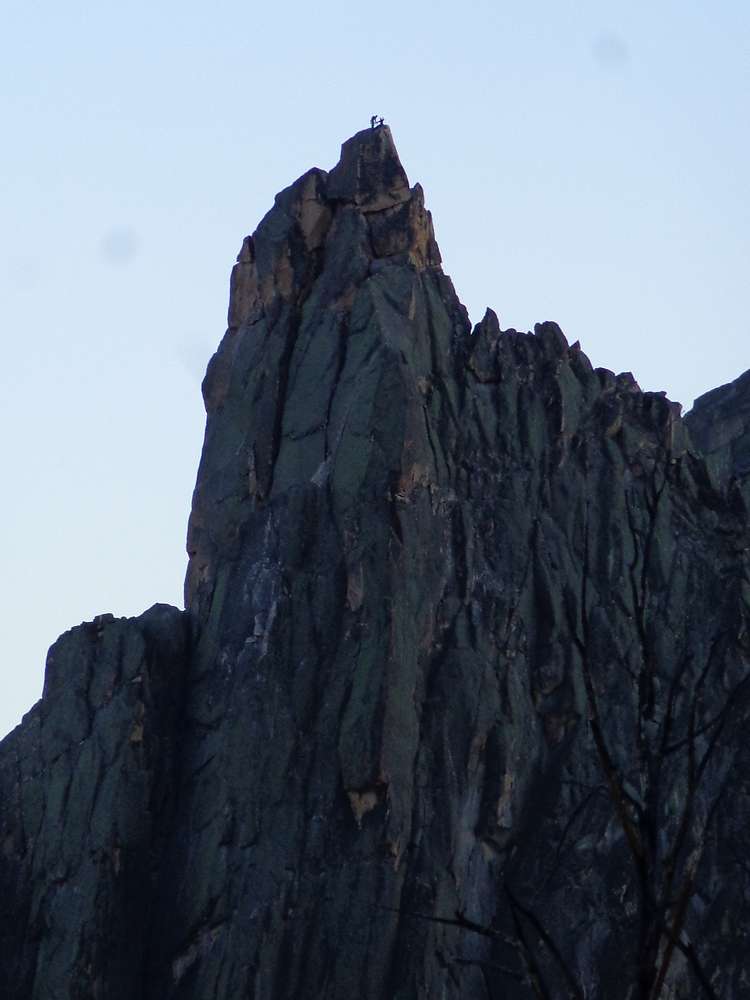
Eventually we made it back to the 9200’ saddle to grab our packs and make do the final uphill of the day to “Decker Tarn” a small lake at just under 9400’ southeast of Decker Peak. It was a beautiful spot with commanding views. After setting up camp and then enjoying dinner, we were able to watch the final group of climbers reach the top of the Finger of Fate at around 9pm. From our vantage point, they looked like little ants perched up there on the summit pinnacle.
Day Three: Decker Peak, Cramer Lakes, back the Redfish
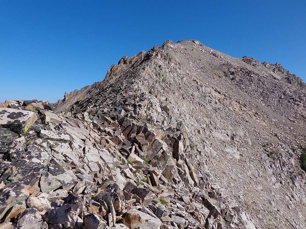
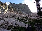
The next morning we could tell it was going to be another beautiful day. We had breakfast, broke camp, and started our climb up to the 10100’ saddle south of Decker Peak. After passing the second tarn (not as nice as the lower one) we were left with talus and boulders to climb, heading straight west to the saddle. Fortunately the rock was pretty stable, and we made good time.
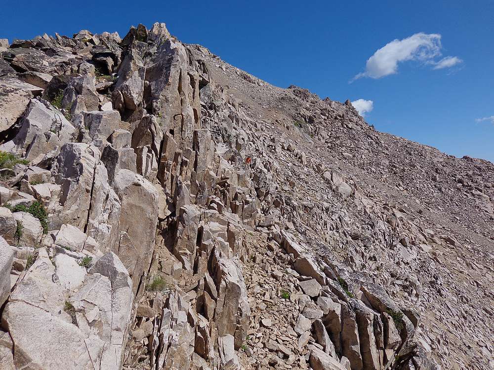
At the 10100’ saddle, Ken decided to start heading down to Cramer Lakes, while John and I headed up the south ridge of Decker Peak. For some reason, we’d expected the ridge to be a walkup, but there was actually quite a bit of scrambling involved as we passed over and around big boulders on the way to the summit. All in all, still not too bad, and we made it to the summit in about half an hour, just after 9am.
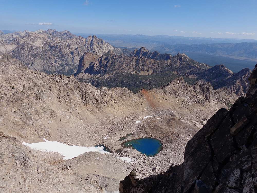
The views from the summit of Decker Peak were great in all directions, and we hung out for a while knowing it was the last summit of the trip. But we also still had a bunch of miles to cover, we reluctantly started back down, retracing our steps back to the saddle. Next we began our descent toward the Cramer Lake. The upper section include some really nasty talus fields until we reached the small pond at 9300’. Not a section I would want to be climbing up. The rest of the way down, we wandered through the forest, wrapping around the hillside in a southwesterly direction until we reached the Upper Cramer Lake.
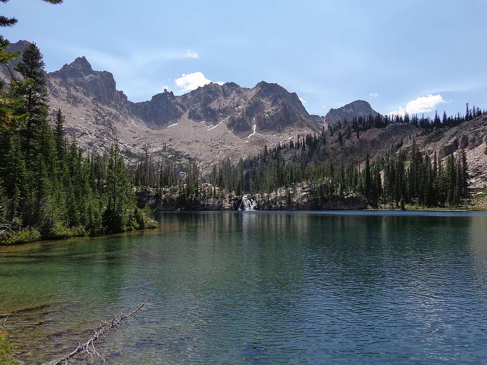
The Cramer Lakes were very scenic, and we enjoyed the views of The Arrowhead and Dave’s Peak high above. We had lunch at the Middle Cramer Lake, with a great view of the famous waterfall. We had the lakes mostly to ourselves since we were there at “shift change” with most of the prior night’s campers having already left, and the next night’s campers still on their way up. The Cramer Lakes are a popular backpacking destination for good reason.
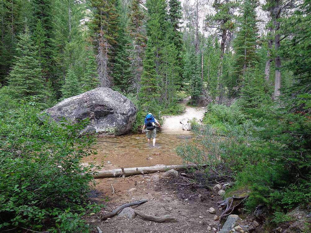
After lunch, we still had about 7 miles of hiking to get back to the trailhead. So we set a quick pace, motivated by thoughts of cheeseburgers in Stanley. The creek crossing just above Flatrock Junction was a welcome relief for our hot and tired feet. From this point on, the only things that slowed us down were huckleberry patches and views of the Elephant’s Perch and the Grand Mogul towering above the trail. We got back to the trailhead around 4pm, and then waited in the shade with a bunch of other hikers for a half hour or so waiting for the boat. After an abrupt reintroduction to society on the beach at Redfish, we made the drive to Stanley for our well-deserved cheeseburgers.
This ended up being an excellent trip. Ken and John are both great hiking partners, and we got to see a ton of amazing terrain that was new to us. Add in four peaks and plenty of solitude along the way, and a trip like this is hard to beat.
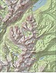
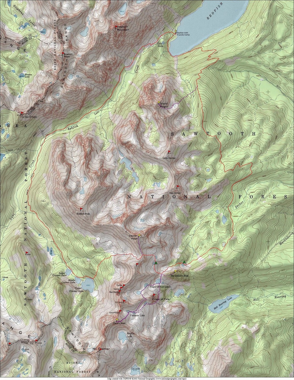
Map of the route, taken clockwise. Base loop is 20 miles and 4500' gain, total of 28 miles and 9600' gain with side trips for peaks. |
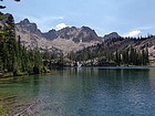
Grand Mogul from the Redfish boat dock. |
West face of Grand Mogul from the Alpine Way Trail. |
Headed up Grand Mogul. |
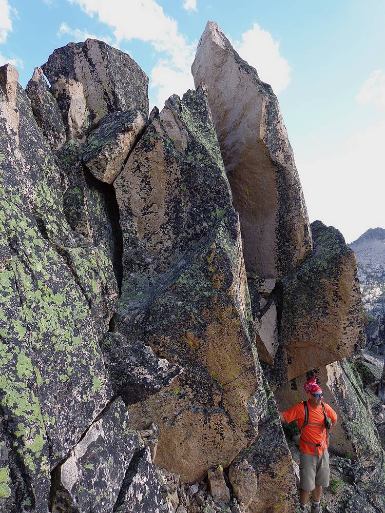
This cool slot ended up not being the way to the summit. |
John on the summit of Grand Mogul. |
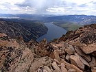
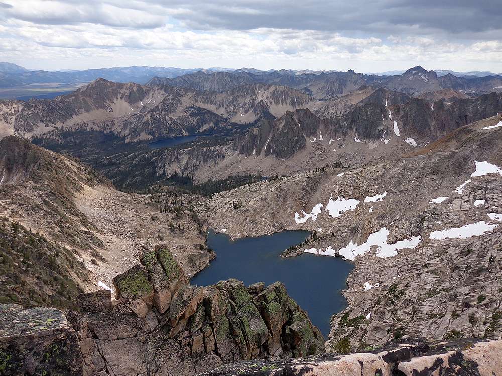
Redfish Lake from the summit of Grand Mogul. |
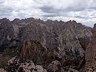
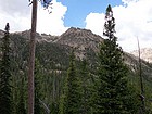
Big Sawtooth peaks northwest of Grand Mogul. |
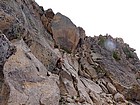
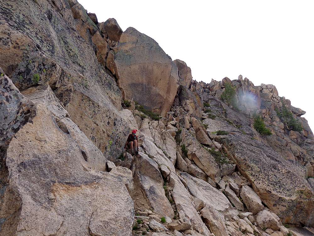
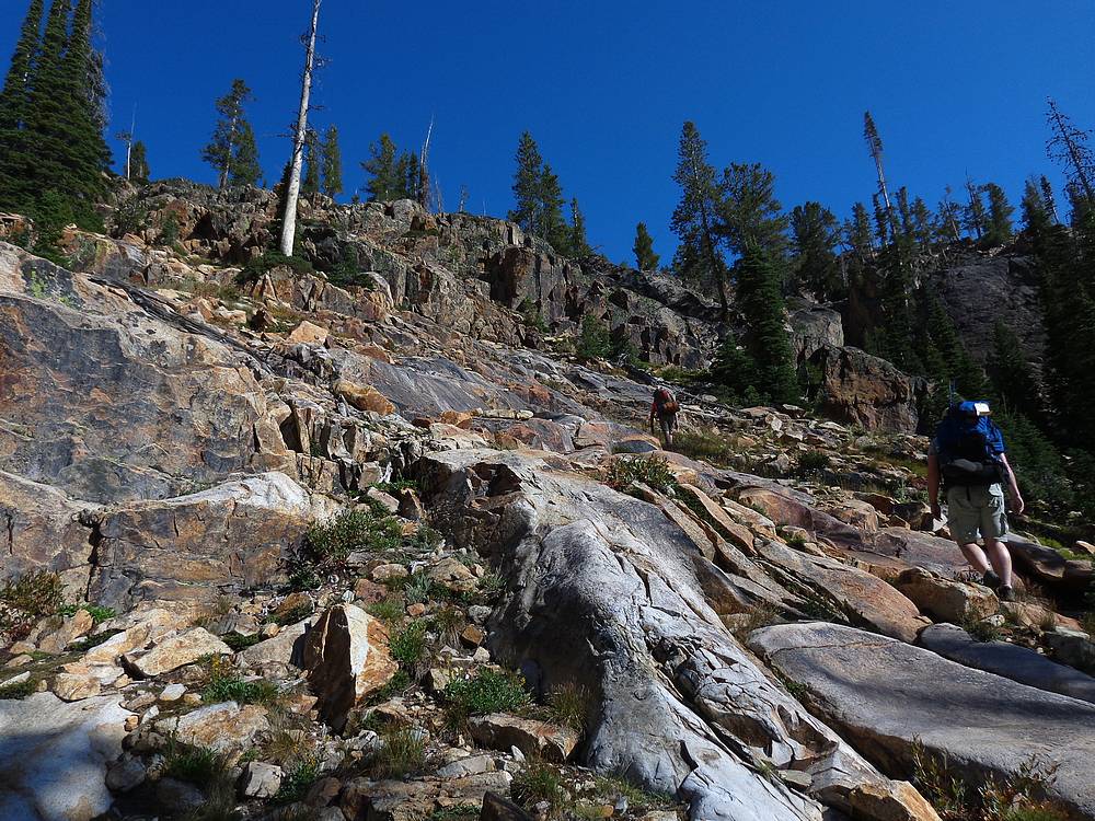
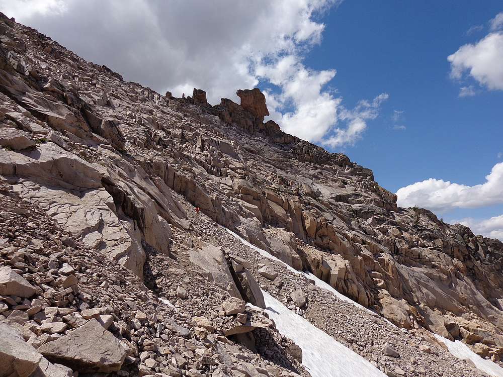
Typical conditions on the downclimb. |
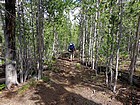
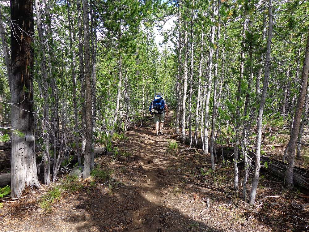
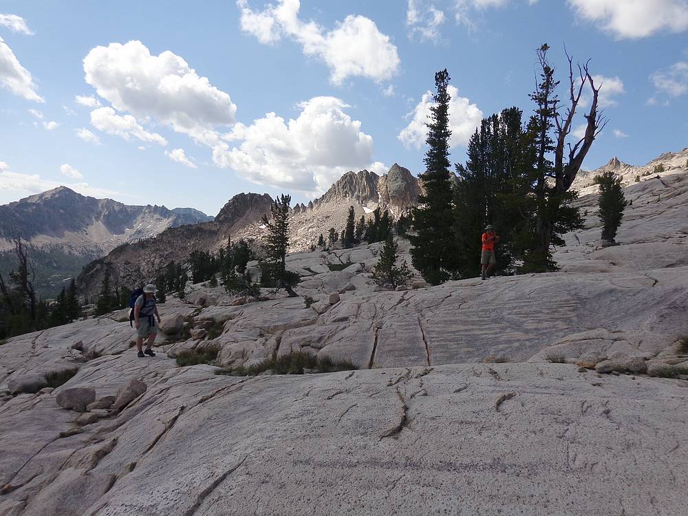
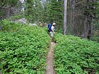
Back on the Alpine Way Trail for a while. |
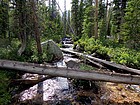
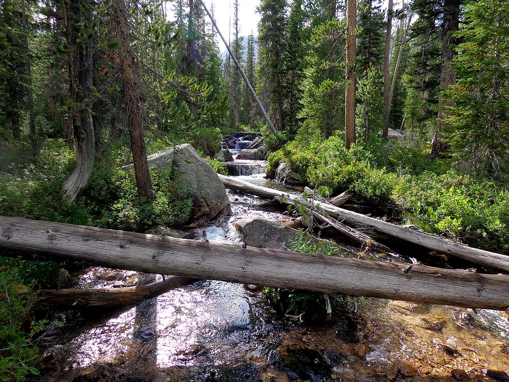
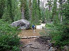
Decker Creek crossing. |
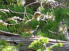
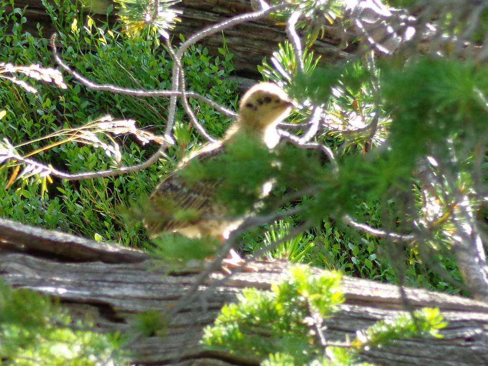
We saw this grouse chick while bushwhacking above Decker Creek. |
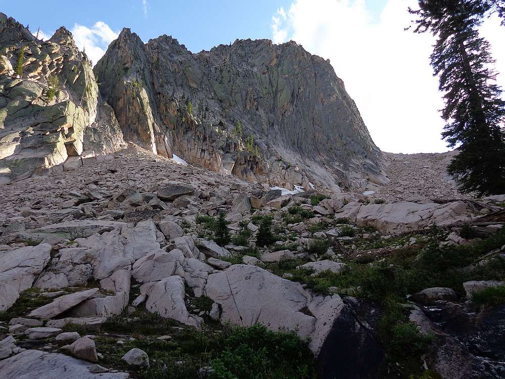
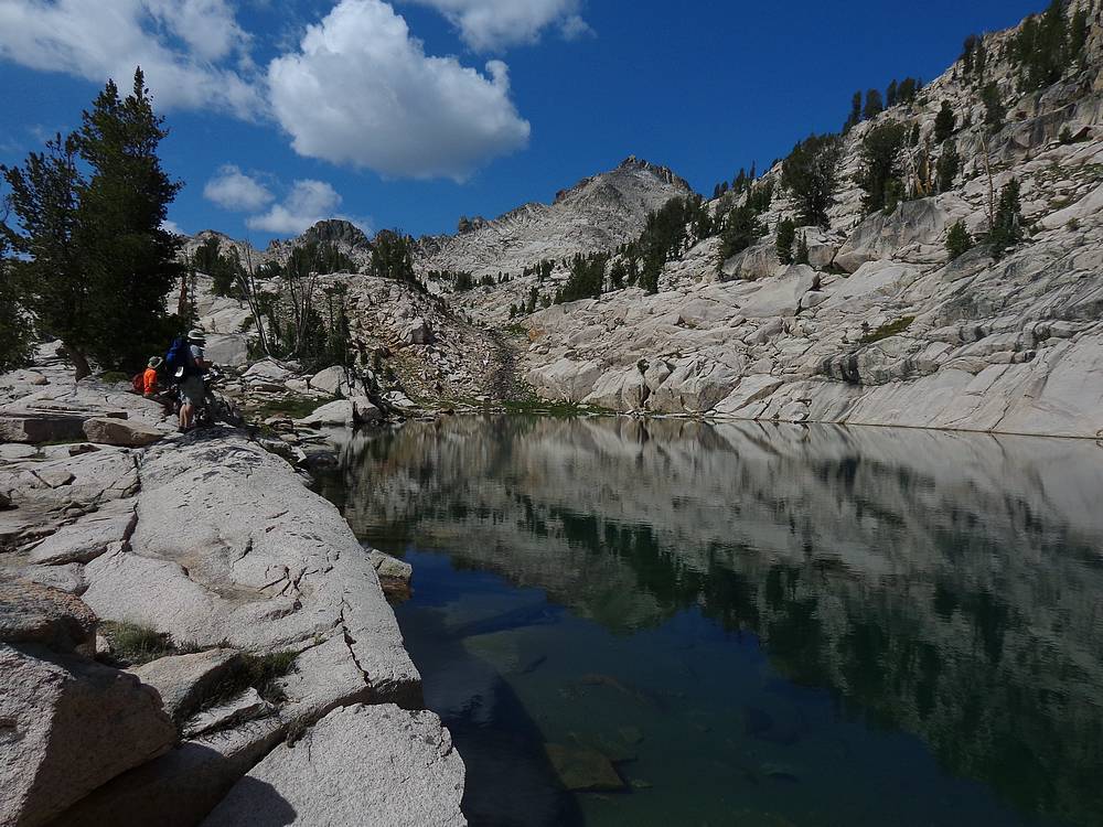
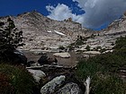
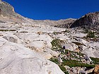
View of the "Huckleberry Wall" as we made our way up to the small lake. |
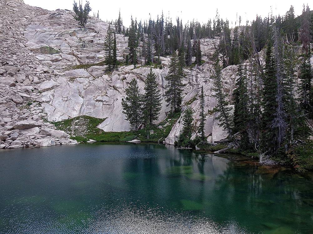
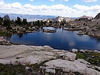
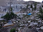
Unnamed lake in the Decker Creek drainage we camped at the first night |
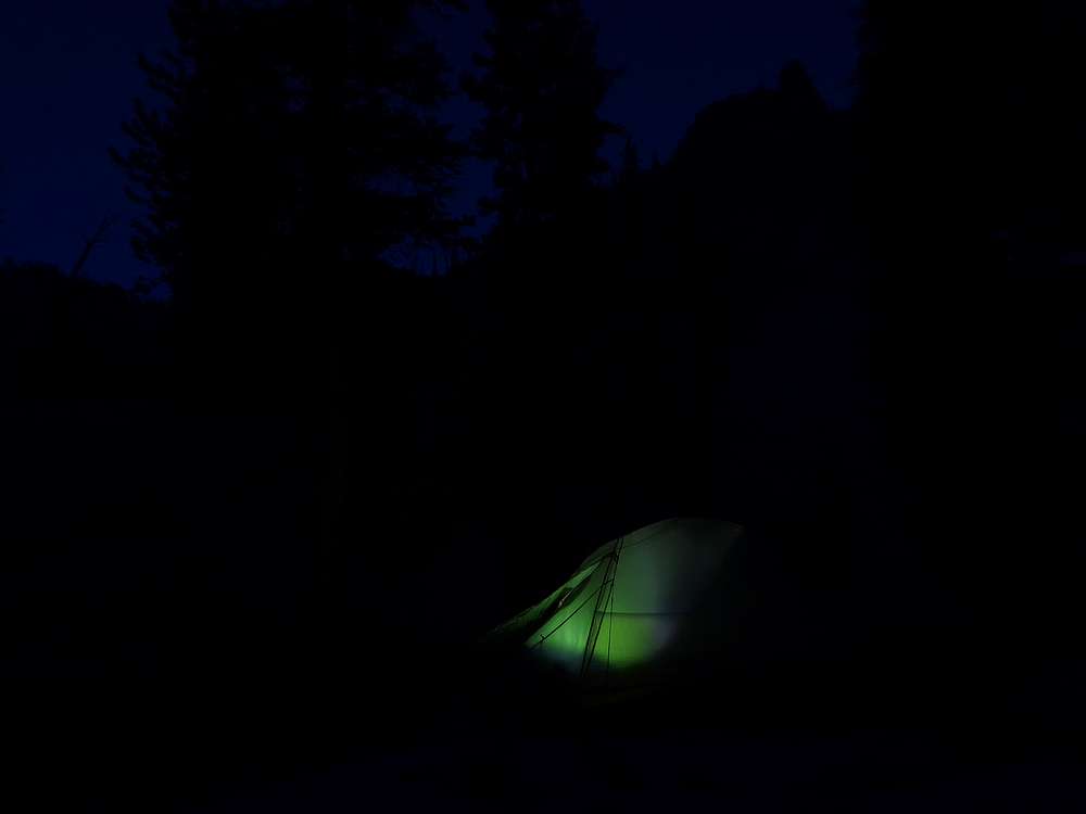
Getting ready to hit the hay after a long day. |

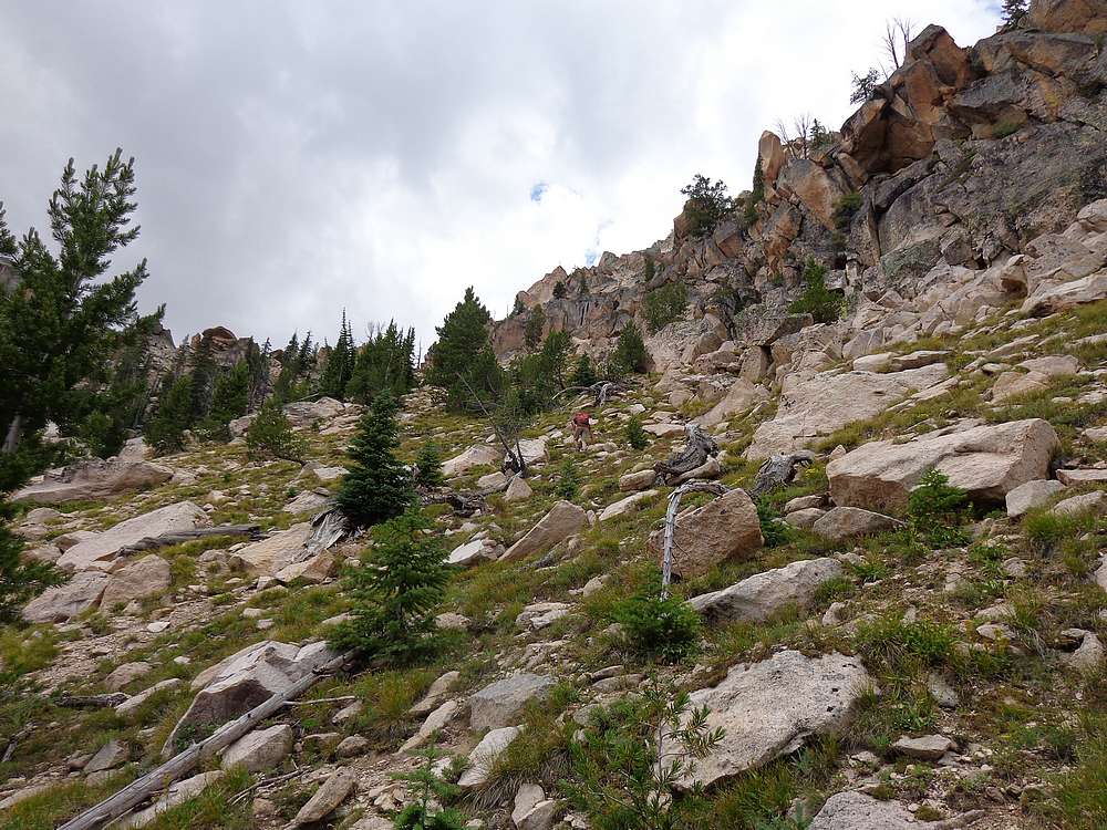
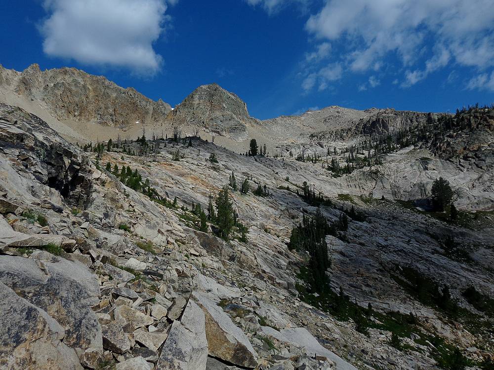
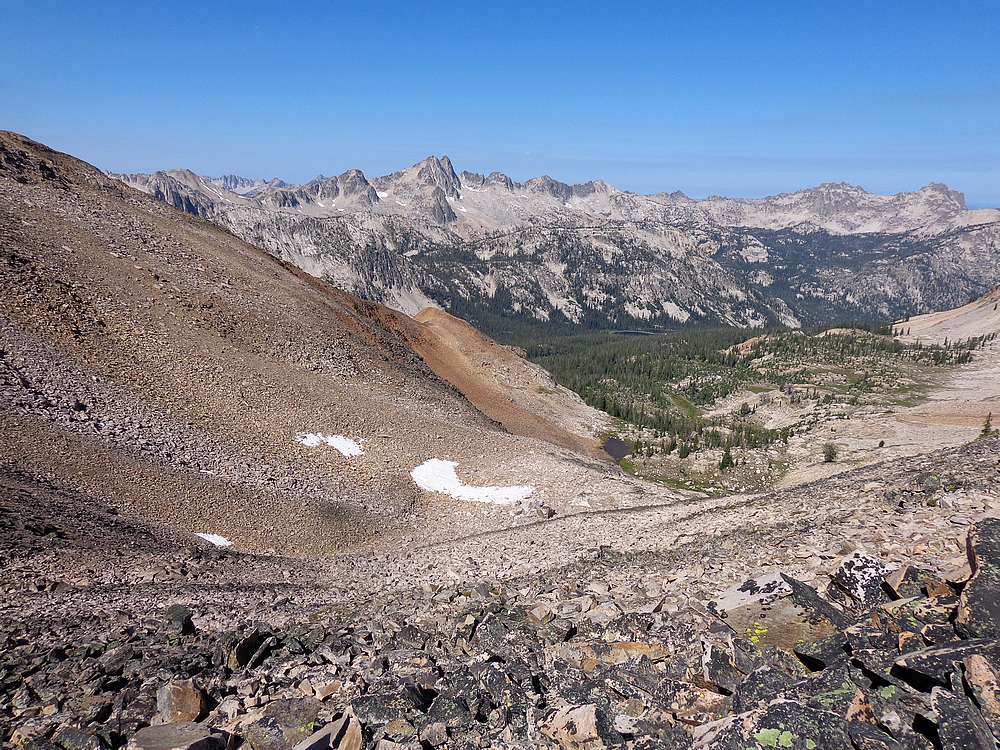
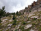
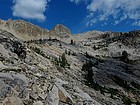
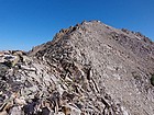
Steep from the start to begin day two. |
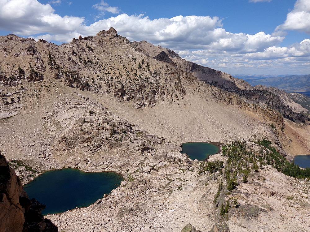
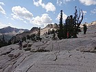
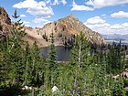
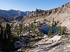
Starting to get above tree-line, Decker Peak on the right. Our next camp would be at a small tarn behind the big tree in the center. |
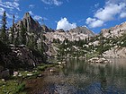
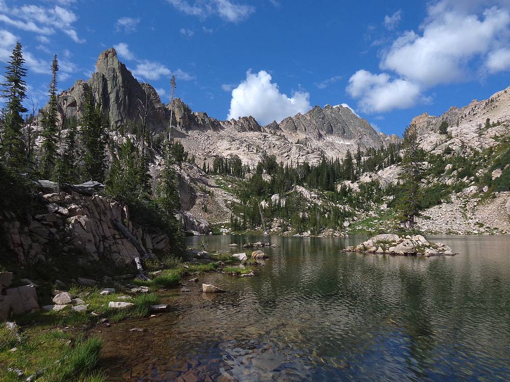
Finger of Fate and Mount Sevy from Finger of Fate Lake #3. |
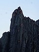
Zoomed in shot of the summit block of Finger of Fate as we pass by. |

We used these ledges to circle under the Finger of Fate. |
Huge polished granite slabs southwest of Finger of Fate. |

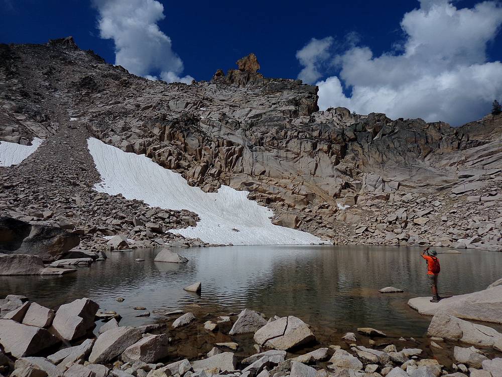
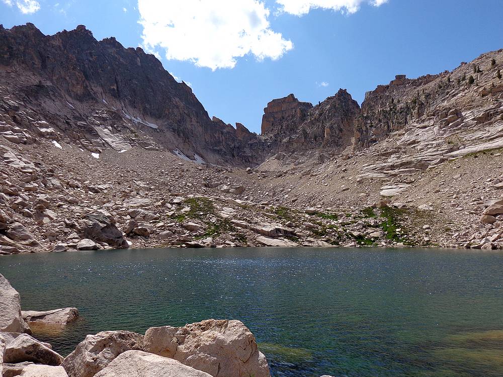
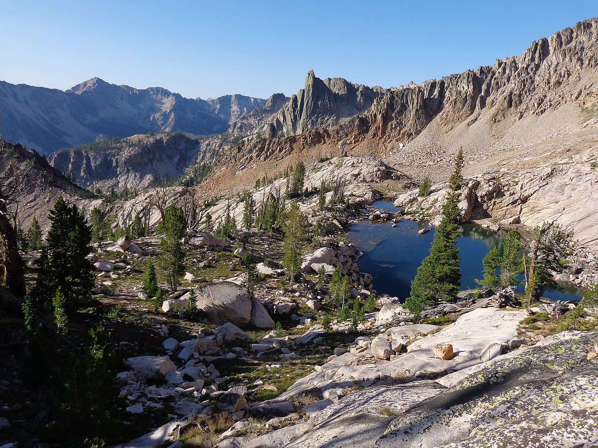
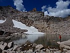
Lake 9500', and the false summit of Daves Peak in the background. |
The Arrowhead and false summit of Daves Peak from "Fantastic Lake". |
John checking out The Arrowhead from the highest lake. |
Taking a breather as we near the false summit of Daves Peak, The Arrowhead looks like a thin spire from the side. |
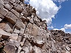
Traversing big blocks on the south face of Daves Peak. |

John is impressed by this massive hole just below the summit of Daves Peak. |

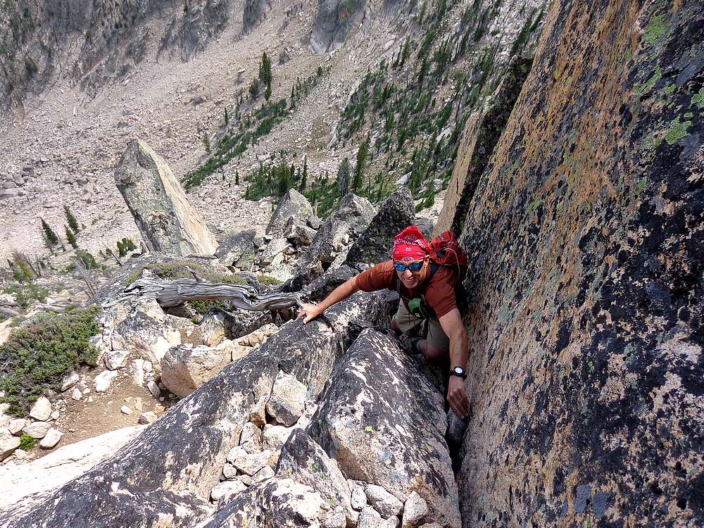
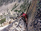
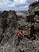
Dave scrambling on the south face of Daves Peak, Profile Lake far below. JohnF photo. |
Exposed scrambling near the summit of Daves Peak. |
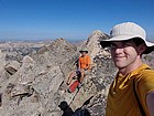
Daves Peak summit splattski shot. |
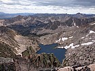
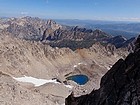
Profile Lake and Imogen Lake from the summit of Daves Peak. |
John descending scree, The Arrowhead in the background. |
Aptly nicknamed "Fantastic Lake". |

Looking down on the uppermost Finger of Fate Lakes. |

Mount Sevy, Red Bluff, Sentry, and The Coffin from the uppermost Finger of Fate Lake. |

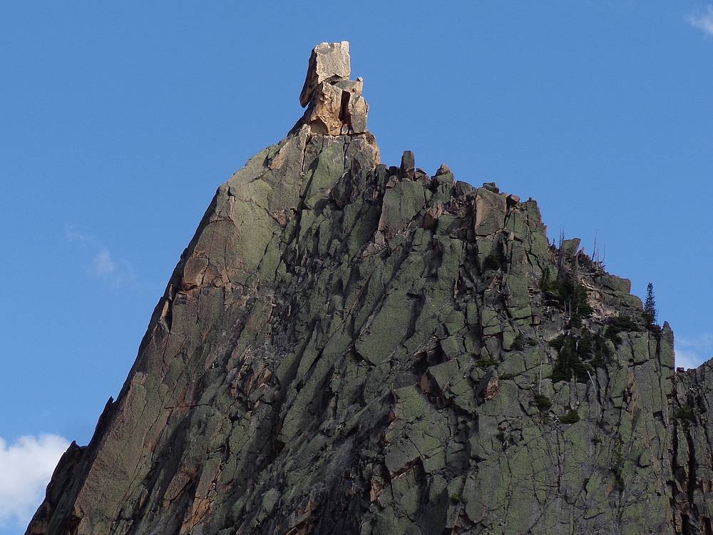
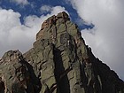
Zoomed in shot of the summit block of Finger of Fate from the northwest. |
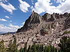
Finger of Fate from the northwest. |
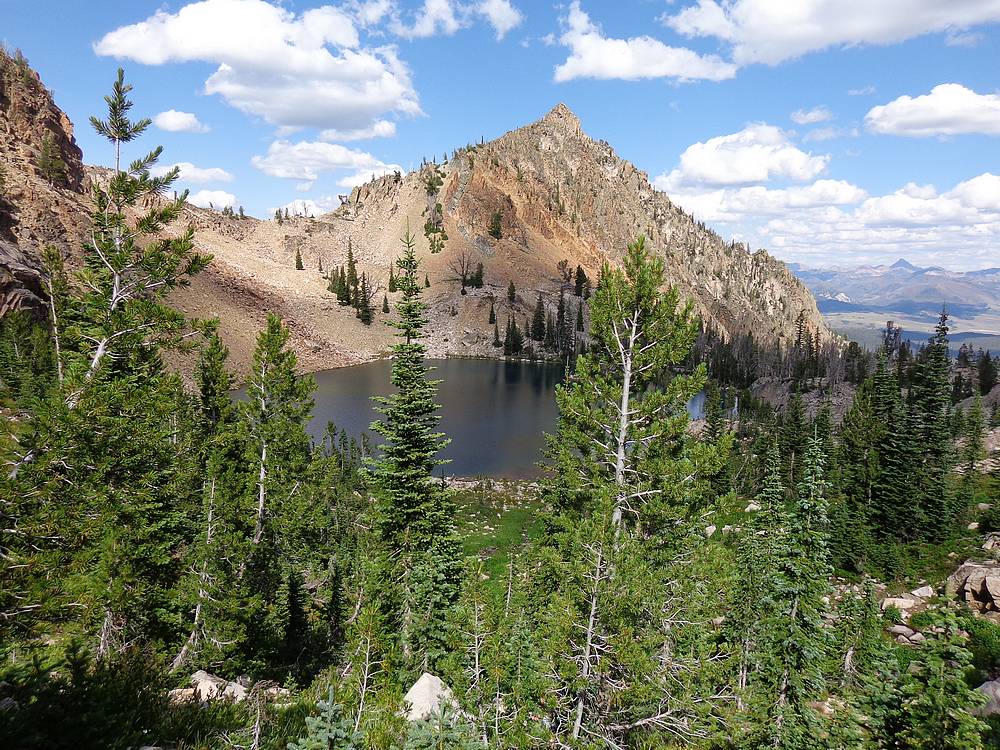
Huckleberry Peak above Finger of Fate Lake #3. |

This deer snuck up on Ken while he was fishing at Finger of Fate Lake #3. |
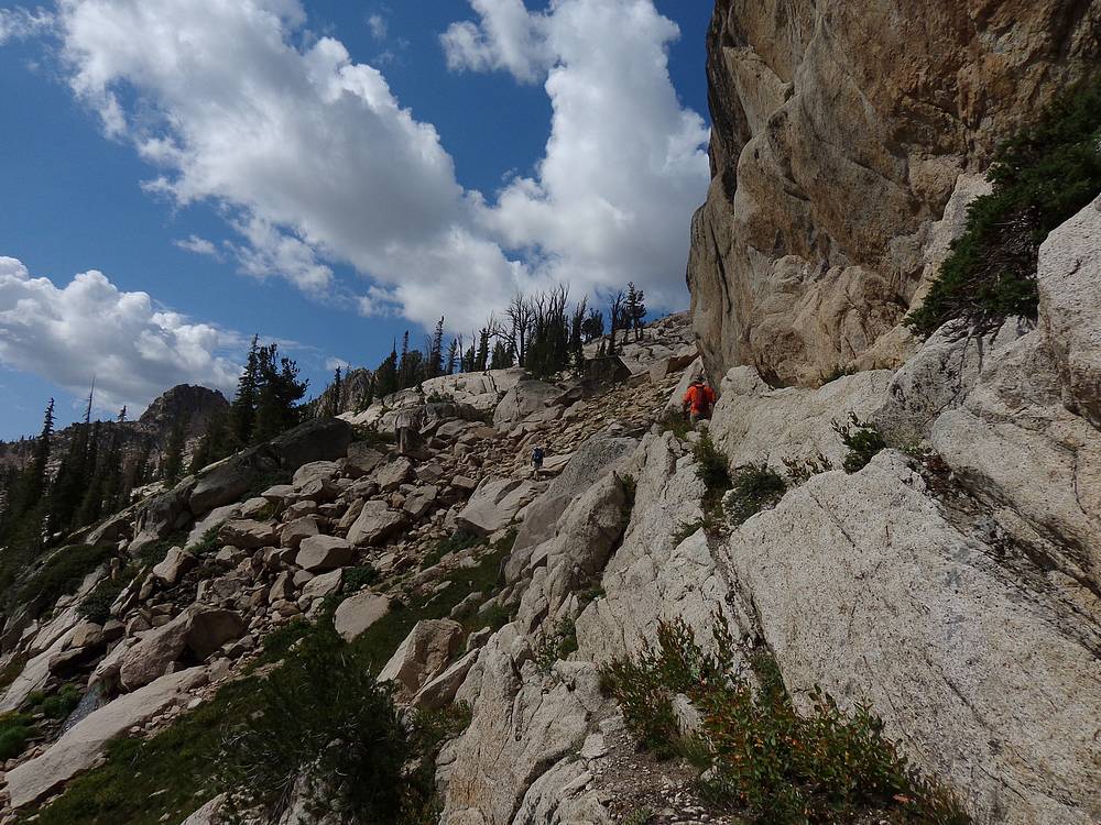
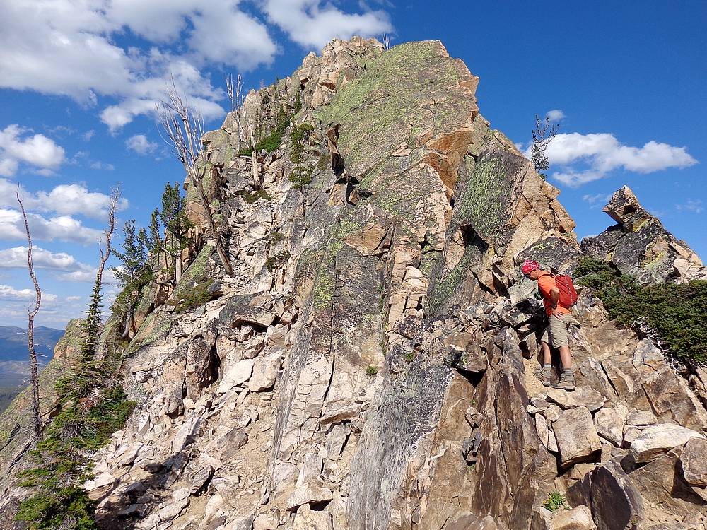
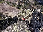
John contemplating his next move on the way up Huckleberry Peak. |
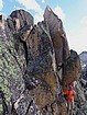
John nearing the summit of Huckleberry Peak. |
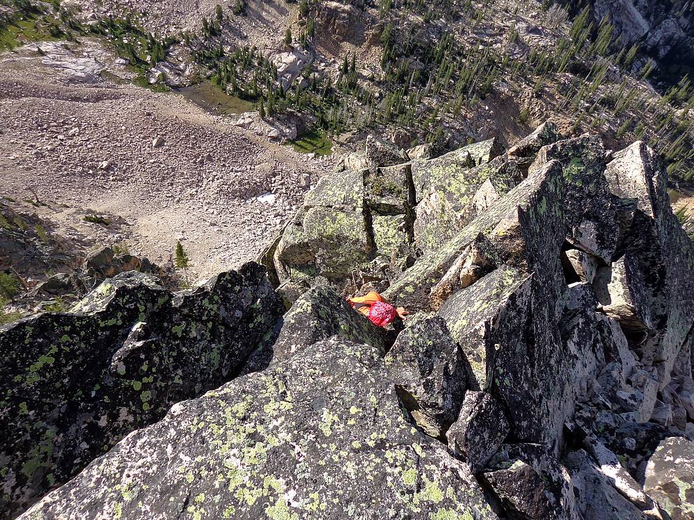
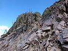
Just below the summit of Huckleberry Peak. |
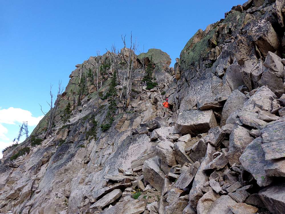
Heading back down from Huckleberry Peak. |
Nearing our campsite at "Decker Tarn" with Decker Peak in the background. |
Our campsite at "Decker Tarn" with Decker Peak in the background. |
Climbers summit Finger of Fate around 9pm. |
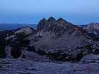
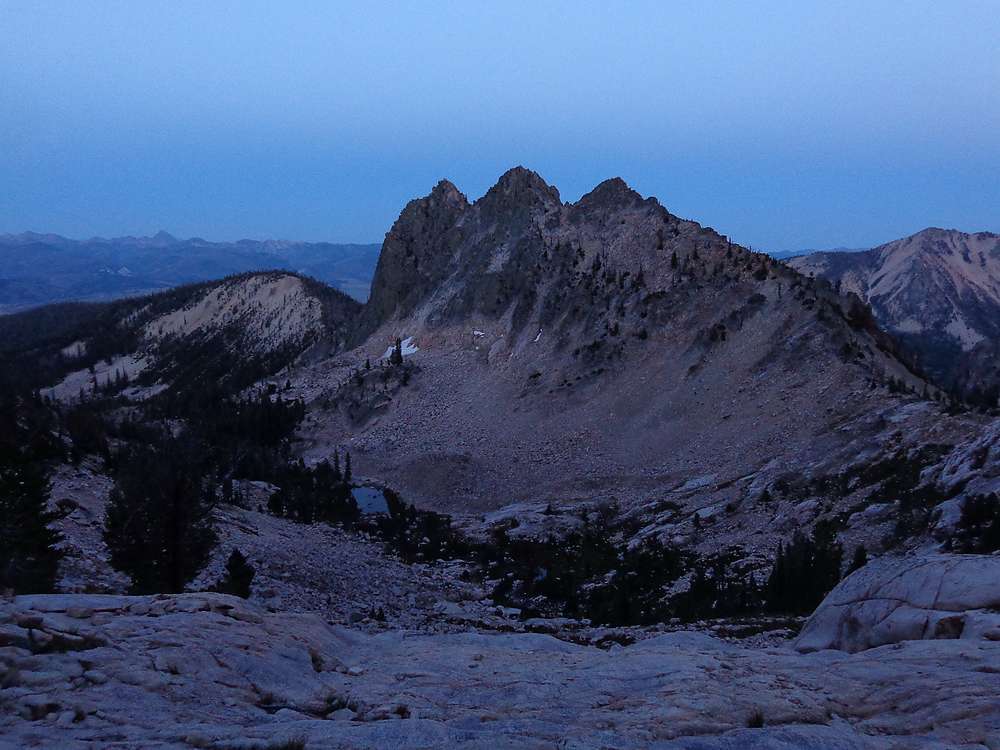
Low light view of Huckleberry Peak from our campsite at "Decker Tarn". |
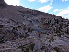
One last look at "Decker Tarn", with Imogene Peak and Finger of Fate in the background. |
Hiking up toward Decker Saddle. |
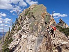
South ridge of Decker Peak from the saddle. |
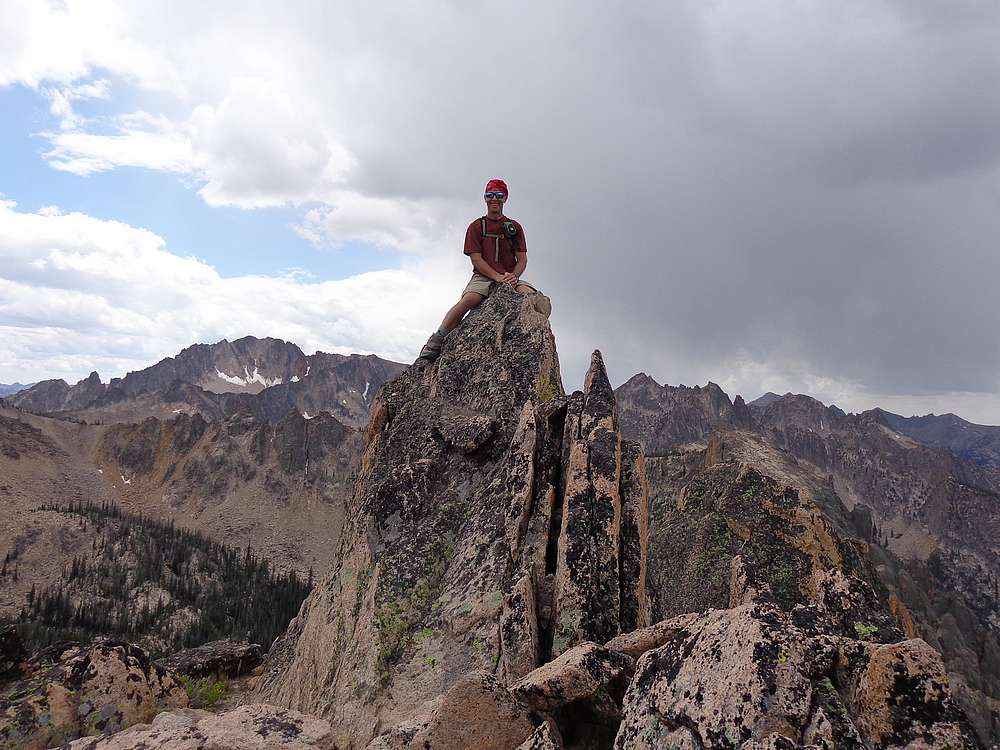
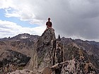
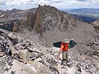
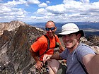
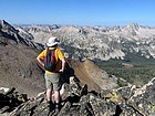
Decker Peak summit splattski shot. |
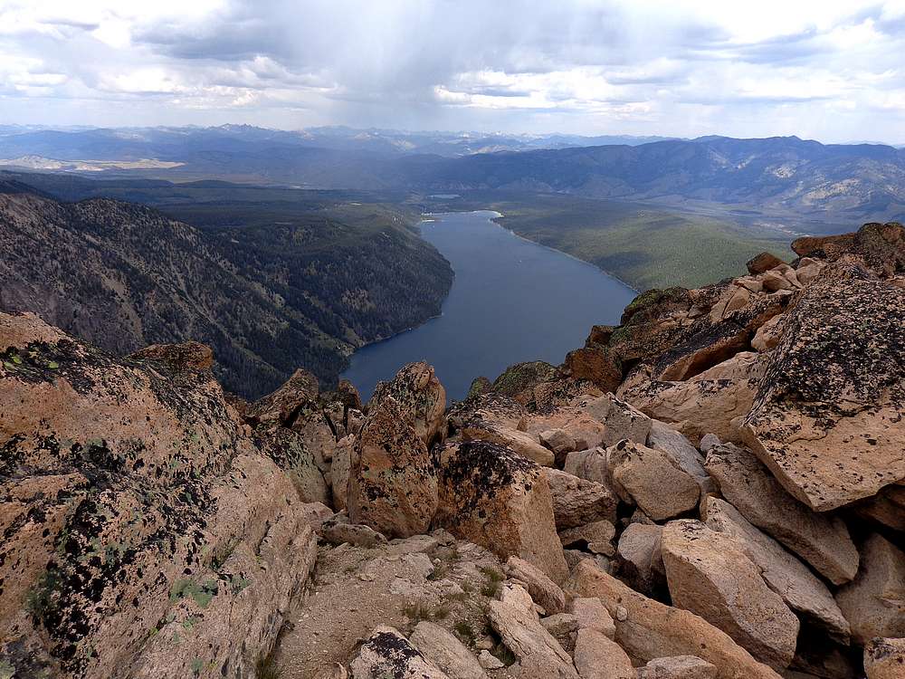
View north from Decker Peak, including Elephant's Perch, Heyburn, Thompson, etc. |
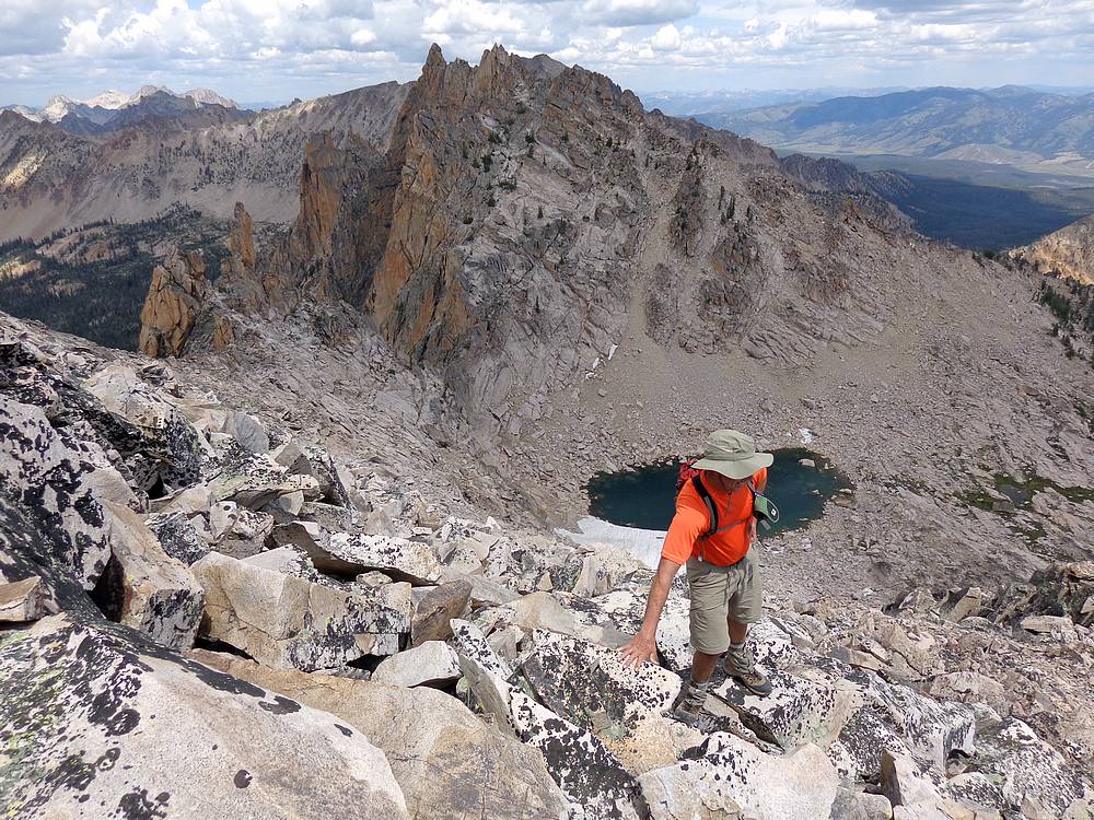
Dave surveying the views from Decker Peak, Cramer Lakes below. John F photo. |

Making our way back down the south ridge of Decker Peak. |
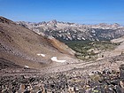
View west from the saddle. Elk Peak in the distance, Cramer Lakes just visible below. |
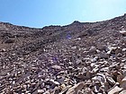
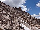
Huge talus field to descend from the saddle. |
Making our way down toward Cramer Lakes, Elk Peak in the background. |
Daves Peak (center) from middle Cramer Lake. |
Crossing Redfish Lake Creek near Flatrock Junction. |
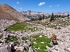
Stopping to snack on huckleberries during the hike out. |
 |
|