|
Granite Peak - Montana
Granite Peak
An amazing three day trip to climb the rugged high point of Montana
Elevation 12799'
September 12-14, 2015
Granite Peak is the highest mountain in Montana and one of the more challenging state high points to reach. It is located in the Absaroka-Beartooth Wilderness, not far from Yellowstone National Park. Granite is a rugged peak located deep into some really big country. The southwest ramp route is quickly becoming a favorite route, but it is still over 25 miles round trip and involves some challenging scrambling. This peak should not be taken lightly, and is a climb you will never forget.
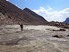
After casually discussing a Granite Peak climb for the last few years, we set firm dates this year. We ended up with a very strong group made up of Michael, Dan, John, and Dylan. After doing a portion of the 8-hour drive from Boise on Friday night, we arrived at the upper Lady of the Lake trailhead and started hiking a little after 11am Saturday morning. It was a beautiful fall day, and we made good time covering the first four miles to the crossing of the Broadwater River, where we hung a right and headed briefly downhill to the start of the Sky Top Creek drainage.
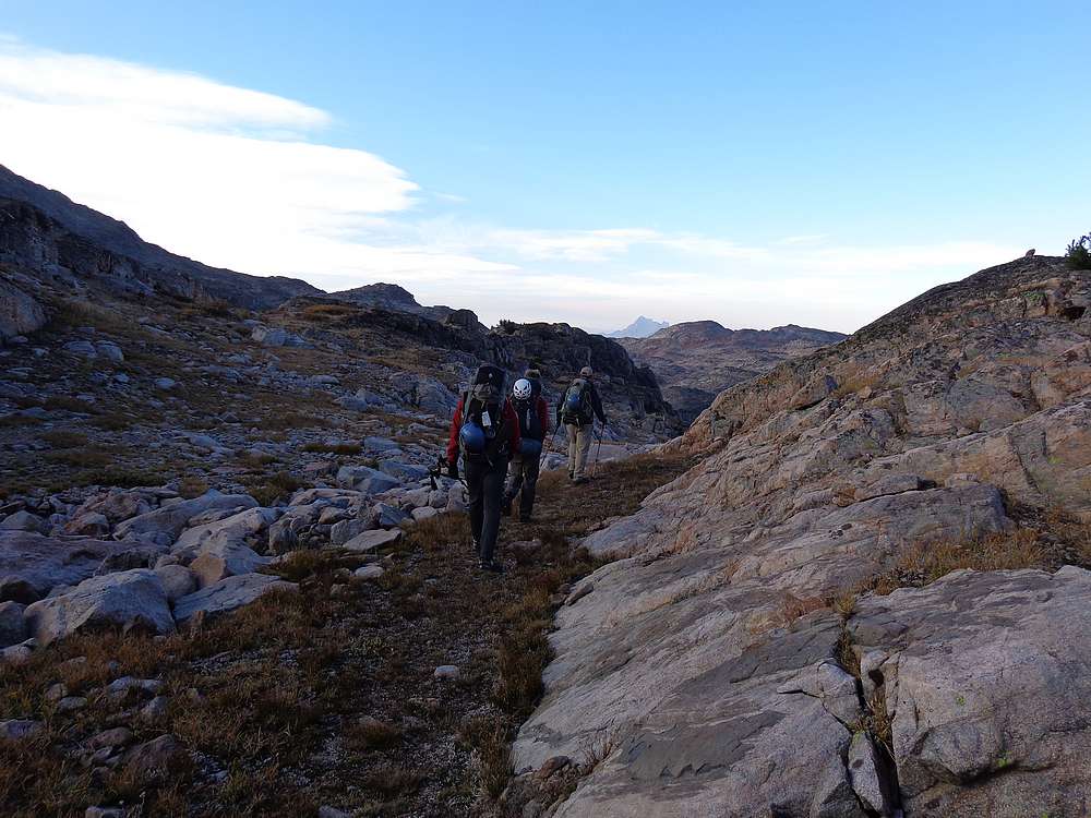
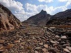
The initial section of the unmaintained trail up Sky Top Creek was in the trees, but we got more and more views as we climbed higher. The scenery along the creek was nice, but started getting really spectacular once we reached the alpine country at Lone Elk Lake. We were above tree-line at this point, with big granite peaks all around us. The views only got better as we hiked up along the south side of Rough Lake.
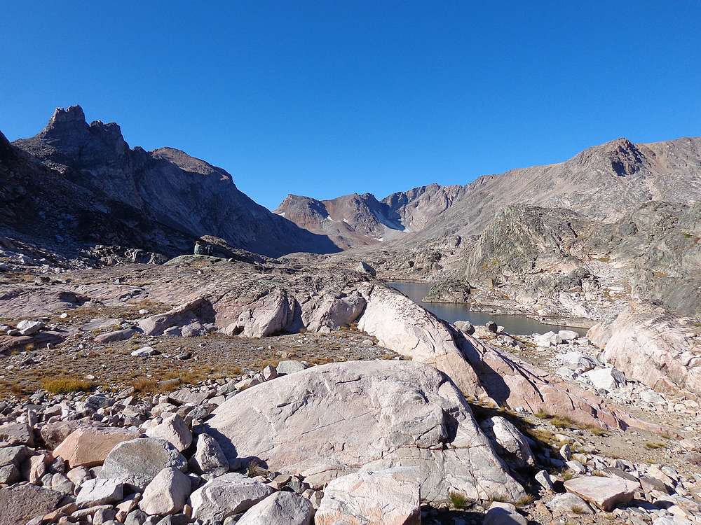
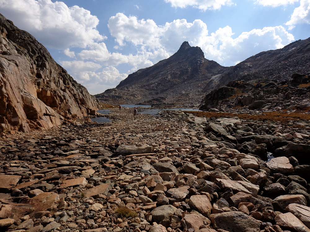
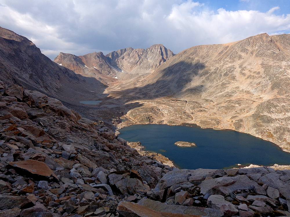
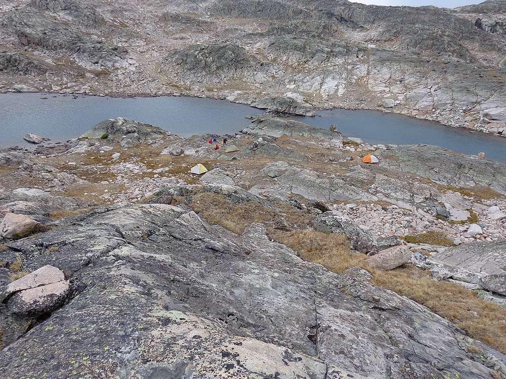
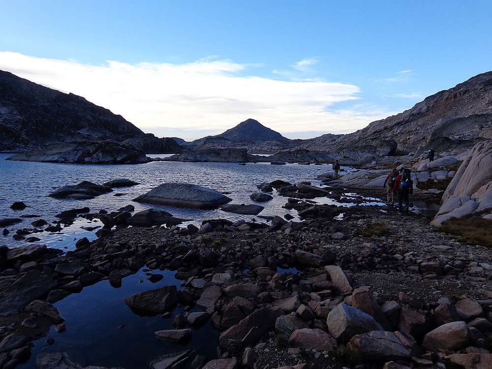
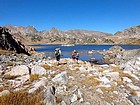
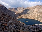
Rough Lake would have made a great camping spot, but we were feeling good and decided to continue on up toward the Skytop Lakes. The trail was fleeting at this point, but cairns marked the route so route-finding was made easy. But there was also quite a bit of boulder-hopping around the lakes, so our pace slowed down somewhat, and we decided that the south end of the largest lake would make a good place to set up camp. After nearly 10 miles of hiking and 6 hours, it felt good to take off our big packs and rest.
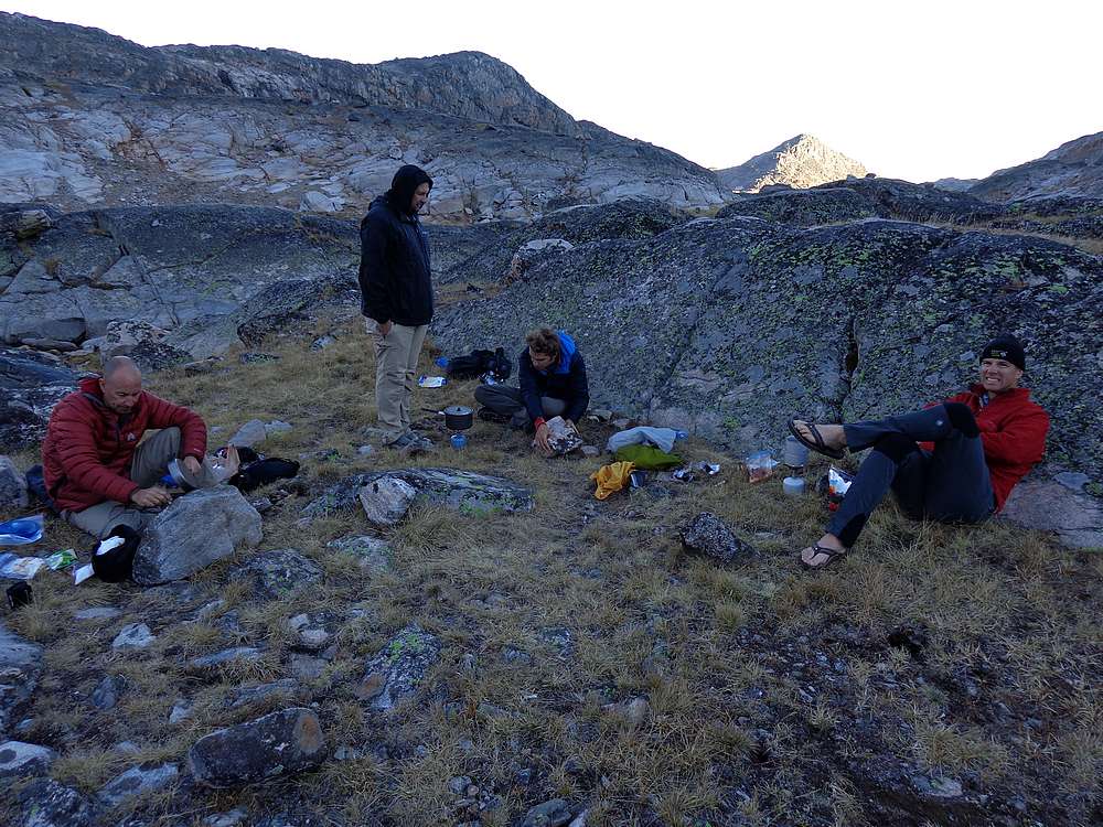
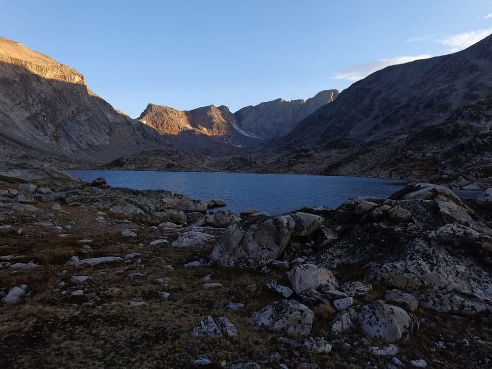
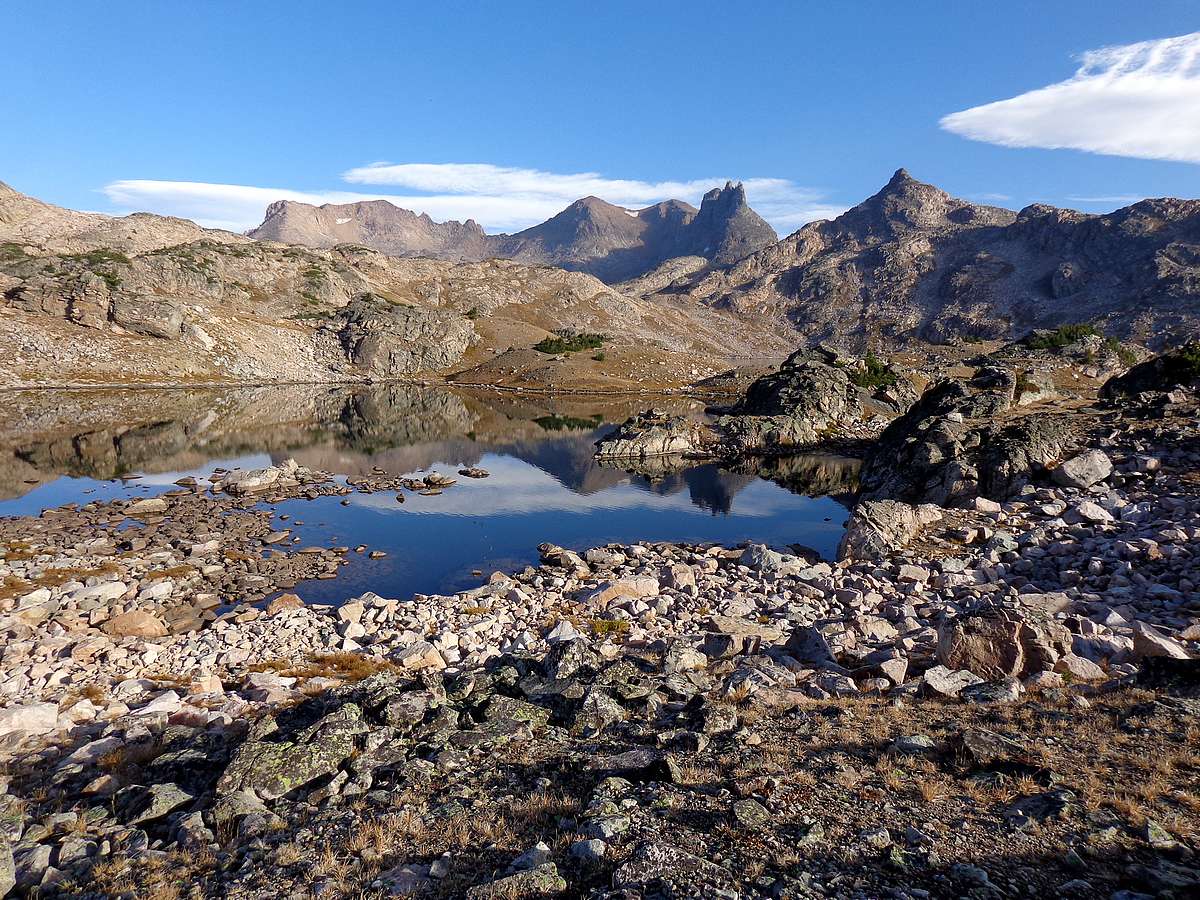
Our campsite at the big Skytop Lake was amazing. Open and rugged country with fantastic views. It was a great vantage point to study Granite Peak, although from our angle, the southwest ramp route was not obvious. After a good day of hiking, and knowing we had a big climb the following day, we hit the sack pretty early. Although a few of us did stay up long enough for night to fall so we could check out the Milky Way visible in the clear night sky.
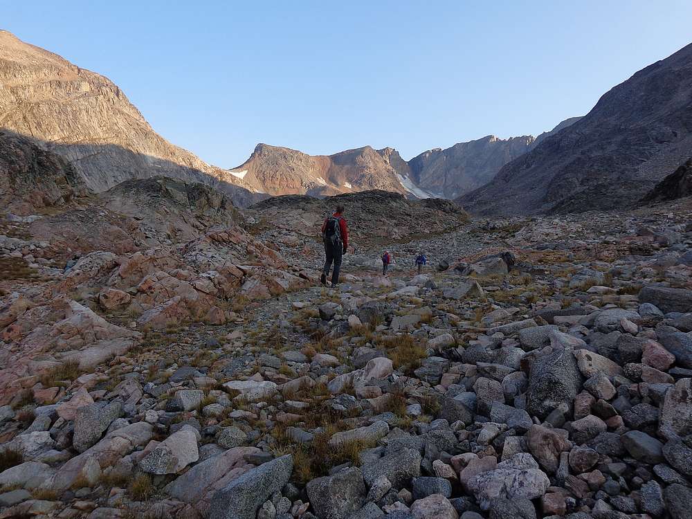
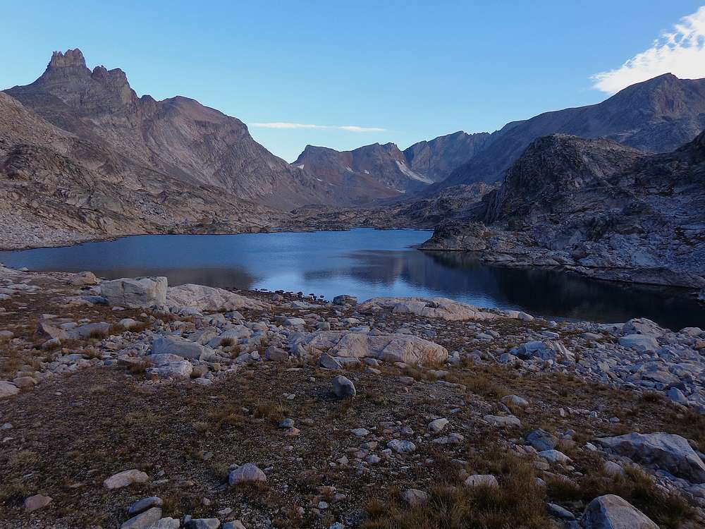
The next morning we arose early, and were hiking by just after 7am. We crossed over to the west side of the lake because it looked a little grassier. But the grass soon gave way to talus, and the talus then gave way to boulders. Needless to say, it was pretty tedious going. But our spirits were high as big views of Granite Peak stared us in the face.
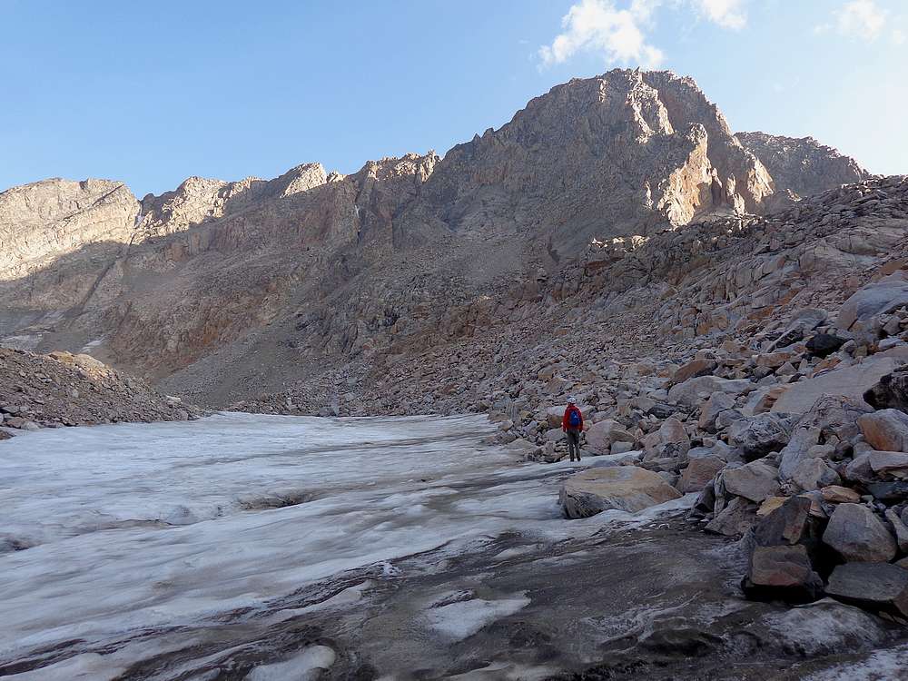
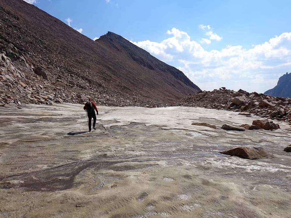
Once above the highest Sky Top Lake at 10,800’, we boulder-hopped up the moraine, and then took advantage of faster terrain on the icy tongue of the Sky Top Glacier, before eventually reaching the saddle and the start of the scramble route. Here we put on our helmets and started climbing in earnest.
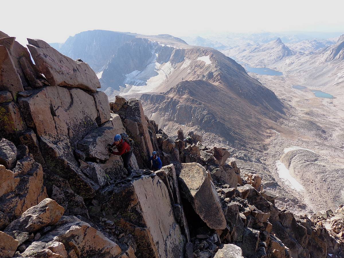
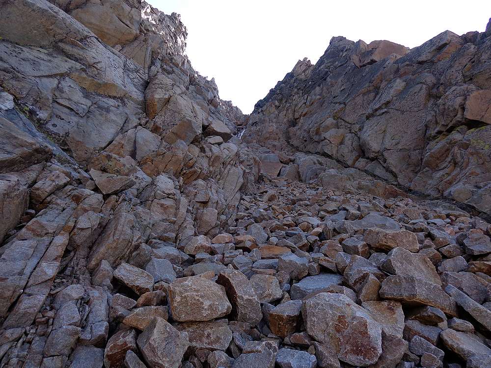
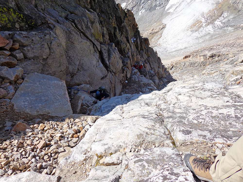
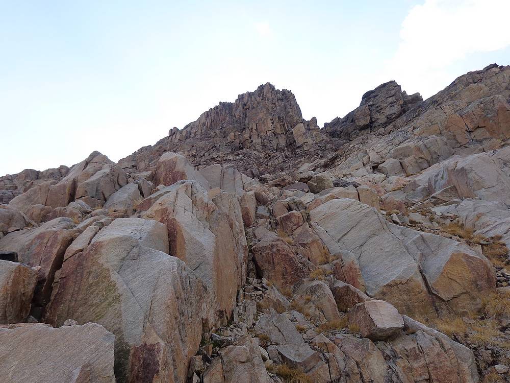
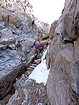
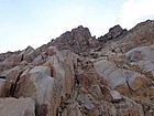
The southwest face of Granite Peak is big and steep, with no apparent weaknesses. But we had all read several trip reports about our route, so we knew what to expect. The lower portion of the route headed up and to the left, following a climbers trail through rubble up the base of a huge granite slab. Once at the slab, we continue along its lower edge until it ended. At this point, we looked up and to our right, and the obvious route appeared. It’s called the southwest ramp, but I would consider it more of a steep gully. The gully is known for loose rock, so were glad that there were no other climbers on the route today to kick rocks down on us.
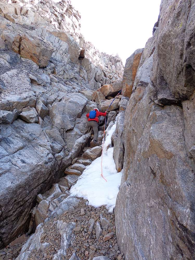
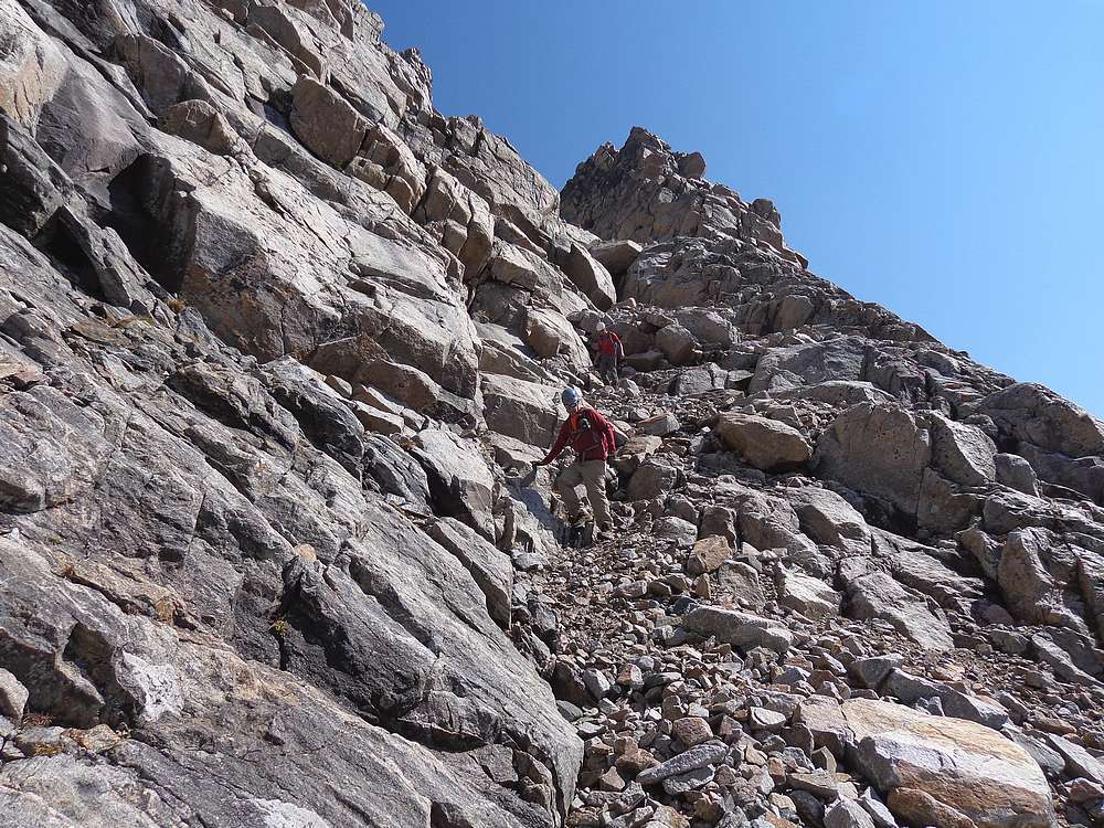
As we started up the gully, we all moved very carefully to keep from dislodging rocks. After a few hundred feet we reached a steep section that had a fixed rope hanging in it. The rock in that area was stable so I didn’t feel the rope was really needed. All of us made it up this section with ease. This was followed by more loose rock climbing and then another steep step that also had a fixed rope. This section had some snow and ice in it, and was the crux of the climb, probably low class 4. The rope here wasn’t absolutely necessary, but it was nice to have for peace of mind. We took our time here, but again made it past without incident.
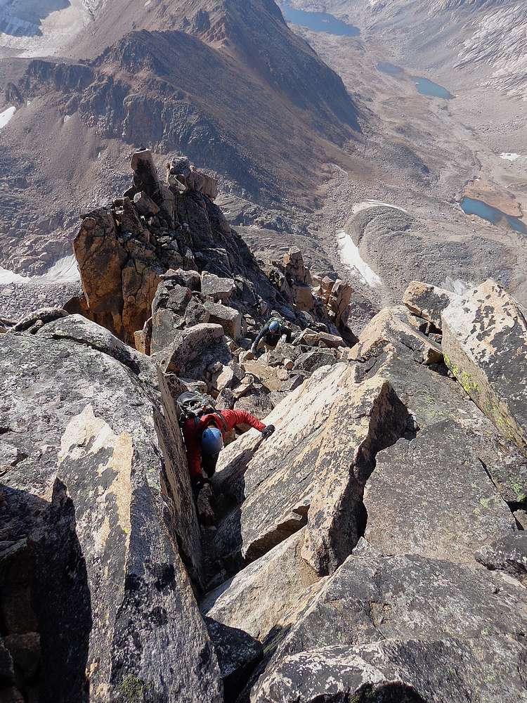
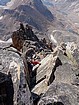
Above the second step, there was still a bunch more climbing. We stayed toward the right-hand side of the gully until reaching the ridge where we hung a left and headed upward. To me this ridge section was a ton of fun and the best part of the climb. It was good stable rock, with a little route-finding along the way. To the right of the ridge was a huge gash that created big exposure, so we always went to the left when in doubt. Soon enough we all arrive on the upper summit ridge, and then all that remained was a quick ridge walk to the highpoint.
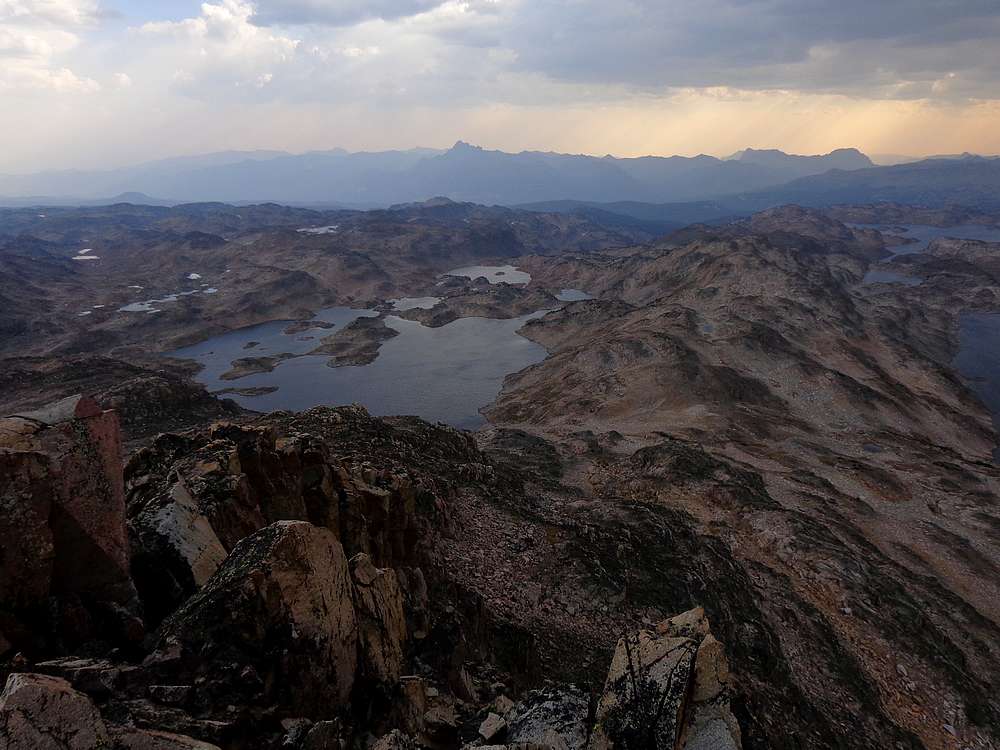
Reaching the summit was very satisfying, and we enjoyed the fantastic views in all directions. We had cell coverage from the summit and were to send messages to family before enjoying a snack break on the summit. Of course we couldn’t mentally relax too much since the down climb needed to be taken seriously.
On the way down, we went slowly and carefully. The upper ridge was no problem, but we did have to be very cautious once back in the gully due to the loose rock. The upper step crux was probably even more challenging on the way down, but we took our time and made it through without issue. The lower step was no problem, and soon enough we were back below the slab, and then down to the saddle.
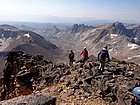
Once back down to the saddle, I think we were all able to relax a little and enjoy our accomplishment. We made our way down the moraine, and then took another extended break on the edge of the glacier. But we still had a long way to go, and the rest of the hike back to camp was slow going as we picked our way through talus and boulder fields.
Our camp was a welcome sight at just after 4pm, and it felt good to have the climb taken care of. The other guys were lacking motivation, but I decided to make the 900 foot climb up “Sky Top Peak” (Peak 11379’), which stood above our camp. It’s a great looking peak, although it pales in comparison to Granite. I headed up the northeast face, and then made a steep climb up the direct east face. This class 4 section can easily be avoided by circling around to the south ridge.
The views from the summit of Sky Top Peak were excellent, and I got my first views of the impressive Aero Lakes. But I also got a good view of storm clouds heading my way, so I made a hurried descent down the south ridge, and then retraced my path down back to camp where I rejoined the others.
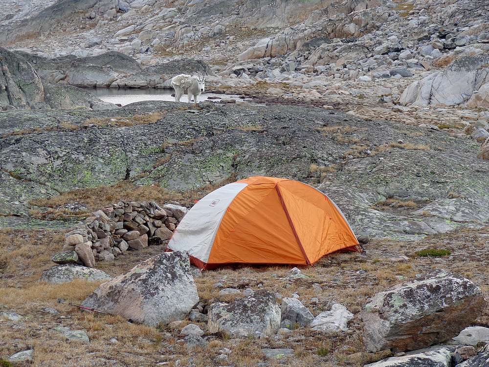
It was raining a little at camp, but it wasn’t bad. After dinner, we were entertained by an emboldened mountain goat who fearlessly circled the perimeter of our campsite to lick our salty dried urine off rocks. Fortunately we’d heard about this type of behavior ahead of time, and knew not to pee too close to camp. We named the goat “Little Dylan”, and shared lots of laughs while taking selfies of ourselves with him, and coming up with what we felt were guaranteed money making ideas related to the obvious value of our very desirable urine. Obviously hypoxia was influencing our senses of humor…
After a breezy night with occasional light rain showers, we were awarded another beautiful morning. After packing up camp, we made our way slowly back down to the boulder fields and then to Rough Lake for some excellent views. We made a steady pace from this point onward. The only things that slowed us down were the handful of annoying uphill section of trail, and a brief bear encounter just north of Our Lady of the Lake.
This trip was amazing. Fantastic scenery, an awesome peak, and a great group of climbing partners. An instant classic for sure. I’d say we snuck one in, because at least a foot of snow fell in the area during the week after our climb, which means we were probably the last group to summit in 2015.
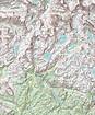
Map of our route, 27 miles and 4400' gain for Granite Peak. Add in another mile and 900' for Sky Top Peak. (3.6MB) |
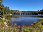
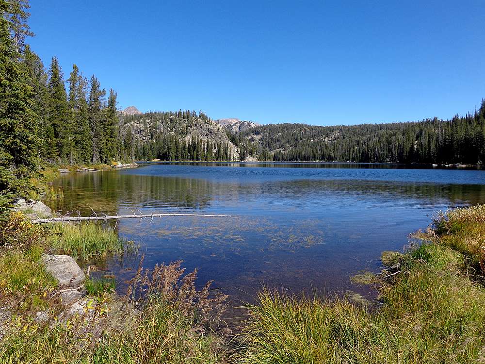
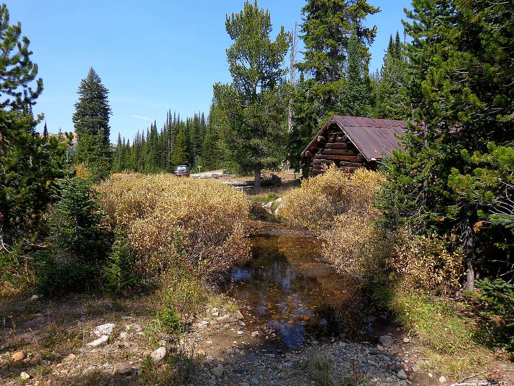
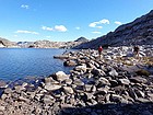
Our Lady of the Lake. |

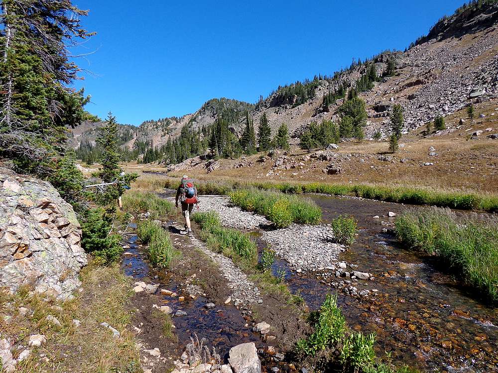
Hiking along Sky Top Creek. |
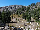
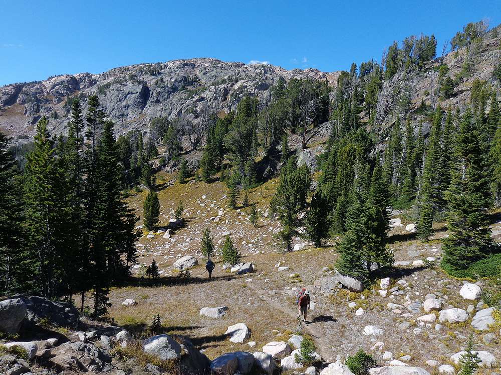
Starting to get above the trees, below Lone Elk Lake. |
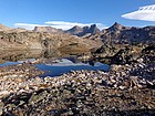
View from Rough Lake. |
Dylan enjoying a first look into the upper Sky Top basin. |
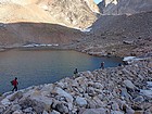
Boulder hopping was a common theme. |
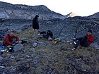
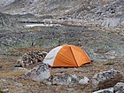
Dinner and relaxation at camp. |
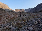
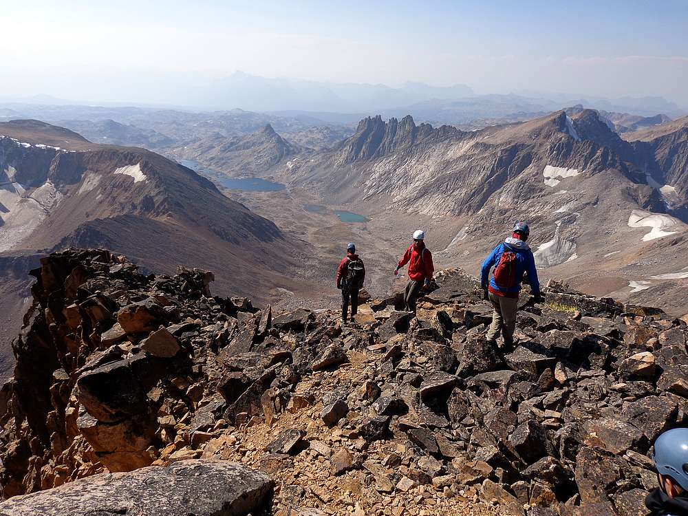
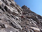
The start of summit day. |
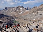
Making our way up the moraine from the upper lake at 10800'. |
The tongue of the Sky Top Glacier, with the imposing Granite Peak above us. |

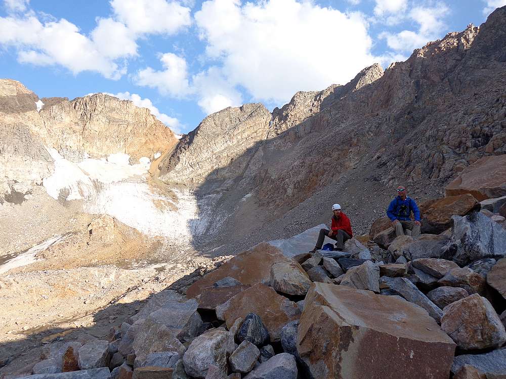
Taking a break on the moraine, Sky Top Glacier in the background. |
Southwest face of Granite Peak. First target is the black area on the left of the huge granite slab. |
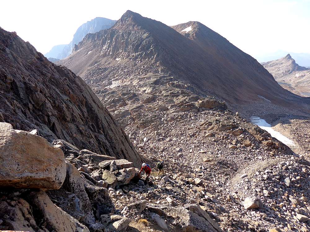
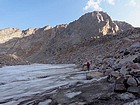
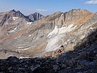
Hiking up from the saddle, Cairn Mountain in the background. |
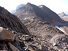
Mount Villard and Glacier Peak from low on the southwest face of Granite. |
Climbing the ramp beneath the slab. |
Just entering the southwest gully, Sky Top Glacier in the background. |

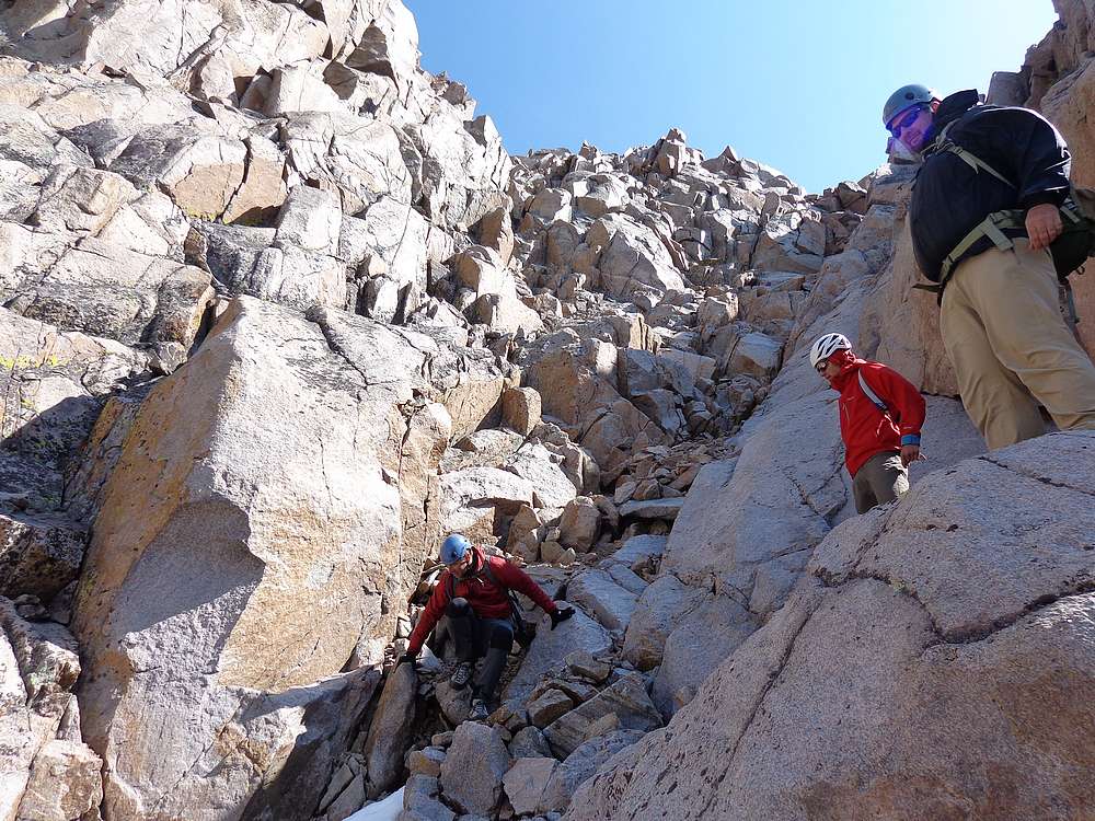
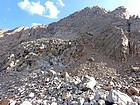
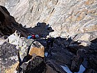
Scramble section low in the gully. |
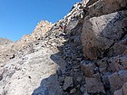
Lots of loose rock in the gully, bring a helmet! |
Making our way up the loose rock in the gully. |
New ice already starting to form below the crux step. |
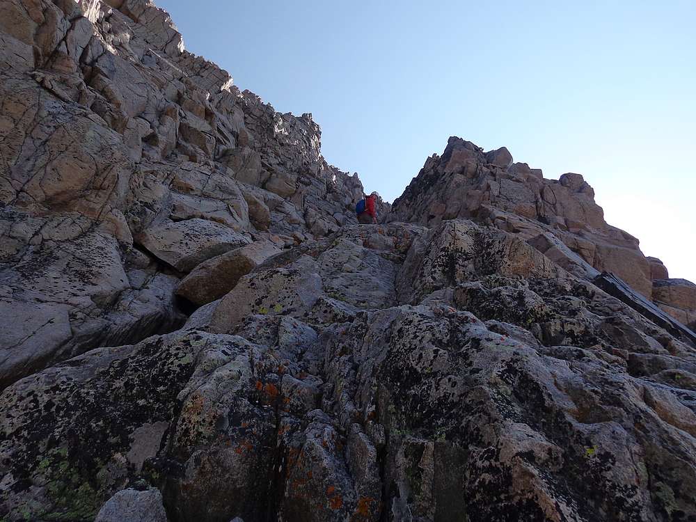
Michael climbing an interesting notch we passed through on the ridge. |

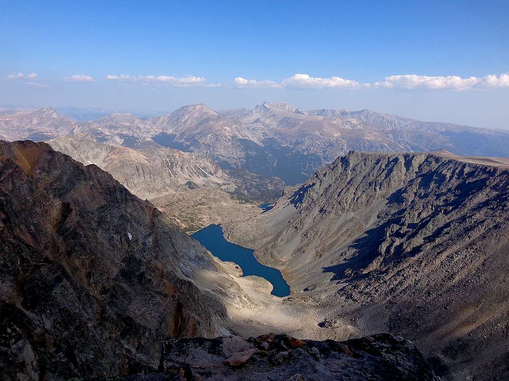
The view north from the summit of Granite Peak includes Mt Hague, Mt Wood, Avalanche Lake, and Freeze To Death Plateau (far right). |
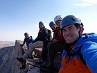
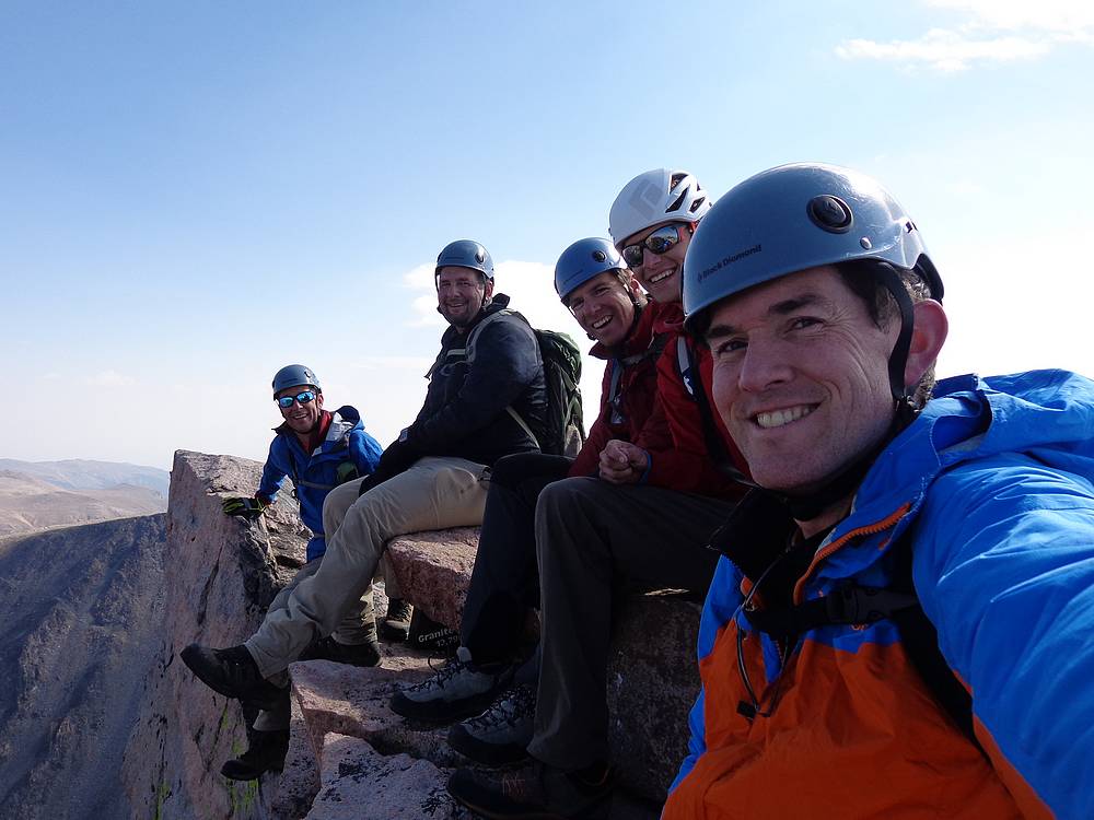
Happy group on the summit of Granite Peak. |
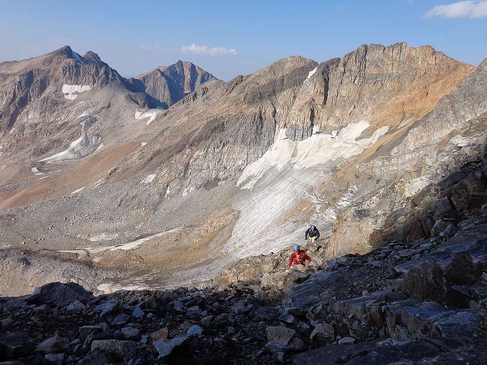
Heading down from the summit, Sky Top Lakes in the distance. |
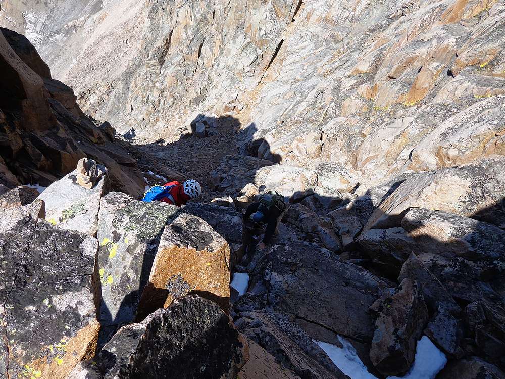
Dropping back into the gully. |
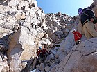
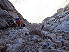
Carefully down climbing, one at a time. |
Dan down climbing the crux. |
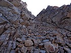
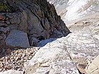
Nearing the bottom of the gully. |
Crossing the glacier on the way down. Way better than boulder hopping. |
Almost back to camp. Sky Top Peak in the background. |
Granite Peak and Sky Top Lake from low on Sky Top Peak. |
Looking up the east face of Sky Top Peak. |
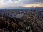
Sky Top Peak summit view of Rough and Aero Lakes. Storm clouds coming! |

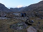
View from just above camp. |
Mountain goat near camp, we named him "Little Dylan". |
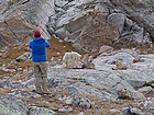
John getting a close-up of the goat. |
Dan relaxing after a great summit day. |
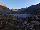
Morning view of Mount Villard and Granite Peak from our campsite. |

More boulder hopping on the way back down. |

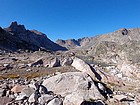
One last view of the upper Sky Top basin. |

Headed home. |
Parting shot of the fantastic terrain around Rough Lake. |
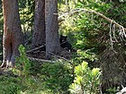
This bear was only about twenty feet from the trail when we passed by. |
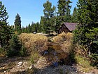
Back to the trailhead, now time for some bacon cheeseburgers in Cooke City. |
 |
|